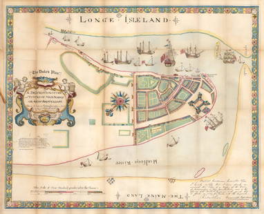
Sold20181859 version of 1664 New York City Plan -- The "Duke'sReserve Reduced! Title/Content of Map: 1859 version of 1664 New York City Plan -- The "Duke's Plan" A Description of the Towne of Mannados or New Amsterdam as it was in September 1661 . . . Anno DominSee Sold Price
Sold20171870 Bridges Plan for New York CityItem: 1870 Bridges Plan for New York City Description: This is an early plan for lower Manhattan and is Bridges’ version of the earlier, failed 1801 Mangin-Goerck plan which was commissioned to prepSee Sold Price
Sold2020Major Holland A Plan of the City of New York 1776Major Holland, "A Plan of the City of New York," engraved map from the 1863 version by G. Hayward. The map was originally from 1776 and is considered one of the earliest and most iconic maps of LowerSee Sold Price
Sold20211664 / 1859 "The Duke's Plan" A Description ofBy: original cartographer unknown / Reissue by: David Thomas Valentine / Engraved by: George HaywardDate: original manuscript 1664 / Reissue 1859 (Published) New YorkDimensions: 21.75 x 27.25 inches (See Sold Price
Sold2021Goerck/Mangin Plan of N. Y. City, Scarce 1856 HaywardManhattan. The 1856 Hayward edition, illustrated in D. T. Valentine’s Manual, is said to be the only vintage version of this map attainable by most collectors. The Common Council of New York comSee Sold Price
Sold2016Map of New York City & Plan of Fort Washington (PortEngraved by George Hayward for D.T. Valentine's Manual. Map features northern Manhattan with Revolutionary War battles and troop movements, hightlighted by number on right side of map. The full titleSee Sold Price
Sold20191832 Marshall Revolutionary War Map of New York City --Title/Content of Map: 1832 Marshall Revolutionary War Map of New York City -- Plan of New York Island and Part of Long Island Shewing the Position of the American & British Armies before, at, and afteSee Sold Price
Sold20191832 Marshall Revolutionary War Map of Lower New YorkTitle/Content of Map: 1832 Marshall Revolutionary War Map of Lower New York from Tappan Sea to New York City -- Plan of the Country from Frogs Point to Croton River Shewing the Positions of the AmericSee Sold Price
Sold2021Hayward Map of New York City -- A Plan of the City ofTitle: Hayward Map of New York City -- A Plan of the City of New York & its Environs to Greenwich … Cartographer: J Hayward / Valentine's manual Year / Place: 1855, New York Map Dimension (in.): 24.See Sold Price
Sold2023OUTSTANDING AESTHETIC MOVEMENT ROSEWOOD INLAIDCREDENZA ATTRIBUTED TO POTTIER & STYMUS. Last quarter 19th century, New York City. August Pottier or William Stymus started their business in 1859 in New York City. They produces some truly lavish furSee Sold Price
Sold2018Bridges: Antique Plan for New York City, 1870Title/Content of Map: 1870 Bridges Plan for New York City -- A Plan of New York City with Recent and Intended Improvements Date Printed: 1870 New York City Cartographer: J Hardy Size: 12.8 x 12.2 in.See Sold Price
Sold20181813 but 1854 Grim's Map of New York CityTitle/Content of Map: 1813 but 1854 Grim's Map of New York City -- A Plan of the City and Environs of New York as they were in the Years 1742, 1743 and 1744 Drawn by D. G. in the 76th Year of his ageSee Sold Price
Sold2023BELLIN, JACQUES-NICOLAS. Two eighteenth-century engraved city plans (New York and Philadelphia) fromBELLIN, JACQUES-NICOLAS. Two eighteenth-century engraved city plans (New York and Philadelphia) from Le Petit Atlas Maritime. 12½x9½ inches each sheet size, wide margins; original hand-colorSee Sold Price
Sold2018New York and BrooklynTitle: New York and Brooklyn Date: 1884 © Cartographer: MITCHELL, SAMUEL AUGUSTUS (JR.) Size: 13.5 X 21 Inset, Northern portion of New York City and County. Simplified plan showing major streets anSee Sold Price
Sold2022"Plan for New York City 1969", two volumesVolume 1" Critical Issues" and Volume 4 "Manhattan" Published by the New York City Planning Committee in 1969, each of these soft-cover volumes is illustrated with multiple black-and-white photographsSee Sold Price
Sold2021Scarce SDUK map of New York City, 1840Elusive vintage 1840 Society for the Diffusion of Useful Knowledge (S.D.U.K.) city map or plan of New York City. Shows southern Manhattan from the Battery northwards to 42nd Street and portions of adjSee Sold Price
Sold2021Scarce 1765 Montresor plan of NY City (1855 Valentine’sOne of the most beautiful and historically important, early plans of New York City, here in a fine 1855 edition by G. Hayward. Nice example of the scarce Valentine's Manual edition of Montressor's earSee Sold Price
Sold2023Select Register of Apartment House Plans NYC3 volumes of the Select Register of Apartment House Plans for New York's East Side. The Cheltenham Press, New York,1928. Each volume contains detailed floor plans for New York City apartments circa 19See Sold Price
Sold2017Harrison, Ballard, Allan Plan for City of New York 1950Harrison, Ballard, Allan: Plan for Rezoning the City of New York - 1950 - Well Illustrated! Harrison, Ballard, Allan NYC/ urban planning 1st ed. 1950, D'Arcy Lithographing & Printing Corp., New York 1See Sold Price
Sold2016Plan of City of New York in 1791, c. 1851Engraved by George Hayward for D.T. Valentine's Manual. Map features historic buildings and landmarks in key grid on upper left corner. Dimensions: 10" x 15" This item ships from Ocean View, DE.See Sold Price
Sold2017Rand McNally: Antique City Plan of Brooklyn, NY, 1912Title/Content of Map: 'Main Portion Brooklyn ' Brooklyn town city map plan. New York. Date Printed: 1912 Image Size: Approx 27.5 x 33.5cm, 10.75 x 13 inches (Large) Type: Antique colour (color) city pSee Sold Price
Sold2019New York Antique Maps (2)Plan of City of New York by Lyne, c. 1900. Map of Provinces of New York and New Jersey by Sauthier, 1878 edition. 26" x 19 1/2".See Sold Price
Sold2018after James Lyne Plan of the City of New Yorkafter James Lyne 1728 A Plan of the City of New York engraved map, on thin laid paper, differs from the 19th c facsimiles, has different writing below lower edge commensurate with an early engraved imSee Sold Price
4 days LeftThe Heritage Gallery at Sayville Antiques, IncWPA Style O/C NYC View Lower Manhattan From Staten IslandUS$475(3 bids)
11 hrs LeftUniversity ArchivesJohn Tyler PSA NM-MT 8 FF Sent to Mother-in-Law in Staten IslandUS$200(1 bid)
Jun 09Estate Collection Auctioneer1986 Photo The Staten Island Anchorage viewed from Narrows Bridge TowerUS$250
18 hrs LeftRapid Estate Liquidators and Auction GalleryBoy Scout Council Shoulder Badges Lot Of 24 CUS$85
6 days LeftKensington Estate AuctionINFINITE CITY Gelatin Silver Photographs, Doug Menuez, N.Y.C.US$150
4 days LeftThe Heritage Gallery at Sayville Antiques, IncIllegibly Signed WPA Era Lithograph 215 W 57th St New York CityUS$50
4 days LeftThe Heritage Gallery at Sayville Antiques, IncJohn Manship O/C NYC Street Scene of William Street 1968US$50
4 days LeftThe Heritage Gallery at Sayville Antiques, IncChristo Signed Postcard Gates Project Central Park, NYC XXIVUS$60(2 bids)