Sold20221866 McNally Map of Texas -- TexasTitle: 1866 McNally Map of Texas -- Texas Cartographer: McNally & Co. Year / Place: 1866, New York Map Dimension (in.): 8.3 X 10.6 in. This is an outstanding and seldom seen map of Texas from just 21See Sold Price
Sold20221911 Rand McNally Map of Texas [verso] Oklahoma -- [Texas] verso [Oklahoma]Title: 1911 Rand McNally Map of Texas [verso] Oklahoma -- [Texas] verso [Oklahoma] Cartographer: Rand McNally Year / Place: 1911 Chicago Map Dimension (in.): 9.2 X 12.5 in. This is a nice map of TexasSee Sold Price
Sold20221914 Rand McNally Map of Texas [verso] Oklahoma -- Texas [verso] OklahomaTitle: 1914 Rand McNally Map of Texas [verso] Oklahoma -- Texas [verso] Oklahoma Cartographer: Rand McNally Year/Place: 1914, Chicago Dimensions: 9.2 X 12.5 in. Description: This is a very nice map ofSee Sold Price
Sold20181895 Rand McNally Map of Texas and Indian TerritoryTitle/Content of Map: 1895 Rand McNally Map of Texas and Indian Territory/Oklahoma -- Texas; Oklahoma and Indian Territory Date Printed: 1895 Chicago Cartographer: Rand McNally Size: 9.2 x 12.5 in. ThSee Sold Price
Sold20201898 Rand McNally Map of Texas and IndianTitle/Content of Map: 1898 Rand McNally Map of Texas and Indian Territory/Oklahoma -- Texas; Oklahoma and Indian Territory Date: 1898, Chicago Cartographer: Rand McNally Size: 9.2 x 12.5 in. This mapSee Sold Price
Sold2017Rand McNally: Antique Map of Texas & Indian TerritoryMap: 1895 Rand McNally Map of Texas and Indian Territory/Oklahoma -- Texas; Oklahoma and Indian Territory Cartographer: Rand McNally Year / Place: 1895 Chicago Map Dimensions: 9.2 x 12.5 in. ConditionSee Sold Price
Sold20201895 Rand McNally Map of Texas and IndianTitle: 1895 Rand McNally Map of Texas and Indian Territory/Oklahoma -- Texas; Oklahoma and Indian Territory Cartographer: Rand McNally Year/Place: 1895, Chicago Size: 9.2 x 12.5 in. Description: ThisSee Sold Price
Sold2017Rand McNally: Antique Map of Texas & Indian TerritoryTitle/Content of Map: 1895 Rand McNally Map of Texas and Indian Territory/Oklahoma -- Texas; Oklahoma and Indian Territory Date Printed: 1895 Chicago Cartographer: Rand McNally Size: 9.2 x 12.5 in. CoSee Sold Price
Sold20181896 Rand McNally Map of Texas and Indian TerritoryTitle/Content of Map: 1896 Rand McNally Map of Texas and Indian Territory/Oklahoma -- Texas [verso] Oklahoma and Indian Territory Date Printed: 1896 Chicago Cartographer: Rand McNally Size: 9.2 x 12.5See Sold Price
Sold20211869 McNally Map of Texas, Indian Territory and NewTitle: 1869 McNally Map of Texas, Indian Territory and New Mexico -- Texas, New Mexico, and Indian Territory Cartographer: F McNally Year / Place: 1869, New York Map Dimension (in.): 8.3 X 10.6 in. ThSee Sold Price
Sold20221st ed. near pristine McNally map of Texas & Ind. Terr., 1881Highly detailed and scarce large format railroad map, one of the best of the period. Rand, McNally & Co.’s Texas and Indian Territory, dated 1881 (first edition). This great map depicts railroadSee Sold Price
Sold2017Rand McNally: Map of Texas from Jones & Hamilton AtlasEarly Rand McNally vertical format Texas map from scarce 1876 Jones & Hamilton atlas. Large and uncommon McNally vertical format map of Texas from the scarce 1876 Jones & Hamilton Historical Atlas ofSee Sold Price
Sold2017McNally: Map of Texas, New Mexico, Indian TerritoryMap of Texas, New Mexico and Indian Territory. McNally's System of Geography. 1875. 12 x 10 inches. Inset showing Vicinity of Galveston Please note that this lot has a confidential reserve. When you lSee Sold Price
Sold2018Rand McNally: Antique Map of Texas, 1894Title/Content of Map: 1894 Rand McNally Texas [verso] Indian Territory, N Dakota -- Texas [verso] Indian Territory, North Dakota Date Printed: 1894, Chicago Cartographer: Rand McNally Size: 18.3 x 13.See Sold Price
Sold20231866 Schönberg's Early Map of Texas Historic Vintage Inspired Map1866 Schönberg's Early Map of Texas Historic Vintage Inspired Map As settlers spread west, Schönberg's map of Texas shows the growing state of Texas and the contemporary counties as ofSee Sold Price
Sold20221866 Schönberg's Early Map of Texas Historic Vintage Inspired Map1866 Schönberg's Early Map of Texas Historic Vintage Inspired Map As settlers spread west, Schönberg's map of Texas shows the growing state of Texas and the contemporary counties as ofSee Sold Price
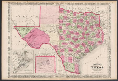
Sold2017JOHNSON'S MAP OF TEXAS, 1866Framed Johnson's Map of Texas, published by A.J. Johnson, New York, c. 1866, eastern counties defined, the panhandle void of listed settlements and listed as an area of the Comanche, sight: 17"h, 24"wSee Sold Price
2023Rand, McNally New Commercial Atlas Map of TexasDescriptionTitle: Rand, McNally New Commercial Atlas Map of TexasPublication Date: c1920-1925Cartographer: RAND, MCNALLY & CO.Publisher: RAND, MCNALLY & CO.Height: 26Width: 37Atlas map to twice naturaSee Sold Price
Sold2023Rand, McNally New Commercial Atlas Map of TexasTitle: Rand, McNally New Commercial Atlas Map of TexasPublication Date: c1920-1925Cartographer: RAND, MCNALLY & CO.Publisher: RAND, MCNALLY & CO.Height: 26Width: 37Atlas map to twice natural size. RaiSee Sold Price
Sold2017Rand Mcnally & Co.'s Railroad Map Of West TexasRailroad Map of West Texas Rand, McNally & Co. c. 1880, 21 x 14.25 in Please note that this lot has a confidential reserve. When you leave a bid in advance of the auction, submit your maximum. Jasper5See Sold Price
Sold2022Exceptional map of Johnson's Texas, 1866Authentic and impressive vintage map of Texas. A highly desirable map that details the state in full. Shows the elevated Table Lands, the U. S. Mail Route, the Staked Plain (El Llando Estadado), numerSee Sold Price
Sold2023[Texas.] Rand, McNally & Co.'s New 11 X 14 Map of Texas.Publication Date: ©1901 Title: [Texas.] Rand, McNally & Co.'s New 11 X 14 Map of Texas. Cartographer: Rand, McNally & Co. Publisher: Rand, McNally & Co. Height: 9.25 Width: 12.5 Page 55 from RandSee Sold Price
Sold2020Rand McNally & Co., County and Railroad Pocket MapRand McNally & Company, Indexed County and Railroad Pocket Map and Shipper's Guide of Texas, Chicago 1904 image size: 24 x 16", frame: 28 x 17.5" Fine separately published map of Texas, colored by couSee Sold Price
Sold2023Excellent example of Johnson’s Texas, 1866Authentic and impressive vintage map of Texas. One of the more collectible maps to be produced in the mid-19th century. A highly desirable map that details the state in full. Shows the elevated TableSee Sold Price
May 16Potter & Potter AuctionsSTORM, Mark. Official Texas Brags Map of North America. 194...US$200(1 bid)
6 days LeftJasper521775-1780 Southwest (Arizona, New Mexico, Texas, with most of Mexico) by Bonne & RaynalUS$160(1 bid)
May 10Rail & Road AuctionsMixed Group of Twelve Airline Timetables - Frontier, Eastern, Southern, Texas International, andUS$20
6 days LeftJasper521884 Rand McNally Map of US Railroad System -- Map Exhibiting the Several Pacific Railroads PreparedUS$140
7 days LeftJasper52Jamaica & the Pedro Bank. South Cuba Haiti. ADMIRALTY sea chart 1866 (1968) mapUS$120
7 days LeftJasper52PUERTO RICO. Inset Port San Juan. RAND MCNALLY 1912 old antique map plan chartUS$15
May 09Rail & Road Auctions1961 Chicago, Milwaukee, St. Paul & Pacific Railroad Polychrome Wall MapUS$50
May 09Hunt and Peck Estate Services, Inc.1867 United States General Land Office "Rapport af Chefen fur Land-Kontoret i Furenta Saterna."US$200


![1911 Rand McNally Map of Texas [verso] Oklahoma -- [Texas] verso [Oklahoma]: Title: 1911 Rand McNally Map of Texas [verso] Oklahoma -- [Texas] verso [Oklahoma] Cartographer: Rand McNally Year / Place: 1911 Chicago Map Dimension (in.): 9.2 X 12.5 in. This is a nice map of Texas](https://p1.liveauctioneers.com/5584/250444/130076930_1_x.jpg?height=310&quality=70&version=1654643749)
![1914 Rand McNally Map of Texas [verso] Oklahoma -- Texas [verso] Oklahoma: Title: 1914 Rand McNally Map of Texas [verso] Oklahoma -- Texas [verso] Oklahoma Cartographer: Rand McNally Year/Place: 1914, Chicago Dimensions: 9.2 X 12.5 in. Description: This is a very nice map of](https://p1.liveauctioneers.com/5584/241996/125442425_1_x.jpg?height=310&quality=70&version=1648585952)


![1896 Rand McNally Map of Texas and Indian Territory: Title/Content of Map: 1896 Rand McNally Map of Texas and Indian Territory/Oklahoma -- Texas [verso] Oklahoma and Indian Territory Date Printed: 1896 Chicago Cartographer: Rand McNally Size: 9.2 x 12.5](https://p1.liveauctioneers.com/5584/120548/61369196_1_x.jpg?height=310&quality=70&version=1524013707)


![Rand McNally: Antique Map of Texas, 1894: Title/Content of Map: 1894 Rand McNally Texas [verso] Indian Territory, N Dakota -- Texas [verso] Indian Territory, North Dakota Date Printed: 1894, Chicago Cartographer: Rand McNally Size: 18.3 x 13.](https://p1.liveauctioneers.com/5584/115725/59466797_1_x.jpg?height=310&quality=70&version=1517366277)


![[Texas.] Rand, McNally & Co.'s New 11 X 14 Map of Texas.: Publication Date: ©1901 Title: [Texas.] Rand, McNally & Co.'s New 11 X 14 Map of Texas. Cartographer: Rand, McNally & Co. Publisher: Rand, McNally & Co. Height: 9.25 Width: 12.5 Page 55 from Rand](https://p1.liveauctioneers.com/5584/285598/150695081_1_x.jpg?height=310&quality=70&version=1681855790)