Sold2020AN ANTIQUE MAP, "New Railroad Map of the United States,AN ANTIQUE MAP, "New Railroad Map of the United States, the Dominion of Canada, Mexico and the West Indies," CHICAGO, CIRCA 1875, hand-colored lithograph on paper, publishing, engraving, and printingSee Sold Price
Sold2017Beers: Antique Map of Mid Atlantic Midwest US, 1875Title: 1875 Warner Beers Map of Mid Atlantic and Midwest United States -- County Map of New York, New Jersey, Pennsylvinia, Ohio, Deleware, Maryland, Virginia, West Virginia Cartographer: Warner BeersSee Sold Price
Sold20201884 Mitchell Railroad Map of the United States --Title/Content of Map: 1884 Mitchell Railroad Map of the United States -- Railroad Map of the United States, Showing the through Lines of Communication from the Atlantic to the Pacific. Together with tSee Sold Price
Sold20211887 Mitchell Railroad Map of the United States --Title: 1887 Mitchell Railroad Map of the United States -- Railroad Map of the United States, Showing the through Lines of Communication from the Atlantic to the Pacific. Together with the Various SteaSee Sold Price
Sold2021Railroad Map of the United States[America, East Coast] Ensign, Bridgman and Fanning's Railroad Map of the United States showing the Depots & Stations. Engraved map with original hand color. Engraved by W. S. Barnard. New York, 1856.See Sold Price
Sold2017Smith: Antique Railroad Map of the United States, 1855Map: Map of the United States of America, Showing the Rail Roads. Large, Colorful Railroad Map of U.S. 1855 Publication Date: 1855 Authors: HARPER & BROTHERS, SMITH, J. CALVIN / D. MCLELLAN Publisher:See Sold Price
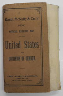
Sold2024Rand, McNally & Co.'S New Official Railroad Map of the United States And Dominion of CanadaTitle:Rand, McNally & Co.'S New Official Railroad Map of the United States And Dominion of Canada Publication Date: 1903 Cartographer:RAND, MCNALLY & CO. Publisher: RAND, MCNALLY & CO. Height: 30 WidtSee Sold Price
Sold2023New Railroad Map of the United States and the Dominion of CanadaPublication Date: 1876 Title: New Railroad Map of the United States and the Dominion of Canada Cartographer: Publisher: BASKIN, FORSTER & CO. Height: 16.25 Width: 26 From their Illustrated HistoricalSee Sold Price
Sold20211879 Railroad map of the United States. Cowperthwait.Title: 1879 Railroad map of the United States. Cowperthwait. 8.75 x 10.75 Description: "Unusual and thorough hand-colored map showing the network of rail lines in the eastern half of the United StatesSee Sold Price
Sold2019Railroad Map of the United States Showing the ThroughReserve Reduced! Title: Railroad Map of the United States Showing the Through Lines of Communication from The Atlantic to The Pacific... Publication Date: 1886 Cartographer: BRADLEY, WM. M. Publisher:See Sold Price
Sold2024Rand, McNally & Co.'S New Commercial Railroad Map of the United States [Chicago to Denver]Title: Rand, McNally & Co.'S New Commercial Railroad Map of the United States [Chicago to Denver] Cartographer: RAND, MCNALLY & CO. Publisher: RAND-MCNALLY & CO. Dimensions: Height: 26 Width: 18.5 DesSee Sold Price
Sold20201862 Colton Map of the United States -- Colton's NewTitle/Content of Map: 1862 Colton Map of the United States -- Colton's New Railroad & County Map of the United States the Canadas &c. Cartographer: J Colton Year/Place: 1862, New York Size: 33.1 X 39See Sold Price
Sold20241878 Tippecanoe Co., Indiana Historical Atlas1878 Tippecanoe County, Indiana Historical Atlas, published by Kingman Bros., interior includes a railroad map of the United States, illustrations of old farmsteads, buildings and residents, 15"T x 17See Sold Price
Sold2017Mitchell: Railroad & Steamboat Map of the US, 1887Map: 1887 Mitchell Railroad and Steamboat Map of the US -- Railroad Map of the United States, Showing the through Lines of Communication from the Atlantic to the Pacific. Together with the Various SteSee Sold Price
Sold20191886 Mitchell/Bradley Railroad and Steamboat Map of theTitle: 1886 Mitchell/Bradley Railroad and Steamboat Map of the US -- Railroad Map of the United States Together with the Various Steamship Lines along the Seaboard Date: 1886, Philadelphia CartographeSee Sold Price
Sold20191886 RR Map of U. S. also shows Steamship linesVery clean, interesting and informative railroad map of the United States from Mitchell's 1887 New General Atlas, with important information on the late 19th century United States. Titled “RailroadSee Sold Price
Sold2024American Express/New York Central Railroad Map of the United States-1934This is a railroad map of the United States, as produced by the American Express Company, for distribution by the New York Central Railroad in 1934. New York Central lines are featured on this map, thSee Sold Price
Sold20221853-Dated Map, Railroads in the United States...Historic Maps 1853 Map "Railroads in the United States in Operation and Progress to Accompany a Treasury Department Report" 1853-Dated Specialized Map, "Railroads in the United States in Operation andSee Sold Price
Sold2021ca. 1929 RAILROAD UNITED STATES MAP SHOWING NEW YORKVintage Railroad Map, "MAP of THE UNITED STATES SHOWING NEW YORK CENTRAL LINES". Map by Rand McNally and Co. Includes printed information on the reverse. Tiny text along bottom partly reads; "NY 4-29"See Sold Price
Sold2021Colton Railroad and County Map United States 1878Colton, after G. W., Colton's Railroad and County Map of the United States, The Canadas, &c, 1878, antique map on paper, folded as originally issued, 33 x 42 inches, in a wood frame 36.5 x 47.5 inchesSee Sold Price
Sold20221879 Powell Map of US with Railroad Grants -- Map of the United States Exhibiting the Grants ofTitle: 1879 Powell Map of US with Railroad Grants -- Map of the United States Exhibiting the Grants of Lands Made by the General Government to Aid the Construction of Railroads and Wagon Roads. CartogSee Sold Price
Sold2023Union Pacific Railroad Brochures & Maps of The United StatesUnion Pacific Railroad Brochures & Maps of The United States Group of Brochures & Maps. Along the Union Pacific Railroad brochures in plastic protective covers and showing minimal use with dates of 19See Sold Price
Sold20231865 Colton's RR and Military Map of the US1865 "Colton's Railroad & Military Map of the United States", folding pocket map laid down on board, framed, some toning from oxidation, 32 1/2" x 42"See Sold Price
Sold2016Warner Beers: Map of Nevada and California, 1872Map: Atlas Map of the United States Map of Nevada and California Maker: Warner Beers Date: 1872 Origin: Chicago, New York Size: 16.3 x 13.5 inches Very nice map of California and Nevada. This was a tiSee Sold Price
2 days LeftJasper521872 Asher and Adams Map of Maine and Parts of Quebec, Vermont and New Hampshire -- Asher & AdamsUS$30(1 bid)
6 days LeftLeonard Auction, a division of The Leonard CompanyEuropean and United States Map AssortmentUS$150
Jul 06Case Antiques, Inc. Auctions & AppraisalsCollection of Railroad Bonds, US and InternationalUS$150
4 days LeftWeatherham Estate TreasuresUnited States Map with American Flag 3-D Wall Mount PaintingUS$300
4 days LeftWeatherham Estate TreasuresUnited States Map with American Flag 3-D Wall Mount PaintingUS$300
6 days LeftEast Coast Fine Arts LLC1777 US Revolutionary War Map French Brion de la Tour Theatre de GuerreUS$1,000
Featured2 days LeftJasper521863 Johnson & Ward Map of the United States -- Johnson's New Military Map of the United StatesUS$140
Jul 13Cain Modern AuctionsDouble Sided U.S. Map by Rand McNally, Illustrated & Equal Area ProjectionUS$70
Jun 25Freeman's | Hindman[Maps & Atlases] A New Map of North America, with the West India Islands...US$300
BonhamsMITCHELL (SAMUEL AUGUSTUS) A New Universal Atlas Containing Maps of the Various Empires, Kingdom...£1,300
Jun 30JM Hobby Supply and Railroad Artifact AuctionsPreiser HO Scale Figure Set 00261-32 Piece United States Marine Band-2 SetsUS$50(1 bid)


![Railroad Map of the United States: [America, East Coast] Ensign, Bridgman and Fanning's Railroad Map of the United States showing the Depots & Stations. Engraved map with original hand color. Engraved by W. S. Barnard. New York, 1856.](https://p1.liveauctioneers.com/1968/203922/103366115_1_x.jpg?height=310&quality=70&version=1620913733)


![Rand, McNally & Co.'S New Commercial Railroad Map of the United States [Chicago to Denver]: Title: Rand, McNally & Co.'S New Commercial Railroad Map of the United States [Chicago to Denver] Cartographer: RAND, MCNALLY & CO. Publisher: RAND-MCNALLY & CO. Dimensions: Height: 26 Width: 18.5 Des](https://p1.liveauctioneers.com/5584/329422/177662153_1_x.jpg?height=310&quality=70&version=1715717898)


![[Maps & Atlases] A New Map of North America, with the West India Islands... (1 of 2)](https://p1.liveauctioneers.com/65/332523/179335173_1_x.jpg?height=282&quality=70&version=1717709447)


