Sold20201889 Map of Eastern TexasAuthor: Cram Title: 1889 Map of Eastern Texas Medium: Ink on Paper Dimensions: 14.5"X22" Map of Eastern part of Texas dated 1889. Engraved and published by George Cram in Chicago. Double folio map. VeSee Sold Price
Sold20181872 Asher and Adams Map of Eastern Texas -- Asher &Reserve Reduced! Title/Content of Map: 1872 Asher and Adams Map of Eastern Texas -- Asher & Adams' Texas Date: 1872 New York Cartographer: Asher & Adams Size: 22.2 X 15.8 in. A very nice, large map ofSee Sold Price
Sold2022(TEXAS.) Texas Engraved Expressly for the World in Miniature.(TEXAS.) Texas Engraved Expressly for the World in Miniature. Detailed small-format lithographed pocket map of eastern Texas. 14x11¾ inches overall, folding into original 12mo cloth case with "TeSee Sold Price
Sold2022Scarce Texas map (eastern part) from Asher & Adams,County map of Eastern Texas extends from Louisiana west to beyond San Antonio and features the railroad system of that time. Features numerous railroads still in their infancy, along with proposed futSee Sold Price
Sold2020George F. Cram (1841-1928). Map of Texas, 1895George F. Cram (1841-1928). Map of the Eastern Half of Texas, Chicago /1895, Outline Color image size: 20.5 x 13.5", frame: 22 x 14.5"See Sold Price
Sold2019W. Williams, "The Southern and South-Western StatesW. Williams, "The Southern and South-Western States (inset – Texas & inset – map of Eastern Virginia), 1849, H. - 13 in., W. - 18 1/2 in.See Sold Price
Sold2023Texas 1889Title/Content of Map: Texas 1889 Date Printed: 1889 Material/Medium: paper Size: approx 13.5"x21" Mast, Crowell & Kirkpatrick Reserve: $45.00 Shipping: Domestic: Flat-rate of $15.00 to anywhere withiSee Sold Price
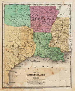
Sold2022(REPUBLIC OF TEXAS.) Alexander Keith Johnston. United States and Texas.(REPUBLIC OF TEXAS.) Alexander Keith Johnston. United States and Texas. Double-page engraved map of the eastern United States and an independent Texas. 21x25½ inches sheet size, wide margins; oriSee Sold Price
Sold20211847 map showing east Texas/Indian TerritoryInteresting map of the southern U. S. in 1847. Map by Cady & Burgess from Roswell SmithÂ’s 1847 Quarto Atlas. Eastern portion of Texas shown along with most of Indian Territory. Also includes ArkanSee Sold Price
Sold20231828 Antique John Shury Eastern United States MapAn antique 1828 of the then United States engraved by John Shury stretching from the east coast to the border of present day Texas. Drawn by a 'J Assheton'.See Sold Price
Sold2019USA 1911 Lot of 12 State Maps incl Texas & CaliforniaIncl Utah, New Jersey, Nebraska, Washington, Arkansas, Oregon, Texas, California and Nevada, Maine, Maryland and Delaware, Massachusetts, and South Eastern Pennsylvania. Lithograph Maps Published 1911See Sold Price
Sold2022London.- Booth (Charles) Descriptive Map of London Poverty 1889, in four parts, 1889London.- Booth (Charles) Descriptive Map of London Poverty 1889, in four parts covering the North-Western, South-Western, North-Eastern, and South Eastern parts of London, based on Stanford's 'LibrarySee Sold Price
Sold2017Antique Arbuckles’ 1889 Victorian # 66 Texas State CardThis Arbuckles’ 1889 Victorian No. 66 Texas State Card. This Arbuckle Bros. Coffee Co. Texas State Trade Card no.66: Map and Vignette Illustrations is in very good condition. Marked New York.: ArbucSee Sold Price
Sold2018EASTERN BRITISH INDIA. Cicars Orissa. Godavery mouths.TITLE/CONTENT OF MAP: 'India No 4' DATE PRINTED: 1889 IMAGE SIZE: Approx 30.5 x 36.5cm, 12 x 14.25 inches (Large) TYPE: Antique colour atlas map CONDITION: Good; suitable for framing. VERSO: There isSee Sold Price
Sold2019U S Coast Survey 1896 LG Map. New Orleans Texas Florida"Sketch of General Progress June 30. 1896" Showing Southern, Eastern and Mid West States, incl Florida, Texas, Gulf of Mexico, Georgia etc. Large Lithograph Map Published 1896, Washington for "U.S. CoSee Sold Price
Sold2017JOHNSON'S MAP OF TEXAS, 1866Framed Johnson's Map of Texas, published by A.J. Johnson, New York, c. 1866, eastern counties defined, the panhandle void of listed settlements and listed as an area of the Comanche, sight: 17"h, 24"wSee Sold Price
Sold2021Scarce 1853 Texas map by Roswell SmithAntique and hard to find antebellum map with full original hand coloring. Engraving on paper. Shows forts, rivers, locations of tribes, towns, counties and topographical features. Eastern Indian TerriSee Sold Price
Sold2023(3) Antique North American Maps incl Indian NationsA group of three (3) antique maps of North America, one being a colored depiction of the eastern United States stretching from the east coast to the borders of present day Texas engraved by Gray & SonSee Sold Price
Sold2017William Faden 1796 Map Eastern US, North AmericaFaden, William (BRITISH, 1749-1836); Map of the Eastern United States, North American with British Territories and Those of Spain according to the Treaty of 1784 (from a larger atlas), 1796; handcolorSee Sold Price
Sold2017Emanuel Bowen, map Eastern SeaboardEmanuel Bowen, map Eastern Seaboard, Emanuel Bowen (British, 1694-1767), "A New and Accurate Map of New Jersey, Pennsylvania, New York, and New England", c. 1744, from Maryland to Nova Scotia, hand-coSee Sold Price
Sold2021MAP, Eastern US, Phelps & EnsignEastern United States. Phelps & Ensign, Phelps & Ensign's Travellers' Guide, and Map of the United States, Containing the Roads, Distances, Steam Boat and Canal Routes &c., 1842 (dated). Hand Color. TSee Sold Price
Sold2019MAP - Eastern US. AnonymousColonial Eastern United States. Anonymous, An Accurate Map of the English Colonies in North America Bordering on the River Ohio, 1754 (published). Hand Color. This unusual map of the colonies spans frSee Sold Price
Sold2023MAP, Eastern US, BowenColonial Eastern United States. Emanuel Bowen, A Map of the British American Plantations, Extending from Boston in New England to Georgia; Including All the Back Settlements in the Respective ProvinceSee Sold Price
Sold2019AN VINTAGE MAP, "Texas and Indian Territory," SECONDAN VINTAGE MAP, "Texas and Indian Territory," SECOND QUARTER 20TH CENTURY, color engraving on paper, showing counties, cities, rail lines, and rivers. 13.25" x 10.125"See Sold Price
Jun 12Dan Morphy AuctionsGEOLOGY OF THE BLACK AND GRAND RAPIDS OF TEXAS INCLUDING THE EASTERN AND WESTERN CROSS TIMBERS,US$100
3 days LeftJasper52SOUTHERN MEXICO & CENTRAL AMERICA. Lighthouses. Key West Yucatan. LETTS 1889 mapUS$10
Jun 23Schilb Antiquarian Rare Books1848 Emory Military Reconnaissance 1ed California MAP Indians Texas New MexicoUS$2(2 bids)
Jun 08Simpson Galleries, LLC.JULIUS BIEN (1826-1909) AN AMERICAN CIVIL WAR RECONNAISSANCE MAP, "Map of Texas and Part of NewUS$100
Jun 12Dan Morphy AuctionsBRUE'S MONUMENTAL WALL MAP OF TEXAS, UPPER CALIFORNIA & MEXICO, C. 1845US$500
Jun 06Akiba GalleriesAntique Mast, Crowell, & Kirkpatrick Map Of Texas, California, & NevadaUS$25(1 bid)
2 days LeftJasper521760 Maire/Leclerk Map of Eastern Belgium and Liege -- Carte De La Principaute De Liege Et De SesUS$500
2 days LeftJasper521593 de Jode Maps of Eastern Germany (Saxony Area) and Western Germany -- Mansfeldiae Comitatus ...US$700
Jun 08Early American History Auctions1853 Map of Portion of British North America and Gulf of St. Lawrence, by Henry PerleyUS$260
3 days LeftAntiques Online AuctionsVintage Texas 1845 Map Printed in 1986, Compiled by John DavisUS$60(4 bids)
3 days LeftJasper52BRAZIL.Shows"Proposed Federal District" (now Brasilia);Rio de Janeiro 1903 mapUS$8
2 days LeftJasper521693 Jaillot Map of the Adriatic Sea and Much of Italy -- Le Golfe de Venise, Avec ses PrincipauxUS$500