Sold2018Large 19th C. Framed Map of FloridaLarge 19th C. Framed Map of Florida. Image size: 26.5 inches.See Sold Price
Sold20211882 Map of Florida from scarce atlas1882 Rand McNally map of Florida from the elusive 1882 Historical Hand Atlas published by H. H. Hardesty. Copperplate engraved map shows great detail, especially in the rendering of swamp lands whichSee Sold Price
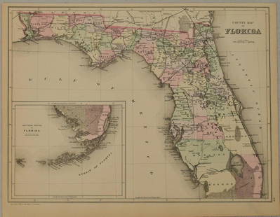
Sold20211883 Mitchell/Bradley Map of Florida -- County Map ofTitle: 1883 Mitchell/Bradley Map of Florida -- County Map of Florida Cartographer: Mitchell / Bradley Year / Place: 1883, Philadelphia Map Dimension (in.): 10.5 X 14.4 in. This is a rather handsome coSee Sold Price
Sold2023ANTIQUE FLORIDA FRAMED MAPS - LOT OF 2148268 ANTIQUE FLORIDA FRAMED MAPS - LOT OF 2 Antique Florida map framed map to include one 1853 U.S. Coast Survey Chart or Map of St. George's Sound, Florida, and one unsigned map of Florida denotedSee Sold Price
Sold2017FRAMED 1800'S MAP OF FLORIDA, COWPERTHWAITDESILVER & BUTLER, HAND COLORED, FROM MITCHELL'S UNIVERSAL ATLAS, 1854, 15†X 12 1/2†SIGHTSee Sold Price
Sold2022Large Framed 1846 Map of FloridaLarge Framed 1846 Map of Florida; a reprint of the original, matted, glazed, and mounted in a wood frame. This map shows the state when central Florida was one large county aptly named Mosquito. All aSee Sold Price
2022Schooner Sailing Ship Picture & Framed Map*Schooner Sailing Ship Picture. Framed behind glass - Apx. 18" x 22 1/4" H. *Framed Print of 1855 Florida Map - @1967 Framed behind Glass - Apx. 20 1/2" W x 18" H. Photo's are considered part of the dSee Sold Price
Sold2020VINTAGE FRAMED FLORIDA TAPESTRY MAPFramed Florida tapestry original linen textile map. Marked Davisco lower right. Measures 44.5" x 37" w/ frame.See Sold Price
Sold2024Vintage or Antique Grays Atlas Map of FloridaDescribed By:Sam 51903 NOD Title: Vintage or Antique Grays Atlas Map of Florida Description:Vintage Grays Atlas Map of Florida, framed. Hallmarks or Signature: N/ASee Sold Price
Sold2023FRAMED 19TH C. JOHNSON'S FLORIDA MAP1863 Civil War Era Colored Map of Florida, by Alvin Jewett Johnson (1827-1884), published by Johnson & Ward, New York, in a gilded and green painted wooden frame with mat, glazed, OS: 19 1/2" x 23 1/2See Sold Price
Sold2019.18th Century French Map of Cuba, Florida and Louisiana21 1/4 x 16 3/4 in. (framed).18th Century French Map of Cuba, Florida and LouisianaGulf of Mexico antique map Golfe du Mexique Zannoni 1762Title: Carte Geo-Hydrographique du Golfe du Mexique et de sesSee Sold Price
Sold2016Map of Florida, 1859 (Custom Framed)Original lithograph from "A New Universal Atlas" by DeSilver & Mitchell, 1859. Displayed in a wood frame and UV glass. Dimensions: 23.75" x 21.5" This item ships from Ocean View, DE.See Sold Price
Sold202119TH CENTURY MAP OF FLORIDAAntique Johnson's Florida by Johnson and Ward framed map. Measures 24 1/4" x 20 1/2" framed.See Sold Price
Sold2023Captain John Bonner Framed Map of BostonPrinting by George C. Smith of Capt. John Bonner's "The Town of Boston in New England". Frame measures approximately 27.5" x 21.75". Original price was $300.00 (see last photo). Estimated shipping cosSee Sold Price
Sold2024Two Vintage Framed Maps of AmericaTwo vintage 20th century maps, nicely framed and matted, including a map of the United States together with a map of Florida and the Gulf of Mexico. Provenance: Phyllis Lucas Gallery, NYC. [Larger fraSee Sold Price
Sold2018ANTIQUE HAND COLORED MAP OF VIRGINIA & FLORIDA.ANTIQUE HAND COLORED MAP OF VIRGINIA & FLORIDA. PROFESSIONALLY FRAMED AND MATTED. 19 1/2 X 14 INCHES.See Sold Price
Sold2017Sartine Map of FloridaCarte Réduite des Cotes et de l’Interieur de la Presqu’ile de la Floride. Antoine Sartine (1729-1801).Engraved map. Paris, 1780. 24 x 17 inches visible, 37 x 29 inches framed. This well engravedSee Sold Price
Sold2021Blaeu. Virginia & Florida Map, 1640Blaeu, Willem. VIRGINIAE PARTIS AUSTRALIS, ET FLORIDAE PARTIS ORIENTALIS. Amsterdam, c. 1640. Hand-colored. Framed and matted. Plate 19 7/8" x 15 1/8". As framed 27.5" x 23.25". *************** A niceSee Sold Price
Sold2018BENSON BOND MOORE (1882-1974) FRAMED OIL PAINTINGFramed oil painting on board, early 20th c., "April Landscape," signed lower left Benson B. Moore (Benson Bond Moore, District Of Columbia, Florida, 1882-1974), titled verso, sight: approx 15"h, 19"w,See Sold Price
Sold202118th Century Florida Gulf Of Mexico Caribbean MapFramed antique map, circa 1777. Depicts map of the Gulf of Mexico, the islands, and countries adjacent. For the Rev. Dr. Robertson's History of America. Contributed by Thomas Kitchen. Published accordSee Sold Price
Sold2023Framed Engraved Map of Eastern US by E. Jones 1805Featured in this lot is this original 1805 E. Jones engraved map showing the United States from Maine to Georgia (Florida is cut off) and west to the Mississippi. The map was engraved by E. Jones, andSee Sold Price
Sold2017JOHNSON'S MAP OF FLORIDA CIRCA 1863 PUBLISHED BYJOHNSON'S MAP OF FLORIDA CIRCA 1863 PUBLISHED BY JOHNSON AND WARD, HAND COLORED, VERY GOOD CONDITION, FRAMED SIZE 22"W X 18"H, SKU896.10See Sold Price
Sold202318thC World Map, Framed18th century world map, framed 17" x 24". Provenance: Palm Beach, Florida estate.See Sold Price
4 days LeftArarity AuctionsC. G. Reichard "Charte des Osmanische Reichs in Asien" 1804 Antique Hand Colored Framed MapUS$50
12 hrs LeftJasper52ASIA."Hindostan" Pegu Niphon Persia Anam Siam "Abou Thubbi" (Abu Dhabi) 1882 mapUS$20
5 hrs LeftRapid Estate Liquidators and Auction GalleryVintage Framed Map of Windsor, ConnecticutUS$80
May 29Cedarburg Auction & Appraisals LLCRare 1877 Double sided map of Milwaukee and WisconsinUS$40(4 bids)
2 hrs LeftThomaston Place Auction GalleriesFRAMED HANDCOLORED MAP OF AUSTRALIA BY JOHNSON & WARD, 1863US$150
2 hrs LeftThomaston Place Auction GalleriesFRAMED HANDCOLORED MAP OF JAPAN BY JOHNSON & WARD, 1863US$150
May 30NY Elizabeth ERNEST FLOYER'S 1882 UNEXPLORED BALUCHISTAN ANTIQUE MAP ILLUSTRATED IN ENGLISHUS$50