Sold2023A. KIRCHER SUBTERRANEUS IDEAL AQUATIC SYSTEM MAPAthanasius Kircher (German 1602-1680), "Systema ideale quo exprimitur, aquarum per canales hydragogos subterraneos ex mari et in montium hydrophylacia protrusio, aquarumq[ue] subterrestrium per pyragoSee Sold Price
Sold2023Kircher, pub. 1678 - Map of the World including Americas (Hydrographic & Subterranean Markings)This scientific engraving is Athanasius Kircher's Mundus subterraneus, in XII Libros digestus; Qvo Divinum Subterrestris Mundi Opificium, mira Ergasteriorum Natur? in eo distributio, verbo PantamorphoSee Sold Price
Sold2023Kircher, pub. 1678 - Map of the Americas (Hydrological and Subterranean markings)This scientific engraving is Athanasius Kircher's Mundus subterraneus, in XII Libros digestus; Qvo Divinum Subterrestris Mundi Opificium, mira Ergasteriorum Natur? in eo distributio, verbo PantamorphoSee Sold Price
Sold2023Kircher, pub. 1678 - Map of the Mediterranean Sea (Hydrographic & Subterranean Markings)This scientific engraving is Athanasius Kircher's Mundus subterraneus, in XII Libros digestus; Qvo Divinum Subterrestris Mundi Opificium, mira Ergasteriorum Natur? in eo distributio, verbo PantamorphoSee Sold Price
2021GREAT NORTHERN’S 2 GREAT TRAINS SYSTEM MAP.Huge dramatic reverse glass advertising Great Northern's two great trains, Empire Builder and Western Star. In script just below Great Northern logo it states "Steamliners twice a day, each way, betweSee Sold Price
Sold2022Grand Trunk Railway System Map LithographCanadian. 1870s. Lithographed paper. Exhibits uniform toning and a series of tears and losses from the outer edges. Frame marked, "Grand Trunk Railway System".See Sold Price
Sold2022Buck Rogers Solar System MapBuck Rogers Solar System Map(Hoboken: R. B. Davis Co., 1933), being a Cocomalt premium; presented behind glass in a burlwood frame. Sheet 18 1/4 x 25 1/4 in.; Frame 20 1/2 x 27 1/2 in. The CollectionSee Sold Price
Sold20181752 Homann Solar System Map -- Systema Solare etTitle/Content of Map: 1752 Homann Solar System Map -- Systema Solare et Planetarium ex hypothesi Copernicana secundum elegantissimas Illustrissimi quondam Hugenii deductiones novissime collectum & exhSee Sold Price
Sold20221884 Chicago & North-Western Railway System MapA hand-colored map of the Chicago and North-Western Railway and its connections, subtitled "The Short Line to the West & Northwest," publishedin 1884 by Rand, McNally & Co. Presented iSee Sold Price
Sold20231665 Kircher Map of South America -- Tabula qua Hydrophylacium Andium Exhibetur, quo UniversaTitle: 1665 Kircher Map of South America -- Tabula qua Hydrophylacium Andium Exhibetur, quo Universa America Australis Innumeris Fluviis Lacubusq Irrigatur Cartographer: A Kircher Year / Place: 1665,See Sold Price
Sold20231665 Kircher Map of South America -- Tabula qua Hydrophylacium Andium Exhibetur, quo UniversaTitle: 1665 Kircher Map of South America -- Tabula qua Hydrophylacium Andium Exhibetur, quo Universa America Australis Innumeris Fluviis Lacubusq Irrigatur Cartographer: A Kircher Year / Place: 1665,See Sold Price
Sold20192-sided Great Northern Railway System Map (printed2-sided Great Northern Railway System Map (printed 1957), framed in polySee Sold Price
Sold2021Pacific Electric LA's Transit System MapInteresting reproduction of the Pacific Electric streetcar route in Los Angeles. Map shows the routes throughout the area and gives a brief history of the formation and heyday of this public transportSee Sold Price
Sold2021Pacific Electric Railways Transit System MapThis cool map is a reprint of the 1926 route map for Pacific Electric Railways. Reprinted by Orange Empire Railway Museum and features all the stops and cities that were served by the trolley lines. NSee Sold Price
Sold202119th Century Map of MemphisPLAN DE LA VILLE DE MEMPHIS (ETATS-UNIS) 40,000 HABITANTS pen and ink with watercolor hand drawn drainage system map, circa 1870. Depicts a grid street plan of the city of Memphis with labeled streetSee Sold Price
Sold2022HAWES. BEA International Air Routes. 1954. GeorgeHAWES. BEA International Air Routes. 1954. George Philip & Son, Ltd. Second edition. Color offset pictorial system map of Europe and Northern Africa, showing BEA and affiliate routes (Aer Lingus, AlitSee Sold Price
Sold2022Georgia Southern & Florida Railroad - Old Folks at Home Sheet MusicOld Folks at Home by S.C. Foster sheet music. Presented as a souvenir of the Georgia Southern & Florida Railroad. Front cover features a steam train with a system map on the rear cover. Minor rips andSee Sold Price
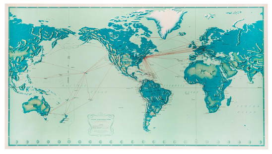
Sold2019Pan American Airways System. World Map 1956.Pan American Airways System. World Map 1956. Art by John Brown, cartography by John Philip. Offset poster showing the airline’s routes across the world. 34 x 60”. Inpainting to lower image, minorSee Sold Price
Sold2017Kircher: Antique Map of Ocean Currents, 1665Title/Content of Map: First Map to show ocean currents of the Western Hemisphere Date Printed: 1665 Cartographer: A. Kircher Material/Medium: Paper Size: Approx 15" x 19" Rare 'crater' Map of the AmerSee Sold Price
Sold2023Kircher, pub. 1678 - DragonThis scientific engraving is Athanasius Kircher's Mundus subterraneus, in XII Libros digestus; Qvo Divinum Subterrestris Mundi Opificium, mira Ergasteriorum Natur? in eo distributio, verbo PantamorphoSee Sold Price
Sold2022Denver & Rio Grande Western, Rio Grande Western RR Map, Framed, 1904 [154552]1904 Denver & Rio Grande Western and the Rio Grande Western System framed map. 15.5x21".Date: Country (if not USA): State: ColoradoCity: Provenance: Gary Bracken CollectionSee Sold Price
Sold2023Kircher, pub. 1678 - DragonThis scientific engraving is Athanasius Kircher's Mundus subterraneus, in XII Libros digestus; Qvo Divinum Subterrestris Mundi Opificium, mira Ergasteriorum Natur? in eo distributio, verbo PantamorphoSee Sold Price
Sold2023Great Western Railway Tin MapGreat Western Railway Tin Map GWR system enamel map, in original oak frame Property from: The Estate of Thomas ('Tom') Jones, Wilton, Connecticut Height: 23 1/2 inches, Width: 29 1/2 inches Frame SizeSee Sold Price
17 hrs LeftPotter & Potter AuctionsPan American Airways World System Map. 1956. Art by John Br...US$200
3 days LeftBidhausCHANEL Pareo Astronomical Map Solar System Planet Cotton Multicolor Women'sUS$1(1 bid)
2 days LeftAlbion AuctionsCooke, George 1801 Antique Map. World Hemispheres by ArrowsmithUS$20(3 bids)
Jun 07Freeman's | HindmanMURCHISON, Roderick Impey, Sir. The Silurian System. 1839. COMPLETE WITH VERY RARE HAND-COLOREDUS$1,500
2 days LeftAlbion AuctionsCooke, George 1801 Antique Map. Pacific Ocean - Australia etc (Fault)US$5(1 bid)
7 days LeftThomaston Place Auction GalleriesHAND COLORED MAP OF PERU & COUNTRY OF THE AMAZONS, 1747, BY EMANUEL BOWEN, FRAMEDUS$250


![A. KIRCHER SUBTERRANEUS IDEAL AQUATIC SYSTEM MAP: Athanasius Kircher (German 1602-1680), "Systema ideale quo exprimitur, aquarum per canales hydragogos subterraneos ex mari et in montium hydrophylacia protrusio, aquarumq[ue] subterrestrium per pyrago](https://p1.liveauctioneers.com/1874/289940/153679686_1_x.jpg?height=310&quality=70&version=1684766036)


![Denver & Rio Grande Western, Rio Grande Western RR Map, Framed, 1904 [154552]: 1904 Denver & Rio Grande Western and the Rio Grande Western System framed map. 15.5x21".Date: Country (if not USA): State: ColoradoCity: Provenance: Gary Bracken Collection](https://p1.liveauctioneers.com/2699/258191/134291078_1_x.jpg?height=310&quality=70&version=1660351799)


