Sold2019Migeon: Northern South America with Curacao InsetTitle: Amerique du Sud (Partie Septentrionale) Cartographer: J. Migeon/Ch. Lacoste Place/Date: Paris / 1870s Size: 16 3/4" x 13" Condition: wash color; overall age-toning A highly detailed and beautifSee Sold Price
Sold2023[ANTIQUE MAP] PARTIE DU NORD DE L'AMERIQUE SEPTENTRIONALE. C.1770s[ANTIQUE MAP] PARTIE DU NORD DE L'AMERIQUE SEPTENTRIONALE. Pour Servir a L'historie Philisophique et Politique... By Rigobert Bonne (1727-1795) Map of the eastern part of North America shows the BritiSee Sold Price
Sold2016Map of Canada Framed Vintage 40s Print After 1720Map of Canada Framed Vintage 40-s Print After 1720 Guillaume De L'Isle Carte Du Canada Qui Comprend la Partie Septentrionale Des Etats Unis D'Amerique Canada and Great Lakes Map Approximately 21 5/8"See Sold Price
Sold202118TH CENTURY FRENCH MAP OF SOUTHEASTERN USRigobert Bonne (French, 1727-1794). "Carte De la Partie Sud Des Etats Unis De L'Amerique Septentrionale" -circa 1780, engraving. Provenance: From the Lifetime Collection of Billy S. Arant, Jr., ChattaSee Sold Price
Sold2022Vintage Air France Airline Poster GroupingVintage Air France Airline Poster Grouping Including (1) Air France Amerique Du Sud, Printed In France 220/p/10-49 Perceval- Paris And (1) Air France Paris, New York, New York Paris Poster Perceval PaSee Sold Price
Sold2022Bowl anthropomorphic geometric shape and patterns South Inca / Southern Highland Peru 1450 to 1532Bowl anthropomorphic geometric shape and patterns South Inca / Southern Highland Peru 1450 to 1532 AD - Weight: 200 g - Region: Amerique du Sud - Sizes: H : 75 mm D : 110 mm - Condition: wear / worn /See Sold Price
Sold2022CASSANDRE: PAQUEBOT L'ATLANTIQUE1983 reprint of the poster designed by Cassandre in 1931, for the ocean stretch towards L'AMERIQUE DU SUD carried out by PAQUEBOT L'ATLANTIQUE. Measurements 68x104 cm, conditions B Measurements 68x104See Sold Price
Sold2017Ensemble d’objets préhistoriques, Amérique du Sud.Ensemble d’objets préhistoriques, Amérique du Sud.See Sold Price
Sold20211820 Renouard Map of South AmericaA map of South America, "Amerique Du Sud", by Jules Renouard, Paris circa 1820. Fine with central fold, measures 11 x 9". Reserve: $20.00 Shipping: Domestic: Flat-rate of $8.00 to anywhere within theSee Sold Price
Sold2019Nicolas Sanson (1600-1667), "Partie Septentrionale duNicolas Sanson (1600-1667), "Partie Septentrionale du Royaume d'lrlande ou soul la Provine D'Ulster .. Leinster et Connaugh," 1665, hand colored, H. - 18 in., W. - 24 1/4 in.See Sold Price
Sold2017Blunt - Cote Orientale De L'AmeriqueEdmund March Blunt (1770-1862), Carte De La Cote Orientale De L'Amerique Septentrionale Partie Comprise Entre New York Et La Riviere Saint Jean Dressee d'apres les Carles publiees en 1828 par l'HydroSee Sold Price
Sold2022c. 1788 French Map of the Eastern United StatesHistoric Maps c. 1788 Map, "Les Etats Unis de L'Amerique Septentrionale, Partie Orientale" (Eastern Part of the Northern United States of America) by M. (Rigobert) Bonne c. 1788 Map titled, "Les EtatsSee Sold Price
Sold2019Les Etats Unis de I'Amérique Septentrionale, partieTITLE/CONTENT OF MAP: 'Les Etats Unis de I'Amérique Septentrionale, partie Occidentale [The United States of North America, western part]' The top image on the right hand side shows the entire map. TSee Sold Price
Sold20221764 Bellin Map of Castries, St Lucia in Lesser Antilles -- Plan du Port et du Carenage de CariacouaTitle: 1764 Bellin Map of Castries, St Lucia in Lesser Antilles -- Plan du Port et du Carenage de Cariacoua Situe dans la Partie du Sud de l'Isle de St. Vincent Cartographer: J Bellin Date/Place: 1764See Sold Price
Sold20171764 Map of Port At St. Vincent BellinCopper Plate Engraved Map “plan Du Port Et Du Carenage De Cariacoua Situe Dans La Partie Du Sud De L'isle De St. Vincent”, Bellin's "le Petit Atlas Maritime, Ou Recueil De Cartes Et De Plans Des QSee Sold Price
Sold2019Gilles Robert de Vaugondy (1688-1766), "PartieGilles Robert de Vaugondy (1688-1766), "Partie Septentrionale du Royaume de Naples," 1750, handcolored, H. - 18 in., W. - 24 in.See Sold Price
Sold2019Champin, Lombrail, Gautier - 23 juin 1984Champin, Lombrail, Gautier - 23 juin 1984 Arts primitifs. Amérique, Océanie, Asie du Sud-Est, Afrique. CHF 10 / 20 EUR 8 / 17See Sold Price
Sold2022Amér. Mér. Brésil #24. Southern Bahia & NE Minas Gerais. VANDERMAELEN 1827 mapTITLE/CONTENT OF MAP: 'Amérique Méridionale - Partie du Brésil - No. 24' Southern Bahia and north-eastern Minas Gerais DATE PRINTED: 1827 IMAGE SIZE: Approx 51.5 x 60.0cm, 20.25 x 23.75See Sold Price
Sold20211783 Delisle/Dezauche Map of Great Lakes and Canada --Title: 1783 Delisle/Dezauche Map of Great Lakes and Canada -- Carte du Canada qui Comprend la Partie Septentrionale des Etars Unis d'Amerique… Cartographer: Delisle/Dezauche Year/Place: 1783, PaSee Sold Price
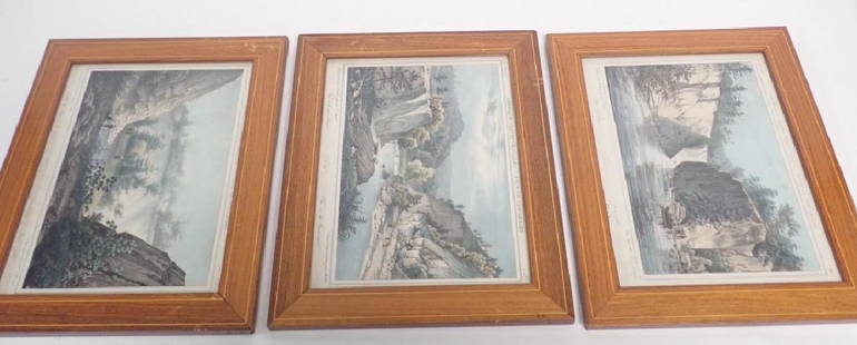
Sold2018Antique Prints of New Jersey Landscape Scenes3 framed Amerique Septentrionale- Etat du New Gersey prints featuring images of the Passaic river and falls. by John Rowson Smith & Jacques Milbert. Height: 12 1/8"; Width: 15 1/4". Image size: 9" x 1See Sold Price
Sold2018Chart of South Pacific with Cook's routes 1774Heading: Author: Cook, James Title: Carte d'une Partie de la Mer du Sud Contenant les Decouvertes de Vaisseaux de sa Majeste le Dauphin, Commodore Byron, la Tamar, Capitne. Mouats, 1765, le Dauphin,See Sold Price
Sold2022VISSCHER, NICOLAS. Nova Tabula Geographica Complectens Borealiorem Americae Partem...VISSCHER, NICOLAS. Nova Tabula Geographica Complectens Borealiorem Americae Partem... [and] Carte Nouvelle Contenant la Partie d'Amerique la Plus Septentrionale... Large engraved two-sheet map of eastSee Sold Price
Sold20221755 Map of North America by De VaugondyHistoric Maps 1755 French & Indian War Era Map of North America by De Vaugondy 1755-Dated French & Indian War Era, Large Hand-Colored Map titled, "PARTIE DE L'AMERIQUE SEPTENTRIONALE, QUI COMPREND LESee Sold Price
Sold2017d'Anville / Santini: Antique Map of Great Lakes, 1775Map: Partie Occidentale du Canada et Septentrionale de la Louisiane Cartographer: d'Anville / Santini Place & Date: Venice / 1775 Size: 22 1/4" x 19" Condition: outline color; light overall age toningSee Sold Price
4 days LeftFleischer's Auctions1755 Map Partie de l'Amerique Septentrionale, qui comprend Le Cours de L'Ohio...US$200(3 bids)
6 days LeftPotter & Potter AuctionsCOLIN, Jean (1912 – 1982). Air France / Amerique du Nord. 1...US$150
6 days LeftPotter & Potter AuctionsBAYLE, Luc Marie (1914 –2000). Air France / Amerique du Nor...US$400
Jun 02Carlsen Gallery, Inc.HAND COLORED FRENCH "AMERIQUE SEPTENTRIONALE" VIEW OF ALBANY & HADLEY FALLS, 19THC. (10" X 12" SITEUS$100
5 days LeftUniversity ArchivesRare 18th C. French Engraving Showing Chilean Hockey Player & Other Exotic CustomsUS$140
6 days LeftJasper52Europe après l'Invasion des Barbares Barbarian invasions 3C MALTE-BRUN c1871 mapUS$30
2 days LeftFichter KunsthandelW. DICKINSON (*1746) after VERNET (*1714), Fisherman by moonlight, 1806, Mezzotint€400
2 days LeftFichter KunsthandelW. DICKINSON (*1746) after VERNET (*1714), The waterfalls of Tivoli, 1806, Mezzotint€400
2 days LeftFichter KunsthandelF. PIRANESI (*1758) after PIRANESI (*1720), Profile of the Ionic column order, 1805, Etching€200
Jun 12Dan Morphy AuctionsBRUE'S MONUMENTAL WALL MAP OF TEXAS, UPPER CALIFORNIA & MEXICO, C. 1845US$500
10 hrs LeftCrescent City Auction GalleryAfter Pieter Cramer (Dutch, 1721-1776) "Papillons Exotiques des Trois Parties du Monde l'Asie,US$400


![[ANTIQUE MAP] PARTIE DU NORD DE L'AMERIQUE SEPTENTRIONALE. C.1770s: [ANTIQUE MAP] PARTIE DU NORD DE L'AMERIQUE SEPTENTRIONALE. Pour Servir a L'historie Philisophique et Politique... By Rigobert Bonne (1727-1795) Map of the eastern part of North America shows the Briti](https://p1.liveauctioneers.com/8321/286473/155024526_1_x.jpg?height=310&quality=70&version=1686787412)


![Les Etats Unis de I'Amérique Septentrionale, partie: TITLE/CONTENT OF MAP: 'Les Etats Unis de I'Amérique Septentrionale, partie Occidentale [The United States of North America, western part]' The top image on the right hand side shows the entire map. T](https://p1.liveauctioneers.com/5584/147595/74587359_1_x.jpg?height=310&quality=70&version=1565730371)


![VISSCHER, NICOLAS. Nova Tabula Geographica Complectens Borealiorem Americae Partem...: VISSCHER, NICOLAS. Nova Tabula Geographica Complectens Borealiorem Americae Partem... [and] Carte Nouvelle Contenant la Partie d'Amerique la Plus Septentrionale... Large engraved two-sheet map of east](https://p1.liveauctioneers.com/199/251723/130782443_1_x.jpg?height=310&quality=70&version=1655133895)


