Sold20201798 1ed Cary ROADS New Itinerary England Wales1798 1ed Cary ROADS New Itinerary England Wales Topography Atlas Travel Guide John Cary was a famous English cartographer from the 18th-century. Cary gained his reputation as a map maker from his workSee Sold Price
Sold20212 Large Scrapbooks of Shell Oil 30's US Road Map BooksPair of Folio Style Shell Oil 1930s US Road Map Books. These map booklets, with tabs for various US States like North Carolina, South Carolina, Virginia, West Virginia, and Texas, were published by ShSee Sold Price
Sold2022Road Atlases, Maps, Books With Mineral AreasIncluded are maps and books of geology and mineral resources in North Carolina, AAA road maps of Colorado and Wyoming, two road atlases for Baltimore County and New Hampshire. Some areas are denoted aSee Sold Price
Sold2024Antique Albums w/ Postcards, Yosemite Photos,More - Car Photos, (1)Travel Book w/ US Map, Berkeley,Antique Albums w/ Postcards, Yosemite Photos,More - Car Photos, (1)Travel Book w/ US Map, Berkeley, Yosemite, San Francisco, YellowStone, More - Travel Album Circa 1908See Sold Price
Sold2019United StatesReserve Reduced! Title: United States Publication Date: 1832 Cartographer: KNIGHT, J. Publisher: KNIGHT, J. Size (inches): H5.3 - W6.3 Frontispiece for Darby Travel Book. Map of U.S. west to Mandan, SSee Sold Price
Sold2023Vintage Lincoln Hwy Road Maps and EphemeraThree travel guide books, a travel play book for kids, approx 17 maps, an Amish tour book, a mini road map, and other ephemera,See Sold Price
Sold20221856 Messages of US President 35 Atlas MAPS Florida1856 Messages of US President 35 Atlas MAPS Florida New York California Pierce Throughout the 19th-century, printed examples of Congress reports and messages of the United States Presidents were regulSee Sold Price
Sold20181788 Greek Travels of Anacharsis ATLAS Maps Greece1788 Greek Travels of Anacharsis ATLAS Maps Greece Philosophy Persia French “The forum is an established place for men to cheat one another, and behave covetously.” ― Anacharsis Jean-JacquesSee Sold Price
Sold2022Vintage Travel Destination Maps & EphemeraThere is a 1949 Rand McNally road atlas, 40+ vintage maps including locations such as New York, Pittsburgh, Boston, Ohio, Pennsylvania, New Jersey, advertising ephemera for various companies includingSee Sold Price
Sold20181785 ATLAS MAPS & Voyages Travel Geography Asia Arabia1785 ATLAS MAPS & Voyages Travel Geography Asia Arabia BEAUTIFUL Noël-Antoine Pluche was an early 18th-century French priest and historian who is most remembered today for his landmark work of naturaSee Sold Price
Sold20201799 Travels of Anacharsis Greek ATLAS Maps Greece1799 Travels of Anacharsis Greek ATLAS Maps Greece Philosophy Persia Barthelemy “The forum is an established place for men to cheat one another and behave covetously.” ― Anacharsis Jean-JacqSee Sold Price
Sold20221878 HUGE MAP of Massachusetts & Boston Harbor Rand McNally Plymouth1878 HUGE MAP of Massachusetts & Boston Harbor Rand McNally Plymouth Rand McNally was a notable 19th and early 20th-century American publishing company known for their maps and travel atlases. This enSee Sold Price
Sold20191763 Travel Guide ITALY Naples Illustrated ATLAS Maps1763 Travel Guide ITALY Naples Illustrated ATLAS Maps Vesuvius Thomas Salmon Thomas Salmon was an English historian known for his extensive reviews, reports, and guides to European travel. He was thorSee Sold Price
Sold20191866 MAPS Atlas Appleton Companion Travel Handbook1866 MAPS Atlas Appleton Companion Travel Handbook Geography United States Color A rare and finely illustrated atlas companion by Richards and Appleton. This Civil War-era work features four enormousSee Sold Price
Sold20211836 Travel's Guide U.S. Map w/ Hand-Written NotesFramed Travel's Guide US Map - "Travel's Guide Through the United States, a Map of the Roads, Distances, Steam Boats & Canal Routes, by J.H. Young, Philadelphia, Published By S. Augustus Mitchell, 183See Sold Price
Sold20221782 ATLAS MAPS Expilly Geography Voyages Travel World America Asia Africa1782 ATLAS MAPS Expilly Geography Voyages Travel World America Asia Africa Jean-Joseph Expilly was an 18th-century French geography and historian who published numerous works on cosmography, history oSee Sold Price
Sold20221777 ATLAS MAPS Expilly Geography Voyages Travel World America Asia Africa1777 ATLAS MAPS Expilly Geography Voyages Travel World America Asia Africa Jean-Joseph Expilly was an 18th-century French geography and historian who published numerous works on cosmography, history oSee Sold Price
Sold20231761 ATLAS MAPS Expilly Geography Voyages Travel World America Asia Africa1761 ATLAS MAPS Expilly Geography Voyages Travel World America Asia Africa Jean-Joseph Expilly was an 18th-century French geography and historian who published numerous works on cosmography, history oSee Sold Price
Sold20171771 New Geographical Grammar Thomas Salmon Atlas1771 New Geographical Grammar Thomas Salmon 24 Atlas MAPS Europe France Scotland Thomas Salmon was a famous English historian, known for his books on geography, English history, and travel. His most fSee Sold Price
Sold20181814 ATLAS Maps of England & Wales Scotland Color Nav1814 ATLAS Maps of England & Wales Scotland Color Navigation Travel John Cary An incredible atlas consisting of 42 color maps of Great Britain by John Cary. The atlas covers cities in England, Wales,See Sold Price
Sold2022Postcards, Photo Books,Maps and Guide Books.Postcards, Photo Books,Maps and Guide Books. Pompeii, France, North Wales, London, Paris, Arundel and Windsor Castle, Imperial War Museum, Pratts England and Wales Road Atlas etc. (39 items)See Sold Price
Sold2021Cyclist Road Books/Map Bermuda & EnglandBook and Maps; Travel related. 2 objects. The Cyclist’s Road Book by Charles Spencer. Hard cover 1891 Edition. 222 pages. Covers are 4-3/4” x 7”. Hundreds of routes, over 1,000 towns listed andSee Sold Price
Sold2017VARIOUS ATLAS AND MAP BOOKSVARIOUS ATLAS AND MAP BOOKS- RAND McNALLY FAMILY WORLD ATLAS- SIXTH PRINTING 1987- HARD COVER- THE MAP BOOK EDITED BY PETER BARBER- FIRST PUBLISHED IN THE U.S. IN 2005- HARD COVER- THE MAP CATALOG- 3RSee Sold Price
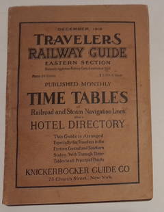
Sold20241915 Traveler's Guide Eastern US. A 344 page bookA 5 3/4" by 8" soft cover book with railroad timetables and other travel information: hotel ads, city, state maps, etc. Paper is supple and not pulpy.See Sold Price
2 days LeftTrillium Antique Prints & Rare BooksKohler & Weigel - Pair of Maps of the Americas: Map of North America (Part of Canada, Greenland,US$75(1 bid)
Jul 14Schilb Antiquarian Rare Books1939 John Ogilby Britannia Atlas MAPS 1ed 1675 facsim England Wales COLOR RoadUS$1
Jun 27NY Elizabeth FIRST US EDITION OF 1869 MALAY ARCHIPELAGO BY A.WALLACE, ANTIQUE ILLUSTRATED WITH MAPSUS$100
2 days LeftTrillium Antique Prints & Rare BooksKarl Bodmer - Pehriska-Ruhpa, A Minaterre or Big-bellied Indian. 17US$300
2 days LeftTrillium Antique Prints & Rare BooksKarl Bodmer - Pachtuwa-Chta, An Arrikkara Warrior. 27US$300
2 days LeftTrillium Antique Prints & Rare BooksKarl Bodmer - Washinga Sahba's Grave on Blackbird's Hills. 12US$300
Jun 27Rail & Road AuctionsTwo Milwaukee Road Travel Photo Books and 10 Electrified Service LithographsUS$20
Jun 27Rail & Road Auctions5 Milwaukee Road and Southern Pacific Travel Picture Books from 1914-1920US$30(1 bid)
6 days LeftJasper52PACIFIC OCEAN currents British French German US Spanish colonies. LETTS 1889 mapUS$15
6 days LeftJasper52PACIFIC OCEAN showing British French Dutch US territory. US Philippines 1947 mapUS$20
6 days LeftJasper52Islands in the Pacific Ocean. Owhyhee/Hawaii Otaheite/Tahiti. THOMSON 1817 mapUS$70
6 days LeftJasper52Océanique. Partie des Iles Salomon #32. Solomon Islands. VANDERMAELEN 1827 mapUS$75
Jun 27Rail & Road AuctionsFive Union Pacific Railroad Travel Books - Colorado, California, Pacific Northwest, Along the SystemUS$30
Jun 27Rail & Road AuctionsFour Baltimore and Ohio Railroad Washington DC Travel Books - 1924 to 1929US$20
BonhamsMITCHELL (SAMUEL AUGUSTUS) A New Universal Atlas Containing Maps of the Various Empires, Kingdom...£1,300
BonhamsMITCHELL (SAMUEL AUGUSTUS) Mitchell's New General Atlas, Containing Maps of the Various Countrie...£500