Sold2022Canada and Northern United States 1878 MapSize: 18 X 13 inches approx. Unframed. Printed 1878. Centerfold as issued.See Sold Price
Sold2021Colton Railroad and County Map United States 1878Colton, after G. W., Colton's Railroad and County Map of the United States, The Canadas, &c, 1878, antique map on paper, folded as originally issued, 33 x 42 inches, in a wood frame 36.5 x 47.5 inchesSee Sold Price
Sold2023Matthaus Seutter Map of North AmericaColored engraving map of eastern North America by Matthaus Seutter (1678-1757). Framed; framing partially obscures borders. Map covers Eastern and Central United States and Canada, Northern Mexico, anSee Sold Price
Sold20211844 map of the U. S., Canada & MexicoGreat map of the United States showing Texas in a very large configuration, otherwise known as the “Stovepipe” shape, with its northern border going all the way into what would become the state ofSee Sold Price
Sold2018Thomson: Antique Map Northeastern United States, 1817Northern Provinces of the United States The beautifully detailed and colored northern United States map from Thomson's New General Atlas, with a lovely inset view of "the Great Falls of Niagara.'" CarSee Sold Price
Sold2021United States MAP 1878Size: 18 X 13 inches approx. Unframed. Printed 1878. Centerfold as issued.See Sold Price
Sold202220th C. Yupik / Inupiaq Wood Shamanic Mask w/ WolfNative American, Northern United States / Canada, Inupiaq or Yupik people, ca. mid-20th to 21st century CE. A remarkable shamanic dance mask with a wolf's head carved from wood with extending feathersSee Sold Price
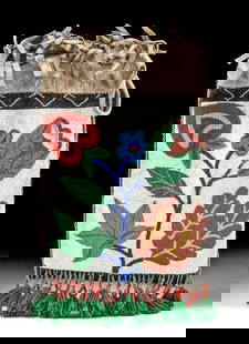
Sold2023Early Winnebago / Ojibwe Beaded Leather PouchNative American / First Nations, Northern United States / Canada, Great Lakes Region & Midwest, Winnebago / Ojibwe, ca. early 20th century CE. A hide bag with beadwork across both sides, the front panSee Sold Price
Sold20162 United States Maps, including 1817.2 United States Maps, including 1817. 1st item: Northern Provinces of the United States map by John Thomson from "Thomson's New General Atlas", engraved by Nathaniel Rodgers Hewitt, 1817. Colored mapSee Sold Price
Sold202220th C. Alaskan Inuit Wool Felt Nivingajuliat Wall ArtNorth America, Northern United States / Canada, Inuit, Yupik or Aleut people, ca. mid-20th century CE. This is a charming embroidered felt textile wall hanging known as a nivingajuliat, with a stylistSee Sold Price
Sold20232 Framed Maps of Canada & U.S.Group of two framed maps depicting Canada and the United States. One map depicting the East Coast of the United States as well as southeastern Canada. One map depicting Lake Superior and south-centralSee Sold Price
Sold202220th C. Alaskan Inuit Wool Felt Panel w/ Appliques**Originally Listed At $450** North America, Northern United States / Canada, Inuit, Yupik or Aleut people, ca. mid-20th century CE. A beautiful wool felt and embroidered textile wall hanging known asSee Sold Price
Sold20211800 Weld Map of Northern United States and Great LakesTitle: 1800 Weld Map of Northern United States and Great Lakes -- Partie des Etats-Unis de L'Amerique Septentrionale Cartographer: I Weld Year / Place: 1800, Paris Map Dimension (in.): 16.1 X !8.2 in.See Sold Price
Sold2020"Northern provinces of the United States". THOMSON.TITLE/CONTENT OF MAP: 'Northern provinces of the United States' The map shows the "District of Maine", prior to its accession to the Union as the state of Maine in 1820. The top image on the right hanSee Sold Price
Sold2023Northern provinces of the United States. THOMSON. District of Main[e] 1817 mapTITLE/CONTENT OF MAP: 'Northern provinces of the United States' The map shows the "District of Maine", prior to its accession to the Union as the state of Maine in 1820. Some Native American Indian viSee Sold Price
Sold2019Northern provinces of the United States. THOMSON.TITLE/CONTENT OF MAP: 'Northern provinces of the United States' The map shows the "District of Maine", prior to its accession to the Union as the state of Maine in 1820. Some Native American Indian viSee Sold Price
Sold2019Bryce, James 1881 Pair of Maps of the USA"Northern United States" and "United States" Lithograph Maps Published 1881, London for ""The International Atlas and Geography..." by James Bryce. Maps by Edward Weller & John Bartholomew. Uncommon.See Sold Price
Sold2017Daniel Burgess: Map of United States & Canada, 1846Map of the United States and Canada. Daniel Burgess, c1846. Drawn and engraved by Stiles, Sherman & Smith. 10.5 x 17.5 inches. Three tiny holes in center fold from publisher’s binding strings. 5”See Sold Price
Sold2023Collection of Service Station Highway Mapsincludes approximately 260 maps from the mid 1900s from across the United States and Canada. Maps advertising various well known gasoline companies.See Sold Price
Sold2022(GOLD RUSH.) J.M. Atwood. Map of the United States, Canada, Mexico, Central America, and the West(GOLD RUSH.) J.M. Atwood. Map of the United States, Canada, Mexico, Central America, and the West India Islands with a Portion of Venezuela & New Granada; Showing the Routes Overland and by the IsthmuSee Sold Price
Sold2019Smith & Jones, "Map of the United States, Canada, theSmith & Jones, "Map of the United States, Canada, the River St. Lawrence, the Lakes," 1801, H. - 16 3/4 in., W. - 13 3/4 in.See Sold Price
Sold2018Engraved map of Canada and United StatesCarte de la Region Orientale des Etats-Unis et de la dominion du Canada, 19th century, engraved map with hand coloring, designed by A. Brue, overall (with frame): 19.5"h x 25"wSee Sold Price
Sold2017Burgess: Antique Map of the United States & Canada 1853Map of the United States and Canada, Burgess 1853. Great map of the U. S. during the transitional period of the American West. Most of the western lands are shown as large territories: Minnesota, NebrSee Sold Price
Sold20171852 CROTONS MAP OF THE UNITED STATES & CANADASCOLTON, J[oseph] H[utchins]. Colton’s Map of the United States & Canadas. Routes are by Railroads, Stage-Roads, and Canals. Lithograph map with original color. Original red cover with gold gilt lettSee Sold Price
6 days LeftKCM GalleriesLarge Detailed Original Oil Painting United States Map Julius Lira Salazar 48 x 36 inchesUS$1,800
3 days LeftWeatherham Estate TreasuresUnited States Map with American Flag 3-D Wall Mount PaintingUS$300
3 days LeftWeatherham Estate TreasuresUnited States Map with American Flag 3-D Wall Mount PaintingUS$300
Jun 07Freeman's | HindmanMICHAUX, François André and Thomas NUTTALL. The North American Sylva...1852-1853. LaterUS$1,000


![Northern provinces of the United States. THOMSON. District of Main[e] 1817 map: TITLE/CONTENT OF MAP: 'Northern provinces of the United States' The map shows the "District of Maine", prior to its accession to the Union as the state of Maine in 1820. Some Native American Indian vi](https://p1.liveauctioneers.com/5584/309982/165835410_1_x.jpg?height=310&quality=70&version=1700599538)


![1852 CROTONS MAP OF THE UNITED STATES & CANADAS: COLTON, J[oseph] H[utchins]. Colton’s Map of the United States & Canadas. Routes are by Railroads, Stage-Roads, and Canals. Lithograph map with original color. Original red cover with gold gilt lett](https://p1.liveauctioneers.com/4597/97465/50069280_1_x.jpg?height=310&quality=70&version=1482846039)


