Sold2022UNFRAMED MODERN MAP OF GIZA EGYPT, ROLLED IN TUBE"The Pyramids Plateau", by J.C. Golvin; inspired by: Rainer Stadekmanand M. Lehner "Die Grossen Pyramiden von Giza"; Copyright: Kamar Trde, LTD. 19" x 27 1/2". Handling dimples.See Sold Price
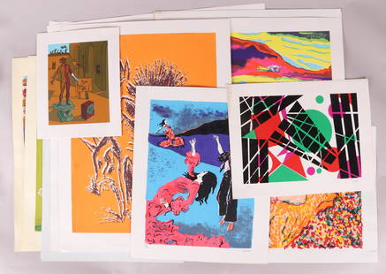
Sold2020A Group of Mid Century Modern PrintsFifty four examples, all but two are pencil signed, artists include: Paul Ritter, Leo Russell, Charles Brant, Paul Nash, Charles Calvert, John Blake, Carl Kent, Viviano, Hans Struck, J. Ellis, Carl ReSee Sold Price
Sold2017Aspin: Antique Map of Africa with European SettlementsMap: Modern Africa With European Settlements Publication Date: 1818 Authors: J. BARFIELD, ASPIN, JEHOSHOPHAT Publisher: J. BARFIELD Size: Quarto – 10.30 H x 11.25 W Inches Modern Africa With EuropeaSee Sold Price
Sold2023Group of Assorted Lithographs and EngravingsGroup of Assorted Lithographs and Engravings, comprising "Patience in a Punt", published by Thomas McLean, London; a map of Yorkshire drawn and engraved by J. Archer, London; "Gordon", published by SiSee Sold Price
Sold20211775 d'Anville Map of Middle Ages Europe -- Germany,Title: 1775 d'Anville Map of Middle Ages Europe -- Germany, France, Italy, Spain, British Isles, In an intermediate Century between Antient and Modern Geography Cartographer: J d'Anville Year / Place:See Sold Price
Sold20181787 Cary Antique Map of Part of YorkshireTitle/Content of Map: 1787 Cary Map of Part of Yorkshire -- Pat of the West Riding of Yorkshire Date Printed: 1787, London Cartographer: J Cary Size: 8.3 x 10.2 in. A nice map of part of Yorkshire, EnSee Sold Price
Sold2017Buchon / Carez: Map of the Modern Americas in 1812Map: De l'Amerique Moderne en 1812 Cartographer: Buchon / J. Carez Place & Date: Paris / 1825 Size: 26 1/4" x 18 1/4" (overall) Condition: wash color; light overall age toning; minor browning along ouSee Sold Price
Sold2020Journal and Maps of Cave J. Couts San Diego to ColoradoHeading: Author: Couts, Cave J. Title: From San Diego to the Colorado in 1849. The Journal and Maps of Cave J. Couts Place Published: Los Angeles Publisher:Arthur M. Ellis Date Published: 19See Sold Price
Sold20191835 Two School Geography Books MapsTwo geography books printed at New York: "A Practical System of Modern Geography" by J. Olney, 1835 and "Cornell's First Steps in Geography" circa 1850. Interesting illustrations and maps. Covers withSee Sold Price
Sold20181810 Pocket Atlas Hand Colored Maps Wallis[ATLAS] "Wallis’s New Pocket Edition of the English Counties or Travellers Companion", published by J. Wallis, complete with 44 hand colored maps including the double page Yorkshire and the Isle ofSee Sold Price
Sold2022Bowen, Thomas 1782 Large Map of Great Britain"A Map of Great Britain" Copper Engraved Map Published 1779-82 by J. Cooke, London for "The Modern Universal British Traveller or, a New, Complete, and Accurate tour Through England, Wales, Scotland,See Sold Price
Sold2022Bowen, Thomas 1782 Large Map of England & Wales"A New & Most Accurate Map of the Roads of England and Wales" Copper Engraved Map Published 1779-82 by J. Cooke, London for "The Modern Universal British Traveller or, a New, Complete, and Accurate toSee Sold Price
Sold2022Burlington 1779 British View. Wentworth House YorkshireFolio Copper Plate Published 1779 by J. Cooke, London for "The Modern Universal British Traveller or, a New, Complete, and Accurate tour Through England, Wales, Scotland, and the Neighbouring Islands"See Sold Price
Sold20201899 Map of British AmericaAuthor: Miller Title: 1899 Map of British America Medium: Ink on Paper Dimensions: 22.5"X16.5" Description: Map of British America, modern day Canada dated 1899. Published by J. Martin Miller and CompSee Sold Price
Sold20241766 Emanuel Bowen "The Maps And Charts Of The Modern Part Of The Universal History"Printed for T. Osborne, A. Millar, J Rivington, B. Law And Co., T. Longman, C. Ware, and S. BladonSee Sold Price
Sold2021Atlas - Johnston, W. & A. K. 1912 Maps, 128/64 Maps"The World-Wide Atlas of Modern Geography" 7th Ed. by J. Scott Keltie. W. & A. K. Johnston Edinburgh & London, 1903. Large 4to (320 x 255mm) Original Pictorial Cloth Binding with Gilt Title to front bSee Sold Price
Sold2021Two Volumes: An Historical Description of Rome"An Historical Description of Ancient and Modern Rome...." in two volumes. J. Salmon. S. Gofnell, London, 1800. The second volume with fold out map. Various engraved illustrations. Each volume: 8-1/2iSee Sold Price
Sold2018Cross: Antique Map of the Gulf of Mexico, 1821Title/Content of Map: Map of the Gulf of Mexico, the Islands and Countries Adjacent. Date Printed: 1821-08-16 Cartographer: CROSS, J. after T. KITCHIN Size: 10.6X17.5 Modern coloring."For the Rev. Dr.See Sold Price
Sold20211859 Map of PalestineTitle: 1859 Map of Palestine Author: Chambers Medium: Ink on Paper Dimensions: 9.5"X11.5" Description: Map of Palestine dated 1859. Part of the Modern & Ancient Geography Atlas. Engraved by J.GellatlySee Sold Price
Sold20211859 Map of CanadaTitle: 1859 Map of Canada Author: Chambers Medium: Ink on paper Dimensions: 11.5"X9.5" Description: Map of Canada dated 1859. Part of the Modern & Ancient Geography Atlas. Engraved by J.Gellatly. PublSee Sold Price
Sold20211859 Map of ScotlandAuthor: Chambers Title: 1859 Map of Scotland Materials: Ink on Paper Dimensions: 9.5"X11.5" Description: Map of Scotland dated 1859. Part of the Modern & Ancient Geography Atlas. Engraved by J.GellatlSee Sold Price
Sold20211859 Map of IrelandTitle: 1859 Map of Ireland Author: Chambers Medium: Ink on Paper Dimensions: 9.5"X11.5" Description: Map of Ireland dated 1859. Part of the Modern & Ancient Geography Atlas. Engraved by J.Gellatly. PuSee Sold Price
Sold20211859 Italy MapAuthor: Chambers Title: 1859 Italy Map Medium: Ink on Paper Dimensions: 9.5"X11.5" Map of Italy dated 1859. Part of the Modern & Ancient Geography Atlas. Engraved by J.Gellatly. Published by William aSee Sold Price
Sold20211859 Map of TurkeyAuthor: Chambers Title: 1859 Map of Turkey Medium: Ink on Paper Dimensions: 9.5"X11.5" Map of Turkey in Europe dated 1859. Part of the Modern & Ancient Geography Atlas. Engraved by J.Gellatly. PublishSee Sold Price
BonhamsPATERSON (WILLIAM) A Narrative of Four Journeys into the Country of the Hottentots, and Caffrari...£600
2 days LeftFreeman's | HindmanMURCHISON, Roderick Impey, Sir. The Silurian System. 1839. COMPLETE WITH VERY RARE HAND-COLOREDUS$1,500
BonhamsCHATELAIN (HENRY ABRAHAM)] Atlas historique... vol. 6 (with Africa section only), 1719; and 3 ot...£500
BonhamsSPILSBURY (FRANCIS B.) Picturesque Scenery in the Holy Land and Syria, FIRST EDITION, Edward Orm...£600
Jun 13Swann Auction Galleries(BOTANICAL.) J. Forbes Royle. Illustrations of the Botany and Other Branches of the Natural HistoryUS$375
BonhamsDENTISTRY FAUCHARD (PIERRE) Le chirurgien dentiste, ou traité des dents, 2 vol., FIRST EDIT...£3,600
Jun 13Swann Auction Galleries(PALEONTOLOGY.) J.B. Hatcher; and William B. Scott. Reports of the Princeton University ExpeditionsUS$375
BonhamsCOLTON (GEORGE WOOLWORTH) Colton's General Atlas... Accompanied by Descriptions, Geographical, S...£500
BonhamsCOLTON (GEORGE WOOLWORTH) Colton's General Atlas... 1865-- Colton/Johnson. New Illustrated Famil...£800
Jun 13Swann Auction Galleries(NATURAL HISTORY.) Thomas Pennant. Two eighteenth-century illustrated works.US$375
BonhamsFRANCE [SEGARD (W.) AND FRANCOIS MARTIN TESTARD] Picturesque Views of Public Edifices in Paris, ...£400
BonhamsPURCHAS (SAMUEL) Purchas his Pilgrimage. Or Relations of the World and the Religions observed in...£700
BonhamsAFRICA MUNSTER (SEBASTIAN) Africa Lybia Morenlandt mit allen königreichen so zu unsern zeit...£300
7 days LeftJasper521552 Munster Regional German Map Centered on Bamberg -- Franconia XIII Nova TabulaUS$95
Jun 14Royal Treasures Warehouse LLCJ. Evola, Modern Art 20th Century Painting On Canvas (after Artist)US$550
3 days LeftEarly American History Auctions1853 Franklin Pierce Indian Peace Medal Largest Size, Small Date Type, Mint StateUS$600
BonhamsPHILLIP (ARTHUR) The Voyage of Governor Phillip to Botany Bay; with an Account of the Establishm...£900


![1810 Pocket Atlas Hand Colored Maps Wallis: [ATLAS] "Wallis’s New Pocket Edition of the English Counties or Travellers Companion", published by J. Wallis, complete with 44 hand colored maps including the double page Yorkshire and the Isle of](https://p1.liveauctioneers.com/5584/130397/66306028_1_x.jpg?height=310&quality=70&version=1541551002)


![CHATELAIN (HENRY ABRAHAM)] Atlas historique... vol. 6 (with Africa section only), 1719; and 3 ot... (1 of 2)](https://p1.liveauctioneers.com/1043/316318/178467460_1_x.jpg?height=282&quality=70&version=1717580423)


![FRANCE [SEGARD (W.) AND FRANCOIS MARTIN TESTARD] Picturesque Views of Public Edifices in Paris, ... (1 of 3)](https://p1.liveauctioneers.com/1043/319451/178359213_1_x.jpg?height=282&quality=70&version=1717515629)


