Sold2021MALAY ARCHIPELAGO/EAST INDIA ISLANDS PhilippinesTITLE/CONTENT OF MAP: 'Malay Archipelago or East India Islands' Vignettes: Victoria Mount - New Guinea; Near Sarawak - Borneo; Natives of New Guinea; The Bee Bear. The map covers the area from Burma aSee Sold Price
Sold2021A Map of East India Archipelago Chart No. 5, 1871A Map of East India Archipelago Chart No. 5, 1871, Western route to China. Showing Hainan Island, Peninsula of Lein-Chew Mainland China. Eight insets including Hong Kong. Published: James Imray & Son,See Sold Price
Sold2020Bartholomew, John 1922 Pair of Maps. East Indies"Farther India" and "Malay Archipelago" Large Lithograph Maps Published 1922 by The Times, London for "The Times Survey Atlas of the World" Maps by John George Bartholomew of the Edinburgh GeographicaSee Sold Price
Sold2019Bartholomew, John 1922 Pair Large Maps of East Indies"Farther India" showing Siam, Indonesia, Singapore, Malaysia. Together with "Malay Archipelago" Large Lithograph Map Published 1922 by The Times, London for "The Times Survey Atlas of the World" MapsSee Sold Price
Sold2023ANTIQUE EAST INDIA ISLANDS C 1840 MAPAntique East India Color Lithograph Map c. 1840 by a British Mapmaker. Purchased at Wattis Fine Art, Hong Kong. Professionally framed and matted. In frame measures 23.25"x22.25"x1.25" Weight 7 pds. PRSee Sold Price
Sold20231766 Emanuel Bowen Map East India IslandsEmanuel Bowen (1693-1767), "A New and Accurate Map of the East India Islands Laid down according to the latest discoveries and agreeable to the most approved Maps & Charts, The whole being regulated bSee Sold Price
Sold20201766 Emanuel Bowen Map East India IslandsEmanuel Bowen (1693-1767), "A New and Accurate Map of the East India Islands Laid down according to the latest discoveries and agreeable to the most approved Maps & Charts, The whole being regulated bSee Sold Price
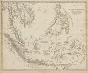
Sold2023Lizars, Daniel 1831 LG Rare HC Map. East India Islands. Philippines Indonesia BorneoLarge Folio Copper Engraved Map Published 1831-2 by John Hamilton, Successor to Daniel Lizars, Edinburgh for "The Edinburgh Geographical and Historical Atlas..." First Edition by Daniel Lizars. Very fSee Sold Price
Sold2022Hughes, William C1865 Map. East India IslandsSteel Engraved Map Published C1865 London for "The History of England..." By David Hume, Tobias Smollett and others. Drawn and Engraved by William Hughes. Centre fold as published. Paper Size: 13.5 xSee Sold Price
Sold2022Barclay, James C1800 Map. East India IslandsCopper Engraved Map Published C1800 Halifax & Newcastle, England for "Barclay's Universal English Dictionary…" by James Barclay. Maps Engraved by Clerk, Milton and others. Paper Size: 10 x 8 inch (2See Sold Price
Sold2022Kelly, Christopher 1836 Antique Map. East India IslandsCopper Engraved Map Published 1836, London for "A New and Complete System of Universal Geography" by Christopher Kelly. Maps Engraved by Findlay, Wallis and others. Paper Size: 10.5 x 8 inch (27 x 20cSee Sold Price
Sold2022Kelly, Christopher 1816 Map. East India IslandsCopper Engraved Map Published 1816, London for "A New and Complete System of Universal Geography" by Christopher Kelly. Maps Engraved by Findlay, Wallis and others. Paper Size: 10 x 8 inch (26 x 21cm)See Sold Price
Sold2022Hughes, William C1865 Map. East India IslandsSteel Engraved Map Published C1865 London for "The History of England..." By David Hume, Tobias Smollett and others. Drawn and Engraved by William Hughes. Centre fold as published. Paper Size: 13.5 xSee Sold Price
Sold2017Malte-Brun Map of the Spice Islands, 18341834 Malte-Brun Map of the Spice Islands -- East India Islands (S China Sea). An attractive and highly detailed map the East India Islands with topographical and settlement details. From the AmericanSee Sold Price
Sold2021Nolan, Edward C1880 Map of The East India IslandsSteel Engraved Map Published C1880, London for "The Illustrated History of the British Empire in India and the East" by Edward H. Nolan. Centre fold as issued. Paper Size: 12 x 10 inch (30 x 25cm) GooSee Sold Price
Sold2017Eastern Islands Or Malay Archipelago Map, 1836Eastern Islands Or Malay Archipelago. Baldwin & Cradock/S.D.U.K. 1836-12-01. Drawn from authorities Horsburgh, Raffles, Crawfurd, Duperray, Laplace &c. Printed by Russell, Penge. Please note that thisSee Sold Price
Sold2023Russell & Barclay 1839 Hand Col Map. Chart of the East India IslandsHand Colored Copper Engraved Map Published 1823-40, by Fisher & Son, "A Complete Atlas of the World" by John Russell et al. A Very Rare Work which is compiled from the same plates used in different edSee Sold Price
Sold2023Russell & Barclay C1825 Antique Map. Chart of the East India IslandsCopper Engraved Map Published C1825., by Fisher & Son, "A Complete Atlas of the World" by John Russell et al. The companion Atlas to "A Complete and Universal English Dictionary" by James Barclay. PapSee Sold Price
Sold2020MALAY ARCHIPELAGO Indonesia Malaysia PhilippinesTITLE/CONTENT OF MAP: 'EASTERN ISLANDS OR THE MALAY ARCHIPELAGO. Sumatra, Java, Borneo, etc' The top image on the right hand side shows the entire map. To view a close up of the map showing the levelSee Sold Price
Sold2020MALAY ARCHIPELAGO Indonesia Malaysia PhilippinesTITLE/CONTENT OF MAP: 'EASTERN ISLANDS OR THE MALAY ARCHIPELAGO. Sumatra, Java, Borneo, etc' The top image on the right hand side shows the entire map. To view a close up of the map showing the levelSee Sold Price
Sold2024East India islands & Indochina. Dutch E. Indies. Philippines. THOMSON 1817 mapTITLE/CONTENT OF MAP: East India Isles [and Birman Empire] A large map of the Dutch East Indies, Indochina and the Philippines. "Pinang" (Penang), "Bankok" (Bangkok), "Manilla" (Manila), and the StraiSee Sold Price
Sold20231730 Bowen Map of China with Marco Polo's Travel Path -- A Map of Marco Polo's Voyages & Travels inTitle: 1730 Bowen Map of China with Marco Polo's Travel Path -- A Map of Marco Polo's Voyages & Travels in the 13th Century Through a Great Part of Asia, All Tartary, the East India Islands & Part ofSee Sold Price
Sold2021Map showing Marco Polo's travelsHeading: Author: Bowen, Emanuel Title: A Map of Marco Polo's Voyages & Travels in the 13th Century Through a Great Part of Asia, All Tartary, the East India Islands & Part of Africa Place Published:See Sold Price
Sold2021Tallis, John (Pub) 1852 Malay Archipelago. East IndiesSteel Engraved Map with Original Outline Hand Color Published 1852-56 by John Tallis, London for "The Universal Pronouncing Dictionary" by Thomas Wright. Drawn & Engraved by John Rapkin. Centre fold aSee Sold Price
2 days LeftJasper521868 TRAVELS in EAST INDIAN ARCHIPELAG0 by ALBERT BICKMORE illustrated ANTIQUEUS$170
3 days LeftJasper52c1720 World showing Dutch East India Co possessions. CA as a island. By J.MalherbeUS$650
4 days LeftJasper52New Guinea & Papuan Archipelago. Solomon & Bismarck islands. THE TIMES 1900 mapUS$20
4 days LeftJasper52New Guinea & Papuan Archipelago. Solomon & Bismarck islands. THE TIMES 1895 mapUS$25
Featured4 days LeftJasper52New Zealand Sandwich Galapagos Islands. Papuan Archipelago. Melanesia 1860 mapUS$130
6 days LeftTrillium Antique Prints & Rare BooksCarey, pub. 1814 - Map of the East Indies with India, China, & New Holland (Australia)US$50(1 bid)
4 days LeftJasper52Océanique. Partie des Iles Carolines #9. Yap Micronesia. VANDERMAELEN 1827 mapUS$50
4 days LeftJasper52Océanique. Partie des Iles Carolines #9. Yap Micronesia. VANDERMAELEN 1827 mapUS$50
4 days LeftJasper52Océanique. Partie des Iles Salomon #33. Solomon Islands. VANDERMAELEN 1827 mapUS$65
4 days LeftJasper52Océanique. Partie des Iles Salomon #33. Solomon Islands. VANDERMAELEN 1827 mapUS$65
4 days LeftJasper52Islands in the Pacific Ocean. Hawaii. Phantom Jardines islands. THOMSON 1830 mapUS$75
3 days LeftJasper52New Map of That Portion of North America Exhibiting the United States and Territories...Mexico...US$360
3 days LeftJasper521723 Dampier Map of Voyages to Brazil, Australia and Eat Indies -- Voyage du Cap. Dampier a la N.US$280
3 days LeftJasper52Map of Survey of Property Of the Sou Pac RR Co Being the East Portion Of The Leal SuerteUS$480
4 days LeftJasper52Océanique Partie… des Iles Basses 48 SE Tuamotus Polynesia VANDERMAELEN 1827 mapUS$50
4 days LeftJasper52Océanique Partie… des Iles Basses 48 SE Tuamotus Polynesia VANDERMAELEN 1827 mapUS$50
4 days LeftJasper52Océanique Iles de la Société #42 Tahiti Rangiroa Polynesia VANDERMAELEN 1827 mapUS$85


![East India islands & Indochina. Dutch E. Indies. Philippines. THOMSON 1817 map: TITLE/CONTENT OF MAP: East India Isles [and Birman Empire] A large map of the Dutch East Indies, Indochina and the Philippines. "Pinang" (Penang), "Bankok" (Bangkok), "Manilla" (Manila), and the Strai](https://p1.liveauctioneers.com/5584/320546/172232433_1_x.jpg?height=310&quality=70&version=1709072904)


