Sold2016Map of California, 1899By Rand, McNally & Co., from Indexed Atlas Of The World. Chicago: 1899. Map features vignettes of Los Angeles, San Bernadino, Orange & San Diego Counties and seperate vignette of San Francisco area. DSee Sold Price
Sold2022California Mines and Minerals, 1899 [154525]California Mines and Minerals, 1899. Souvenir Edition. Calaveras County and Motherlode foldout map. 450pp with index plus ads.Date: Country (if not USA): State: CaliforniaCity: Calaveras CountyProvenaSee Sold Price
Sold2023Rare Mt. Tam Railway schedule & map 1899Heading: (California - Marin County) Author: Title: Mill Valley and Mt. Tamalpais Scenic Railway Place Published: [Mill Valley, Calif.] Publisher:[Mill Valley & Mt. Tamalpais Scenic Railway Co.]See Sold Price
Sold20171703 Scherer - World Map [California as an Island]Title: World Map [without title] "Map maker: Heinrich Scherer, Atlas Marianus" "Place and Year: Munich, 1703" "Dimensions: 23.6 x 35.5 cm (9.3 x 14 in)" "Technique: Copperplate engraving" "Coloring: USee Sold Price
Sold20171749 MAP CALIFORNIA AS AN ISLAND, JACQUES CHIQUETFramed map, c. 1749, "L’AMERIQUE SEPTENTRIONALE qui fait partie des Indes Occidentales. Dressée selon les dernieres Relations des Voiageurs et Suivant les nouvelles Observations de Mur. de lSee Sold Price
Sold2021Map California during the ConquestHeading: Author: U.S. War Department Title: [Untitled map of California from Bodega Bay to San Diego, with inset of lower tip of Baja California and the Gulf of California] Place Published: [WashingtSee Sold Price
Sold20231790 George Anson World Voyage Spain South America HUGE MAP California Island1790 George Anson World Voyage Spain South America HUGE MAP California Island George Anson was an 18th-century British Navy admiral who is noted for his important world voyage in which he circumnavigaSee Sold Price
Sold2021de Fer, Nicolas 1717 World Map. California as Island"Mappe-Monde ou Carte Generale de la Terre" Copper Engraved Map Published 1717, Paris for "Introduction a la Geographie" by Nicolas de Fer. Folds as issued. Paper Size: 14 x 10 inch (36 x 25cm) Very mSee Sold Price
Sold2018Diderot/Vaugondy: Antique Map California & West AmericaTitle/Content of Map: Carte De La Californie Et Des Pays Nord Ouest separes de L'Asie par le Detroit d'Anian… Cartographer: Diderot/de Vaugondy Place & Date: Paris / 1772 Size: 14 3/8" x 11 7/8" ConSee Sold Price
Sold2023Williamson, Lieut. R. S. 1856 LG HC Map. California - First Geological Map"Geological Map of a Part of the State of California" Explored in 1855 by Lieut R. S. Williamson. Prepared to accompany the Report of William P. Blake. THE FIRST GEOLOGY MAP OF CALIFORNIA. Hand ColoreSee Sold Price
Sold2021Soil Map California Imperial sheet (second survey)Title: Soil Map California Imperial sheet (second survey) Cartographer: J. Garnett Holmes Publisher: U.S. Department of Agriculture Bureau of Soils Height: 24.1 Width: 16 Shows "Salton Sink" before itSee Sold Price
Sold20221926 Union Oil Company Road Map California, Washington, Oregonrated 6.5, 9"x4", cover is slightly yellow, has wear on the inside.See Sold Price
Sold2023Williamson, Lieut. R. S. 1856 Map. California, New Mexico, Texas, Mexico"United States & Mexican Boundary Survery" Lithograph Map Published 1853-61, Washington for "Reports of explorations and surveys, to ascertain the most practicable and economical route for a railroadSee Sold Price
Sold2019U S Coast Survey 1896 Map. California Nevada Boundary"Boundary Survey between California and Nevada. Sheet 1" Lithograph Map Published 1896, Washington for "U.S. Coast and Geodetic Survey" Folds as issued. Rare. Paper Size: 20 x 19.5 inch (50 x 49cm) GoSee Sold Price
Sold2019U S Coast Survey 1896 Map. California Nevada Boundary"Boundary Survey between California and Nevada. Sheet 1" Lithograph Map Published 1896, Washington for "U.S. Coast and Geodetic Survey" Folds as issued. Rare. Paper Size: 20 x 19.5 inch (50 x 49cm) VeSee Sold Price
Sold2023Williamson, Lieut. R. S. 1856 Map. California - Tejon Pass & Canada de las Uvas"Geological Map of the Tejon Pass & Canada de las Uvas and the Vicinity. Including the Pass of San Francisco & Williamsons Pass"Lithograph Map Published 1853-61, Washington for "Reports of explorationSee Sold Price
Sold2022U S Coast Survey 1896 LG Map. California & NevadaSheet No. 2 "Boundary Survey between California and Nevada" Large Lithograph Map Published 1896, Washington for "U.S. Coast and Geodetic Survey" Folds as issued. Paper Size:23 x 21.5 inch (58 x 55cm)See Sold Price
Sold20181768 Geography ATLAS MAPS California Island Asia China1768 Geography ATLAS MAPS California Island Asia China 17 MAPS A rare 18th-century geographical treatise by Jean Baptiste Gibrat. This work features 17 impressive folding, engraved maps. Little is knoSee Sold Price
Sold20222-Sears, Roebuck & Co Road Maps California & Nevada-Utahrated 7, 9"x4.5", have soiling.See Sold Price
Sold2018LOT ASSORTED ENGRAVED MAPS, CALIFORNIA, OREGON ANDLOT ASSORTED ENGRAVED MAPS, CALIFORNIA, OREGON AND ALASKA COASTAL REGIONS, 19/20TH CENTURY. VARIOUS SIZESSee Sold Price
Sold20221940 & 1942 Union Oil Company Road Maps California, Nevadarated 8, 9"x5", both have good color, light wear.See Sold Price
Sold2020USA 1903 Lot of 6 State Maps. California, Utah, NevadaPlus Washington, Colorada and Arizona/New Mexico. Lithograph Maps Published 1903 by Adam & Charles Black, Edinburgh & London for "Encyclopaedia Brittannica" Tenth Edition. Centre fold as published. PaSee Sold Price
Sold2020Olaf Wieghorst (American/California, 1899-1988)Olaf Wieghorst (American/California, 1899-1988) "Strays" oil on canvas signed lower left. Framed. 16" x 20", framed 26" x 30"See Sold Price
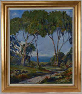
Sold2020Philip Paval (CA) Oil PaintingPhilip Kran Paval (California, 1899 - 1971) 28 1/2" H x 24" W oil on canvas titled, "Huntington Palacades." Signed lower left, "Phililp Paval." Also written on verso from an art conservator before relSee Sold Price
6 days LeftJasper52EUROPEAN CITIES. Environs of Paris Brussels Amsterdam Geneva.JOHNSTON 1899 mapUS$20
Featured6 days LeftJasper52EUROPE POLITICAL. Austria-Hungary. United Sweden & Norway. JOHNSTON 1899 mapUS$20
7 days LeftPotter & Potter AuctionsPictorial Map of Hollywood and Vicinity / Hollywood Film Ca...US$125(1 bid)
5 days LeftAkiba Galleries(2 Pc) Allain Manesson Mallet Description De L'Univers 2 Vol. German TranslationUS$200(1 bid)
May 22Thomaston Place Auction GalleriesCOLLECTION OF TRAVEL EPHEMERA, BROCHURES, BOOKLETS, MAPS 1900-1950US$100
6 days LeftJasper52EUROPEAN CITIES. London Edinburgh Madrid Lisbon Dublin. JOHNSTON 1899 old mapUS$40
Jun 12Dan Morphy AuctionsBRUE'S MONUMENTAL WALL MAP OF TEXAS, UPPER CALIFORNIA & MEXICO, C. 1845US$500
Jun 23Treasure Quest AuctionsPhilip Kran Paval O/C Painting of Ringling Bros. Circus Clown Lou Jacobs MCMUS$300
7 days LeftPotter & Potter AuctionsLINDGREN, Hjalmer “Jolly” (1895–1952). A Hysterical Map of ...US$150(1 bid)
5 days LeftJasper52Courtisanes célèbres : Phryné - Art Berthon Great Condition (1899) 14.75x33 FrenchUS$950
5 days LeftJasper52Editions De La Revue Blanche 'Nos Actrices' - Art Leonetto Cappiello (1899) 18x14 French HardcoverUS$1,000
5 days LeftJasper52La Viole de Gambe - Art Berthon Great Condition (1899) 19.75x25.5 French Poster LBUS$1,000
May 30Forum AuctionsAmerica.- California gold mining.- Palmer (N.S.) Autograph Letter signed to his brother on mining£400


![California Mines and Minerals, 1899 [154525]: California Mines and Minerals, 1899. Souvenir Edition. Calaveras County and Motherlode foldout map. 450pp with index plus ads.Date: Country (if not USA): State: CaliforniaCity: Calaveras CountyProvena](https://p1.liveauctioneers.com/2699/258191/134290967_1_x.jpg?height=310&quality=70&version=1660351799)
![Rare Mt. Tam Railway schedule & map 1899: Heading: (California - Marin County) Author: Title: Mill Valley and Mt. Tamalpais Scenic Railway Place Published: [Mill Valley, Calif.] Publisher:[Mill Valley & Mt. Tamalpais Scenic Railway Co.]](https://p1.liveauctioneers.com/642/280725/147901344_1_x.jpg?height=310&quality=70&version=1678135933)
![1703 Scherer - World Map [California as an Island]: Title: World Map [without title] "Map maker: Heinrich Scherer, Atlas Marianus" "Place and Year: Munich, 1703" "Dimensions: 23.6 x 35.5 cm (9.3 x 14 in)" "Technique: Copperplate engraving" "Coloring: U](https://p1.liveauctioneers.com/5584/112867/57947644_1_x.jpg?height=310&quality=70&version=1511920104)

![Map California during the Conquest: Heading: Author: U.S. War Department Title: [Untitled map of California from Bodega Bay to San Diego, with inset of lower tip of Baja California and the Gulf of California] Place Published: [Washingt](https://p1.liveauctioneers.com/642/218849/112379356_1_x.jpg?height=310&quality=70&version=1631988625)