Sold2023Map of Palestine in 1841 by Thunot Duvotenay - 1875 printMap of Palestine in 1841. Published in 1875. Thunot Duvotenay (1796-1875) was a French cartographer & geographer. This is a folding map. Size: 19x25 cms. Condition: some foxing. Reserve: $48.00 ShippiSee Sold Price
Sold2018Duvotenay: Antique Map of the United States, 1852Very beautiful map of United States coloured by hand Author: Thunot Duvotenay (1796 - 1875) Atlas: Atlas Illustre Date: 1852 Technique: etching on steel Leaf Dimension: 33x25,5 cm (13x10.04 inches) EnSee Sold Price
Sold2021A REPUBLIC OF TEXAS MAP, "Méxique," THUNOT DUVOTENAY,A REPUBLIC OF TEXAS MAP, "Méxique," THUNOT DUVOTENAY, PARIS, CIRCA 1843, hand-colored lithograph on paper, Thunot Duvotenay, French cartographer, Charles Smith, English plate engraver, a page fragmeSee Sold Price
Sold2015Map of Palestine. Print in 1850.Print of steel engraving titled „Carte de la Palestine sous Constantin le Grand 33 apres J. C.“.Author A. Houze.Engraved by unknown.From the „Atlas Universel Historique et Geographique“ by A.See Sold Price
Sold2022Antique Map Print - Palestine - England - Terre SainteSet of 4 Map Prints. Hand-colored map print of the edition of 1851 from the work Universal Historical and Geographical Atlas ("Atlas Universel Historique et Geographique"). This iconic map contains diSee Sold Price
Sold2023Authentic 1875 map of Palestine, O. W. GrayMap of Palestine or the Holy Land from an 1875 National Atlas by O. W. Gray. Full original hand coloring. Inset: Arabia Petraea. “Land of the Philistines” shown at lower left of map. VerySee Sold Price
Sold2022Antique Map Print - England - PalestineSet of 4 Map Prints. Hand-colored map print of the edition of 1851 from the work Universal Historical and Geographical Atlas ("Atlas Universel Historique et Geographique"). This iconic map contains diSee Sold Price
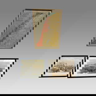
Sold2023Lot of 3 Framed Prints of Jerusalem, Jaffa and Modern Palestine Map.Lot of 3 Framed Prints of Jerusalem, Jaffa and Modern Palestine Map. Size 10 3/4 - 14 inches length.See Sold Price
Sold2022Antique Map Print - South Africa - Algeria - Egypt - PalestineSet of 4 Map Prints. Antique lithographic map originates from "Letts's Popular Atlas", being a series of maps delineating the whole surface of the globe, with many special and original features; and aSee Sold Price
Sold2018Map Prison Philadelphia Pennsylvania 1841 DemetzPRISON DE COMTE A PHILADELPHIA. PENNSYLVANIA. PAR THOMAS WALTER ARCH. Beautiful collection of four prints taken from the scarce work of 1841 about american prisons Rapports a M. Le Comte de MontalivetSee Sold Price
Sold2021Goldsmith, J. 1852 Lot of 15 Maps and Prints6 Maps of Africa, Canaan/Palestine, Asia, Central Europe, British Isles, and Europe. Together with 9 Prints showing Astronomy, Brunei/New Zealand/Sydney, Cairo/Egypt/Algiers, New York/North American ISee Sold Price
Sold2023Nakai Yoshitaki Japanese Woodblock Print - Nakamura SojuroArtist: Yoshitaki, Nakai, 1841-1899 Title: Metal: Nakamura Sojuro as Kamiya Jihei in Shinju Ten no Amijima Series: The Five Elements Date: 1875 Medium: Japanese woodblock printSee Sold Price
Sold2016Map of United States. North America. 1839.Print of steel engraving titled „Etats-Unis“.Drawn by Th. Duvotenay.Engraved by unknown.From „Etats-Unis D‘Amerique by M. Roux de Rochelle. Published by Firmin didot freres. Paris. 1839.The UnSee Sold Price
Sold2016Map of China and Japan. Asia. 1837.Print of steel engraving titled „Chine et Japon“.Drawn by TH. Duvotenay.Engraved by unknown.From „Chine ou Description Historique, Geographique et Litteraire de ce vaste empire, d‘apres des doSee Sold Price
Sold2018Oversized Industrial Commercial Oak Map Print CheOversized Industrial Commercial Oak Map Print Chest. Metal handles, panel sides. Antique.-- Dimensions: H: 65.5 inches: W: 63 inches: D: 25 inches ---See Sold Price
Sold2017German Moscovia Map PrintTitled "Mosvavw", hand colored, note on verso "Braun and Hogenburg, Cologne c. 1585 The earliest obtainable map or view of Moscow". Map, 15-1/2" x 21", framed 22-1/2" x 28"See Sold Price
Sold2021(3) LARGE DECORATIVE PARIS MAP PRINTSDimensions: (Frame) H 76.25" x W 34" Condition: Light frame wear.See Sold Price
Sold2022LARGE ARCHITECTS PRINT / MAP / CHART CABINETFantastic very large Architectural draftsman/chart/map/print flat file - George III-Style mahogany with satinwood inlay, inset tooled leather top. 8 Drawer over 4 drawer. from the Audubon Gallery, KinSee Sold Price
2016Rare Pair Of English Terrestrial GlobesTable Models, Set In Mahogany Bases. From The. Prive' Collection, Dallas. No Reserve. Provenance: Riddell Rare Maps & Prints. 19"h.gloobe Diameter Is 13"See Sold Price
Sold2022Hand-Colored MapsHand-Colored Maps (2) items including a posthumous printing of John Speed 'A New Mappe of the Romane Empire' including original invoice from George Ritzlin Maps & Prints, depicting the areas encompassSee Sold Price
Sold2023ESTATE OF SEYMOUR STEIN: 3 LARGE FRAMED MAPS/PRINTS - NY, PEEKSILL, PHILADELPIA EXHIBITION, LARGESTESTATE OF SEYMOUR STEIN: 3 LARGE FRAMED MAPS/PRINTS - NY, PEEKSILL, PHILADELPIA EXHIBITION, LARGEST IS 40" X 41"See Sold Price
Sold2021Haunted Mansion Imagineering Map Blueline Print.(Disneyland, 1969) A large and remarkable WED Imagineering blueline design print of the Haunted Mansion drawn by Imagineer Dan Williams. Dated in the print 04-3-69, the 1/8":1' scale Key Area & LocatiSee Sold Price
Sold2018Map of Palestine - Engraving - Belgium, 16th CenturyTerrae Sanctae, quae Promissionis terra, est Syriae pars ea, quae Palaestina uocatur... edited by Gerard de Jode. Drawn after Tilemann Stella. Copperplate engraving, hand-colored. [Antwerp, 1593]. MapSee Sold Price
Sold20221833 MAP OF PALESTINE EMBROIDERED on COTTON GREEK UNIQUE antique JudaicaONE OF A KIND HAND EMBROIDERED COTTON GREEK MAP of PALESTINE Size 23 b 33 3/4" Some wear. Reserve: $1,050.00 Shipping: Domestic: Flat-rate of $25.00 to anywhere within the contiguous U.S. InternationaSee Sold Price
Crawford Family Auctions LLCFramed print of Map of Part of the Island of Hawaii & Sandwich Islands, w/COAUS$20


![Map of Palestine - Engraving - Belgium, 16th Century: Terrae Sanctae, quae Promissionis terra, est Syriae pars ea, quae Palaestina uocatur... edited by Gerard de Jode. Drawn after Tilemann Stella. Copperplate engraving, hand-colored. [Antwerp, 1593]. Map](https://p1.liveauctioneers.com/1980/117218/60259210_1_x.jpg?height=310&quality=70&version=1520155929)


