Sold2017Harenburg/Homann Heirs: Holy Land, 12 Tribes, 1750Palaestina in XII tribus divisa. Homann's fascinating map of the Holy Land "divided into 12 tribes and it adjacent lands" was "revised and augmented by J.C. Harenburg" according to the French title trSee Sold Price
Sold2018Harenburg / Homann: Holy Land with Tribal Divisions,Palaestina in XII tribus divisa Homann's fascinating map of the Holy Land "divided into 12 tribes and it adjacent lands" was "revised and augmented by J.C. Harenburg" according to the French title traSee Sold Price
Sold2018Harenburg / Homann Heirs: Palestine & Cyprus, 1744Palaestina seu Terra olim Sancta J.C. Harenburg's map of the Holy Land "divided into 12 tribes and extended by Kings David and Solomon," is both highly dramatic and scholarly (Harenburg, clearly had iSee Sold Price
Sold2022Theodore Danckerts (Dutch, 1663-1727) - Holy Land Map Divided to Tribes, Etching, Amsterdam, CaTheodore Danckerts (Dutch, 1663-1727) - The Holy Land Map Divided to Tribes, Colored Etching, Amsterdam, Circa 1690. Title: Judaea sive Terra Sancta quae Israelitarum In Suas Duodecim Tribus DestincatSee Sold Price
Sold2024John Senex (1678-1740) 1710 Map of the Holy Land IsraelJohn Senex ( 1678 - 1740 ) 18th Century Rare 1710 Engraved titled "A Map of the Holy Land " " Divided into the XII Tribes of Israel wherein is exactly marked ye travels of Jesus Christ " Original handSee Sold Price
Sold2020Antique Johnson and Ward "Holy Land" MapDESCRIPTION: map of the Holy Land, based upon the 12 tribes and contemporary (to mid-19th Century) borders. Insets of view of Damascus and town plan of Jerusalem. Shows towns, roads, rivers, lakes, moSee Sold Price
Sold2016Bown map of Holy Land 1747Heading: Author: Bowen, Emanuel Title: An Accurate Map of the Holy Land Divided into the XII Tribes of Israel. Accomodated to Sacred History, & describing the Travels of Jesus Christ Place Published:See Sold Price
Sold2021Terra Sancta Holy Land Map with the Borders of the 12Terra Sancta Holy Land Map with the Borders of the 12 Tribes of Israel, Nuremberg, 1707. Johann Baptista Homann (German, 1664-1724). Title: Iudaea seu Palaestina ob sacratissima Redemtoris vestigia hoSee Sold Price
Sold2023Scarce 1701 Herman Moll map of Palestine (1st ed.)“Canaan, Palestine or the Holy Land &c divided into twelve Tribes of Israel,” from Herman Moll’s “A System of Geography,” published 1701. Many place names and individualSee Sold Price
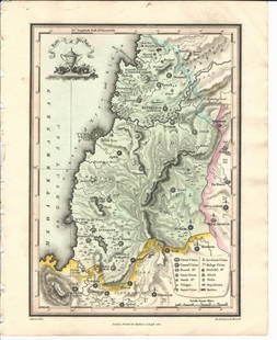
Sold2021(HOLY LAND.) Johannes Janssonius; and Georg Horn.(HOLY LAND.) Johannes Janssonius; and Georg Horn. [Regions of the 12 Tribes of Israel]. Together six double-page or folding engraved mapsheets to form a large wall map. Folio sheets, a few margins triSee Sold Price
Sold2022Ancient Holy land. 12 tribes 1810 by DelalainAncient Holyland showing the twelve tribes. 1810 published in ‘Atlas tables elementaires de geographie ancienne et moderne’, Paris, by Auguste Delalain. Hand-colored outline copperplate enSee Sold Price
Sold2023Ancient Holy Land, 12 tribes 1790 by BonneTitle: Ancient Holy Land, 12 tribes 1790 by Bonne Date/Period: 1790 Materials: Copper plate engraved Size: 14 3/4” x 10 3/4” 1780-1790, published 1790 in "Atlas Portatif general pour swrviSee Sold Price
Sold2015Map of the Holy Land. Print in 1850.Map of the Holy Land divided into Kingdoms of Israel and Judahin 975 - 588 J.C. Print in 1850.Print of steel engraving titled „Carte de la Terre Sainte divisee en Royaumes D‘Israel et de Juda de 9See Sold Price
Sold20161812 Handcolored Map Tribe of Manasseh Holy Land1812 Hand Colored Map of the Holy Land “The Tribe of Manasseh beyond Jordan”. Printed for Mathews and Leigh, measures 9 x 11.5”. Free shipping within the continental USSee Sold Price
Sold2023Antique Map of Holy Land Palestine Map, Israel Twelve Tribes Jerusalem 1833 Lapie Large Folio MapAntique Holy Land Palestine Israel Twelve Tribes Jerusalem Antique 1833 Lapie Large Folio MapAntique Holy Land Palestine Israel Twelve Tribes Jerusalem 1833 Lapie Large Folio Map. Carte de la PalestinSee Sold Price
Sold2022Impressive 1st ed. map of Palestine from J. H. Colton, 1855Detailed map of the Holy Land, colored by tribes and showing scripture names, classical names, modern names, roads, rivers, towns, villages, mountains, etc. Includes the modern-day nations of Israel,See Sold Price
Sold2018ANTIQUE MAP OF PALESTINE HOLY LAND PALESTINE JudaicaANTIQUE MAP OF PALESTINE HOLY LAND PALESTINE Judaica Size 12 1/2 by 10" Very good condition, folds. Reserve: $10.00 Shipping: Domestic: Flat-rate of $10.00 to anywhere within the contiguous U.S. InterSee Sold Price
Sold20151812 Hand Colored Map Holy landHandcolored map of the “Tribe of Manasseh” in the Holy land , printed by Mathews and Leigh, 1812. Measures 11 x 9”.See Sold Price
Sold20151812 Hand Colored Map of Holy landHand colored map of the “Tribe of Asher” in the Holy land , printed by Mathews and Leigh, 1812. Measures 9 x 11”.See Sold Price
Sold20151812 Handcolored Map of Holy LandHand colored map of the “Tribe of Gad” in the Holy land , printed by Mathews and Leigh, 1812. Measures 11 x 9”.See Sold Price
Sold2021Pilgrims Holy Land c1961Title/Content of Map: Pilgrims Holy Land c1961 Date Printed: c1961 Cartographer: Japheth Press Material/Medium: glossy paper Size: approx. 25.5x11 inches open, 3.5x6.5 inches folded. c1961. 12-fold. aSee Sold Price
Sold20231866 Johnson Map of Palestine / Holy land -- Johnson's PalestineTitle: 1866 Johnson Map of Palestine / Holy land -- Johnson's Palestine Cartographer: Johnson & Ward Year / Place: 1866, New York Map Dimension (in.): 15.6 X 12.6 in. This is an attractive map of PaleSee Sold Price
Sold2019Collins, William (Pub) C1870 Pair of HC Holy Land Maps"Geography of the Hebrews" and "Canaan in Possesion of the Twelve Tribes of Israel" Hand Coloured Steel Engraved Map Published C1870 by William Collins, London & Glasgow for "The Holy Bible" Paper SizSee Sold Price
Sold20181699 Bible Commentary Holy Land Maps Gospel Harmony1699 Bible Commentary Holy Land Maps Gospel Harmony Latin Bernard Lamy Bernard Lamy was a 17th-century French theologian whose book ‘Harmonia, sive Concordia’ struck controversy among many FrenchSee Sold Price
7 days LeftSchilb Antiquarian Rare Books1790 Life of Jesus Christ Fleetwood Bible ART Miracles Jerusalem MAP Holy LandUS$115(6 bids)
Jun 27Forum AuctionsHanway (Jonas) The Seaman's Christian Friend, Dodsley, 1779 & others, 18th century theology (c.30)£150
Jun 30Heartland Artifact Auctions Inc3 1/2" Superb Antique Native American Indian Plains Beaded Umbilical Cord Fetish Amulet In The FormUS$16(4 bids)
5 days LeftArader GalleriesLand Grant for the Chemung River in Northumberland County New York StateUS$800
Swann Auction GalleriesRUDOLF II; HOLY ROMAN EMPEROR. Vellum Document Signed, "Rudolff II," as Emperor, patent of nobilityUS$800
BonhamsSPILSBURY (FRANCIS B.) Picturesque Scenery in the Holy Land and Syria, FIRST EDITION, Edward Orm...£600(1 bid)
5 days LeftTrillium Antique Prints & Rare BooksDavid Roberts, RSE - Jerusalem from the SouthUS$500(1 bid)
5 days LeftTrillium Antique Prints & Rare BooksDavid Roberts - The Great Temple of Aboo Simble, NubiaUS$200(1 bid)
5 days LeftTrillium Antique Prints & Rare BooksDavid Roberts, RSE - Slave Boat on the Nile, View Looking Towards the Pyramids of Dashour andUS$500
BonhamsBLAEU (WILLEM AND JAN) Toonneel des Aerdrycz, oft Nieuwe Atlas... Tweede Deels, 2 parts in 1 vol...£8,000
Featured3 days LeftJasper52Rare LEGA KWAME Kayamba Mask Bwami Cult Congo Drc African Tribal Art 1131US$1,200
Jul 14Schilb Antiquarian Rare Books1836 Holy Land 1ed Syria & Turkey Arabic Ruins Damascus ConstantinopleUS$1(1 bid)
1 day LeftMatsart Auctioneers and Appraisers LTD.Salvador Dali 1904-1989 (Spanish) 12 Tribes of Israel, Silver Medals Set, 1973 Issued by MedallicUS$2,400
3 days LeftThe Ross Art GroupOriginal Vintage David Klein Fly TWA Poster - Holy Land Israel c1960US$550(2 bids)
Jul 14Schilb Antiquarian Rare Books1850 Life of Jesus Christ Fleetwood Bible 52 ART Miracles Jerusalem Holy LandUS$1(1 bid)


![(HOLY LAND.) Johannes Janssonius; and Georg Horn.: (HOLY LAND.) Johannes Janssonius; and Georg Horn. [Regions of the 12 Tribes of Israel]. Together six double-page or folding engraved mapsheets to form a large wall map. Folio sheets, a few margins tri](https://p1.liveauctioneers.com/199/226915/117191999_1_x.jpg?height=310&quality=70&version=1637249113)