Sold2017Millar: Antique Map Netherlands Belgium Luxenburg, 1768Title/Content of Map: 1768 Millar Map of Netherlands, Belgium, Luxenburg -- A New and Accurate Map of the Seven United Provinces Imcluding the Dutch Netherlands & e. Date Printed: 1768 Cartographer: GSee Sold Price
Sold2022Lizars, Daniel 1831 LG Rare HC Map. Netherlands - Dutch ProvincesLarge Folio Copper Engraved Map Published 1831-2 by John Hamilton, Successor to Daniel Lizars, Edinburgh for "The Edinburgh Geographical and Historical Atlas..." First Edition by Daniel Lizars. Very fSee Sold Price
Sold2020Barclay, James C1835 Pair of Hand Col Maps. NetherlandsHand Colored Copper Engraved Map Published C1835, London for "A Complete and Universal English Dictionary" by the Rev. James Barclay et al. Folds as issued. Paper Size: 11 x 8.5 inch (28 x 22cm) GoodSee Sold Price
Sold2021Guthrie, William 1790 Antique Map. NetherlandsCopper Engraved Map Published 1790, London for "A New Geographical, Historical and Commercial Grammar..." by William Guthrie. The maps are by John Senex, Thomas Kitchin and others. Folds as issued. EaSee Sold Price
Sold2022Lizars, Daniel 1831 LG Rare HC Map. Netherlands - Belgic ProvincesLarge Folio Copper Engraved Map Published 1831-2 by John Hamilton, Successor to Daniel Lizars, Edinburgh for "The Edinburgh Geographical and Historical Atlas..." First Edition by Daniel Lizars. Very fSee Sold Price
Sold2022Barclay, James 1812 Hand Col Map. Netherlands"The Severn United Provinces..." Hand Colored Copper Engraved Map Published 1812-13 by Brightly & Childs, Bungay for "A Complete and Universal Dictionary of the English Language..." by the Rev. JamesSee Sold Price
Sold2021Barlow 1807 Antique Map. NetherlandsCopper Engraved Map Published 1807 by Brightly & Kinnersley, Bungay, England for "A General View of the World, Geographical, Historical and Philosophical" by The Rev. E. Blomfield. Engraved by Barlow.See Sold Price
Sold2022Barclay, James 1812 Hand Col Map. NetherlandsHand Colored Copper Engraved Map Published 1812-13 by Brightly & Childs, Bungay for "A Complete and Universal Dictionary of the English Language..." by the Rev. James Barclay. Paper Size: 10.5 x 8 incSee Sold Price
Sold2022Barlow 1807 Antique Map. Netherlands HollandCopper Engraved Map Published 1807 by Brightly & Kinnersley, Bungay, England for "A General View of the World, Geographical, Historical and Philosophical" by The Rev. E. Blomfield. Engraved by Barlow.See Sold Price
Sold2021Guthrie, William 1798 Pair of Maps. Netherlands HollandCopper Engraved Map Published 1798, London for "A New Geographical, Historical and Commercial Grammar..." by William Guthrie. The maps are by John Senex, Thomas Kitchin and others. Folds as issued. PaSee Sold Price
Sold2024Russell & Allen (Pub) 1812 Map. NetherlandsFolio Copper Engraved Map Published 1812 by Russell and Allen, Manchester for "A New And Commercial System Of Geography" Paper Size: 15.5 x 9 inch (39 x 23cm) Some tone spotting, otherwise Good ConditSee Sold Price
Sold2023Thomson, John (Pub) 1825 Map. NetherlandsCopper Engraved Map Published 1825 by John Thomson, Edinburgh for "The Edinburgh School Atlas" by N. R. Hewitt. Maps Engraved by Hewitt. Original Outline Hand Colour. Rare. Paper Size: 10.5 x 8 inch (See Sold Price
Sold2021Lochhead (Pub) 1811 Rare Map. Netherlands Holland"The Severn United Provinces with the Dutch and Austrian Netherlands" Copper Engraved Map Published 1811 by William Lochhead, Berwick for "Modern Geography: And a Compendious General Gazetteer" Rare.See Sold Price
Sold2023Turner, Richard 1805 Pair of Miniature Maps. NetherlandsUnited Provinces and The Netherlands. Copper Engraved Map Published 1805, London for "A New and Easy Introduction to Universal Geography..." by the Rev. Richard Turner. Paper Size: 5.5 x 3.5 inch (14See Sold Price
Sold2021Guthrie, William 1806 Map. NetherlandsCopper Engraved Map Published 1806, London for "A New Geographical, Historical and Commercial Grammar..." by William Guthrie. The maps are by John Senex, Thomas Kitchin and others. Folds as issued. PaSee Sold Price
Sold2019Barclay, James 1809 Antique Map. Netherlands & Belgium"The Seven United Provinces, with The Dutch Possessions in Flanders, Brabant and Limburg" Outline Hand Coloured Copper Engraved Map Published 1809, Leeds for "Barclay's Complete and Universal DictionaSee Sold Price
Sold2024Set of 4 Maps - Netherlands - Seven United Provinces - Germany - Sweden, Denmark, Norway, FinlandSet of 4 engraved maps by J. Barlow. Size: 20 cm x 24 cmSee Sold Price
Sold2024Set of 3 Maps - Netherlands - Belgien - Switzerland - J. BarlowSet of 3 engraved maps, by J. Barlow and more. Size: ca 20 cm x 25 cmSee Sold Price
Sold2019Netherlands and BelgiumTitle/Content of Map: Netherlands and Belgium Date: 1861 Cartographer: Johnson Material/Medium: steel engraved Size: 18x14” Provenance: New York Additional Info: Hand colored Reserve: $20.00 ShippinSee Sold Price
Sold2020Petrus Bertius Map of Africa 1640Petrus Bertius (1565-1629), "Carte de L'Afrique," Paris, 1640. This highly detailed map of Africa features African animals, including lions and elephants, throughout the continent, and ships and sea mSee Sold Price
Sold20191720 Homann Map of Netherlands, Belgium and LuxemburgReserve Reduced! Map Title/Content: 1720 Homann Map of Netherlands, Belgium and Luxemburg -- Tabula Generalis Totius Belgii qua Provinciae XVII. Infer. Germaniae olim sub S.R.I. Circulo Burgundiae…See Sold Price
Sold2017Bertius, Map of SpitsbergDelineatio Spitsbergiae. Petrus Bertius (1565-1629). from Tabularum geographicarum contractarum libri septem. Miniature engraved map with original hand color. Amsterdam: Jodocus Hondius, 1618. 4 3/4 xSee Sold Price
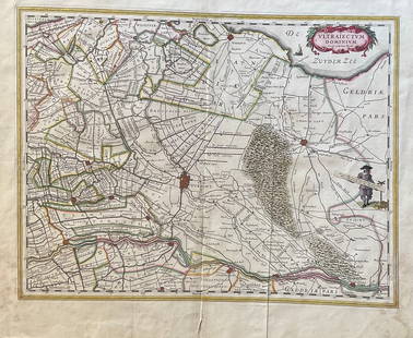
Sold2023The Netherlands Map. The region Around the city of Utrecht. 1660?s by W. BlaeuTitle: The Netherlands Map. The region Around the city of Utrecht. 1660?s by W. Blaeu Date/Period: 1660?s Materials: Hand colored copper plate engraved Size: 22 x 19 1/2'' Netherlands regional map cenSee Sold Price
Sold2018Desnos/de la Tour: Antique Map of Netherlands & BelgiumTITLE/CONTENT OF MAP: 'Les Pays Bas François. Autrichiens, et Hollandois, divisés en Provinces Civiles et Ecclésiastiques. à Paris. Chez le Sr. Desnos. Ingenieur Géographe pour les Globes et Sph�See Sold Price
Featured4 days LeftJasper521680 Wit Map of Southern Netherlands -- Ducatus Geldriae, et Comitatus Zutphaniae, Tabula...US$130
4 days LeftJasper521811 Cary Map of the Netherlands -- A New Map of the United Provinces, Comprehending Holland,US$80
Jun 23Leonard Auction, a division of The Leonard CompanyEuropean and United States Map AssortmentUS$150
4 days LeftJasper521680 de Vit Map of Northwest Germany and Netherlands -- Nova Totius Westphaliae DescriptioUS$120
4 days LeftJasper521691 Coronelli Map of Northwest Germany and Netherlands -- La Vestfalia, detta Altrimenti / DieUS$120
5 days LeftJasper52Norwegia by Bertius / Langenes. The first map to show Norway seperately 1603US$2,000
5 days LeftJasper52Terrae Novae / Terra Nova by Bertius / Langenes. Newfoundland, Canada 1603 mapUS$500
4 days LeftJasper521720 Homann Map of Parts of Begium and Netherlands -- Ducatus Brabantiae Nova Tabula in qua LovaniiUS$120
5 days LeftJasper52Maioricae / Majorcae et Minorcae by Bertius / Langenes. Balearics 1603 old mapUS$320
5 days LeftJasper52Africae / Africa by Bertius / Langenes 1603 old antique vintage map plan chartUS$260
5 days LeftJasper52Americae Australis / Peruana by Bertius / Langenes. South America 1603 old mapUS$280
6 days LeftSwann Auction Galleries(AMERICAS.) Petrus Bertius; and Pierre Mariette. Carte de l'Amerique.US$500
5 days LeftJasper52Zelanda, e parte orientale della Flandra. Flanders & Zeeland. CORONELLI 1696 mapUS$360
5 days LeftJasper52Arabiae / Arabia by Bertius / Langenes. Arabia Persian Gulf Red Sea 1603 mapUS$280
5 days LeftJasper52Chart of the Sea Coasts of England, Flanders & Holland. MOUNT & PAGE 1758 mapUS$420
6 days LeftSwann Auction Galleries(LEO BELGICUS.) Claes Janszoon Visscher; after Hessel Gerritsz. Nova XVII Provinciarum, GermaniaeUS$7,500
6 days LeftSwann Auction Galleries(MERCATOR/HONDIUS.) Group of 19 double-page engraved atlas maps.US$375
BonhamsSHOBERL (FREDERIC) The World in Miniature, FIRST EDITION, COMPLETE IN 43 VOLUMES, R. Ackerman, [...£3,000