Sold2023Pictorial map of western WashingtonHeading: (Washington) Author: Title: Good Natured Map - Shrine Playground - Seattle Washington Place Published: Seattle Publisher:Farwest Lithograph & Printing Co. Date Published: 1936See Sold Price
Sold2023Pictorial map of Washington StateHeading: (Washington) Author: Herman, John F. & Chark Teegarden Title: A Pictorial Map of Washington: The Evergreen State"" Place Published: Seattle, WA Publisher:Ridgway Litho. Co. Date PublisheSee Sold Price
Sold2023Pictorial map of western OregonHeading: (Oregon) Author: Title: Oregon Playground Map. Published by Oregon Recreational Service Eugene, Oregon Place Published: Eugene Publisher:Oregon Recreational Service Date Published:See Sold Price
Sold2018Map of Western Washington Showing Classification ofReserve Reduced! Title: Map of Western Washington Showing Classification of Lands Publication Date: 1898 Cartographer: PLUMMER, GEO. H./J.H. RANKINE Publisher: U.S. GEOLOGICAL SURVEY Size: 42 X 27.5 TSee Sold Price
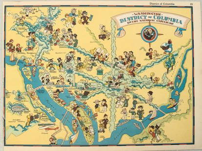
Sold20211938 R Taylor White Pictorial Map of Washington D.C. --Title: 1938 R Taylor White Pictorial Map of Washington D.C. -- Washington District of Columbia the National Capital Cartographer: Ruth Taylor White Year / Place: 1938, Boston Map Dimension (in.): 11.6See Sold Price
Sold20181944 Western Pacific Railroad Pictorial Map of WesternTitle/Content of Map: 1944 Western Pacific Railroad Pictorial Map of Western US with Illustrations -- From San Francisco along the line of Western Pacific Railroad to Salt Lake City Date: 1944, DenverSee Sold Price
Sold20211938 R Taylor White Pictorial Map of Washington --Title: 1938 R Taylor White Pictorial Map of Washington -- Washington Cartographer: Ruth Taylor White Year / Place: 1938, Boston Map Dimension (in.): 11.6 x 8.5 in. This is Ruth Taylor White's charmingSee Sold Price
Sold2022[PACIFIC NORTHWEST]. Two pictorial maps of Oregon and Washi...[PACIFIC NORTHWEST]. Two pictorial maps of Oregon and Washington. Including: -- PETRUCCELLI, Antonio (1907-1994). Pictorial map of Washington and Oregon. 1940. Art Deco style map of the Pacific NorthwSee Sold Price
Sold20201869 McNally Map of Western US -- Washington, Oregon,Title: 1869 McNally Map of Western US -- Washington, Oregon, Idaho, Nevada, Utah, and Arizona Date: 1869, New York Cartographer: F McNally Size: 10.8 X 8.5 in. Additional Information: This is a charmiSee Sold Price
Sold2021Color pictorial bird's-eye airline route maps 1929Heading: (Aviation - pictorial route maps) Author: Title: Western Air Express: Travel by Air, Speed - Comfort - Dependability Place Published: [California?] Publisher:Western Air Express Date PuSee Sold Price
Sold20211877 Mitchell Map of Oregon, Washington, Idaho andTitle: 1877 Mitchell Map of Oregon, Washington, Idaho and Western Montana -- Map of Oregon, Washington, Idaho and Part of Montana Cartographer: S Mitchell Year / Place: 1877 Philadelphia Map DimensionSee Sold Price
Sold20191876 Mitchell Map of Oregon, Washington, Idaho andTitle/Content of Map: 1876 Mitchell Map of Oregon, Washington, Idaho and Western Montana -- Map of Oregon, Washington, Idaho and Part of Montana Date: 1876 Philadelphia Cartographer: S MitchellSize: 1See Sold Price
Sold2022Dole Pictorial Map of the Hawaiian Islands. 1937. Scarce pi...Dole Pictorial Map of the Hawaiian Islands. 1937. Scarce pictorial map of the islands, illustrated with natural and man-made landmarks, native and Western/colonial vessels and boats, attractions, withSee Sold Price
Sold2024Needlepoint MapNOT ELIGIBLE FOR IN-HOUSE SHIPPING. Ribbon attached to verso: "Third Premium Womens Western Washington Fair Puyallup". Sight: 17-3/4" high x 22-1/4" wide. Overall with frame: 19-1/4" high x 24" wide.See Sold Price
Sold2018Cram's RailRoad & Township Map of Washington.Title: Cram's RailRoad & Township Map of Washington. Publication Date: 1881 Cartographer: GEO. F. CRAM Publisher: GEO. F. CRAM Size: 15.5X19 Published for Geo. F. Cram. Proprietor of the Western Map DSee Sold Price
Sold20201869 Mitchell Map of Western US [verso] Mexico andTitle: 1869 Mitchell Map of Western US [verso] Mexico and Central America -- XIX California, Oregon, Idaho, Utah, Nevada, Arizona and Washington [verso] XX Mexico and Central America Cartographer: S MSee Sold Price
Sold2020WYETH, N.C. Map of Discovery - Western HemisphereWYETH, N.C. "Map of Discovery - Western Hemisphere." Fifth of the series of five mural by N.C. Wyeth, the originals which adorn the walls of the National Geographic Society buildings.Washington: NatioSee Sold Price
Sold2016Large geologic map of YellowstoneHeading: Author: U.S. Geological Survey Title: Yellowstone National Park and North Western Wyoming Place Published: Washington Publisher: Date Published: c.1885 Description:See Sold Price
Sold2017Four 19th Century Maps Pertaining to the Western Unitedas follows: Geological Map of a Part of the State of California Explored in 1855 by Lieut. R. S. Williamson U.S. Top Engr (Washington: War Department, 1856); color-coded (24.5 x 19.25 in.) (Some edgeSee Sold Price
Sold2023Map: United States– East Coast / Connecticut– New York/ Long Island Western PartDescription: United States– East Coast / Connecticut– New York/ Long Island Western Part. Published at Washington D.C. US Department of Commerce, National Oceanic Service. Measurement apSee Sold Price
Sold2023Western Territory with NativeTribes namedHeading: Author: [Kingsbury, Lt. J.P.] Title: [Western Territory] Place Published: Washington, D.C. Publisher: Date Published: 1836-[1861] Description: Lithographed map. 25x43 cm (See Sold Price
Sold2021PAIR NC WYETH NAT GEO 1928 MAPSTwo Rare National Geographic Eastern and Western Hemispheres Chromolithographic Maps by NC Wyeth (1822-1945). Washington, DC, 1928. Each: 16 3/4 x 18 1/2 inches sheet. Fold lines visible, as is frequeSee Sold Price
Sold201619thc Civil War Map, Invasion of PennsylvaniaOriginal 19th Century Map, Page from "Harper's Pictorial History Of The Civil War." Shows Pennsylvania, Maryland ,Virginia & Delaware. Gettysburg, Philadelphia & Washington. June, 1863. Approx 10" X 1See Sold Price
Sold2018Group of Four Vintage American Pocket Maps[Maps] Group of Four Vintage American Pocket Maps. Chicago: Rand McNally, 1913 – 14. Including California, Alabama, Washington and Oregon. Brown paper wraps. Pictorial ads, fold out color maps.See Sold Price
4 days LeftJasper521795 Lewis Map of Maryland -- The State of Maryland, from the best AuthoritiesUS$360
Jun 08Leon GalleryGiovanni Battista Ramusio (1485 - 1557) Giacomo Gastaldi (1500 - 1566) - Terza Ostro Tavola (The₱1,300,000
4 days LeftJasper521593 de Jode Maps of Eastern Germany (Saxony Area) and Western Germany -- Mansfeldiae Comitatus ...US$700
4 days LeftJasper521552 Munster Map of Netherlands and Western Germany -- Brabantia III Rheniet X Nova TabulaUS$240
5 days LeftJasper52PERU BOLIVIA CHILE.shows battles/dates inc.War of the Pacific 1877-80 1903 mapUS$25
Jun 08Early American History Auctionsc 1797 JOHN ADAMS, President of the United States of America. Historical Liverpool Creamware PitcherUS$2,000


![[PACIFIC NORTHWEST]. Two pictorial maps of Oregon and Washi...: [PACIFIC NORTHWEST]. Two pictorial maps of Oregon and Washington. Including: -- PETRUCCELLI, Antonio (1907-1994). Pictorial map of Washington and Oregon. 1940. Art Deco style map of the Pacific Northw](https://p1.liveauctioneers.com/928/255324/132836177_1_x.jpg?height=310&quality=70&version=1658268357)

![Color pictorial bird's-eye airline route maps 1929: Heading: (Aviation - pictorial route maps) Author: Title: Western Air Express: Travel by Air, Speed - Comfort - Dependability Place Published: [California?] Publisher:Western Air Express Date Pu](https://p1.liveauctioneers.com/642/204898/103985846_1_x.jpg?height=310&quality=70&version=1621652446)


![1869 Mitchell Map of Western US [verso] Mexico and: Title: 1869 Mitchell Map of Western US [verso] Mexico and Central America -- XIX California, Oregon, Idaho, Utah, Nevada, Arizona and Washington [verso] XX Mexico and Central America Cartographer: S M](https://p1.liveauctioneers.com/5584/188299/94765046_1_x.jpg?height=310&quality=70&version=1608072723)


![Western Territory with NativeTribes named: Heading: Author: [Kingsbury, Lt. J.P.] Title: [Western Territory] Place Published: Washington, D.C. Publisher: Date Published: 1836-[1861] Description: Lithographed map. 25x43 cm (](https://p1.liveauctioneers.com/642/305820/163366515_1_x.jpg?height=310&quality=70&version=1697748923)


![Group of Four Vintage American Pocket Maps: [Maps] Group of Four Vintage American Pocket Maps. Chicago: Rand McNally, 1913 – 14. Including California, Alabama, Washington and Oregon. Brown paper wraps. Pictorial ads, fold out color maps.](https://p1.liveauctioneers.com/928/124137/63148815_1_x.jpg?height=310&quality=70&version=1530051387)


