Sold2018Soconyland 1930 Map of New EnglandSoconyland 1930 Map of New England Large fold-out map. Type in orange and blue. This would be nice if it was framed. Maker: Standard Oil Co of NeSee Sold Price
Sold2022Old Houses in England, Chunter, 1930CHUNTER, ROWLAND. Old Houses in England. New York: John Wiley & Sons; London: Chapman & Hall, 1930. Folio (13 3/4" x 10 3/4"). Red gilt cloth, pictorial map endpapers. Full-page black and white photogSee Sold Price
Sold20241746 Large Engraved Map New England Nova ScotiaA New Chart of the Coast of New England, Nova Scotia, New France or Canada with the Islands of NewFoundl(an)d, Cape Breton, St. John and C.. by Nicolas Bellin, English version printed for Gentleman'sSee Sold Price
Sold20171746 Leather Volume Map New England English Rebellion1746 Volume , featuring large folding “New Chart of the Coast of New England Nova Scotia, New France or Canada…”, of Gentleman’s Magazine for the year 1746 containing all twelve issues and SupSee Sold Price
Sold20181884 Captain John Smith Works maps New England VirginiaHard bound. Printed in England in 1884 Maps with some acid free tape repairs. Back cover is almost detached. Size 5 3/4 by 8" 982 pages Please note that this lot has a confidential reserve. When you lSee Sold Price
Sold2023Dept 56 Navigational Charts & Maps New England Village Series Heritage Village CollectionDepartment 56 Navigational Charts & Maps New England Village Series Heritage Village Collection Christmas Village Building with Original BoxSee Sold Price
Sold2021Painting, Gardner SymonsGardner Symons (American, 1863-1930), New England Winter Scene, oil on board, signed lower left, board: 8"h x 10"w, overall (with frame): 16"h x 18"wSee Sold Price
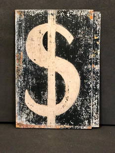
Sold2017Vintage Gas Pump Dollar Sign, Circa 1930Gas Pump Dollar Sign, c. 1930 New England. Iconic symbol. 13 1/2 h x 9 1/2 w c. 1930 Please note that this lot has a confidential reserve. When you leave a bid in advance of the auction, submit your mSee Sold Price
Sold2017Dangerous! Wood Warning Sign, Circa 1930DANGEROUS! wood sign, c 1930 New England sign in original color with grey border, shaded red lettering & graphic tilted exclamation point. Good surface & nail bleed. 21" w x 5 1/2" h. Please note thSee Sold Price
Sold2019New England states, MI, MA, NH, VT, CT, RITitle/Content of Map: New England states, MI, MA, NH, VT, CT, RI Date: 1861 Cartographer: Johnson Material/Medium: steel engraved Size: 28x14” Provenance: New York Additional Info: Hand colored ReseSee Sold Price
Sold2021New England States 1873Title/Content of Map: New England States 1873 Date Printed: 1873 Cartographer: J. BartholemewMaterial/Medium: paper Size: 13x 18 inches Zell's Descriptive Hand Atlas Reserve: $30.00 Shipping: DomSee Sold Price
Sold20221947 New England Airport Map & Circa 60's American AirlinesSystem Map. New England Map has some tearing. Please see photos and come to the 2 day preview for condition.See Sold Price
Sold2022John Smith Map of New England, Extremely Rare 2nd StateSMITH, John (1580-1631). New England the most remarqueable parts thus named by the high and mighty Prince Charles, Prince of great Britaine. Observed and described by Captayn John Smith... CopperplateSee Sold Price
Sold2024John Speed and Francis Lamb "Map of New England and New York", ca. 1676. Hand colored engraved mapJohn Speed and Francis Lamb "Map of New England and New York", ca. 1676. Hand colored engraved map with depictions of animals such as beavers, elk, bears, foxes, and more. Vivid colors. Slight tear upSee Sold Price
Sold2018Homann: Antique Map of New England, 1720The map names New England as "Almouchi Cosen" as well as Nova Anglia, while present-day New York State is named variously as New Jork, Nieuw Nederland and Novum Belgium (New York, New Netherlands andSee Sold Price
Sold20181730 Seutter Map of New England to Virginia -- RecensTitle/Content of Map: 1730 Seutter Map of New England to Virginia -- Recens Edita totius Novi Belgii, in America Septentrionali siti, delineatio cura et Sumtibus Date: 1730, Nurnberg Cartographer: M SSee Sold Price
Sold2020Tobias Lotter Map of New England 1776Tobias Conrad Lotter (1717-1777), "A Map of the Most Inhabited part of New England, containing the Provinces of Massachusets Bay and New Hampshire, with the Colonies of Conecticut and Rhode Island, DiSee Sold Price
Sold20191730 Seutter Map of New England to Virginia -- RecensTitle: 1730 Seutter Map of New England to Virginia -- Recens Edita totius Novi Belgii, in America Septentrionali siti, delineatio cura et Sumtibus Date: 1730, Nurnberg Cartographer: M Seutter Size: 19See Sold Price
Sold2021Matthäus Seutter, Map of New England, c. 1730Property from a Private Collection, Hilton Head Island, SC Description: Matthäus Seutter (German/ Augsburg, 1678–1756/57) Map of New England, c. 1730, an updated view of New Netherlands inSee Sold Price
Sold2016MAP OF NEW ENGLAND'Nova Belgica et Anglia Nova', by Willem Blaeu (1571-1663), hand-colored engraving, after a manuscript map by Adriaen Block, see Burden 241: 'First printed map that depicts canoes and North American fSee Sold Price
Sold2016Blaeu map of New England and New Yourk 1635Heading: Author: Blaeu, Willem Title: Nova Belgica et Anglia Nova Place Published: Amsterdam Publisher: Date Published: 1635 Description: Copper-engraved map, hand-coloredSee Sold Price
Sold20231777 Jefferys-Mead Map of New England French Ed.Bottom two sheets of the French edition of the "Map of the most Inhabited part of New England..." produced by Georges-Louis Le Rouge, then the royal Geographer to Louis XVI, after the English originalSee Sold Price
6 days LeftJasper521892 Black Map of US New England to New York, Pennsylvania, New Jersey and Canadian Maritimes plusUS$85
May 23Sloans & KenyonMOTOR ROUTES TO "REAL NEW ENGLAND INNS" MAP JOHN HELD JR, CIRCA 1930S. - Sight: 41 x 27 inches.US$750
May 23Sloans & KenyonTOTAL ECLIPSE OF THE SUN : SEE NIGHT-TIME WHEN ITS DAY IN NEW ENGLAND WHILE YOU PLAY JOHN HELD JRUS$1,000
May 23Sloans & KenyonNORTHWARD TRAVEL BY TRAIN TO VACATION LAND - NEW ENGLAND AND CANADA. THE NEW HAVEN R.R. TRAVELUS$1,000
6 days LeftThomaston Place Auction GalleriesCOLLECTION OF TRAVEL EPHEMERA, BROCHURES, BOOKLETS, MAPS 1900-1950US$100
Jun 07Freeman's | Hindman[HARDY, Thomas]. -- WINDLE, C.A. The Wessex of Thomas Hardy. Edmund H. New, illustrator. 1902.US$200


![[HARDY, Thomas]. -- WINDLE, C.A. The Wessex of Thomas Hardy. Edmund H. New, illustrator. 1902. (1 of 3)](https://p1.liveauctioneers.com/197/329395/177650387_1_x.jpg?height=282&quality=70&version=1715364962)


