Sold2023SOUTH AMERICA. Britannica 9th edition 1898 old antique vintage map plan chartTitle: SOUTH AMERICA. Britannica 9th edition 1898 old antique vintage map plan chart Description: South America' by Britannica, Encyclopaedia (1898). Antique coloured map, 32.5 x 25.0cm, 12.75 x 9.75See Sold Price
Sold2023AFRICA. Africa. Britannica 9th edition 1898 old antique vintage map plan chartTITLE/CONTENT OF MAP: 'Africa' DATE PRINTED: 1898 IMAGE SIZE: Approx 26.0 x 32.5cm, 10.25 x 12.75 inches (Large); Please note that this is a folding map. TYPE: Antique coloured map CONDITION: Good; suSee Sold Price
Sold2023Isothermal lines of South America 1885 old antique vintage map plan chartTitle: Isothermal lines of South America 1885 old antique vintage map plan chart Description: Isothermal lines of South America' by Engraved for Élisée Reclus (1885). Antique wood-engraved mSee Sold Price
Sold2023ARGENTINA. Inset Buenos Aires. BARTHOLOMEW 1898 old antique map plan chartTitle: ARGENTINA. Inset Buenos Aires. BARTHOLOMEW 1898 old antique map plan chart Description: South America (Section 3); Inset maps of Buenos Ayres; Valparaiso' by John Bartholomew (1898). Antique coSee Sold Price
Sold2024CARIBBEAN. West Indies & Central America. Britannica 9th edition 1898 old mapTITLE/CONTENT OF MAP: 'West Indies' DATE PRINTED: 1898 IMAGE SIZE: Approx 18.0 x 24.5cm, 7.25 x 9.75 inches (Medium) TYPE: Antique coloured map CONDITION: Good; suitable for framing. However, please nSee Sold Price
Sold2023MAPS. South America 1870 old antique vintage plan chartTitle: MAPS. South America 1870 old antique vintage plan chart Description: South America' by Engraved by John Bartholomew, F.R.G.S. (1870). Coloured antique map, 30.0 x 23.0cm, 12 x 9 inches; PleaseSee Sold Price
Sold2023South America (Relief). Rivers Mountains 1907 old antique map plan chartTitle: South America (Relief). Rivers Mountains 1907 old antique map plan chart Description: South America (Relief)' by Scientific American (1907). Vintage colour map, 21.0 x 17.5cm, 8.25 x 7 inches;See Sold Price
Sold2018Bonne: Antique Map of South America, 1780TITLE/CONTENT OF MAP: 'Amerique Méridionale' A map of South America. old antique map plan chart DATE PRINTED: 1780 IMAGE SIZE: Approx 34.5 x 22.5cm, 13.5 x 9 inches (Large); Please note that this isSee Sold Price
Sold2023Amerique Méridionale. South America. BONNE 1780 old antique map plan chartTitle: "Amerique Méridionale". South America. BONNE 1780 old antique map plan chart Description: Amerique Méridionale' by Rigobert Bonne (1780). Antique copperplate engraved map, 34.5 x 22.5cm,See Sold Price
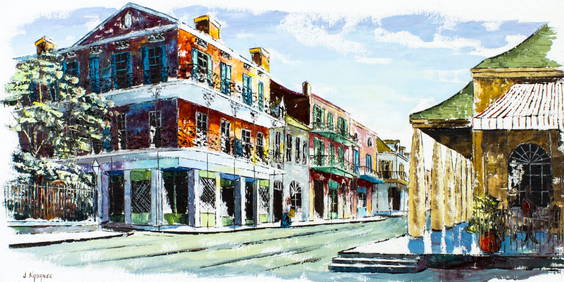
Sold2024SOUTH AMERICA. Political. BARTHOLOMEW 1924 old vintage map plan chartTITLE/CONTENT OF MAP: 'South America; Inset map of Continuation of Southern Part' DATE PRINTED: 1924 IMAGE SIZE: Approx 44.5 x 34.0cm, 17.5 x 13.25 inches (Large); Please note that this is a folding mSee Sold Price
Sold2023South America. Second World War 1942 old vintage map plan chartTitle: South America. Second World War 1942 old vintage map plan chart Description: South America' by George Philip & Son (1942). Vintage colour map, 27.5 x 22.0cm, 10.75 x 8.5 inches Product InformatSee Sold Price
Sold2023South America. Second World War 1942 old vintage map plan chartTitle: South America. Second World War 1942 old vintage map plan chart Description: South America' by George Philip & Son (1942). Vintage colour map, 27.5 x 22.0cm, 10.75 x 8.5 inches Product InformatSee Sold Price
Sold2023South America by George Heriot SWANSTON 1860 old antique map plan chartTitle: South America by George Heriot SWANSTON 1860 old antique map plan chart Description: South America' by G H Swanston (1860). Antique atlas map with original hand colour, 53.0 x 42.5cm, 21 x 16.7See Sold Price
Sold2023South America. Bolivia w/ Littoral. HUGHES 1876 old antique map plan chartTitle: South America. Bolivia w/ Littoral. HUGHES 1876 old antique map plan chart Description: South America' by William Hughes (1876). Antique hand coloured engraved map, 30.5 x 26.0cm, 12 x 10.25 inSee Sold Price
Sold2024SOUTH AMERICA. general map. BARTHOLOMEW 1890 old antique plan chartTITLE/CONTENT OF MAP: 'South America' DATE PRINTED: 1890 IMAGE SIZE: Approx 42.0 x 30.5cm, 16.5 x 12 inches (Large); Please note that this is a folding map. TYPE: Antique colour map CONDITION: Good; sSee Sold Price
Sold2023SOUTH AMERICA. general map. BARTHOLOMEW 1890 old antique plan chartTitle: SOUTH AMERICA. general map. BARTHOLOMEW 1890 old antique plan chart Description: South America' by John Bartholomew (1890). Antique colour map, 42.0 x 30.5cm, 16.5 x 12 inches; Please note thatSee Sold Price
Sold2016America.- Burr (David H.) - An Atlas of the State ofContaining a Map of the State and of the Several Counties, [third edition], engraved title, 51 hand-coloured engraved maps and plans on 52 sheets as issued, including double-page and folding, some foxSee Sold Price
Sold2023Antique 1805 Map of the United States of America On Silk School Girl LivingstonAntique map of the United States on silk. Made by a school girl Mary Livingston 1805. Survives in excellent condition as it was discovered in a blanket chest along the Hudson River from an estate a feSee Sold Price
Sold2024Lot of 3 Mens Antique South Bend Watch Co Openface Running Vintage Pocket WatchesDescribed By:Edison CNX 1623 8166, 8167, 8168 Title:Lot of 3 Mens Antique South Bend Watch Co Openface Running Vintage Pocket Watches Description: Lot of 3 Mens Antique South Bend Watch Co Openface FaSee Sold Price
Sold2024Lot of 3 Antique South Bend Watch Co Mens And Ladies Vintage Art Deco Running Pocket WatchesDescribed By:Edison CNX 1623 8160,8161,8162 Title:Lot of 3 Antique South Bend Watch Co Mens And Ladies Vintage Art Deco Running Pocket Watches Description: Lot of 3 Antique South Bend Watch Co Mens AnSee Sold Price
Sold2024Sailor Ship Wheel Rope Folk Art Vintage or Antique Impressive Size and DetailSailor Rope Folk Art Vintage or Antique Impressive Size and Detail, this appears to be all natural fibers, we estimate it to be at least 75 years old, but it could be quite a bit older than that. MeasSee Sold Price
Sold2024Audubon - Common or Arctic Puffin. 464This hand-colored lithograph comes from John James Audubon's first octavo edition of Birds of America published from 1840 to 1844. The work was completed under the direct supervision of J. J. Audubon.See Sold Price
Sold2019Old Chinese 24K Pure Gold IngotOld Chinese 24K Pure Gold Ingot , famous brand ,with maker's mark and five signatures , late 19th century to early 20th century , weight : 31.04 grams , in excellent conditionSee Sold Price
Sold2024Audubon, Imperial Folio - Polar Bear. 91This exceptional folio lithograph is from John James Audubon's The Viviparous Quadrupeds of North America. It was part of the Imperial Folio Edition published between 1845 and 1851. The color on thisSee Sold Price
7 days LeftTHOS. CORNELL GALLERIES, LTD.GROUP OF ANTIQUE AND VINTAGE MAPS, INC.. NORTH AND SOUTH AMERICA, WORLD MAPS, LOSSES THROUGHOUT,US$100(1 bid)
May 19Broward Auction GalleryJohann Adalbert Heine (German,1850-1900) oil painting antiqueUS$240(12 bids)


![America.- Burr (David H.) - An Atlas of the State of: Containing a Map of the State and of the Several Counties, [third edition], engraved title, 51 hand-coloured engraved maps and plans on 52 sheets as issued, including double-page and folding, some fox](https://p1.liveauctioneers.com/410/84263/43496522_1_x.jpg?height=310&quality=70&version=1453293226)