Sold2019Unknown, "Southern States," 1839, hand colored, H. - 11Unknown, "Southern States," 1839, hand colored, H. - 11 1/2 in., W. - 18 1/4 in.See Sold Price
Sold2019Two Maps by Samuel Augustus Mitchell (1790-1868), "MapTwo Maps by Samuel Augustus Mitchell (1790-1868), "Map of the Western States and Chief Parts of the SouthernStates," 1852, hand colored, H.-11/2 in., W.- 17 1/2 in., and 11 5/8 in., W.- 18 in.See Sold Price
Sold2019S. AUGUSTAS MITCHELLS. AN ENGRAVED MAP OF THE SOUTHERNS. AUGUSTAS MITCHELLS. AN ENGRAVED MAP OF THE SOUTHERN STATES, HAND COLORED,1839, for Mitchell's School and Family Geography. 11 1/4" x 17 1/4".See Sold Price
Sold2019S. AUGUSTAS MITCHELLS, AN ENGRAVED MAP OF THE SOUTHERNS. AUGUSTAS MITCHELLS, AN ENGRAVED MAP OF THE SOUTHERN STATES, HAND COLORED,1839, for Mitchell's School and Family Geography. 11 1/4" x 17 1/4"See Sold Price
Sold20201839 Maps, Middle States, Burgess, MitchellTwo hand colored maps, both dated 1839: "Map of the Middle States and part of the Southern, Engraved to Illustrate Mitchells School and family Geography" by S. Augustus Mitchell, engraved by J. H. YouSee Sold Price
Sold2019Samuel Augustus Mitchell (1790-1868), "Map of theSamuel Augustus Mitchell (1790-1868), "Map of the United States," 1852, hand colored, H.-11 1/4 in., W.- 18 in.See Sold Price
Sold2022Menardeau Signed Etchings Set of 4 Original FramesArtist: Maurice Menardeau Title: La Rochepot, Les Peupliers, Unknown, La Cote Medium: Hand Colored Etchings Art Dimensions: 13 H x 11 W inches Framed Dimensions: 15 H x 17 W inchesSee Sold Price
Sold20181839 Hand Colored Bartlett Engraving Natural Bridge1839 Handcolored engraving of W. H. Bartlett of “Natural Bridge, Virginia”, printed at London George Virtue and Co., Fine, measures 8.25 x 11”. Please note that this lot has a confidential reserSee Sold Price
Sold2019Unknown, "A Map of the United States of America withUnknown, "A Map of the United States of America with Part of Adjoining Provinces," c. 1800, matted and mounted, hand colored, H. - 10 in., W. - 12 1/2 in.See Sold Price
Sold2020Unknown Artist. Baby Boy.Unknown Artist. Baby Boy. Hand-colored and painted photograph. 7" w x 5". Ornate gold frame is 13.25" w x 11.25" h. Excellent condition. Est. $100-300. Ship: $35See Sold Price
Sold2022Antique Vernis Martin Style VitrineTitle: Vitrine Medium: Wood Style: Hand Colored Size: 64" H x 26" L x 11" W Age: Antqiue Condition: Good overall condition for its age, Maker: Unknown Great for collection or home decoration. ProvenanSee Sold Price
Sold202317TH C. ENGRAVED VIEW OF VIENNAHand-colored engraving, view of Vienna. Unknown publication. With very flourished German script. Table with (24) noted locations. Dimensions: (Frame) H 17.5" x W 19.5", (Sight) H 11.5" x W 14" ConditiSee Sold Price
Sold2022TWO CURRIER AND IVES PRINTS.Hand colored lithograph on paper. Oval "An American Winter Scene" with toning. 9.25"h. 11.25"w. and "Southern River Scenery", 15.75"h. 19.5"w. Framed sizes.See Sold Price
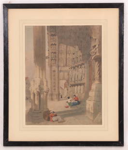
Sold2022Thomas Shotter Boys (British, 1803–1874) ChartresA hand colored lithograph on paper titled "S. Porch Of Chartres Cathedral," signed in the plate lower right "J. Boys 1839." Dimensions: 20.5" H x 17.25" W framed, 14" H x 11" W mat opening. ProvenanceSee Sold Price
Sold20201839 Western States – unsettled borders, ColtonOregon, Washington, California, Colorado, Nevada, Utah, New Mexico and Arizona, J. H. Colton. 1839 copyright date found in 1864 Colton school atlas. This hand colored map was created before most westeSee Sold Price
Sold20221839 Western States – unsettled borders, ColtonOregon, Washington, California, Colorado, Nevada, Utah, New Mexico and Arizona, J. H. Colton. 1839 copyright date found in 1864 Colton school atlas. This hand colored map was created before most westeSee Sold Price
Sold2023Genova, Paolo Rivara Geografia Commerciale Italian Hand Colored MapItalian hand colored map depicting the Eastern United States titled "Stati Occidentali Della Unione Americana" originally from Geografia Commerciale 1858. Sight Size: 11 1/2" H X 13 3/4" W.See Sold Price
Sold2019Nicolas De Fer (1646-1720),'le Canada au NouvelleNicolas De Fer (1646-1720),'le Canada au Nouvelle France la Florida, la Virginie, Pensivanie, Caroline," 1702,hand colored, H. - 11 1/2 in., W. - 15 3/8 in.See Sold Price
Sold2019Nicolas De Fer (1646-1720), "Mappe Mondeou CarteNicolas De Fer (1646-1720), "Mappe Mondeou Carte Universal," 1702, hand colored, H. - 11 1/4 in., W.- 15 1/4 in.See Sold Price
Sold2019Nicolas De Fer (1646-1720), "Cette Carte de CalifornieNicolas De Fer (1646-1720), "Cette Carte de Californie et du Nouveau Mexique," 1700, hand colored, H.- 11 1/2 in., W.- 15 1/4 in.See Sold Price
Sold2019Two Maps by Samuel Augustus Mitchell (1790-1868), "MapTwo Maps by Samuel Augustus Mitchell (1790-1868), "Map of North America," No. 4, 1852, hand colored, H. -11 1/2 in., W. - 9 1/8 in. (2 Pcs.)See Sold Price
Sold2019Three Copies of Samuel Augustus Mitchell (1790-1868),Three Copies of Samuel Augustus Mitchell (1790-1868), "Plan of New Orleans," 1862, hand colored, H. -11 1/4 in., W. - 15 1/8 in.See Sold Price
Sold2019Samuel Augustus Mitchell (1790-1868), "County Map ofSamuel Augustus Mitchell (1790-1868), "County Map of Scotland and Ireland," 1852, hand colored, H.-11 5/8 in., W.- 9 1/4 in.See Sold Price
Sold2019J. H.Colton, "Plan of New Orleans," 1884, hand colored,J. H.Colton, "Plan of New Orleans," 1884, hand colored, H.- 11 3/4 in., W.- 15 1/4 in.See Sold Price
Jul 06Case Antiques, Inc. Auctions & Appraisals4 Theodor de Bry, Early Fla. & Va. Native American PrintsUS$200
Jul 07Case Antiques, Inc. Auctions & Appraisals5 Framed Currier & Ives Kitten LithographsUS$150(1 bid)
4 days LeftEldred'sCARTOON DRAWING "THE MAN WHO CHEWED GUM IN THE MARLBOROUGH!" 20th Century 11.5" x 16.25" sight.US$70