Sold2021Wilkes, John 1798 Map. Ancient AfricaCopper Engraved Map Published 1796-1828 London for "Encyclopaedia Londinensis, or universal dictionary of arts, sciences and literature" by John Wilkes et al. Paper Size: 10.5 x 8.5 inch (27 x 22cm) GSee Sold Price
Sold2021Wilkes, John 1804 Map. Ancient EuropeCopper Engraved Map Published 1796-1828 London for "Encyclopaedia Londinensis, or universal dictionary of arts, sciences and literature" by John Wilkes et al. Paper Size: 10.5 x 8.5 inch (27 x 22cm) VSee Sold Price
Sold2021Wilkes, John C1815 Map. Ancient AsiaCopper Engraved Map Published 1796-1828 London for "Encyclopaedia Londinensis, or universal dictionary of arts, sciences and literature" by John Wilkes et al. Paper Size: 10.5 x 8.5 inch (27 x 22cm) TSee Sold Price
Sold2021Wilkes, John 1796 Map. Modern AfricaCopper Engraved Map Published 1796-1828 London for "Encyclopaedia Londinensis, or universal dictionary of arts, sciences and literature" by John Wilkes et al. Paper Size: 10.5 x 8.5 inch (27 x 22cm) GSee Sold Price
Sold2022Wilkes, John 1804 Pair of Maps. Ancient & Modern EuropeCopper Engraved Map Published 1796-1828 London for "Encyclopaedia Londinensis, or universal dictionary of arts, sciences and literature" by John Wilkes et al. Paper Size: 10.5 x 8.5 inch (27 x 22cm) VSee Sold Price
Sold2021Wilkes, John 1807 Hand Col Map. Ancient Britain"Britannia Antiqua" Finely Hand Colored Copper Engraved Map Published 1796-1828 London for "Encyclopaedia Londinensis, or universal dictionary of arts, sciences and literature" by John Wilkes et al. PSee Sold Price
Sold2021Wilkes, John 1807 Hand Col Map. Ancient Spain"Hispania Antiqua" Finely Hand Colored Copper Engraved Map Published 1796-1828 London for "Encyclopaedia Londinensis, or universal dictionary of arts, sciences and literature" by John Wilkes et al. PaSee Sold Price
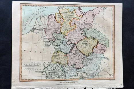
Sold2021Wilkes, John 1807 Hand Col Map. Ancient Germany"Germania Antiqua" Finely Hand Colored Copper Engraved Map Published 1796-1828 London for "Encyclopaedia Londinensis, or universal dictionary of arts, sciences and literature" by John Wilkes et al. PaSee Sold Price
Sold20191798 Wilkinson Map of Northern Africa in Ancient TimesTitle: 1798 Wilkinson Map of Northern Africa in Ancient Times -- Africa Antiqua Date: 1798, London Medium: R Wilkinson Size: 7.9 X 11.1 in. Additional Information: This is an attractive map Northern ASee Sold Price
Sold2021Guthrie, William 1798 Map. Africa ContinentCopper Engraved Map Published 1798, London for "A New Geographical, Historical and Commercial Grammar..." by William Guthrie. The maps are by John Senex, Thomas Kitchin and others. Folds as issued. PaSee Sold Price
Sold20201747 Map of Ancient Europe Asia AfricaA Map of Europe Asia and Africa as far as they are described in Lucan's Pharsalia, published by John and Paul Knapton, London, 1747 in "Geographia Classica". 13.5" x 8" overall and map measureing 9 xSee Sold Price
Sold2021Wilkes, John 1798 Antique Print. ArmourCopper Plate Published 1796-1828 London for "Encyclopaedia Londinensis, or universal dictionary of arts, sciences and literature" by John Wilkes et al. Paper Size: 10.5 x 8.5 inch (27 x 22cm) Tiny watSee Sold Price
Sold2021Wilkes, John 1798 Lot of 4 Military Prints. ArtilleryCopper Plates Published 1796-1828 London for "Encyclopaedia Londinensis, or universal dictionary of arts, sciences and literature" by John Wilkes et al. Paper Size: 10.5 x 8.5 inch (27 x 22cm) Some maSee Sold Price
Sold2021Wilkes, John 1797 Map. United StatesCopper Engraved Map Published 1796-1828 London for "Encyclopaedia Londinensis, or universal dictionary of arts, sciences and literature" by John Wilkes et al. Paper Size: 10.5 x 8.5 inch (27 x 22cm) GSee Sold Price
Sold2021Wilkes, John 1796 Map. North AmericaCopper Engraved Map Published 1796-1828 London for "Encyclopaedia Londinensis, or universal dictionary of arts, sciences and literature" by John Wilkes et al. Paper Size: 10.5 x 8.5 inch (27 x 22cm) ISee Sold Price
Sold2021Wilkes, John 1797 Map. British Colonies in N. AmericaCopper Engraved Map Published 1796-1828 London for "Encyclopaedia Londinensis, or universal dictionary of arts, sciences and literature" by John Wilkes et al. Paper Size: 10.5 x 8.5 inch (27 x 22cm) VSee Sold Price
Sold20201798 Map of Ancient ItalyAuthor: Anonymous Title: 1798 Map of Ancient Italy Medium: Ink on Paper Dimensions: 14"X19" Map of Ancient Italy dated 1798. Engraved in 2 parts, north and south on hand laid cotton paper. Roman key lSee Sold Price
Sold20211747 Map of Ancient Africa EgyptA map of "Africa ex Bello Africano C I Caesaris", with inset of Egypt at the time of the Roman Empire. Printed at London by Knapton, 1747. Map measures 9.97 x 6.75" with extra wide left margin. Fine.See Sold Price
Sold2021Wilkes, John 1800 Map. ChinaCopper Engraved Map Published 1796-1828 London for "Encyclopaedia Londinensis, or universal dictionary of arts, sciences and literature" by John Wilkes et al. Paper Size: 10.5 x 8.5 inch (27 x 22cm) GSee Sold Price
Sold2021Wilkes, John 1804 Map. England & WalesCopper Engraved Map Published 1796-1828 London for "Encyclopaedia Londinensis, or universal dictionary of arts, sciences and literature" by John Wilkes et al. Paper Size: 10.5 x 8.5 inch (27 x 22cm) GSee Sold Price
Sold2021Wilkes, John 1810 Map. ItalyCopper Engraved Map Published 1796-1828 London for "Encyclopaedia Londinensis, or universal dictionary of arts, sciences and literature" by John Wilkes et al. Paper Size: 10.5 x 8.5 inch (27 x 22cm) TSee Sold Price
Sold2021Wilkes, John 1802 Map. CornwallCopper Engraved Map Published 1796-1828 London for "Encyclopaedia Londinensis, or universal dictionary of arts, sciences and literature" by John Wilkes et al. Paper Size: 10.5 x 8.5 inch (27 x 22cm) WSee Sold Price
Sold2021Wilkes, John 1811 Map. Middlesex LondonCopper Engraved Map Published 1796-1828 London for "Encyclopaedia Londinensis, or universal dictionary of arts, sciences and literature" by John Wilkes et al. Paper Size: 10.5 x 8.5 inch (27 x 22cm) VSee Sold Price
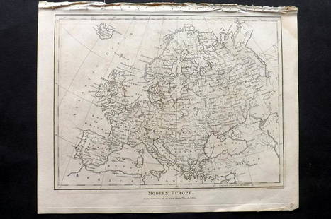
Sold2021Wilkes, John 1804 Map. Modern EuropeCopper Engraved Map Published 1796-1828 London for "Encyclopaedia Londinensis, or universal dictionary of arts, sciences and literature" by John Wilkes et al. Paper Size: 10.5 x 8.5 inch (27 x 22cm) VSee Sold Price
2 days LeftZikorn Arts & History ObjectsJohn W. Barber: Barber's Illustrated Proverbs, 1856 First EditionUS$120
55 mins LeftJasper521600 GEOGRAPHICAL HISTORIE OF AFRICA antique by JOANNES LEO AFRICANUS 16th cent.US$1,900
1818 AuctioneersTravel. Africa. Roberts, John S. - Africa, and African Travel and Adventure, &c. London: W. P.£10
4 days LeftTrillium Antique Prints & Rare BooksCatherwood - Principal Court of the Palace at Palenque [upper subject]; Interior of Casa No. III.,US$500
2 days LeftPotter & Potter AuctionsAUDIBERTI, J. Choain. Afrique Equatoriale Francaise. Paris:...US$100(1 bid)
2 days LeftPotter & Potter AuctionsSTORM, Mark. Official Texas Brags Map of North America. 194...US$200(1 bid)
2 days LeftPotter & Potter AuctionsPan American Airways World System Map. 1956. Art by John Br...US$200
7 days LeftFreeman's | HindmanJohn Tabraham (20th Century) Dining TableKallenbach, South AfricaUS$400
16 hrs LeftUniversity ArchivesFeb. 1777 Issue of The Gentleman's Magazine with Superb Map of PhiladelphiaUS$140(1 bid)
16 hrs LeftUniversity ArchivesDeclaration of Independence, Very Early British Publ. in Gentleman's Magazine & Rare MapUS$1,000


![Catherwood - Principal Court of the Palace at Palenque [upper subject]; Interior of Casa No. III., (1 of 3)](https://p1.liveauctioneers.com/6581/329359/177638024_1_x.jpg?height=282&quality=70&version=1715344772)


![[MAP]. SPEED, John. A New Mappe of the Romane Empire. 1676. (1 of 2)](https://p1.liveauctioneers.com/197/329395/177650541_1_x.jpg?height=282&quality=70&version=1715364962)


