Sold20201887 Map of Oklahoma and the Indian TerritoryAuthor: Cram Title: 1887 Map of Oklahoma and the Indian Territory Medium: Ink on PaperDimensions: 14.5"X11" Map of Oklahoma and the Indian Territory dated 1887. Engraved and published by George Cram iSee Sold Price
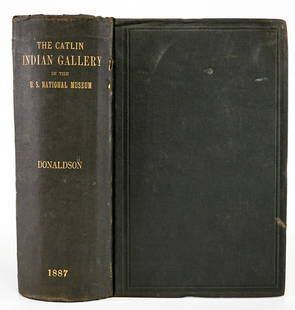
Sold2023George Catlin Indian Gallery [170312]This is a publication put out by the U.S. National Museum and authored by Thomas Donaldson. This 939 page book has an 1887 copyright. There are also several loose maps, showing the various tribal landSee Sold Price
Sold2020George Catlin Indian Gallery by Donaldson 1887The George Catlin Indian Gallery in the U. S. National Museum with Memoir and Statistics by Thomas Donaldson. 1887. Government Printing Office, Washington. 915 pp. with 142 illustrations, 3 photogravuSee Sold Price
Sold2022George Catlin - Outline Map of Indian Localities 1833Artist: George Catlin Title: Outline Map of Indian Localities 1833 Year: 1844 Dimensions: 6in. by 10in. Edition: From the Rare Limited Edition Publisher: ChattoSee Sold Price
Sold20181887 Mitchell Map od Indian Territory -- IndianTitle/Content of Map: 1887 Mitchell Map od Indian Territory -- Indian Territory Date: 1887, Philadelphia Cartographer: S Mitchell Size: 11.6 x 14.5 in. A very nice map of the Indian Territories, but oSee Sold Price
Sold20201887 Map of Oklahoma and the Indian territoryAuthor: Watson Title: 1887 Map of Oklahoma and the Indian territory Medium: Ink on Paper Dimensions: 14.5"X11.5" Map of Oklahoma and the Indian territory dated 1887. Engraved and published by Watson iSee Sold Price
Sold20201887 Cram Map of Texas [verso] Indian Territory [verso]Title/Content of Map: 1887 Cram Map of Texas [verso] Indian Territory [verso] Arkansas -- Texas [verso] Indian Ty. [verso] Arkansas Date: 1887, Chicago Cartographer: G Cram Size: 12 X 17 in. This is aSee Sold Price
Sold20201887 Map of Oklahoma and the Indian TerritoryAuthor: Watson Title: 1887 Map of Oklahoma and the Indian Territory Medium: Ink on Paper Dimensions: 16"X11.5" Map of Oklahoma and the Indian territory dated 1887. Engraved and published by Watson inSee Sold Price
Sold20201887 Map of Oklahoma and the Indian TerritoryAuthor: Cram Title: 1887 Map of Oklahoma and the Indian Territory Medium: Ink on Paper Dimensions: 14.5"X11" Description: Map of Oklahoma and the Indian territory dated 1887. Engraved and published bySee Sold Price
Sold2021Map of Texas and Indian Territory - 1850'sMap of Texas and Indian Territory Cartographer: George Woolworth Colton Dated: C 1850's Type: Engraved Hand Colored Dimensions: 9 1/2 x 7 1/2" ConditiSee Sold Price
Sold2021Large Map of Oklahoma & Indian TerritoriesMap of Oklahoma & Indian Territories With map of New Mexico on verso Cartographer: George Franklin Cram Dated: Circa 1900 Type: Color LithographSee Sold Price
Sold20201887 Map of Indian NationsAuthor: Clare Title: 1887 Map of Indian Nations Medium: Ink on Paper Dimensions: 14"X11.5" Map dated 1887 part of Watson's General Atlas. Engraved by I.S. Clare it captures the Indian Nations territorSee Sold Price
Sold2022(NATIVE AMERICANS.) George Catlin. North American Indians Being Letters and Notes on Their Manners,(NATIVE AMERICANS.) George Catlin. North American Indians Being Letters and Notes on Their Manners, Customs, and Conditions. 180 chromolithographed plates (including 3 maps, one folding). 2 volumes. RSee Sold Price
Sold2017Cram: Antique Map of Indian Territory, 1891Map: Indian Territory Date: 1891 From Cram's "Unrivaled Family Atlas of the World Indexed" Size: 14.5 x 11 inches George F. Cram (1842-1928) served in the U.S. Army during the American Civil War. AfteSee Sold Price
Sold2021Catlin, George 1848 Pair of USA Maps. American Indians"A Chart Shewing The Moves of The Mandans & The Place of their extinction" and "U. States Indian Frontier in 1840" Etchings Published 1848, London for "Illustrations of the Manners, Customs, and CondiSee Sold Price
Sold2024North American Indians by George Catlin, octavo,2 volumes, London, 1841, second edition, full leather with 400 illustrations and maps. All edges gilt. Very good overall condition with some wear on edges of bindings. Handwritten dedication to AdoraSee Sold Price
Sold2019George Cram’s "Rail Road Map, Texas and IndianGeorge Cram’s "Rail Road Map, Texas and Indian Territory," 1900, H.- 18 3/8 in., W.- 26 3/4 in.See Sold Price
Sold20201883 Map of the Indian TerritoryAuthor: Cram Title: 1883 Map of the Indian Territory Medium: Ink on Paper Dimensions: 13.5"X11" Map of the Indian Territory dated 1883. Engraved and published by George Cram in Chicago. Key lower leftSee Sold Price
Sold20201894 Map of Oklahoma and the Indian territoriesAuthor: Cram Title: 1894 Map of Oklahoma and the Indian territories Materials: Ink on Paper Dimensions: 22"X15" Description: Map of Oklahoma and the Indian territories dated 1895. Published by GeorgeSee Sold Price
Sold20201892 Map of Oklahoma and the Indian TerritoryAuthor: Cram Title: 1892 Map of Oklahoma and the Indian Territory Medium: Ink on Paper Dimensions: 21.5"X14.5" Map of Oklahoma and the Indian territory dated 1892. Engraved and published by George CraSee Sold Price
Sold20201888 Map of Oklahoma and the Indian territoryAuthor: Cram Title: 1888 Map of Oklahoma and the Indian territory Medium: Ink on Paper Dimensions: 14.5"X11" Map of Oklahoma and the Indian territory dated 1888. Engraved and published by George CramSee Sold Price
Sold20201892 Map of Oklahoma and the Indian TerritoriesAuthor: Cram Title: 1892 Map of Oklahoma and the Indian Territories Medium: Ink on Paper Dimensions: 14.5"X11" Map of Oklahoma and the Indian Territories dated 1892. Printed and published by George CrSee Sold Price
Sold20201888 Map of Oklahoma/Indian TerritoryTitle: 1888 Map of Oklahoma/Indian Territory Author: Cram Medium: Ink on Paper Dimensions: 14.5"X11.5" Map of Oklahoma and the Indian territory dated 1888. Engraved and published by George Cram in ChiSee Sold Price
Sold20171870 SECTIONAL POCKET MAP OF THE STATE OF MISSOURI"Engraved from Official Draughts of Each County", published by George F. Cram & Co., the lower left corner denotes INDIAN TERRITORY, lower left legend outlines Railroads in Progress, Railroads CompletSee Sold Price
Jun 12Dan Morphy AuctionsPLATE CXIII. MAP OF INDIAN TERRITORY SHOWING DISTRIBUTION OF WOODLAND” FROM THE TWENTY-FIRST$100
Jun 12Dan Morphy AuctionsMAP OF THE CHOCTAW NATION, INDIAN TERRITORY - COAL AND ASPHALT SEGREGATION 1903$150
Jun 12Dan Morphy AuctionsMAP OF THE CHOCTAW NATION, INDIAN TERRITORY - COAL AND ASPHALT SEGREGATION 1903$100
Jun 12Dan Morphy AuctionsINDIAN TERRITORY - DEPARTMENT OF THE INTERIOR GENERAL LAND OFFICE, C.1883$100
BonhamsFITZCLARENCE (GEORGE AUGUSTUS) Journal of a Route across India, through Egypt, to England, in th...£10
Jun 08Simpson Galleries, LLC.SIGNED BY PRESIDENT WILLIAM MCKINLEY, A DAWES ACT OF 1887 UNITED STATES OF AMERICA LAND GRANT TO$150
2 days LeftFreeman's | Hindman[NATIVE AMERICANS]. SIGNOL, Emile, artist. C.H.C. Melody et les Indiens Ioways. Paris: Bertauts,$1,000
4 days LeftTrillium Antique Prints & Rare BooksSanson - Map of Canada or New France with the Great Lakes$75
4 days LeftTrillium Antique Prints & Rare BooksSanson - Map of Florida (encompassing most of Southeast North America)$95(2 bids)
4 days LeftTrillium Antique Prints & Rare BooksSanson - Map of the British Isles (Ireland, Scotland, England)$75


![George Catlin Indian Gallery [170312]: This is a publication put out by the U.S. National Museum and authored by Thomas Donaldson. This 939 page book has an 1887 copyright. There are also several loose maps, showing the various tribal land](https://p1.liveauctioneers.com/2699/299063/159201542_1_x.jpg?height=310&quality=70&version=1692045182)


![1887 Cram Map of Texas [verso] Indian Territory [verso]: Title/Content of Map: 1887 Cram Map of Texas [verso] Indian Territory [verso] Arkansas -- Texas [verso] Indian Ty. [verso] Arkansas Date: 1887, Chicago Cartographer: G Cram Size: 12 X 17 in. This is a](https://p1.liveauctioneers.com/5584/164510/83043299_1_x.jpg?height=310&quality=70&version=1585094571)


![[NATIVE AMERICANS]. SIGNOL, Emile, artist. C.H.C. Melody et les Indiens Ioways. Paris: Bertauts, (1 of 3)](https://p1.liveauctioneers.com/197/329785/177758575_1_x.jpg?height=282&quality=70&version=1715625218)


