Sold2022Antique Print - Map of Rhodes - Aegean Islands - Dodecanese Greece - Joseph RouxOriginal copper engraving print originates from ”Recueil des Principaux Plans des Ports et Rades de la Mer Mediterranee …” by Joseph Roux of the edition of 1804. The charts are engraSee Sold Price
Sold2022Antique Print - Map of Gramvousa Island - Crete - Gramvousa Greece - Joseph RouxOriginal copper engraving print originates from ”Recueil des Principaux Plans des Ports et Rades de la Mer Mediterranee …” by Joseph Roux of the edition of 1804. The charts are engraSee Sold Price
Sold2022Antique Print - Map of Adakoy Koyu - Ankara - Turkey - Asia Minor - Joseph RouxOriginal copper engraving print originates from ”Recueil des Principaux Plans des Ports et Rades de la Mer Mediterranee …” by Joseph Roux of the edition of 1804. The charts are engraSee Sold Price
Sold2022Antique Print - Map of ancient Knidos - Triopion & Cavo Crios - Turkey - RouxOriginal copper engraving print originates from ”Recueil des Principaux Plans des Ports et Rades de la Mer Mediterranee …” by Joseph Roux of the edition of 1804. The charts are engraSee Sold Price
Sold2022Antique Print - Map of The Port of Tilos - Aegean Islands - Greece - Joseph RouxOriginal copper engraving print originates from ”Recueil des Principaux Plans des Ports et Rades de la Mer Mediterranee …” by Joseph Roux of the edition of 1804. The charts are engraSee Sold Price
Sold2021Antique Coast Survey Map of the Atchafalaya BayAntique Coast Survey Map of the Atchafalaya Bay , "Preliminary Chart of Atchafalaya Bay Louisiana... A.D. Bache, Superintendant", 1858, lithograph, with later hand-coloring, sight 24 1/2 in. x 31 1/4See Sold Price
Sold2023Redoute, Rare, Large Folio - Rose - Rosa Gallica VersicolorThis large folio, stipple engraving is from the first edition of Pierre Joseph Redoute's Les Roses. The work was published in Paris by Firmin Didot between 1817 and 1824. The large paper rose engravinSee Sold Price
Sold2024Matthaus Merian 1627 Antique Map Engraving "Virginia" from Theodore de Bry's "Grand Voyages" #1Antique 1627 map of Virginia by Matthaus Merian after John Smith's 1612 map, from Theodore de Bry's "Grand Voyages". Please see "The Philidelphia Print Shop" sheet shown in final photo. Good conditionSee Sold Price
Sold2023Collection of Antique Prints "Cities of the World"Antique prints and etchings depicting "Cities of the World" - including Harper's Weekly illustrations, landscapes, antique maps, depictions of notable landmarks and famous cities such as Paris, New YoSee Sold Price
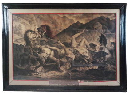
Sold2024After Claude J. VERNET: "La Mart..." - PrintAfter Claude Joseph Vernet (French, 1714-1789) large antique framed print laid on canvas, 19th century, titled "La Mort D'Hippolyte" depicting the death of Hippolytus capturing the final moment whereSee Sold Price
Sold2024Henricus Hondius 1630 "Nova Virginiae Tabula" Hand Colored Map of Virginia and Chesapeake #1Antique, original hand-colored map of Virginia and the Chesapeake Bay originally by Henricus Hondius in 1630 titled "Nova Virginiae Tabula". With French text on reverse final catchword "n'en" and signSee Sold Price
Sold2021US Coast Survey Map of the Louisiana CoastAntique US Coast Survey Map of the Louisiana Coast , "U.S. Coast Survey, A.D. Bache, Superintendent", 1855, lithograph, with later hand-coloring, showing Vermillion Bay, LA to Mobile Bay, AL, sight 15See Sold Price
Sold2022Joseph Holston "Jazz" Lithograph print. Signed near leg.Joseph Holston "Jazz" Lithograph print. Signed near leg. Dimensions: H: 21.5 inches: W: 15.5 inches: Frame Height: 29.5 inches: Frame Width: 23 inches ---See Sold Price
Sold2023John Speed 1676 Map of Virginia, Maryland, and Chesapeake BayA MAP OF VIRGINIA AND MARYLAND by John Speed, 1676, engraved by Francis Lamb. London: Thomas Basset and Richard Chiswell. Hand colored. In addition to showing parts of Virginia and Maryland, the map aSee Sold Price
Sold20231702 P. Lindstrom PA/DE Delaware Bay/RiverPeter Lindstrom (Lindestrom) Stockholm Sweden May of Pennsylvania, Delaware, Deleware River, & Bay 5 10 3/4 in Matt. From Philadelphia Print Shop. Lindstrom was mapping Swedish settlements in 1653. ItSee Sold Price
Sold2023Early Map of Tennessee, Daniel Smith, 1795A MAP OF THE TENNASSEE [sic] GOVERNMENT FORMERLY PART OF NORTH CAROLINA TAKEN CHIEFLY FROM SURVEYS BY GENL. D. SMITH & OTHERS, drawn by Daniel Smith, engraved by Joseph T. Scott, for "General Atlas FoSee Sold Price
Sold2023Seutter - Map of North America including Great Lakes, Florida, Virginia, New England, Mexico, WestThis engraving is from a composite atlas presented by the Homann Heirs. Many of the maps in the collection were completed by J. B. Homann, Homann Erben, M. Seutter, and T. C. Lotter. The maps were oriSee Sold Price
Sold2016Map of Bermuda, by Hondius 1633Map of Bermuda, by Hondius 1633. Original hand colored copper engraving. Showing the "tribes" that were granted by the gentleman onboard the shipwreck that force the European settlement of the island.See Sold Price
Sold2024Audubon, Imperial Folio - Polar Bear. 91This exceptional folio lithograph is from John James Audubon's The Viviparous Quadrupeds of North America. It was part of the Imperial Folio Edition published between 1845 and 1851. The color on thisSee Sold Price
Sold2024Antique Map of New OrleansAntique Map of New Orleans, "Plan of New Orleans the Capital of Louisiana", 1761, by Benning, engraved map from the London Magazine, 7 1/2 in. x 9 1/2 in., framed.See Sold Price
Sold2024L'Irlanda o'vero Hibernia. Ireland. DE ROSSI 1689 old antique map plan chartTITLE/CONTENT OF MAP: L'Irlanda o'vero Hibernia [Ireland, or Hibernia] DATE PRINTED: 1689 IMAGE SIZE: Approx 59.0 x 45.0cm, 23.25 x 17.75 inches (Large) TYPE: Antique 17th century folio atlas map CONDSee Sold Price
Sold2024Martin, Benjamin 1781 Antique Print. Sea Hermit CrabCopper Plate Published 1781, London for "The Young Gentleman and Lady's Philosophy... by Benjamin Martin. Paper Size: 8 x 5 inch (21 x 13cm) Good ConditionSee Sold Price
Sold2024Buffon, Comte de 1785 Antique Print. White or Polar BearCopper Plate Published 1785, London for "Natural History, General and Particular" by the Count de Buffon. Translated by William Smellie. Paper Size: 8.5 x 5 inch (22 x 13cm) Good ConditionSee Sold Price
Sold2024Buffon, Comte de 1785 Antique Print. BearCopper Plate Published 1785, London for "Natural History, General and Particular" by the Count de Buffon. Translated by William Smellie. Paper Size: 8.5 x 5 inch (22 x 13cm) Good ConditionSee Sold Price
4 days LeftBill Hood & Sons Art & Antique AuctionsDr. Joseph Scheer (German/American, B. 1958) Digital print on heavy watercolor paper, Automeris Io$500(1 bid)
4 days LeftBill Hood & Sons Art & Antique AuctionsDr. Joseph Scheer (German/American, B. 1958) Digital print on heavy watercolor paper, Arctia caja$400(1 bid)
Featured4 days LeftJasper521771 ASTRONOMY by Joseph M. de La Lande 2 VOLUMES ILLUSTRATED antique in FRENCH$480
5 days LeftJasper52Océanique. Partie… Iles Mariannes #2 North Mariana Islands VANDERMAELEN 1827 map$40
5 days LeftJasper52Océanique. Iles des Navigateurs #41 Samoa & American Samoa VANDERMAELEN 1827 map$60
5 days LeftJasper52Océanique Iles de la Société #42 Tahiti Rangiroa Polynesia VANDERMAELEN 1827 map$85
19 hrs LeftTrillium Antique Prints & Rare BooksPtolemy & Magini, pub. 1620 - Map of the World with Six Windheads$130(4 bids)
19 hrs LeftTrillium Antique Prints & Rare BooksPtolemy & Magini, pub. 1620 - Double Hemisphere Map of the World$400(5 bids)
19 hrs LeftTrillium Antique Prints & Rare BooksBonne - Map of the Eastern Coast of North America$85(3 bids)
19 hrs LeftTrillium Antique Prints & Rare BooksCarey, pub. 1814 - Map of the State of Tennessee$50(1 bid)
19 hrs LeftTrillium Antique Prints & Rare BooksAudubon, Imperial Folio - American Black Bear. 141$375(1 bid)


![Early Map of Tennessee, Daniel Smith, 1795: A MAP OF THE TENNASSEE [sic] GOVERNMENT FORMERLY PART OF NORTH CAROLINA TAKEN CHIEFLY FROM SURVEYS BY GENL. D. SMITH & OTHERS, drawn by Daniel Smith, engraved by Joseph T. Scott, for "General Atlas Fo](https://p1.liveauctioneers.com/525/272425/142901899_1_x.jpg?height=310&quality=70&version=1671337478)


![L'Irlanda o'vero Hibernia. Ireland. DE ROSSI 1689 old antique map plan chart: TITLE/CONTENT OF MAP: L'Irlanda o'vero Hibernia [Ireland, or Hibernia] DATE PRINTED: 1689 IMAGE SIZE: Approx 59.0 x 45.0cm, 23.25 x 17.75 inches (Large) TYPE: Antique 17th century folio atlas map COND](https://p1.liveauctioneers.com/5584/326140/175577116_1_x.jpg?height=310&quality=70&version=1713288521)


