Sold2022Nice map of Asia from S. A. Mitchell, Jr. – 1860sMap of Asia Showing its Political Divisions and also the Various Routes of Travel Between London & India, China & Japan, etc. Detailed map of Asia, colored by country. Full and original hand coloring.See Sold Price
Sold2022Bowen, Emanuel Collection of engraved maps, c.1750-65Bowen, Emanuel Collection of engraved maps, c.1750-65 including: A New and Accurate Map of China; A New and Accurate Map of the Empire of Japan; Turky in Asia, Arabia, etc.; A New and Accurate Map ofSee Sold Price
Sold2016(2) Photo/ Postcard Albums of China, Japan Etc.Each circa 1910 and include: RPPC, Cina, Japan, Korea, Orient, Mongolia, Hong Kong, Rangoon, Macoa, many hand colored.See Sold Price
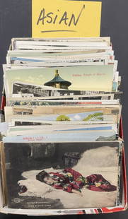
Sold2022Asian Postcards incl. China, Japan, etcA Nice Group of Asian Postcards including, Shang Hai, China, Japan etc. Including some photo cards - Approx. 175pcsSee Sold Price
Sold2023Perry, Commodore 1856 Large Map. China, Japan & Philippines"Chart of the coast of China and of the Japan Islands including the Marianes and a part of the Philippines" Large Folio Lithograph Map Published 1856, Washington for "Narrative of the Expedition of anSee Sold Price
Sold2020Three Maps, China & Japan, Brazil, and EuropeComprising, "An Accurate Map of Europe from the latest Observations & Discoveries, Universal Magazine J. Hinton, Newgate Street," "Carte Geographique Statistique et Historique du Bresil," and "China aSee Sold Price
Sold2021Nolan, Edward C1880 Lot of 3 Maps. China, Japan, AsiaSteel Engraved Map Published C1880, London for "The Illustrated History of the British Empire in India and the East" by Edward H. Nolan. Centre fold as issued. Paper Size: 12 x 10 inch (30 x 25cm) GooSee Sold Price
Sold2022Times Atlas 1895 Pair of Maps. China & JapanLithograph Maps Published 1895, London for "The Times Atlas" Paper Size: 16 x 10.5 inch (41 x 27cm) Good ConditionSee Sold Price
Sold2024Group (15) Asian baskets and woven objectsGroup (15) Asian baskets and woven objects, 20th c., incl. China, Japan, etc., incl. trays, baskets, bag, boxes, utensils, etc., some bamboo, 16.5"dia (largest),4"h x 5.5"dia (smallest) Provenance: ThSee Sold Price
Sold2023MAP, China, Korea & Japan, MercatorHondius' Map of China, Korea, and Japan. China, Korea & Japan. Mercator/Hondius, China, from Gerardi Mercatoris - Atlas sive Cosmographicae, 1623 (published). Hand Color. Besides China, this map depicSee Sold Price
Sold2022Paper Currency, China, Japan, Cuba etc. (120)Collection of paper currency from China, Japan, Italy and more. Dated from the 1940s-60s. Approximately 120 items. Condition: good original pre-owned estate condition. View photographs for accuracy. PSee Sold Price
Sold2022MAP, China, Korea & Japan, MollChina, Korea & Japan. Herman Moll, China According to the Newest and Most Exact Observations, 1720 (circa). Hand Color. Nice copper engraved map in Moll's typical style presents the Korean peninsula,See Sold Price
Sold20201782 Bayly Map of China, Japan, Korea -- A New Map ofTitle/Content of Map: 1782 Bayly Map of China, Japan, Korea -- A New Map of China, By J. Bayly, Geographer Cartographer: J Bayly Year/Place: 1782, London Size: 8.7 X 12.5 in. This is a rather attractiSee Sold Price
Sold2016Map of China & Japan, 1868Original engraving from Johnson's Atlas of the World, 1868. Map includes vignette of Canton and details cities, towns and territories. Dimensions: 18" x 26". This item ships from Ocean View, DE.See Sold Price
Sold2016Map of China & Japan 1861Heading: Author: Johnston, Keith Title: China and Japan Place Published: Edinburgh & London Publisher:W. & A.K. Johnston and William Blackwood & Sons Date Published: 1861 Description:See Sold Price
Sold20191831 Teesdale Map of China, Japan and Korea -- ChinaTitle/Content of Map: 1831 Teesdale Map of China, Japan and Korea -- China and Japan Date: 1831, London Cartographer: H Teesdale Size: 13.2 X 17 in. This is a very nice map of China, Korea and Japan.See Sold Price
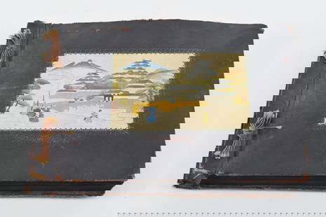
2017Johnston: Antique Map of China & Japan, 1879Title/Content of Map: 'China and Japan [inset: Islands of Japan]' Date Printed: 1879 Image Size: Approx 47.5 x 61.0cm, 18.75 x 24 inches (Large); Please note that this is a folding map. Type: Large, fSee Sold Price
Sold2023Pages of Old Stamps from China, Japan, Georgia etc.Pages of Old Stamps from China, Japan, Georgia etc..See Sold Price
Sold2023Early 20th century important photo album containing labeled snapshot photographs and real photoEarly 20th century important photo album containing labeled snapshot photographs and real photo postcards of travels in Asia - including China, Philippines, Japan, etc. Photos include Chinese EmperorSee Sold Price
Sold2022(2) albums housing negatives by R L Van Tassel, ( 200 ) in all, many identified, topics incl. China,(2) albums housing negatives by R L Van Tassel, ( 200 ) in all, many identified, topics incl. China, Japan, Hawaii, etc. From the estate collection of Richard G. Miller's 19th & 20th century hand painSee Sold Price
Sold2016LOT OF 354 REAL PHOTO STEREOVIEWS WORLD VIEWS, ALLLOT OF 354 REAL PHOTO STEREOVIEWS WORLD VIEWS, ALL CURVED MOUNTS, INCLUDING CHINA, JAPAN, EUROPEAN, ETC, AS PICTURED, FROM THE COLLECTION OF HARRY AMDUR (1922-2005), THE LONGTIME CO-OWNER OF MODERNAGESee Sold Price
Sold202110 ASIAN CURRENCY. KOREA, JAPAN, CHINA ETC.10 ASIAN CURRENCY. KOREA, JAPAN, CHINA ETC.See Sold Price
Sold20201871 Voyages in ASIA Java Siam CHINA Japan MAP Indones1871 Voyages in ASIA Java Siam CHINA Japan MAP Indonesia Canton Peking Beauvoir “Behind a bend of the Maenam, the entire town of Bangkok appeared in sight. I do not believe that there is a sight inSee Sold Price
Sold2018Johnston: Antique Map of China and Japan, 1873Title/Content of Map: China and Japan Cartographer: JOHNSTON, KEITH Size: 12X16.25 by Keith Johnston, F.R.S.E. Sheet 49 from an American and French Joines and Hamilton atlas edition printed by Ferd. MSee Sold Price
3 days LeftTrillium Antique Prints & Rare BooksPrevost - Map of China, Korea, Japan, Phlippines and Surrounding Islands$50
7 days LeftJasper52ASIA POLITICAL. Persia Siam Hejaz China Japan Corea Turkestan. JOHNSTON 1900 map$8
7 days LeftJasper52ASIA POLITICAL. Persia Siam Hejaz China Japan Corea Turkestan. JOHNSTON 1903 map$8
7 days LeftJasper52ASIA POLITICAL. Persia Siam Hejaz China Japan Korea Turkestan. JOHNSTON 1910 map$10
7 days LeftJasper52Tartarie Chinoise, Royaume de Corée &… Japon. China Korea Japan. BONNE 1788 map$30
7 days LeftJasper52Tartarie Chinoise, Royaume de Corée &… Japon. China Korea Japan. BONNE 1790 map$30
5 days LeftBonhamsMaharajah Jagatjit Singh of Kapurthala, My Travels in China, Japan and Java, 1903 Hutchinson & C...£1,200
7 days LeftJasper52INDOCHINA. Siam Burma Annam Cambodia Tong King Southern China. JOHNSTON 1913 map$45
7 days LeftJasper52Suite de l’Ocean Oriental…' East Asia/Indies. Western Pacific. BELLIN 1746 map$200
May 30Forum AuctionsChina & Japan.- Liu Xiang Ryukyo Retsujo Den [Biographies of Virtuous Women], 5 vol., , Kyoto, 1720£2,600
May 30Forum AuctionsChina.- Japan.- Manchuria Daily News Souvenir Enthronement Supplement March First 1934, [Dairen],£400


![Johnston: Antique Map of China & Japan, 1879: Title/Content of Map: 'China and Japan [inset: Islands of Japan]' Date Printed: 1879 Image Size: Approx 47.5 x 61.0cm, 18.75 x 24 inches (Large); Please note that this is a folding map. Type: Large, f](https://p1.liveauctioneers.com/5584/108292/55552456_1_x.jpg?height=310&quality=70&version=1503667951)


![China & Japan.- Liu Xiang Ryukyo Retsujo Den [Biographies of Virtuous Women], 5 vol., , Kyoto, 1720 (1 of 4)](https://p1.liveauctioneers.com/5458/329231/177514916_1_x.jpg?height=282&quality=70&version=1715269091)
![China.- Japan.- Manchuria Daily News Souvenir Enthronement Supplement March First 1934, [Dairen], (1 of 2)](https://p1.liveauctioneers.com/5458/329231/177514924_1_x.jpg?height=282&quality=70&version=1715269091)