

Item Details
Description
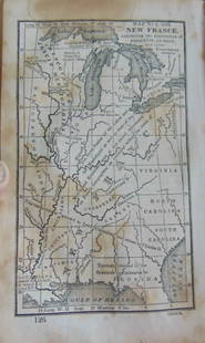
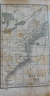
Map of Vermont and New Hampshire
Color Map. Questions on the Map at base.
Publisher Harper Brothers
Dated: Circa 1888
Dimensions: 20 x 12"
Condition Report Fold in center as issued. Text on verso. Good Plus.
Subject References: Maps 148
Color Map. Questions on the Map at base.
Publisher Harper Brothers
Dated: Circa 1888
Dimensions: 20 x 12"
Condition Report Fold in center as issued. Text on verso. Good Plus.
Subject References: Maps 148
Buyer's Premium
- 25%
Map of Vermont and New Hampshire Circa 1880
Estimate $300 - $350
Starting Price
$150
or 4 payments of $37.50 with 
2 bidders are watching this item.
Get approved to bid.
Shipping & Pickup Options
Item located in Otisville, NY, USOffers In-House Shipping
Payment
Accepts seamless payments through LiveAuctioneers
Auctioneer Announcement
American Prints on Memorial Day

Spring Hudson Valley Estates Auction
Otisville, NY, USA
Related Maps & Atlases
More Items in Maps & Atlases
View MoreRecommended Transportation & Travel Collectibles
View MoreRelated Searches
TOP


![North America Map circa 1800s [179302]: Early map of the North American continent circa 1810. Shows the western area as New Albion, southwest Canada as New Caledonia and the Russian Possessions of western Canada and Alaska. Also noted are s](https://p1.liveauctioneers.com/2699/331495/178785793_1_x.jpg?height=310&quality=70&version=1717094933)

![Pocket Map of Richland Co., OH c1910 [180795]: Pocket map - "New Road Map of Richland County, Ohio." Published by The Daily Globe, Shelby, OH, c1910. Map measures 21" x 30". Please see photo(s) for more details. Richland County Ohio](https://p1.liveauctioneers.com/2699/331495/178785767_1_x.jpg?height=310&quality=70&version=1717094933)


![1902 Cram Map of New York City [verso] Washington DC [verso] Baltimore -- New York [verso]: Title: 1902 Cram Map of New York City [verso] Washington DC [verso] Baltimore -- New York [verso] Washington] and [verso] Baltimore Cartographer: G Cram Year / Place: 1902, Chicago Map Dimension (in.)](https://p1.liveauctioneers.com/5584/331064/178466310_1_x.jpg?height=310&quality=70&version=1716924723)
![[MAPS]. HOMANN, Johann Baptist, HOMANN HEIRS, and Georg Matthäus SEUTTER. [Composite Atlas].: [MAPS]. HOMANN, Johann Baptist (1663-1724), HOMANN HEIRS, and Georg Matthäus SEUTTER (1678-1757). [Composite Atlas]. [Nuremberg, Augsburg, and others: Homann Heirs and others, maps dated between](https://p1.liveauctioneers.com/197/329395/177650530_1_x.jpg?height=310&quality=70&version=1715364962)
![[MAP]. TODESCHI, Pietro. [Nova et Acurata Totius Americae Tabula auct. G.I. Blaeu] America quarta: [MAP]. TODESCHI, Pietro. [Nova et Acurata Totius Americae Tabula auct. G.I. Blaeu] America quarta pars orbis quam plerunq, nuvum orbem appellitant primo detecta est anno 1492 a Christophoro Columbo...](https://p1.liveauctioneers.com/197/329395/177650542_1_x.jpg?height=310&quality=70&version=1715364962)


![[MAP]. ORTELIUS, Abraham. Americae Sive Novi Orbis, Nova Descriptio. 1573.: [MAP]. ORTELIUS, Abraham (1527-1598). Americae Sive Novi Orbis, Nova Descriptio. Antwerp, 1573. Engraved map with hand-coloring. Framed and double glazed, visible area 375 x 521 mm (unexamined out of](https://p1.liveauctioneers.com/197/329395/177650534_1_x.jpg?height=310&quality=70&version=1715364962)

![[MAP]. ORTELIUS, Abraham. Turcici Imperii Descriptio.1592.: [MAP]. ORTELIUS, Abraham (1527-1598). Turcici Imperii Descriptio. Antwerp, 1592. Engraved map with hand-coloring. Matted, framed, and double glazed, sight 406 x 521 mm (unexamined out of frame). Decor](https://p1.liveauctioneers.com/197/329395/177650538_1_x.jpg?height=310&quality=70&version=1715364962)
![[MAP]. SPEED, John. A New Mappe of the Romane Empire. 1676.: [MAP]. SPEED, John (ca 1551-1629). A New Mappe of the Romane Empire. London: Basset & Chiswell, 1676. Engraved map with hand-coloring. Framed and double glazed, sight 419 x 559 mm. Decorative cartouch](https://p1.liveauctioneers.com/197/329395/177650541_1_x.jpg?height=310&quality=70&version=1715364962)
![Set of Twelve Satirical Anthropomorphic Maps of Europe: [SATIRICAL MAPS] A set of twelve satirical anthropomorphic maps of Europe. London: circa 1868. A set of 12 (believed complete) lithographed maps by Vincent Brooks, Day & Son, London, each offering](https://p1.liveauctioneers.com/292/330597/178279264_1_x.jpg?height=310&quality=70&version=1716409282)


![[MAP]. ORTELIUS, Abraham. Romani Imperii Imago. 1592.: [MAP]. ORTELIUS, Abraham (1527-1598). Romani Imperii Imago. Antwerp, 1592. Engraved map with hand-coloring. Matted, framed, and double glazed, visible area 381 x 521 mm (unexamined out of frame). 6 de](https://p1.liveauctioneers.com/197/329395/177650537_1_x.jpg?height=310&quality=70&version=1715364962)

![[MAP]. ORTELIUS, Abraham. Aevi Veteris, Typus Geographicus. 1601.: [MAP]. ORTELIUS, Abraham (1527-1598). Aevi Veteris, Typus Geographicus. Antwerp, 1601. Engraved map with hand-coloring. Matted, framed, and double glazed, visible area 343 x 470 mm (unexamined out of](https://p1.liveauctioneers.com/197/329395/177650532_1_x.jpg?height=310&quality=70&version=1715364962)


