Sold2021Eleven Antique Maps of EuropeEleven Antique Maps of Europe , 16th-18th c., incl. Ptolemy from 1541 (4); a Blaeu map of "Regno di Napoli", Hondius map of the Holy Land, de Wit map of Southern Spain, an undated manuscript map of MeSee Sold Price
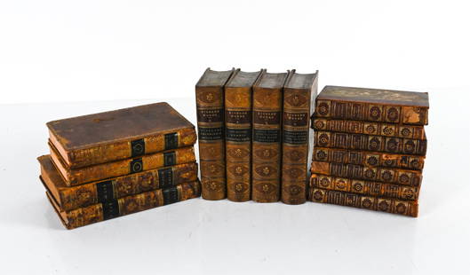
Sold2022GROUPING OF ANTIQUE LEATHER-BOUND BOOKSIncluding (7) vol. "Epochs of History" 1899, with fold-out maps of Europe; (4) vol. Dickens' Works, 1869, plus some miscellaneous volumes. Dimensions: (Overall linear) H 8.75" x W 19" Condition: As isSee Sold Price
Sold2020Bartholomew, John 1922 Lot of 4 Maps. EuropeIncl Europe Political, Orography/Vegetation/Races/Population, Western Europe Political, and Eastern Europe Political. Large Lithograph Maps Published 1922 by The Times, London for "The Times Survey AtSee Sold Price
Sold202216th C. Woodcut Ptolemy Maps by Lorenz Fries (4)**Originally Listed At $800** Lorenz (Laurent) Fries (ca. 1485-1532). Published in Geographia of Claudius Ptolemy (Claudius Ptolemaeus, after 83-ca. 168 CE), 1541. Four Ptolemaic maps, all woodblocksSee Sold Price
Sold2020Bartholomew, John 1922 Lot of 4 Large Maps. EuropeIncl Europe Political, Orography/Vegetation/Races/Population, Western Europe Politcal, Eastern Political. Large Lithograph Maps Published 1922 by The Times, London for "The Times Survey Atlas of the WSee Sold Price
Sold20184 Maps: Central Europe. Homann, Thomson , de Witt.[Homann/Thomson] 4 Maps. Hand colored. ++ L’Allemagne, distinguee en ses Cercles & subdivisee in ses Etats, contenant son Etendue presente… Mr. Schatz A. 1741 avec Privilege Imperial. Title aboveSee Sold Price
Sold2019Butler, George 1874 Lot of 4 Maps of EuropeIncl Europe Continent, France, Switzerland, and Spain/Portugal. Lithograph Maps Published 1874, London for "The Public School Atlas of Modern Geography" by Rev. George Butler. Paper Size: 13.75 x 10.5See Sold Price
Sold2021Barclay, James C1835 Lot of 4 Hand Col Europe MapsGermany, Holland/Belgium, France and Spain/Portugal. Hand Colored Steel Engraved Maps Published C1835, London for "A Complete and Universal English Dictionary" by the Rev. James Barclay et al. EngraveSee Sold Price
Sold2019Bartholomew, John 1922 Lot of 4 Maps of EuropeIncl Europe Political, Eastern Europe Political, Western Europe Political, and Europe Physical Features & Population. Large Lithograph Maps Published 1922 by The Times, London for "The Times Survey AtSee Sold Price
Sold2019Bryce, James 1881 Lot of 4 Maps of EuropeHistorical Maps of Europe, France and Britain. Lithograph Maps Published 1881, London for ""The International Atlas and Geography..." by James Bryce. Maps by Edward Weller & John Bartholomew. UncommonSee Sold Price
Sold2023Cary Antique Maps, Western European (4)Set of 4 maps including Europe, France, Netherlands, Portugal. John Cary, London, early 19th C. Hand-colored engravings. Center vertical folds, as issued.See Sold Price
Sold2019Bartholomew, John 1922 Lot of 4 Large Maps of EuropeLarge Lithograph Maps Published 1922 by The Times, London for "The Times Survey Atlas of the World" Maps by John George Bartholomew of the Edinburgh Geographical Institute. Centre fold as issued. PapeSee Sold Price
Sold2021Bartholomew, John 1922 Lot of 4 LG Maps of EuropeLarge Lithograph Maps Published 1922 by The Times, London for "The Times Survey Atlas of the World" Maps by John George Bartholomew of the Edinburgh Geographical Institute. Centre fold as issued. PapeSee Sold Price
Sold2017Arrowsmith: Map of Europe, 1806Map: Europe. Publication Date: 1806 Authors: Aaron Arrowsmith Publisher: Aaron Arrowsmith Size: 7.5 H x 9.3 W Inches From Arrowsmiths 4 Sheet Map of Europe Please note that this lot has a confidentialSee Sold Price
Sold2019Cortambert, Eugene 1874 Lot of 4 Maps. UK, World EuropeTwo of the British Isles, Europe Physical Map and World on Mercators Projection. Hand Coloured Lithograph Maps Published 1874, Paris for "Atlas de la Geographie de L'Europe" by Eugene Cortambert. PapeSee Sold Price
Sold20241834 Europe by Thomas StarlingTitle: 1834 Europe by Thomas Starling Date/Period: 1834 Materials: Hand colored, steel engraved Size: 6 1/2 x 4 inches. This map presents Europe as seen in 1834, created by Thomas Starling for the See Sold Price
Sold2017Ptolemy: Map of Bactria Scythia North India, 1597Map: Tabula Asiae VIII Cartographer: Ptolemy, Magini / Porro, P.Keschedt Place & Date: Cologne / 1597 Size: 6 3/4" x 5 1/4" Condition: b&w; overall age toning The eighth Ptolemaic Asia map from the MaSee Sold Price
Sold20211969 East German Interflug Route Map -- Europe AfricaTitle: 1969 East German Interflug Route Map -- Europe Africa Middle East Cartographer: Interflug Year / Place: 1969 Map Dimension (in.): 31.4 X 23.2 in. unfolded This folding route map of the East GerSee Sold Price
Sold2017Homann Heirs: Antique Map of Europe, 1746Map: Europe ** Nuremberg?? Date Printed: 1746 Cartographer: Homann Heirs Material/Medium: Paper Size: 21" x 23 1/4" Nuremberg. Hand colored copperplate engraved. Beautiful baroque style cartouche. PleSee Sold Price
Sold2023ESTATE OF SEYMOUR STEIN: 4 SMALL FRAMED MAPS (2) OF EUROPE (1) OF N. AMERICA (1) OF ASIA 12" X 15"ESTATE OF SEYMOUR STEIN: 4 SMALL FRAMED MAPS (2) OF EUROPE (1) OF N. AMERICA (1) OF ASIA 12" X 15"See Sold Price
Sold2016MAP OF EUROPE'EUROP, and the cheife Cities contaned therin', by John Speed, hand-colored engraving, London: Humber, 1626, framed, 18 x 22-3/4 in. (overall)See Sold Price
Sold2016Napoleon's Pocket Map of Europe. 1811-12Carte des Routes des Postes de l'Empire Francais du Royaume de l'Italie et de la Confederation du Rhin. Tardieu, gravieur des postes Imperiales, 1812. Approximately 50 x 56 1/4 inches, color outlSee Sold Price
Sold20211813 Embroidered Map of EuropeTitle: 1813 Embroidered Map of Europe Dimension: 20 3/4" x 24 1/4" framed. Materials: Silk on wool Additional Information: G. Smerdon Embroidered Map of Europe Probably Southern English dated 1813 CarSee Sold Price
5 days LeftJasper52Europe after the Congress of Vienna. 4 sheets. 128x106cm. THOMSON 1817 old map$600
5 days LeftJasper52Hyperboreorum/Septentrionalum regionum. Bertius/Langenes. Europe Arctic 1603 map$440
22 hrs LeftArader GalleriesNicholas Visscher Map of the Danube River and the Dalmatian Coast, colored by Dirk Jansz Van Santen$1,000
22 hrs LeftArader GalleriesNicholas Visscher Map of Upper Palatinates of Bavaria, colored by Dirk Jansz Van Santen$1,000
22 hrs LeftArader GalleriesNicholas Visscher Map of Northern Liege, Belgium, colored by Dirk Jansz Van Santen$1,000
22 hrs LeftArader GalleriesNicholas Visscher Map of Frankfurt, Germany colored by Dirk Jansz Van Santen$1,000
22 hrs LeftArader GalleriesFrederick De Wit Map of the Duchy of Savoy and Piemonte, showing from Geneva to Nice and Monaco,$1,000
22 hrs LeftArader GalleriesNicholas Visscher Map of Liege, Belgium colored by Dirk Jansz Van Santen$1,000
22 hrs LeftArader GalleriesNicholas Visscher Map of Wallonia Region of Belgium, colored by Dirk Jansz Van Santen$1,000
22 hrs LeftArader GalleriesNicholas Visscher Map of South Flanders, colored by Dirk Jansz Van Santen$1,000
22 hrs LeftArader GalleriesNicholas Visscher Map of North Flanders, colored by Dirk Jansz Van Santen$1,000
22 hrs LeftArader GalleriesNicholas Visscher Map of Louvain (Leuven), Belgium, colored by Dirk Jansz Van Santen$1,000
22 hrs LeftArader GalleriesNicholas Visscher Map of Cologne, Germany colored by Dirk Jansz Van Santen$1,200
6 days LeftFrost & NicklausDavid Robb, Art In Western World, 1942 1st Revised Ed., Art History, illustrated$8
Oct 05Ripley AuctionsMerian Map of Europe (1707) by J.P. Andrea for Matth?us Merian's Theatrum Europaeum 11 1/2"H x 14$100
6 days LeftForum AuctionsEuropean Satirical Map.- Ohara (Kisaburo) A Humorous Diplomatic Atlas of Europe and Asia, lithograph£900
6 days LeftForum AuctionsEuropean Satirical Map.- Tanaka (Ryozo) A Humoros [sic] Atlas of the World. The Illustration of the£900


![4 Maps: Central Europe. Homann, Thomson , de Witt.: [Homann/Thomson] 4 Maps. Hand colored. ++ L’Allemagne, distinguee en ses Cercles & subdivisee in ses Etats, contenant son Etendue presente… Mr. Schatz A. 1741 avec Privilege Imperial. Title above](https://p1.liveauctioneers.com/179/117971/60557753_1_x.jpg?height=310&quality=70&version=1520636872)


![European Satirical Map.- Tanaka (Ryozo) A Humoros [sic] Atlas of the World. The Illustration of the (1 of 1)](https://p1.liveauctioneers.com/5458/342368/185863674_1_x.jpg?height=282&quality=70&version=1725378977)