Sold20191854 Journey to Central Africa EGYPT Sudan Ethiopia MAP1854 Journey to Central Africa EGYPT Sudan Ethiopia MAP Nile Bayard Taylor Bayard Taylor was a 19th-century travel writer whose abundant notes and reports have been referenced for decades since the miSee Sold Price
Sold20211874 Journey to Central Africa Lakes EGYPT Sudan1874 Journey to Central Africa Lakes EGYPT Sudan Ethiopia MAP Nile Bayard Taylor Bayard Taylor was a 19th-century travel writer whose abundant notes and reports have been referenced for decades sinceSee Sold Price
Sold2024NORTH EAST AFRICA. Libya Egypt Sudan Ethiopia Ubangi-Shari Chad 1952 old mapCAPTION PRINTED BELOW PICTURE: 'Africa, North-East' DATE PRINTED: 1952 IMAGE SIZE: Approx 34.0 x 44.0cm, 13.5 x 17.25 inches (Large); Please note that this is a folding map. TYPE: Vintage colour map;See Sold Price
Sold2023NORTH EAST AFRICA. Libya Egypt Sudan Ethiopia Ubangi-Shari Chad 1952 old mapTITLE/CONTENT OF MAP: 'Africa, North-East' DATE PRINTED: 1952 IMAGE SIZE: Approx 34.0 x 44.0cm, 13.5 x 17.25 inches (Large); Please note that this is a folding map. TYPE: Vintage colour map; Scale 1:1See Sold Price
Sold20181874 1st ed ISMAILIA Central Africa Slave Trade SUDAN1874 1st ed ISMAILIA Central Africa Slave Trade SUDAN Egypt Illustrated Baker 2v ‘Ismailia’ is a classic work aimed to bring awareness to and suppress the slave-trade in Central Africa. Written bySee Sold Price
Sold20231895 AFRICA Morocco EGYPT Sudan Sierra Leonne Sahara Illustrated MAPS 2v SET1895 AFRICA Morocco EGYPT Sudan Sierra Leonne Sahara Illustrated MAPS 2v SET Augustus Keane was a 19th-century historian and author whose studies in ethnology resonate with even modern day ethnologistSee Sold Price
Sold20171833 Nubia & Abyssinia EGYPT Ethiopia Africa Missions1833 Nubia & Abyssinia EGYPT Ethiopia Africa Missions Geography MAP Bishop Michael Russell was a 19th-century historian who was well-versed in a variety of subjects, including Biblical and Holy Land hSee Sold Price
Sold2021WEST AFRICA; ABYSSINIA: SUDAN, ETHIOPIA,AND ERITREA. ABRAHAM ORTELIUS (1527-1598)Presbiteri Iohannis, Sive, Abissinorum Imperii Descriptio. Antwerp: Ortelius, c. 1600. Double page copper-plate engraved map on laid paper, hand-colored, textSee Sold Price
Sold20241801 AFRICA RELATIONS 2 VOLUMES antique Carthage Ethiopia Egypt MAPHÉEREN (A. H. L.). Idées sur les relations politiques et commerciale des anciens peuples de l’Afrique. [ Ideas on the political and commercial relations of the ancient peoples of Africa. ] 2 volumSee Sold Price
Sold2019Bartholomew, John 1922 Lot of 4 Large Maps of AfricaCentral Africa - East and West, Egypt and North West Africa. Large Lithograph Maps Published 1922 by The Times, London for "The Times Survey Atlas of the World" Maps by John George Bartholomew of theSee Sold Price
Sold2020Bartholomew, John 1922 Lot of 9 Large Maps of AfricaIncl Africa Political, North Africa, Central/Southern Africa, Central Africa West, Central Africa East, West Africa, North West Africa, Egypt/Nile, and Lower Egypt. Large Lithograph Maps Published 192See Sold Price
Sold2019Bartholomew, John 1922 Lot of 4 Large Maps of AfricaCentral Africa - East and West, Egypt and North West Africa. Large Lithograph Maps Published 1922 by The Times, London for "The Times Survey Atlas of the World" Maps by John George Bartholomew of theSee Sold Price
Sold2019Johnston, W. & A. K. 1903 Lot of 28 MapsLot of 28 Lithograph Maps, incl Twin Hemisphere, Europe, Argentina, Canada, New Guinea, New Zealand, Australia, Pacific, Abyssinia, Egypt, Rhodesia, Central Africa, Algeria, Africa, Tibet, Japan, RussSee Sold Price
Sold2019Johnston, W. & A. K. 1903 Lot of 28 MapsLot of 28 Lithograph Maps, incl Twin Hemisphere, Europe, Argentina, Canada, New Guinea, New Zealand, Australia, Pacific, Abyssinia, Egypt, Rhodesia, Central Africa, Algeria, Africa, Tibet, Japan, RussSee Sold Price
Sold2023SUB-SAHARAN AFRICA. 'Ancienne Ethiopie'. Ancient Ethiopia. MALLET 1683 old mapTITLE OF THE MAP: 'Ancienne Ethiopie' (De L'Afrique) Central, Eastern & Southern Africa plus Madagascar DATE PRINTED: 1683 IMAGE SIZE: Approx Overall page size 13 x 21cm approximately (5 x 8 inches);See Sold Price
Sold2021Jack & Bartholomew 1885 Mixed Lot of 21 MapsIncl Aral Sea, Cape Colony, French Ports, Alps, Algiers, Central Africa, Azores, Bristol Channel, Brazil, Borneo, Faroe Islands, Egypt, Dutch Guyana, Dublin, Fiji/Cyprus, Crimea, Belfast/Cork, ConstanSee Sold Price
Sold2020Philip, George C1900 Lot of 5 Maps of AfricaIncl Northern Africa, Egypt and the Valley of the Nile, Central Africa, Africa and South of the Zambesi, and South Africa. Lithograph Maps Published C1900, London for "Philips' New Handy General AtlasSee Sold Price
Sold2021Goldsmith, J. 1852 Lot of 15 Maps and Prints6 Maps of Africa, Canaan/Palestine, Asia, Central Europe, British Isles, and Europe. Together with 9 Prints showing Astronomy, Brunei/New Zealand/Sydney, Cairo/Egypt/Algiers, New York/North American ISee Sold Price
Sold202219th C. Ethiopian Coptic Wood Triptych Icon**First Time At Auction** Horn of Africa, Ethiopia, Central and Northern Highlands, Amhara or Tigrinya peoples, ca. 19th to 20th century CE. A hand-built wood tryptic icon of the Virgin and Child flanSee Sold Price
Sold202220th C. Egyptian & Asian Silver Cuff Bracelets, 2 pcs**Originally Listed At $500** North Africa, Egypt & Central Asia, ca. mid-20th century CE. A lovely pair of high-quality sterling silver bracelet cuffs from Egypt and Central Asia. The Egyptian bracelSee Sold Price
Sold20191592 Ortelius Map of Central Africa -- PresbiteriTitle/Content of Map: 1592 Ortelius Map of Central Africa -- Presbiteri Iohannis, sive Abissinorum Imperii Descriptio Date: 1592 c., Antwerp Cartographer: A Ortelius Size: 14.8 X 17.3 in. This is an oSee Sold Price
Sold2020Dinka Neckrest, South Sudan, 20th c.A Dinka neckrest. South Sudan, East/Central Africa. 20th century. Wood and brass tacks. 9 1/2" x 18 1/2" x 6 1/4". Provenance: S.C. Ghysels, Belgium. Private New York Collection.See Sold Price
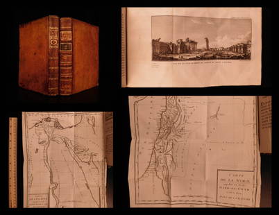
Sold20201787 1st ed Voyages in Syria & EGYPT Africa Illustrated1787 1st ed Voyages in Syria & EGYPT Africa Illustrated MAPS Sphinx 2v Volney “The best expose of Ottoman Empire at the end of the 18th-century!” (Blackmer) Constantin-François Volney, an 18th-ceSee Sold Price
Sold20201790 1ed James Bruce AFRICA Voyages of Ethiopia Egypt1790 1ed James Bruce AFRICA Voyages of Ethiopia Egypt Illustrated Hottentot 9v First French edition of James Bruce’s expedition in Ethiopia! James Bruce was an 18th-century Scottish voyager known prSee Sold Price
May 12Schilb Antiquarian Rare Books1859 AFRICA VOYAGES Barth Timbuktu Tripoli SLAVES Illustrated Slavery MAP African$62(4 bids)
May 09Hunt and Peck Estate Services, Inc.William Hole "A Description of the land of Gosen, and Moses passage though the Deserts"$50
May 16Potter & Potter AuctionsAUDIBERTI, J. Choain. Afrique Equatoriale Francaise. Paris:...$100(1 bid)


![1801 AFRICA RELATIONS 2 VOLUMES antique Carthage Ethiopia Egypt MAP: HÉEREN (A. H. L.). Idées sur les relations politiques et commerciale des anciens peuples de l’Afrique. [ Ideas on the political and commercial relations of the ancient peoples of Africa. ] 2 volum](https://p1.liveauctioneers.com/5584/318267/170789234_1_x.jpg?height=310&quality=70&version=1707248973)