Sold2015Syria, The Holy Land, Asia Minor & c.Syria, The Holy Land, Asia Minor & c. Illustrated. In a Series of Views Drawn From Nature Volume 3. Bartlett, W. H.; Purser, William; Carne, John. Published by FISHER, SON & CO. Provenance: Private esSee Sold Price
Sold2023BARTLETT. SYRIA, THE HOLY LAND, ASIA MINOR. 1836. 3 VOLS. IN 2[antiquarian book] BARTLETT, W. H. SYRIA, THE HOLY LAND, ASIA MINOR. Illustrated In a Series of Views Drawn From Nature By Bartlett, William Purser. With Descriptions of the Plates by John Carne. PublSee Sold Price
Sold20201842 Syria The Holy Land 120 PlatesSyria. The Holy Land & Asia Minor Illustrated…, by John Carne, printed by Peter Jackson at London, [1842]. Three volumes bound as one. One hundred and twenty plates as called for done by W H BartletSee Sold Price
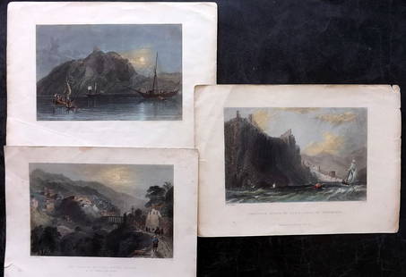
Sold2020Bartlett, William 1838 Lot of 5 Turkish Prints. TurkeySteel Engravings Published 1836-38, London for "Syria, the Holy Land, Asia Minor, &c." by William Bartlett and John Carne. Paper Size: 11 x 8 inch (28 x 21cm) Minor margin toning, images fine.See Sold Price
Sold2020Bartlett, William 1838 Lot of 6 Holy Land PrintsSteel Engravings Published 1836-38, London for "Syria, the Holy Land, Asia Minor, &c." by William Bartlett and John Carne. Paper Size: 11 x 8 inch (28 x 21cm) Minor toning in parts, otherwise generallSee Sold Price
Sold2020Bartlett, William 1838 Lot of 6 Holy Land PrintsSteel Engravings Published 1836-38, London for "Syria, the Holy Land, Asia Minor, &c." by William Bartlett and John Carne. Paper Size: 11 x 8 inch (28 x 21cm) Minor toning in parts, otherwise generallSee Sold Price
Sold2020Bartlett, William 1838 Lot of 5 Holy Land PrintsSteel Engravings Published 1836-38, London for "Syria, the Holy Land, Asia Minor, &c." by William Bartlett and John Carne. Paper Size: 11 x 8 inch (28 x 21cm) Minor margin toning, images fine.See Sold Price
Sold2015Carne (John) - Syria, The Holy Island, Asia Minor,3 parts in one, additional engraved titles, 117 engraved plates, 2 engraved maps, tissue guards, a little minor spotting and light finger-marking but overall internally clean and bright, contemporarySee Sold Price
Sold2022With maps, vignettes and 120 engraved platesHeading: Author: Carne, John Title: Syria, The Holy Land, Asia Minor, &c. Illustrated Place Published: London, Paris, & America Publisher:Fisher, Son & Co. Date Published: [c. 1838] DeSee Sold Price
Sold2022Travel Books, Palestine and the LevantLot of travel books in Palestine, including: Syria, the Holy land and Asia minor Illustrated (2 Volumes) *The Holy Land painted by John Fulleylove *Recent Explorations in Palestine *Scripture Lands bySee Sold Price
Sold2020Bartholomew, John 1922 Lot of 5 Maps Egypt & Holy LandIncl Egypt and The Nile, Lower Egypt, Asia Minor/Syria/Mesopotamia, Palestine and Persia. Large Lithograph Maps Published 1922 by The Times, London for "The Times Survey Atlas of the World" Maps by JoSee Sold Price
Sold2019Bartholomew, John 1922 Lot of 3 Maps of the Holy Land"Asia Minor, Syria & Mesopotamia" "Palestine" and "Persia" Large Lithograph Maps Published 1922 by The Times, London for "The Times Survey Atlas of the World" Maps by John George Bartholomew of the EdSee Sold Price
Sold2024Bartlett - Holy Land 1838 Lot of 3 Hand Col Prints. Turkey, SyriaMount Amanus, Cliffs of Alaya, and Mount Casius. Hand Colored Steel Engraving Published 1836-38, London for "Syria, the Holy Land, Asia Minor, &c." by William Bartlett. Paper Size: Up to 10.5 x 7.5 inSee Sold Price
Sold2021Eadie, John 1863 Lot of 5 Holy Land MapsIncl Journeys of Apostle Paul/Asia Minor Apocalyptic Churches, Plan of Jerusalem, Journeys of the Children of Israel/Old & New Canaan, Judah & Israel/Land of Canaan, and The World as peopled by the deSee Sold Price
Sold2021Eadie, John 1864 Lot of 5 Holy Land MapsIncl Journeys of Apostle Paul/Asia Minor Apocalyptic Churches, Plan of Jerusalem, Journeys of the Children of Israel/Old & New Canaan, Judah & Israel/Land of Canaan, and The World as peopled by the deSee Sold Price
Sold20231859 Ottoman Empire in Asia. Turkey, Iraq , Syria, holy land. By ColtonTitle: 1859 Ottoman Empire in Asia. Turkey, Iraq , Syria, holy land. By Colton Date/Period: 1859 Materials: Hand colored steering engraved Size: 17 1/2 x 14 1/2” Shows the Ottoman Empire in AsiaSee Sold Price
Sold2019Bartholomew, John 1922 Mixed Lot of 9 Large MapsIncl Mapping of the World, World Climate, Germany East, Southern Russia, Asia Minor/Syria/Mesopotamia, Palestine, Indian Ocean, North America - Political, North Atlantic Ocean. Large Lithograph Maps PSee Sold Price
Sold2023Fleetwood, Rev. John 1854 Map of Jerusalem, Holy LandSteel Engraved Map Published 1854, London for "The Life of Our Blessed Lord and Saviour Jesus Christ" by the Rev. John Fleetwood. Paper Size: 10.5 x 8 inch (27 x 21cm) Very minor margin toning. Good CSee Sold Price
Sold2018Maps 18th-19th Century. Mixed Lot of 23Mixed Lot of Maps, mostly 19th Century Lithographed. Incl UK, South America, Syria, Germany, France, Caribbean, USA, Panama, Europe, Holy Land, Italy, Mediterranean, Cambridge, Ludlow, Pacific, Asia aSee Sold Price
Sold20221797 1ed VOYAGES in Italy Syria Holy Land Jerusalem1797 1ed VOYAGES in Italy Syria Holy Land Jerusalem Russia CHINA Morocco Mavor William Mavors Historical Account of the Most Celebrated Voyages is one of the best and most thorough collections of repoSee Sold Price
Sold20231780 Jesuit Voyages Missions SYRIA Holy Land MAPS Greece Lettres Edifiantes1780 Jesuit Voyages Missions SYRIA Holy Land MAPS Greece Lettres Edifiantes The Lettres Edifiantes et Curieuses is a collection of reports and letters from Jesuit missions from around the world. It isSee Sold Price
Sold2023Calmet, Augustin 1732 LG Folio Print. Tripoli, Syria. Holy Land"A Prospect of the Town and Harbour of Tripoli in Syria" Folio Copper Plate Published 1732, London for "An Historical, Critical, Geographical, Chronological and Etymological Dictionary of the Holy BibSee Sold Price
Sold2022Cellarius & Patrick 1816 Map. Syria & Holy Land"Syria, Coelesyria, Phoenicia & Mesopotamia" Copper Engraved Map Published 1816, London for "Geographia Antiqua" by Samuel Patrick. Maps based on those by Andreas Cellarius. Folds as issued. Paper SizSee Sold Price
Sold20246 Decorative Old Maps of 16th-18th CenturiesSet of six vintage "Decorative Old Maps of 16th, 17th, 18th Centuries" including colored maps of Europe, The Holy Land, Asia, Belgium, and Canada and the Great Lakes. [Sheets: 16" H x 20" W]. In goodSee Sold Price
2 days LeftAlbion AuctionsRoberts, David 1856 Print. Ruins of the Memnonium, Thebes 176 Egypt$5(1 bid)
May 30NY Elizabeth 1696 ANCIENT ILLUSTRATED VELLUM FROM SYRIA, ASIA MINOR, AND THE SYRIAN-ARAB REGION OF HISTORY$50
4 days LeftTrillium Antique Prints & Rare BooksDavid Roberts - View from under the Portico of the Temple of Dendera$200
4 days LeftTrillium Antique Prints & Rare BooksDavid Roberts - Fragments of the Great Colossi, at the Memnonium$200
2 days LeftNadeau's Auction Gallery1996 My Jerusalem 18k Gold Israel Medal Holy Land Jewish Capital$300(1 bid)


![BARTLETT. SYRIA, THE HOLY LAND, ASIA MINOR. 1836. 3 VOLS. IN 2: [antiquarian book] BARTLETT, W. H. SYRIA, THE HOLY LAND, ASIA MINOR. Illustrated In a Series of Views Drawn From Nature By Bartlett, William Purser. With Descriptions of the Plates by John Carne. Publ](https://p1.liveauctioneers.com/8321/286473/152001047_1_x.jpg?height=310&quality=70&version=1686162815)
![1842 Syria The Holy Land 120 Plates: Syria. The Holy Land & Asia Minor Illustrated…, by John Carne, printed by Peter Jackson at London, [1842]. Three volumes bound as one. One hundred and twenty plates as called for done by W H Bartlet](https://p1.liveauctioneers.com/5584/188171/94694200_1_x.jpg?height=310&quality=70&version=1608072723)


![With maps, vignettes and 120 engraved plates: Heading: Author: Carne, John Title: Syria, The Holy Land, Asia Minor, &c. Illustrated Place Published: London, Paris, & America Publisher:Fisher, Son & Co. Date Published: [c. 1838] De](https://p1.liveauctioneers.com/642/255997/133163486_1_x.jpg?height=310&quality=70&version=1658864460)


![6 Decorative Old Maps of 16th-18th Centuries: Set of six vintage "Decorative Old Maps of 16th, 17th, 18th Centuries" including colored maps of Europe, The Holy Land, Asia, Belgium, and Canada and the Great Lakes. [Sheets: 16" H x 20" W]. In good](https://p1.liveauctioneers.com/1221/316726/170695118_1_x.jpg?height=310&quality=70&version=1706931805)


