Sold2023COLONIAL FRENCH INDOCHINA. Indochine française. Politique. Political 1929 mapTitle: COLONIAL FRENCH INDOCHINA. Indochine française. Politique. Political 1929 map Description: Indochine - Politique' by Commandant P. Pollacchi (1929). Vintage atlas map, 51.0 x 34.0cm, 20 x 13.5See Sold Price
Sold2020Book - "Jews and Americans. Kings of North Africa"French anti-Semitic pocket book "Juifs et Americans. Rois de l'Afrique du Nord" or "Jews and Americans - Kings of North Africa" written by André Chaumet. This book talks about the connection betweenSee Sold Price
Sold2024COLONIAL AFRICA Afrique. League of Nations Mandates. Ethnicity 1929 old mapTITLE/CONTENT OF MAP: 'Afrique - Politique. Pluies annuelles. Régions naturelles. Races' DATE PRINTED: 1929 IMAGE SIZE: Approx 36.0 x 25.5cm, 14 x 10 inches (Large) TYPE: Vintage atlas map CONDITSee Sold Price
Sold2024COLONIAL AFRICA Afrique. League of Nations Mandates. Ethnicity 1929 old mapTITLE/CONTENT OF MAP: 'Afrique - Politique. Pluies annuelles. Régions naturelles. Races' DATE PRINTED: 1929 IMAGE SIZE: Approx 36.0 x 25.5cm, 14 x 10 inches (Large) TYPE: Vintage atlas map CONDITSee Sold Price
Sold2020Roger Broders (French, 1883-1953) MarseillePorte de l'Afrique du Nord 1929 artist's name printed in image; printed Lucien Serre & Cie., Paris 39.5 x 24.5 in.See Sold Price
Sold2024Colonial Africa. Ethnicity. British French Portuguese Belgian. TIMES 1922 mapTITLE/CONTENT OF MAP: 'Africa - Political' DATE PRINTED: 1922 IMAGE SIZE: Approx 44.0 x 57.5cm, 17.25 x 22.5 inches (Large); Please note that this is a folding map. TYPE: Antique atlas map CONDITION:See Sold Price
Sold2023Colonial Africa. Ethnicity. British French Portuguese Belgian. TIMES 1922 mapTITLE/CONTENT OF MAP: 'Africa - Political' DATE PRINTED: 1922 IMAGE SIZE: Approx 44.0 x 57.5cm, 17.25 x 22.5 inches (Large); Please note that this is a folding map. TYPE: Antique atlas map CONDITION:See Sold Price
Sold2023Colonial Africa. Ethnicity. British French Portuguese Belgian. TIMES 1922 mapTITLE/CONTENT OF MAP: 'Africa - Political' DATE PRINTED: 1922 IMAGE SIZE: Approx 44.0 x 57.5cm, 17.25 x 22.5 inches (Large); Please note that this is a folding map. TYPE: Antique atlas map CONDITION:See Sold Price
Sold2023[ANTIQUE MAP] PARTIE DU NORD DE L'AMERIQUE SEPTENTRIONALE. C.1770s[ANTIQUE MAP] PARTIE DU NORD DE L'AMERIQUE SEPTENTRIONALE. Pour Servir a L'historie Philisophique et Politique... By Rigobert Bonne (1727-1795) Map of the eastern part of North America shows the BritiSee Sold Price
Sold2017Rare French map of Alaska Panhandle 1896Heading: (North America - Pacific Northwest) Author: Title: Amérique du Nord - Côte Ouest. De Dixon Entrance à Cross Sound d'après les Cartes anglaises et américaines Place Published: [Paris, FrSee Sold Price
Sold2016Malte-Brun: Afrique Septentionale, 1812Map: Afrique Septentionale Maker: M Malte-Brun Date: 1812 Origin: Paris Size: 8.7 x 12.7 inches An excellent map of North Africa, rich with topographical and political division details. It shows the eSee Sold Price
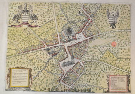
Sold201518th C French Map Of SteenvoordePLOUICH, Vedastus du -" Illvstrissimo viro domino" .The city of Steenvoorde is a small town located north of France. The city of Steenvoorde is located in the department of Nord of the french region.See Sold Price
Sold20241801 AFRICA RELATIONS 2 VOLUMES antique Carthage Ethiopia Egypt MAPHÉEREN (A. H. L.). Idées sur les relations politiques et commerciale des anciens peuples de l’Afrique. [ Ideas on the political and commercial relations of the ancient peoples of Africa. ] 2 volumSee Sold Price
Sold2019Vuillemin, A 1848 Group of 4 Decorative French MapsCorreze, Cote-D'Or, Cotes du Nord, Creuse. Steel Engraved Maps Published 1848, Paris for "La France et ses colonies" by Alexandre Vuillemin & Migeon. Paper Size: 13 x 10 inch (33 x 25cm) Good ConditioSee Sold Price
Sold2016French printed panel (Vue de L'Amerique du Nord), oneFrench printed panel (Vue de L'Amerique du Nord), one of seven scenes of North America published in French scenic wallpaper 1795-1865 by Odile Nouvel-Kammerer. 75"h.x74"w.See Sold Price
Sold2023Colored Map Engraving of North America Before the French Indian War 18th CenturyCharte von dem Engellaendischen u. Franzoesischen Besitzungen in Nord America. This map detail delineation of the English and French colonies prior to the French and Indian War pg. 8. This hand coloreSee Sold Price
Sold2020LARGE FRENCH SCHOOL Aid politica MAP OF AFRICA MIDPublished by the Librairie Amand Collin in Paris Circa 1950 edited by Vidal and Lablache this map shows the political boundaries of the African colonies of the 1950 with a color coding including theirSee Sold Price
Sold20241719 Map of Colonial era North America, by Sanson - JaillotTitle: 1719 Map of Colonial era North America, by Sanson - Jaillot Date/Period: 1719 Materials: Copperplate engraved Size: 25 1/2 x 18” This map is a rare and valuable map of history, showing NoSee Sold Price
Sold2018AFTER NICOLAS SANSON (FRENCH, 1600-1667) MAP OF NORTHAFTER NICOLAS SANSON (FRENCH, 1600-1667) MAP OF NORTH AMERICA, hand-colored, on laid paper, title in cartouche to upper left corner lettered "NORTH AMERICA / Divided into it's Principall Parts / whereSee Sold Price
Sold2018A.M. Cassandre Art Deco PosterOriginal Art Deco Chemin de Fer du Nord poster by A.M. Cassandre, France 1929. Frame: 47" H x 33" W. Poster: 39" H x 25" W.See Sold Price
Sold2023Zuber Views of North America Wall Paper CompleteAntique Zuber and Co. Panoramic Wallpaper "Les Vues d'Amerique du Nord" Includes Complete Wall Paper Panels. These panels were professionally removed from a New York Estate and are offered in the origSee Sold Price
Sold2023Epée en acier à poignée à décor koftgari or (shamshir), Inde du Nord XI...Epée en acier à poignée à décor koftgari or (shamshir), Inde du Nord XIXe siècle A gold koftgari-steel hilted sword (shamshir), North India, 19th Century the single-edgedSee Sold Price
Sold2022(COLONIAL NORTH AMERICA.) John Senex, Charles Price, and John Maxwell. North America.(COLONIAL NORTH AMERICA.) John Senex, Charles Price, and John Maxwell. North America. Large engraved map of North America on two sheets of laid paper joined. 39x26¾ inches overall, wide margins;See Sold Price
Sold2021Amérindiens des Plaines du Nord, Lakotas (SiouxAmérindiens des Plaines du Nord, Lakotas (Sioux Tetons). Moccasins Description: Pair of moose skin moccasins with buffalo skin soles, decorated with abundant glass bead embroidery with the North starSee Sold Price
5 days LeftJasper52COLONIAL FRENCH INDOCHINA. Indochine française. Politique. Political 1931 map$100
5 days LeftJasper52COLONIAL FRENCH INDOCHINA. Indochine française. Politique. Political 1938 map$100
5 days LeftJasper52FRENCH INDOCHINA. N Laos & Annam. Vietnam. Tourane (Da Nang) city plan 1929 map$30
4 days LeftJasper521760 MAP CARTE PARTICULIERE DE L'ISLE DE JUAN FERNANDES antique Robinson Crusoe$55
2 days LeftUkiyoe Gallery Japanese Woodblock PrintsYoshida Hiroshi: Soshu 1940 JIZURI Woodblock$2,500(5 bids)
2 days LeftUkiyoe Gallery Japanese Woodblock PrintsHiroshi Yoshida - Evening Nara 1st Ed JIZURI Woodblock$450(3 bids)


![[ANTIQUE MAP] PARTIE DU NORD DE L'AMERIQUE SEPTENTRIONALE. C.1770s: [ANTIQUE MAP] PARTIE DU NORD DE L'AMERIQUE SEPTENTRIONALE. Pour Servir a L'historie Philisophique et Politique... By Rigobert Bonne (1727-1795) Map of the eastern part of North America shows the Briti](https://p1.liveauctioneers.com/8321/286473/155024526_1_x.jpg?height=310&quality=70&version=1686787412)


![1801 AFRICA RELATIONS 2 VOLUMES antique Carthage Ethiopia Egypt MAP: HÉEREN (A. H. L.). Idées sur les relations politiques et commerciale des anciens peuples de l’Afrique. [ Ideas on the political and commercial relations of the ancient peoples of Africa. ] 2 volum](https://p1.liveauctioneers.com/5584/318267/170789234_1_x.jpg?height=310&quality=70&version=1707248973)


![[EPHEMERA]. Group of Booklets, Magazines, Postcards, Brochu... (1 of 1)](https://p1.liveauctioneers.com/928/328184/176813372_1_x.jpg?height=282&quality=70&version=1714496988)


