Sold2021Map: An early 20th century pencil and watercolour mapMap: An early 20th century pencil and watercolour map of Devonshire with place name labels and decorated with animal illustrations to include badgers, deer, horses, seals, hares, birds, squirrels, fisSee Sold Price
Sold2016Important Firestone Watercolor Hunt Mapearly to mid 20th century. depicting the Lauray Hunt, Bath, Ohio in hand-painted detail. signed at lower left, “Designed by Nancy Wilds.” sight size: H20” W25” Estate of Dale K. and Judy FiresSee Sold Price
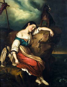
Sold2021Manuscript Map of the Holy Land, early 18th Century[Manuscript map of the Holy Land] Pencil, ink, and watercolor on faux vellum with horizontal and vertical folding creases (8 segments) and no mounting guard; pencil grid visible in upper left and righSee Sold Price
Sold2023American School, Architectural RenderingAmerican, early 20th century pencil and watercolor on paper depicting the outside of a train station, 12 1/2" x 21" sight size, 14" x 22 1/2" framed.See Sold Price
Sold2022Portfolio of 41 Russian Academic drawingsFolder of 41 Russian Academic drawings with Empire stamps ; late 19th - early 20th century ; charcoal, pencil and watercolor on paper ; approx. folder dimensions 33 x 45 cm (13 x 18 in.) ; signed andSee Sold Price
Sold2018Folio of various early 20th Century maps and threeFolio of various early 20th Century maps and three printsSee Sold Price
Sold2020Grp: 10 Maps of New York City 18th-Early 20th c.Group of 18th to early 20th century maps of New York City. Multiple are 19th-20th c. reprints of 17th-18th c. maps. Includes a small census map of New York City from 1850 with populations of New YorkSee Sold Price
Sold20241905 Rand McNally Unrivaled Atlas of the WorldPresenting a cartographic gem, the 1905 Rand McNally Unrivaled Atlas of the World stands as a testament to the art and science of early 20th-century map-making. This edition, in good condition with aSee Sold Price
Sold2021LATE 19TH & EARLY 20TH C. KANSAS MAPS LOT OF 6LATE 19TH & EARLY 20TH C. KANSAS MAPS LOT OF 6 Lot of late 19th and early 20th century maps of Kansas. Includes 5 Hand drawn and hand colored maps from the 1880s. Fort Scott, Eldorado, Emporia, SalinSee Sold Price
Sold20162 Watercolors attrib. to Alfred J. Munnings.Munnings, Alfred J. attrib. (Great Britain, 1878-1959). Late 19th / early 20th century. Watercolor and pencil on paper. Watercolor sketches of horses with carriages. One of two signed l.l. "A.J.M." 5See Sold Price
Sold2022SIX-DRAWER MAP CHEST Early 20th Century Height 22.5”. Width 23.5”. Depth 17.25”.SIX-DRAWER MAP CHESTEarly 20th CenturyIn pine. Bracket base.Height 22.5”. Width 23.5”. Depth 17.25”. Drawer interiors 14.75” x 19.75”.See Sold Price
Sold2022Two Illustrations of a Young Woman.Early 20th century, each watercolor and pencil on paper, 7 x 6 inches, in folk art frames.See Sold Price
Sold201519th/Early 20th Century Softwood Map Case.Late 19th/Early 20th Century Softwood Map Case. Original chrome yellow paint, 14 full width drawers. 49"h. x 29-1/2"w. x 19-1/2"d. Condition: Good with wear and soiling.See Sold Price
Sold2018Early 20th c. mahogany map cabinet w/ 5 drawersMahogany map cabinet, early 20th century, of rectangular form with five wide drawers having brass cup pulls, the whole resting on a plinth base, 36"h x 55"w x 37.5"d. Top replaced.See Sold Price
Sold20181900 HUGE Folding Color Street Map of London 70001900 HUGE Folding Color Street Map of London 7000 Streets Visitors Travel Guide A large, color indicator map of London from the early 20th-century. This map is bound in a hardcover binding and pairedSee Sold Price
Sold2016Six Drawer Walnut Double Sided Map CaseA Six (6) drawer walnut double sided map case. Early 20th century. Hardware pulls on both sides. Drawer will completely come out.Dimensions: 31 1/2" X 23" X 30 1/2"See Sold Price
Sold2017Six Drawer Walnut Double Sided Map CaseA Six (6) drawer walnut double sided map case. Early 20th century. Hardware pulls on both sides. Drawer will completely come out.Dimensions: 31 1/2" X 23" X 30 1/2"See Sold Price
Sold2023Box of 35+ Assorted 19th/20th C. Small MapsBox of mostly 19th and early 20th century small maps, approximately 35 pieces including maps of Paris, London, Spain, Caudine Forks, New England, Egypt, Russia, Italy, Europe, Africa, Asia, road maps,See Sold Price
Sold2016Artist Unknown (Early 20th Century) Study ofArtist Unknown (Early 20th Century) Study of Versailles. Watercolor and pencil on paper. Annotated along lower edge "Verseilles. 1912. EG." Sight: 10" x 7" Frame: 13.5" x 10"See Sold Price
Sold2015Boris Solotareff (Russian, 1889-1966)Drawing of men beside river. Watercolor and pencil on paper, early 20th century. Signed (LL). Frame size 18.5 x 15 inches, sight size 8.5 x 12 inches. Matted and framed. Notice to bidders: Condition rSee Sold Price
Sold2021A REPUBLIC OF TEXAS MAP, "Amérique Septentrionale,"A REPUBLIC OF TEXAS MAP, "Amérique Septentrionale," EARLY 20TH CENTURY, hand-colored lithograph on paper, after geographical works by Malte-Brun, Thierry et Barthelmier, engravers, J. Blumenthal,See Sold Price
Sold2023Frank Lengel French Textile MapFrance,Early 20th Century Long textile map depicting four variations of France marking them with cities, famous places, and illustrations. Frank Lengel Textile,Approx. 12' 11" x 3' 1". From the collecSee Sold Price
Sold2019Original Art 20th Cent. Mixed Lot of 7, LargeMixed Lot of 7. Early 20th Century-C2000. Watercolours, Gouache, and Pencil drawings. Mixed standard (Some poor) but some of a good standard. Those that are Signed include G. G. Read, "Spider of JapanSee Sold Price
Sold2023Group of 14 Ireland County MapsGroup of 14 early 20th century Ireland County maps, in partial color, including Cork, Donegal, Kerry, Dublin, Galway, and others. Provenance: Phyllis Lucas Gallery, NYC. [6 1/2" H x 9 3/4" W]. Light tSee Sold Price


![Manuscript Map of the Holy Land, early 18th Century: [Manuscript map of the Holy Land] Pencil, ink, and watercolor on faux vellum with horizontal and vertical folding creases (8 segments) and no mounting guard; pencil grid visible in upper left and righ](https://p1.liveauctioneers.com/1968/225974/116712048_1_x.jpg?height=310&quality=70&version=1636655147)


![Group of 14 Ireland County Maps: Group of 14 early 20th century Ireland County maps, in partial color, including Cork, Donegal, Kerry, Dublin, Galway, and others. Provenance: Phyllis Lucas Gallery, NYC. [6 1/2" H x 9 3/4" W]. Light t](https://p1.liveauctioneers.com/1221/310017/167287163_1_x.jpg?height=310&quality=70&version=1702345350)