Sold2019History of the Town of Litchfield, ConnecticutThe History of the Town of Litchfield, Connecticut 1720 - 1920 Compiled for the Litchfield Historical Society Author: Alan C. White IllustrationsSee Sold Price
Sold2022Map of the Town of Cornwall, Connecticut, Circa 1854Map of the Town of Cornwall, Connecticutcirca 1854marked "Map of the Town of Cornwall, Litchfield County, Connecticut, Surveyed & Drawn by L. Fagan, Published by Richard Clark, 42, Moyamensing RoSee Sold Price
Sold20231979 Town of Woodbury, Conn Framed MapDescription: This lot includes a framed map of Woodbury Conn from there American Bi-Centennial in 1979. Original map was done by L. Fagan in 1853. Condition: Minor expected surface wear associated witSee Sold Price
Sold2017Handbook to Arizona 1878Heading: Author: Hinton, Richard J. Title: The Hand-Book of Arizona: Its Resources, History, Towns, Mines, Ruins and Scenery. Amply Illustrated. Accompanied with a New Map of the Territory Place PublSee Sold Price
Sold20231845 HISTORY of WYOMING in LETTERS from CHARLES MINER antique AMERICANAHISTORY of WYOMING in A SERIES of LETTERS from CHARLES MINER Philadelphia ; 1845 Illustrated with map Size: 6 by 9 1/4" Original publisher's cloth Good condition, some wear of binding, some foxing. ReSee Sold Price
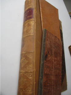
Sold20221878 History of Gardner, MA Book1878 History of Town of Gardner From Incorporation 1785 to Present Time by Rev. W. D. Herrick - Leather Marbled Cover, loose pages - Pull out Map has tear. Please see photos and come to the 2 day prevSee Sold Price
Sold2019History of Minisink New YorkMinisink - A Bicentennial History Map endpapers Illustrations B/W Photos Dated: 1988 Publisher: Bicentennial Commission Town of MinisinSee Sold Price
Sold20221882 History of The Town of Milford & JournalsSales Journals From Local Store - One Dated 1866 Another Dated 1883 - Book Has A Little Wear and Fold Out Map Has A Tear - See photos for condition and detailsSee Sold Price
Sold2018Meyer: South Carolina with Charleston InsetReserve Reduced! The beautifully detailed and colored map of South Carolina "with its canals, streets, steamship routes and distances between main towns" from the 1845 edition of Meyer's Hand-Atlas. ISee Sold Price
Sold20241881 Westchester County New York Yonkers Illustrated MAPS 2v SET Bolton History1881 Westchester County New York Yonkers Illustrated MAPS 2v SET Bolton History Robert Boltons “History of County of Westchester” is a rare, 19th-century survey of towns and manors throughoutSee Sold Price
Sold20211903 Medieval Towns Moscow Paris France Seville Spain1903 Medieval Towns Moscow Paris France Seville Spain Perugia MAPS 4v Hutton William Holden Hutton’s “Medieval Towns” is an early 20th-century set of histories on iconic ancient towns including:See Sold Price
Sold20211902 Medieval Towns Ancient Florence Italy1902 Medieval Towns Ancient Florence Italy Constantinople Ferrara MAPS 4v Hutton William Holden Hutton’s “Medieval Towns” is an early 20th-century set of histories on iconic ancient towns includSee Sold Price
Sold2022Scotland.- Tytler (Patrick Fraser) History of Scotland, 7 vol., 1845; and 10 others Scottish historyScotland.- Tytler (Patrick Fraser) History of Scotland, 7 vol., folding engraved map, contemporary tree calf, spines gilt with red morocco labels, vol. 1 spine and upper cover detached, vol. 3 rebackeSee Sold Price
Sold2017History of Wyoming - William Miner 1845History of Wyoming in a Series of Letters from Charles Miner, to His Son William Penn Miner, Esq. Map of Wyoming present. Hand colored. Author: Charles MinSee Sold Price
Sold202219th Century Massachusetts Books2 Books: 1839 Massachusetts Historical Collections History and Antiquities of Every Town in Massachusetts by John Warner Barber with Map. 1840 Massachusetts Historical Collections History and AntiquitSee Sold Price
Sold2022LINCOLNSHIRE Directories, etc:LINCOLNSHIRE Directories, etc: LINCOLNSHIRE Directories, etc: White, W: The History and Directory of the Towns and Principal Villages in the County of Lincoln. Leeds, 1826. No map present. Cont. fullSee Sold Price
Sold2022Panoramic Map of Jerusalem Book - 1845Panoramic Map of Jerusalem and the Adjacent Towns and Villages, from a drawing by the Librarian of the Armenian Convent. Drawn from the original and engraved by Nathaniel Whittock. Bound in a book thaSee Sold Price
Sold2022HISTORY OF PELHAM NY in WESTCHESTERTitle: HISTORY OF PELHAM NY in WESTCHESTER Description: ANCIENT TOWN OF PELHAM ACCOUNT AND SETTLEMENT. by Lockwood Barr, 1946, The Dietz Press, 190pp with Index, b&w photos, foldout maps, map endpaperSee Sold Price
Sold2023Historical Collections of New York, 1845New York State. - John W. BARBER & Henry HOWE. Historical Collections of the State of New York. New York: 1845. Octavo. 1 folding map (hand-colored I outline), plates, numerous illustrations. (ToningSee Sold Price
Sold2022Huge 1876 Historical Map of the U.S. by BlanchardHistoric Maps 1876 "Historical Map of the United States Showing Early Spanish, French & English Discoveries and Explorations, also Forts, Towns & Battlefields of Historic Interest" by Rufus BlanchardSee Sold Price
Sold2023GIBBON. History of the Roman Empire, 1781-88Edward GIBBON. The History of the Decline and Fall of the Roman Empire. London: 1782-81-81-88-88-88. 6 volumes, quarto. Portrait frontispiece, 3 folding engraved maps. Half-titles ton vols. II-VI. (NoSee Sold Price
Sold2023ENTICK. The General History of the Late War, 1779John ENTICK. The General History of the Late War ... Fourth Edition. London: 1779. 5 volumes, octavo. Title in red and black, 49 engraved plates and maps. Contemporary tree calf, spines gilt (spines cSee Sold Price
Sold2017History of Oregon and CaliforniaHistory of Oregon and California by Robert Greenhow. Boston 1845, 2nd enlarged ed. with facsimile map. Unbound in box. Provenance: Private collection, Davenport, WA. We gladly combine shipping on allSee Sold Price
Sold2020Meyer: Missouri, 1845Description: The beautifully detailed and colored map of Missouri, from Meyer's Hand-Atlas. Includes steamship routes between St. Louis and Shawnee Town, Prairie du Chien, and Kanzas (sic) River. CartSee Sold Price
May 30Antiques Online AuctionsVintage Texas 1845 Map Printed in 1986, Compiled by John Davis$1(1 bid)
133 Lots AwayAlbion AuctionsMarmocchi, F. C. 1845 Hand Col Map. Judaica - Jewish World & Israelites Camp$5
130 Lots AwayAlbion AuctionsMarmocchi, F. C. 1845 Hand Col Map. Arabia, Syria, Cyprus, Crete, Egypt$15(2 bids)
140 Lots AwayAlbion AuctionsMarmocchi, F. C. 1845 Hand Col Map. Greek Colonies. Ancient Greece$5(1 bid)
135 Lots AwayAlbion AuctionsMarmocchi, F. C. 1845 Hand Col Map. Egypt Pharaoh Empire, David Salomon$10(2 bids)
134 Lots AwayAlbion AuctionsMarmocchi, F. C. 1845 Hand Col Map. Holy Land. Canaan. Israel Palestine$10(2 bids)
137 Lots AwayAlbion AuctionsMarmocchi, F. C. 1845 Hand Col Map. Holy Land. Persia Empire, Alexander the Great$5(1 bid)
136 Lots AwayAlbion AuctionsMarmocchi, F. C. 1845 Hand Col Map. Holy Land. Israel, Jerusalem inset$5(1 bid)
141 Lots AwayAlbion AuctionsMarmocchi, F. C. 1845 Hand Col Map. Asia Minor. Macedonia Greece Cyprus$5
128 Lots AwayAlbion AuctionsMarmocchi, F. C. 1845 Hand Col Map. Black Sea. Greece Armenia Turkey Russia$5(1 bid)