Sold2020Baker Albert N'yanza 1866 1st Edition Leather BoundThe Albert n’yanza Great Basin of the Nile and the Explorations of the Nile Sources by Samuel White Baker with Maps illustrations and Portraits in two volumes. MacMillan and Company 1866 LondonSee Sold Price
Sold2023Lot of 2 Africa, Asia Maps 1808-1809. Size 13 1/2 x 10 1/2 inches lengthLot of 2 Africa, Asia Maps 1808-1809. Size 13 1/2 x 10 1/2 inches length. The map shows Africa way before the infamous expedition by John Hanning Speke to the source of the Nile.See Sold Price
Sold2021Bruce, James 1813 Map of of the River Nile"Copper Plate Published 1813, Edinburgh for "Travels to discover the source of the Nile" by James Bruce. Paper Size: 21 x 12.5 inch (53 x 32cm) Very large closed tear, backed with Linen. Heavy toningSee Sold Price
Sold2021Bruce, James 1813 Map of Masuah, Massawa. Red Sea"Plan of The Island and harbbour of Masuah" Copper Plate Published 1813, Edinburgh for "Travels to discover the source of the Nile" by James Bruce. Paper Size: 12 x 9.5 inch (30 x 24cm) Water stain inSee Sold Price
Sold2018WERNE, Ferdinand (1800-1874). Expedition to discoverWERNE, Ferdinand (1800-1874). Expedition to discover the sources of the White Nile, in the years 1840, 1841. London: Richard Bentley, 1849. 2 volumes, 8vo (201 x 118 mm). Folding route map, lithographSee Sold Price
Sold20191866 1ed Albert N’Yanza Nile Tributaries Africa Egypt1866 1ed Albert N’Yanza Nile Tributaries Africa Egypt Abyssinia Illustrated Map Samuel White Baker was an English naturalist, big game hunter, explorer and was the first Englishman to sit in a highSee Sold Price
Sold2017van der Aa: Antique Explorers Map of the Atlantic OceanTitle: H. Benzos Scheep-togt uit Italie over Spanje na de Westindize Eylanden, en Kusten van't Zuider America. Lovely 1707 explorers' map set in a decorative border Map maker: Pieter van der Aa PlaceSee Sold Price
Sold2017Antique Explorers Map of North America, 1903Title/Content of Map: 'North America' USA CANADA MEXICO: Explorers routes: Cabot Cortes Baffin Hudson Drake Date Printed: 1903 Image Size: Approx 38.5 x 28.0cm, 15.25 x 11 inches (Large); Please noteSee Sold Price
Sold2023A.J. JOHNSON ATLAS MAP OF AFRICA, 19TH C.Framed atlas map, "Johnson's Africa," published by A.J. Johnson (Alvin J. Johnson, 1827-1884), New York, with insets depicting map of Liberia, delta of the Nile, map of Cape Colony, sight: approx 23.5See Sold Price
Sold2017Rare 1967 Mouzon Map of North & South Carolinavery limited production by Louis and Clark Explorer Maps LLC in Kitty Hawk, and Charlotte, North Carolina. reproduction gives excellent detail and very well resembles the original map. marked "L&C" atSee Sold Price
Sold2021Map of North and South CarolinaMap is North and South Carolina by H. S. Tanner North and South Carolina 1825 printed in 1967 by Lewis and Clark explorer maps LTD Kitty Hawk North Carolina re-printed from the original map publishedSee Sold Price
Sold20221895 1ed Yellowstone National Park American West Indian Explorer Illustrated MAP1895 1ed Yellowstone National Park American West Indian Explorer Illustrated MAP Hiram Chittendens The Yellowstone National Park is a finely illustrated work on the first American National Park. ThisSee Sold Price
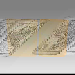
Sold2022The Albert N'Yanza, Great Basin of the Nile. 1866.[Africa] Baker, Samuel White, Sir. The Albert N'yanza, Great Basin of the Nile, and Explorations of the Nile Sources. Macmillan and Co., London, 1866. 2 volumes. First edition of Sir Baker's account oSee Sold Price
Sold2022The Albert N'YanzaGreat basin of The Nile and Explorations of the Nile Sources Two volumes in slipcase. Foreword by Alan Moorehead. Pictorial dust-jackets with protective mylar covers. Publishers brown cloth with giltSee Sold Price
Sold20191854 Journey to Central Africa EGYPT Sudan Ethiopia MAP1854 Journey to Central Africa EGYPT Sudan Ethiopia MAP Nile Bayard Taylor Bayard Taylor was a 19th-century travel writer whose abundant notes and reports have been referenced for decades since the miSee Sold Price
Sold20211874 Journey to Central Africa Lakes EGYPT Sudan1874 Journey to Central Africa Lakes EGYPT Sudan Ethiopia MAP Nile Bayard Taylor Bayard Taylor was a 19th-century travel writer whose abundant notes and reports have been referenced for decades sinceSee Sold Price
Sold2022Africa.- Petherick (John).- Sources of the Nile. Subscription to Raise £2,000, 4pp., 1861.Africa.- Petherick (John).- Sources of the Nile. Subscription to Raise £2,000 for sending an expedition... to aid that of Captain Speke, already dispatched by way of Zanzibar...,4pp., spotting, sSee Sold Price
Sold2022Bruce's Travels to Discover Source of the NileLeather bound 7 volumes, 1813 Dimensions: 9" x 11.5" Provenance: Property from the Personal Collection of Seymour Stein.See Sold Price
Sold2016Speke's Discovery of the Source of the NileHeading: Author: Speke, John Hanning Title: Journal of the Discovery of the Source of the Nile Place Published: Edinburgh Publisher:William Blackwood & Sons Date Published: 1864 DescriSee Sold Price
Sold2020Speke's Discovery of the Source of the NileHeading: Author: Speke, John Hanning Title: Journal of the Discovery of the Source of the Nile Place Published: New York Publisher:Harper & Brothers Date Published: 1864 Description: <See Sold Price
Sold2016Speke's Discovery of the Source of the NileHeading: Author: Speke, John Hanning Title: Journal of the Discovery of the Source of the Nile Place Published: New York Publisher:Harper & Brothers Date Published: 1864 Description: <See Sold Price
Sold2024Africa. Tribes/pre-European Kingdoms. Great Lakes & Nile. BARTHOLOMEW 1862 mapTITLE OF PRINT (NOT PRINTED ON THE PAGE):'Africa' DATE PRINTED: 1862 IMAGE SIZE: Approx 56.5 x 44.0cm, 22.25 x 17.25 inches (Large); Please note that this is a folding map. TYPE: Antique coloured atlaSee Sold Price
Sold20191803 Map of Nile from Thebes to Cairo1803 Map of the Course of the Nile from Thebes to Cairo with the Track of the Indian Army”, published by Cadell & Davies. Fine, trimmed at upper left margin. Measures 8 x 14”. Reserve: $20.00 ShipSee Sold Price
Sold2019Egypt Map, Pyramids, NileAntique map of Egypt. Pyramids, King Tut. Usages, Sciences, Arts et Monuments de L'Egypt, Buy de Mornas, Paris: 1756. 15" x 22".See Sold Price
6 days LeftJasper521671 Ogilby Map of Venezuela -- Venezuela, cum Parte Australi Novae Andalusiae$160
May 29Jasper52SOUTH AMERICA. La Plata & Chilé. Chile Argentina Uruguay Bolivia. SDUK 1851 map$40
Jun 08Leon GalleryAbraham Ortelius (1527 - 1598) - Indiae Orientalis (Philippines/China/ India/ Southeast Asia)₱200,000
May 29Cedarburg Auction & Appraisals LLCSet of Four Maps Showing All of Spain and Portugal$375(2 bids)
509 Lots AwayHannam's Auctioneers LtdThe Complete Atlas of Modern, Classical and Celestial Maps, together with Plans of the Principal Cit£240
Jun 07Freeman's | Hindman[MAPS]. HOMANN, Johann Baptist, HOMANN HEIRS, and Georg Matthäus SEUTTER. [Composite Atlas].$15,000


![The Albert N'Yanza, Great Basin of the Nile. 1866.: [Africa] Baker, Samuel White, Sir. The Albert N'yanza, Great Basin of the Nile, and Explorations of the Nile Sources. Macmillan and Co., London, 1866. 2 volumes. First edition of Sir Baker's account o](https://p1.liveauctioneers.com/179/268856/140615967_1_x.jpg?height=310&quality=70&version=1668545725)


![[MAPS]. HOMANN, Johann Baptist, HOMANN HEIRS, and Georg Matthäus SEUTTER. [Composite Atlas]. (1 of 5)](https://p1.liveauctioneers.com/197/329395/177650530_1_x.jpg?height=282&quality=70&version=1715364962)