Sold2022(UNITED STATES - REPUBLIC OF TEXAS.) James Wyld. Map of the United States and the Provinces of Upper(UNITED STATES - REPUBLIC OF TEXAS.) James Wyld. Map of the United States and the Provinces of Upper & Lower Canada, New Brunswick, and Nova Scotia, Compiled from the Latest Surveys and Other AuthentiSee Sold Price
Sold2019James Wyld (1812-1887, London), "Map of North AmericaJames Wyld (1812-1887, London), "Map of North America Exhibiting Recent Discoveries Geographical and Nautical," hand colored atlas page, H.- 23 in., W.- 17 in.See Sold Price
Sold2023Map of the Atlantic Coast Southern StatesMap of the Atlantic Coast of the Southern States North Carolina South Carolina Constructed and Engraved to Illustrate the War with the South Print Type: EngravingSee Sold Price
Sold2022Scarce early Cram RR map of Southern states“New Railroad and County Map of Alabama, Georgia, South Carolina and North Carolina” from the extremely scarce 1882 edition of Cram’s Unrivaled Family Atlas of the World. This was tSee Sold Price
Sold20241795 Map of the Southern States of AmericaRUSSELL, John C. (ca 1750-1829) Map of the Southern States of America, Comprehending Maryland, Virginia, Kentucky, Territory Sth. of the Ohio, North Carolina, Tennessee Government. South Carolina, & GSee Sold Price
Sold2016Large 1862 US Civil War Wall MapColton's Map of the Southern States. Including Maryland, Delaware, Virginia, Kentucky, Tennessee, Missouri, North Carolina, South Carolina, Georgia, Alabama, Mississippi, Arkansas, Louisiana, Texas ..See Sold Price
Sold2024James H. Young's Mitchell's Map of America, 1850YOUNG, James Hamilton (1792- c.1870). Mitchell's National Map of the American Republic or United States of North America. Engraved map with original hand color. Philadelphia: S. Augustus Mitchell, 185See Sold Price
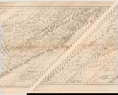
Sold20201860 Map of the United StatesAuthor: Stockley Title: 1860 Map of the United States Medium: Ink on Paper Dimensions: 10.5"X9" Map of the United States dated 1860. Engraved by James Stockley. Published by James Wyld engraver to QueSee Sold Price
Sold20221855 US Naval Astronomical Expedition Southern1855 US Naval Astronomical Expedition Southern Hemisphere INDIANS Maps James Melville Gilliss was an astronomer, officer in the US Navy and founder of the United States Naval Observatory. US Naval AstSee Sold Price
Sold2023Laurie & Whittle Map of the Southern British Colonies of AmericaLAURIE, Robert (1755-1836), and WHITTLE, James (1757-1818). A New and General Map of the Southern Dominions belonging to the United States of America... Engraved map with original hand color in outlinSee Sold Price
Sold2019Bryce, James 1881 Lot of 10 Maps of Canada & USADominion of Canada, North America, Middle States. New York, Pennsylvannia, New Jersey, Delaware and Maryland, New England States. Maine, New Hampshire, Vermont, Massachusetts, Rhode Island and ConnectSee Sold Price
Sold2018United States of North America: South EasternTitle/Content of Map: United States of North America: (South Eastern Division) the Southern States Date Printed: c1885 Cartographer: PHILIP, GEORGE & SON Size: 19.6X23.75 Printed 56-page index insideSee Sold Price
Sold20181839 Mitchell Map of New York to North Carolina -- No.Title/Content of Map: 1839 Mitchell Map of New York to North Carolina -- No. 11 Map of the Middle States and Part of Southern… Date: 1839 Philadelphia Cartographer: S Mitchell Size: 16.8 x 10.4 in.See Sold Price
Sold2018Mitchell: Antique Map of New York to North CarolinaTitle/Content of Map: 1852 Mitchell Map of New York to North Carolina -- No. 11 Map of the Middle States and Part of Southern… Date Printed: 1852 Philadelphia Cartographer: S Mitchell / CowperthwaitSee Sold Price
Sold20231858 Mitchell Map of New York to North Carolina -- No. 11 Map of the Middle States and Part of theTitle: 1858 Mitchell Map of New York to North Carolina -- No. 11 Map of the Middle States and Part of the Southern… Cartographer: S Mitchell Year / Place: 1858, Philadelphia Map Dimension (in.):See Sold Price
Sold2023Laurie & Whittle Map of the British Colonies of North AmericaLAURIE, Robert (1755-1836), and WHITTLE, James (1757-1818). A New and Correct Map of the British Colonies in North America comprehending Eastern Canada...with the adjacent states of New England. EngraSee Sold Price
Sold2016[Map] Southern States of America1795; by Russel, colored, framed 26 in. L., 21 in. H.See Sold Price
Sold2019India.- Wyld (James) Map of the Countries betweenIndia.- Wyld (James) Map of the Countries between England and India Designed to shew the Over-Land and Sea Routes to the East..., map of Europe and Asia between Britain and India, with the MediterraneSee Sold Price
Sold2019Colton's Virginia Map [Southern States]Colton's Virginia Map; Delaware on the right, Maryland on the left. J. H. Colton Cartographer. Published by J. H. Colton, New York. Stamped 'Entered according to Act of Congress in the Year 1855 by J.See Sold Price
Sold2019Colton's Delaware/Maryland Map [Southern States]Colton's Delaware and Maryland Map; Delaware on the right, Maryland on the left. J. H. Colton Cartographer. Published by J. H. Colton, New York. Insert of 'District of Columbia' lower left. Stamped 'ESee Sold Price
Sold2021Mitchell's New National Map, United States, NorthMitchell's New National Map, United States, North American British Provinces, Sandwich Islands, Mexico and Central America, Cuba, West Indies Philadelphia, published by S. Augustus Mitchell. 1856 65 xSee Sold Price
Sold20231891 Mitchell Map of Southern States -- Map of Georgia, Florida, Alabama, Mississippi andTitle: 1891 Mitchell Map of Southern States -- Map of Georgia, Florida, Alabama, Mississippi and Tennessee.. Cartographer: S Mitchell Year / Place: 1891, Philadelphia Map Dimension (in.): 10.6 X 8.2 iSee Sold Price
Sold20241891 Mitchell Map of Southern States -- Map of Georgia, Florida, Alabama, Mississippi andDescriptionTitle: 1891 Mitchell Map of Southern States -- Map of Georgia, Florida, Alabama, Mississippi and Tennessee..Cartographer: S MitchellYear / Place: 1891, PhiladelphiaMap Dimension (in.): 10.6See Sold Price
Sold20201852 OLD ANTIQUE MAP SOUTHERN UNITED STATES, MITCHELL1852 OLD ANTIQUE MAP SOUTHERN UNITED STATES, MITCHELL FL GA SC NC TN MS AR LA AL 1852 Antique Map by S. Augustus Mitchell of Pennsylvania. ??No. 12 - MAP OF THE CHIEF PART OF THE SOUTHERN STATES AND PSee Sold Price
23 hrs LeftJasper52Part of the Western Coast of Africa…' by James Wyld. Sierra Leone 1840 old map$300
Featured23 hrs LeftJasper52London and its environs by James Wyld. 108x130cm. Folding map on linen c1850$3,200
4 days LeftTrillium Antique Prints & Rare BooksCarey, pub. 1796 - 3 Maps of States in North America$75(1 bid)
2024Jasper521874 Mitchell Map of Mississippi, Louisiana and Arkansas -- County Map of the States of ArkansasSee Sold Price
23 hrs LeftJasper52The County of Surrey from Trigonometrical Survey. James Wyld 117x88cm 1874 map$340
23 hrs LeftJasper52Parish of Clerkenwell, drawn from an actual survey, by James Wyld 1865 old map$480
23 hrs LeftJasper52Large Civil War map of the United States. ETTLING. Illustrated London News 1861$300
23 hrs LeftJasper52Brabantia III Rheni Tabula. Benelux & North Rhine-Westphalia. MÜNSTER 1572 map$340
Featured23 hrs LeftJasper52United States of North America. Early territorial boundaries. LOWRY 1859 map$380
23 hrs LeftJasper52Amér Sep Partie de… Vieille Californie #53 Baja California VANDERMAELEN 1827 map$260
4 days LeftTrillium Antique Prints & Rare BooksVan der Aa - Map of Southern Atlantic Ocean: South America, part of North America, Europe, Africa$75
23 hrs LeftJasper52United States of North America, Pacific States by Joseph Wilson Lowry 1860 map$340
Oct 06Schilb Antiquarian Rare Books1860 CIVIL WAR PREDICTION 1ed Messages of President Buchanan Slavery Indians$36(3 bids)
Oct 12JM Hobby Supply and Railroad Artifact AuctionsUS Railroad Association-1918 North Dakota Agricultural Brochure$30


![[Map] Southern States of America: 1795; by Russel, colored, framed 26 in. L., 21 in. H.](https://p1.liveauctioneers.com/523/84219/43476536_1_x.jpg?height=310&quality=70&version=1453240168)

![Colton's Virginia Map [Southern States]: Colton's Virginia Map; Delaware on the right, Maryland on the left. J. H. Colton Cartographer. Published by J. H. Colton, New York. Stamped 'Entered according to Act of Congress in the Year 1855 by J.](https://p1.liveauctioneers.com/5755/154409/77936948_1_x.jpg?height=310&quality=70&version=1573094011)
![Colton's Delaware/Maryland Map [Southern States]: Colton's Delaware and Maryland Map; Delaware on the right, Maryland on the left. J. H. Colton Cartographer. Published by J. H. Colton, New York. Insert of 'District of Columbia' lower left. Stamped 'E](https://p1.liveauctioneers.com/5755/154409/77936946_1_x.jpg?height=310&quality=70&version=1573094011)


