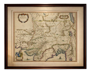
![[MAPS AND PRINTS]. DE L'ISLE, Gulliaume (1675-1726). Eight Maps of France by Gulliaume: [MAPS AND PRINTS]. DE L'ISLE, Gulliaume (1675-1726). Eight Maps of France by Gulliaume De L'Isle. Paris: De L'Isle et al., 1712-1745. Including:Carte de France. Paris: De L'Isle, 1731. Sight approxima](https://p1.liveauctioneers.com/928/421136/234320834_1_x.jpg?height=310&quality=70&version=1781294369)
No upcoming results for "rwp-plates"
But we've sold 10000 before. Follow this search to get notified as soon as more arrive.


You May Also Like
![[MAPS AND PRINTS]. DE WIT, Frederik¬†(ca.¬†1629-1706).¬†Mare¬: [MAPS AND PRINTS]. DE WIT, Frederik (ca. 1629-1706). Mare Balticum. Nieuwe Pascaert van de Oost Zee. Amsterdam: de Wit, [ca. 1680]. Presumed first edition with later hand-coloring matted under plexi.](https://p1.liveauctioneers.com/928/421136/234320842_1_x.jpg?height=310&quality=70&version=1781294369)
![[MAPS AND PRINTS].¬†D'ANVILLE, Jean Baptiste Bourguignon (1697-1782). Amérique: [MAPS AND PRINTS]. D'ANVILLE, Jean Baptiste Bourguignon (1697-1782). Amérique Septentrionale. Paris: d'Anville, 1746. Four sheets joined in two horizontal segments matted under plexi. Sight appro](https://p1.liveauctioneers.com/928/421136/234320828_1_x.jpg?height=310&quality=70&version=1781294369)
![[WESTERN EXPANSION, RAILROADS] 1867 General Land Office Map: Joseph Gorlinski (1825-1900). Map of the United States and Territories showing the extent of Public Surveys and other Details. [Washington, D.C.: General Land Office; Bowen & Co, lithogr](https://p1.liveauctioneers.com/7226/422185/235035403_1_x.jpg?height=310&quality=70&version=1781916990)
$150
![[MAPS] California as an Island, 1719 Mallet Map "Amerique Septentrionale": [Alain Manesson Mallet (1630-1706).] Amerique Septentrionale. Copper engraving on paper. [Frankfurt: Anton Heinscheidt for Johann Adam Jung, 1719]. Image 114 x 152 mm (4 1/2 x 6 in.), s](https://p1.liveauctioneers.com/7226/422185/235035059_1_x.jpg?height=310&quality=70&version=1781916990)

$50


Similar Items on
Explore similar finds from our sister marketplace, Chairish

10000 past auction results for "rwp-plates"
Browse a record of outcomes from past auctions, including sale prices and unsold items.
Ararity AuctionsLorton , VA

Ararity AuctionsLorton , VA

Ararity AuctionsLorton , VA

Delmar AuctionsNewark, DE

GOLDEN SUN AUCTIONS, Inc.Fullerton, CA

Delmar AuctionsNewark, DE

Delmar AuctionsNewark, DE

Delmar AuctionsNewark, DE

Delmar AuctionsNewark, DE

Delmar AuctionsNewark, DE

GOLDEN SUN AUCTIONS, Inc.Fullerton, CA

GOLDEN SUN AUCTIONS, Inc.Fullerton, CA

GOLDEN SUN AUCTIONS, Inc.Fullerton, CA

Soulis AuctionsLone Jack, MO

Treasure of Gems & JewelryLake Charles, LA

Treasure of Gems & JewelryLake Charles, LA

Treasure of Gems & JewelryLake Charles, LA

Alltrades AuctionLos Angeles, CA

Alltrades AuctionLos Angeles, CA

Alltrades AuctionLos Angeles, CA

Soulis AuctionsLone Jack, MO

Soulis AuctionsLone Jack, MO

MJ Welch Auctioneers & AppraisersDyersburg, TN

MJ Welch Auctioneers & AppraisersDyersburg, TN
TOP