


Done
New York, NY, United States
Auction Details
18th-20th Century Maps of the Americas
Explore both land and sea with this array of North, Central, and South American maps. With this focused yet varied auction, discover an antique view of Manhattan, or re-live history with the 19th century understanding Spanish North America. Not only will these maps serve as decorative pieces, but they also will reveal innumerable ways to view our world.
Lot Number: Lowest
24


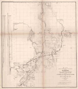
![Map of Florida, 1855: Map: [Florida] F. Diagram: Explanatory of the Surveys Proposed to Be Executed in the Order of Importance to The Interests Of The GovernmentMaker: General Land Office/A.O.P. Nicholson, John](https://p1.liveauctioneers.com/5584/102085/52141924_1_x.jpg?height=310&quality=70&version=1490997744)


View:
24
Auction Details

Bid Increments
PriceBid Increment
$0$1
$10$5
$100$10
$200$20
$500$50
$1,000$100
$2,000$200
$5,000$500
$10,000$1,000
$20,000$2,000
TOP