Arader Galleries July 25th Auction 2020-07-25 Auction - 292 Price Results - Arader Galleries in NY - Page 9
LiveAuctioneers Logo

Audubon Aquatint, Louisiana HeronAudubon Aquatint, Trumpeter SwanOgilby & Moxon Map of Carolina
Done
New York, NY, United States
Auction Details

Arader Galleries July 25th Auction

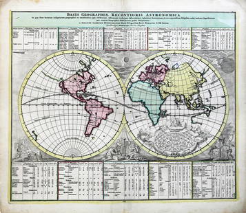
This auction features stunning examples from John James Audubon's Birds of America, as well as his famous Quadrupeds of North America, both individual plates and a complete set. There is a vast selection of natural history material and Americana, as well as an outstanding offering of maps and views.
Lot Number: Lowest
24
Fisher Map of Delaware Bay: FISHER, Joshua (1707-1783).A Chart of the Delaware Bay and River.... Engraved map.London: Faden, 1776.21 3/4" x 29 3/4" sheet.Fine example of William Faden's important early chart of the Delaware
0193: Fisher Map of Delaware BayEst. $4,000-$6,000Lot Passed
Sold
Faden Map of North America: FADEN, William (1749-1836).The United States of North America with the British Territories and those of Spain according to the Treaty, of 1784.Engraved map with hand color in outline. London: 1796.
0194: Faden Map of North AmericaEst. $3,000-$5,000
See Sold Price
Sold
Forlani Map of the British Isles: FORLANI, Paolo & LILY, George Lily.Britannia insula quae duo regna continent Angliam et Scotiam cum Hibernia (The British Isles, comprising two kingdoms, England and Scotland, with Ireland).Engraved
0195: Forlani Map of the British IslesEst. $12,000-$25,000
See Sold Price
Sold
Gibson Map of the Midwest: GIBSON, John (active 1750-1792). [Colonial America]. Midwest.Engraved Map. London: 1763. 8 1/3" x 10" sheet. Relief shown pictorially. Shows the area from Canada to the Gulf of Mexico and the Rocky
0196: Gibson Map of the MidwestEst. $200-$400
See Sold Price
Hollar View of London: HOLLAR, Wenceslaus (1607-1677).A True and Exact Prospect of the Famous City of London... Another Prospect of the Appeareth now after Sad Calamity and Destruction by Fire...Engraving.London, ca. 16669
0197: Hollar View of LondonEst. $8,000-$12,000Lot Passed
Sold
Homann Map of Virginia: HOMANN, Johann B. (1663-1724).Virginia Marylandia et Carolina.Engraved map with original hand color.Nuremberg: c. 1715.21 1/2" x 23 3/4" sheet.One of the most decorative maps of the area: The huge
0198: Homann Map of VirginiaEst. $2,000-$3,000
See Sold Price
Sold
Homann Map of North America: HOMANN, Johann Baptist (1664-1724), after POPPLE, Henry (d. 1743).Amerique septentrionale : suivant la carte de Pople faite à Londres en 20 feuilles.Engraved map with hand color in full.Paris,
0199: Homann Map of North AmericaEst. $4,000-$8,000
See Sold Price
Homann Map of the World: HOMANN, Johann Baptist (1664-1724), after DOPPLEMAYR, Johann Gabriel (1677-1750).Basis Geographiae Recentioris Astronomica.Engraved map with original hand color.Nuremberg: Homann, c. 1730.21 3/4" x
0200: Homann Map of the WorldEst. $500-$1,000Lot Passed
Sold
Homman Map of New Spain: HOMANN, Johann Baptist (1664-1724).Regni Mexicani seu Novae Hispaniae...Engraved map with original hand color in part.Nuremberg, c. 1725.21" x 25" sheet.This attractively decorated map by the German
0201: Homman Map of New SpainEst. $1,000-$1,500
See Sold Price
Sold
Homman Map of the Americas: HOMANN, Johann Baptist (1664-1724).Totius Americae Septentrionalis et Meridionalis Novissima Repraesentatio.Engraved map with hand color in full.Nuremberg: Homann, c. 1742.20 3/4" x 23 5/8" sheet.
0202: Homman Map of the AmericasEst. $1,500-$3,000
See Sold Price
Homann Map of the World: HOMANN, Johann Baptist (1664-1724).Planiglobii Terrestris cum Utroq Hemisphaerio Caelesti...Engraved map with original hand color in part.Nuremberg, c. 1730.20 1/2" x 23 3/4" sheet.One of the most
0203: Homann Map of the WorldEst. $1,500-$2,000Lot Passed
Sold
Hondius Map of Virginia: HONDIUS, Henricus (1597-1651).Nova Virginiae Tabula.Engraved map with original hand color in full.Amsterdam, 1633-38 (German Text).18 3/4" x 23" sheet.The present is derived from John Smith's 1612
0204: Hondius Map of VirginiaEst. $1,800-$2,500
See Sold Price
Sold
Hondius Map of Lithuania: HONDIUS, Henricus (1597-1651). / JANSSONIUS, Johannes (1588-1664). Magni Ducatus Lithuaniae. Engraved map with original hand color.Amsterdam c. 1645.19" x 22 1/2" sheet.Beautiful hand colored map of
0205: Hondius Map of LithuaniaEst. $600-$800
See Sold Price
Hondius Map of the S.E. U.S.: HONDIUS, Jodocus (1562-1612).Virginiae Item et Floridae Americae Provinciarum ova Descriptio.Engraved map with original hand color in part.Amsterdam, c. 1606-1638.18 1/2" x 22" sheet.This stunning
0206: Hondius Map of the S.E. U.S.Est. $3,000-$5,000Lot Passed
Sold
Hondius map of the Americas: HONDIUS, Jodocus (1563-1612).America.Engraved map with original hand color in full.Amsterdam, 1606.18" 22 1/4" sheet.Hand colored map of North and South America from Hondius' first edition of the
0207: Hondius map of the AmericasEst. $4,000-$6,000
See Sold Price
Sold
Hulsius Map of South America: HULSIUS, Levinus (1564-1606).Nova et exacta delineatio Americae Partis Australis Que est...Engraved map.Nuremburg, 1599.19" x 13 1/4" sheet.Rare first edition of the Hulsius map of South America,
0208: Hulsius Map of South AmericaEst. $7,000-$10,000
See Sold Price
Sold
Linschoten Map of the Island of Terceira: HUYGEN VAN LINSCHOTEN, Jan (1563-1611)A Cidade de Angra. Na Ilha de Iesu Xpoda Tercera Que Estan Em 39 Graos (Angra, Terceira, Axores). Engraved map with original hand color in full. Amsterdam,
0209: Linschoten Map of the Island of TerceiraEst. $3,000-$4,000
See Sold Price
Jaillot Map of North America: JAILLOT, Alexis Hubert (1632-1712).Amerique Septentrionale.Engraved map with hand color in outline.Paris, 1713.21 1/4" x 29" sheet. Map of North American with California an island in the style of the
0210: Jaillot Map of North AmericaEst. $2,000-$4,000Lot Passed
Sold
Jaillot Map of the Danube: JAILLOT, Alexis-Hubert (1632-1712).Le Cours du Danube Depuis sa Source Iusqu'a ses Embouchures Dresse sue les Memoires lesplus Nouveau du P.Coronelli et autres par le Sr. Sanson...Atlas
0211: Jaillot Map of the DanubeEst. $1,000-$2,000
See Sold Price
Jaillot Map of South America: JAILLOT, Hubert (ca. 1632-1712), after SANSON, Nicholas (1600-1667).Amerique Meridionale divisee en ses principales Parties ou sont distingues les uns des autres Les Estats...Engraved map with
0212: Jaillot Map of South AmericaEst. $1,000-$2,000Lot Passed
Jaillot Map of North America: JAILLOT, Hubert (ca. 1632-1712), after SANSON, Nicholas (1600-1667).Amerique Septentrionale divisee en ses principales parties...Engraved map with original hand-color in full.Paris, 1692.25" x 38
0213: Jaillot Map of North AmericaEst. $5,000-$8,000Lot Passed
Jansson Map of Columbia: JANSSON, Johan (1558. - 1664).[Columbia] Terra Firma et Novum Regnum Granatayense et Popayan.Atlas Blavianus Magnus.Amsterdam: 1636. 19" x 21 1/2".This beautifully decorative map displays Columbia,
0214: Jansson Map of ColumbiaEst. $400-$600Lot Passed
Sold
Jefferys Map of Florida: JEFFERYS, Thomas (1710 - 1771).Carte de la Floride Occidentale et Louisiane...La Peninsule et Golfe de la Floride ou Canal de Bahama avec Les Isles de Bahama.Engraved map in two sheets. Paris: George
0215: Jefferys Map of FloridaEst. $3,000-$5,000
See Sold Price
Jefferys Map of the East Indies: JEFFERYS, Thomas (1710 - 1771). The East Indies with the Roads, second edition. Engraved map with original hand color in two parts.London: Robert Sayer, 1768. 23 1/4" x 55" sheet.This impressive,
0216: Jefferys Map of the East IndiesEst. $3,000-$5,000Lot Passed
View:
24
TOP