Antique Maps of the World 2021-06-23 Auction - 148 Price Results - Jasper52 in NY
LiveAuctioneers Logo

1845 Map of Missouri1902 Map of South Carolina1885 Map of Jamaica
Done
New York, NY, United States
Auction Details

Antique Maps of the World

Jasper52

Jasper52

badge TOP RATED
In this auction you can discover collector's maps that date back to the 1800s! Presented by a third generation art, engravings and map dealer, this collection covers a wide array of maps from the 1800s. Explore this catalog to discover a Map of West Indies Island from 1817 and much more! All items are carefully vetted and acquired in our overseas buying trips.
Lot Number: Lowest
24
1902 Map of Florida: Author: McNallyTitle: 1902 Map of FloridaMedium: Ink on PaperDimensions: 27.5"X21.5" Map of Florida dated 1902. Printed and published by the Rand McNally Co. Part of the Indexed Atlas of the World.
0001: 1902 Map of FloridaEst. $120-$150Lot Passed
1898 Map of Georgia: Author: McNallyTitle: 1898 Map of GeorgiaMedium: Ink on PaperDimensions: 21.5"X27.5" Map of Georgia dated 1898. Printed and published by the Rand McNally Co. Part of the Indexed Atlas of the World.
0002: 1898 Map of GeorgiaEst. $120-$150Lot Passed
1898 Map of Louisiana: Author: McNallyTitle: 1898 Map of LouisianaMedium: Ink on PaperDimensions: 27.5"X21.5" Map of Louisiana dated 1898. Printed and published by the Rand McNally Co. Part of the Indexed Atlas of the
0003: 1898 Map of LouisianaEst. $120-$150Lot Passed
1898 Map of North Carolina: Author: McNallyTitle: 1898 Map of North CarolinaMedium: Ink on PaperDimensions: 27.5"X21.5" Map of North Carolina dated 1898. Printed and published by the Rand McNally Co. Part of the Indexed Atlas
0004: 1898 Map of North CarolinaEst. $120-$150Lot Passed
1902 Map of South Carolina: Author: McNallyTitle: 1902 Map of South CarolinaMedium: Ink on PaperDimensions: 27.5"X21.5" Map of South Carolina dated 1902. Printed and published by the Rand McNally Co. Part of the Indexed Atlas
0005: 1902 Map of South CarolinaEst. $120-$150Lot Passed
1898 Map of Alabama: Author: McNallyTitle: 1898 Map of AlabamaMedium: Ink on PaperDimensions: 21.5"X27.5" Map of Alabama dated 1898. Printed and published by the Rand McNally Co. Part of the Indexed Atlas of the World.
0006: 1898 Map of AlabamaEst. $120-$150Lot Passed
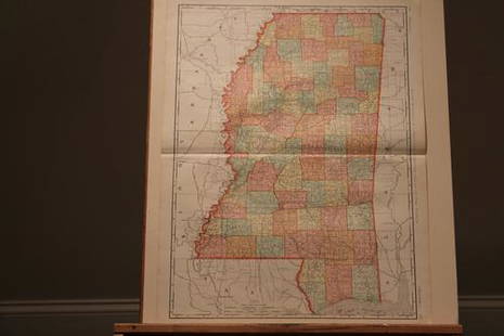
1898 Map of Mississippi: Author: Mc NallyTitle: 1898 Map of MississippiMedium: Ink on PaperDimensions: 21.5"X27.5" Map of Mississippi dated 1898. Printed and published by the Rand McNally Co. Part of the Indexed Atlas of
0007: 1898 Map of MississippiEst. $100-$120Lot Passed
Sold
1900 US Population Density Map: Author: Mc NallyTitle: 1900 US Population Density MapMedium: Ink on PaperDimensions: 21"X14.5" US population density map dated 1900. Printed and published by the Rand McNally Co. Part of the Indexed
0008: 1900 US Population Density MapEst. $90-$110
See Sold Price
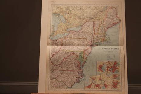
1878 Map of the US: Author: PhillipTitle: 1878 Map of the USMedium: Ink on PaperDimensions: 21.5"X27.5" Map of the US dated 1878. It captures the North East part of the country. Printed by George Philip & Son. For the
0009: 1878 Map of the USEst. $100-$120Lot Passed
1867 Map of Pennsylvania: Author: MitchellTitle: 1867 Map of PennsylvaniaMedium: Ink on Paper/Glass/WoodDimensions: 22"X19" Framed map of Pennsylvania dated 1867. Engraved and drawn by W.H.Gamble. Published by Augustus
0010: 1867 Map of PennsylvaniaEst. $90-$110Lot Passed
1888 Map of Indiana: Author: CramTitle: 1888 Map of IndianaMedium: Ink on PaperDimensions: 14.5"X22.5" Map of Indiana dated 1888. Engraved and published by George Cram in Chicago. Part of his Family Atlas. Inset of
0011: 1888 Map of IndianaEst. $30-$40Lot Passed
Sold
1895 Map of Virginia: Author: CramTitle: 1895 Map of VirginiaMedium: Ink on PaperDimensions: 22"X14.5" Map of Virginia dated 1895. Engraved and published by George Cram in Chicago. Part of his World Atlas. Double folio
0012: 1895 Map of VirginiaEst. $40-$50
See Sold Price
Sold
1897 Map of Guam: Author: CramTitle: 1897 Map of GuamMedium: Ink on PaperDimensions: 14.5"X11.5" Map of Guam and US possessions in the Pacific dated 1897. Printed and published by George Cram in Chicago. Part of his
0013: 1897 Map of GuamEst. $30-$40
See Sold Price
1873 Map of the US: Author: BartholomewTitle: 1873 Map of the USMedium: Ink on PaperDimensions: 13.5"X18" Map of the United States dated 1873. It captures Virginia, North Carolina and South Carolina. Part of Zell's
0014: 1873 Map of the USEst. $50-$60Lot Passed
1892 Map of Nebraska: Author: CramTitle: 1892 Map of NebraskaMedium: Ink on PaperDimensions: 21.5"X14.5" Map of Nebraska dated 1892. Engraved and published by George Cram in Chicago. Part of his Family Atlas. Key lower
0015: 1892 Map of NebraskaEst. $40-$50Lot Passed
Sold
1890 US Population Map: Author: CramTitle: 1890 US Population MaMedium: Ink on PaperDimensions: 14.5"X11.5" Map of the Centers of Population in the US between 1790 and 1890. Dated 1890. Engraved and published by George
0016: 1890 US Population MapEst. $30-$40
See Sold Price
1885 Map of Utah: Author: CramTitle: 1885 Map of UtahMedium: Ink on PaperDimensions: 11"X13.5" Map of Utah dated 1885. Printed and published by George Cram in Chicago. Part of the People's Atlas. Key upper right.
0017: 1885 Map of UtahEst. $30-$40Lot Passed
1888 Map of Arkansas: Author: WatsonTitle: 1888 Map of ArkansasMedium: Ink on PaperDimensions: 16"X12" Map of Arkansas, dated 1888 engraved for Watson's General Atlas. Color coded for counties. Explanation to the right
0018: 1888 Map of ArkansasEst. $30-$40Lot Passed
1923 US Rail Road Map: Author: McNallyTitle: 1923 US Rail Road MapMedium: Ink on PaperDimensions: 28"X21" United States Rail Road Map dated 1923. Published by McNally & Co in Chicago. Shows detailed rail roads in the
0019: 1923 US Rail Road MapEst. $100-$120Lot Passed
Sold
1887 US Territorial Acquisition Map: Author: CramTitle: 1887 US Territorial Acquisition MapMedium: Ink on PaperDimensions: 14.5"X11.5" Map of US territorial acquisition dated 1887. Map covers period from 1776 to 1886. Engraved and
0020: 1887 US Territorial Acquisition MapEst. $30-$40
See Sold Price
1895 Map of Nevada: Author: CramTitle: 1895 Map of NevadaMedium: Ink on PaperDimensions: 14.5"X22.5" Map of Nevada dated 1895. Engraved and published by George Cram in Chicago. Part of Cram's World Atlas. Double folio
0021: 1895 Map of NevadaEst. $40-$50Lot Passed
Sold
1868 Map of US Atlantic Ports: Author: PhilipTitle: 1868 Map of US Atlantic PortsMedium: Ink on PaperDimensions: 28"X20" Map of the US Atlantic Ports dated 1868. Engraved by George Philip and Son for the London Geographical
0022: 1868 Map of US Atlantic PortsEst. $120-$150
See Sold Price
1859 Map of New York State: Author: JohnsonTitle: 1859 Map of New York StateMedium: Ink on PaperDimensions: 26"X18" Map of New York state dated 1859. Engraved by A.J. Johnson. Published by Johnson and Ward in New York. This is
0024: 1859 Map of New York StateEst. $110-$150Lot Passed
View:
24
TOP