Sold20211807 Lewis Map of Lower Hudson River -- A Plan of theTitle: 1807 Lewis Map of Lower Hudson River -- A Plan of the Country from Frogs Point to Croton River showing the Positions of the American and British Armies from the 12th of October 1776 untill theSee Sold Price
Sold2021(NEW YORK.) David H. Burr. Hudson River & Vicinity.(NEW YORK.) David H. Burr. Hudson River & Vicinity. Engraved strip map of the Hudson River from lower Warren County to New York City. 24¾x4½ inches extended, folding into publisher's 12mo foSee Sold Price
Sold2022Framed Plan Of West Point Topographic Ink EtchingFramed topographic ink etching of the Plan of Weat point. Map depicts the land on either side of the North Hudson River. Marked on corner, Plan of West Point. Professionally framed, in black wooden frSee Sold Price
Sold2017Edmund Darch Lewis Oil on Canvas, LandscapeEdmund Darch Lewis (American, 1835-1910). An oil on canvas landscape titled "Bannerman's Island on the Hudson River, 1860". Signed and dated lower left. Exhibited Woodmere Art Museum, March 10-May 5,See Sold Price
Sold2023Henry Ary, View of the Hudson RiverHenry Ary (American, 1807-1859)View of the Hudson Riveroil on boardsigned lower center Ary29 1/2 x 24 1/2in (75 x 61cm) Footnote:A related work entitled View from Mount MSee Sold Price
Sold20231852 Map of New York City1852 map "Plan of the City of NY," copy of D. Longwerth's Map of 1808 for D.T. Valentine's Manuel for 1852. Includes North or Hudson River, Port of Nassau of Long Island. Encompasses 1-10 wards. LithoSee Sold Price
Sold20191832 Marshall Revolutionary War Map of Lower New YorkTitle/Content of Map: 1832 Marshall Revolutionary War Map of Lower New York from Tappan Sea to New York City -- Plan of the Country from Frogs Point to Croton River Shewing the Positions of the AmericSee Sold Price
Sold2016Map LotLot (3) framed maps including "Carte De La Baye De Hudson" (sight 9 1/4" x 12 1/4"), "The River St. Laurence" (sight 10" x 14 1/2"), "A Plan of the City and Harbour of Louisburg" (sight 11" x 14 1/2")See Sold Price
Sold2016Map, Hudson River, Rev. War, Sauthier, 1776At the top of the map is written: "A Topographical Map of Hudsons River, with the Channels Depth of Water, Rocks, Shoals, &c. and the Country Adjacent, from Sandy-Hook, New York and Bay to Fort EdwardSee Sold Price
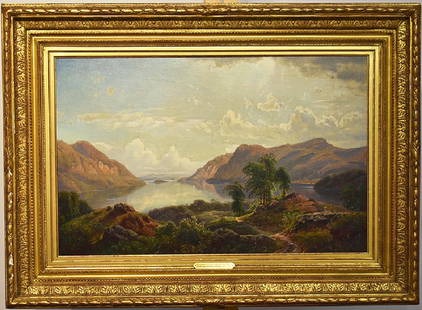
Sold2021H. Lewis - Hudson River Oil on PanelHudson River scene signed LR L. Lewis. Oil on artist's panel. Original condition. Frame size H 14-1/2" W 19". Panel size H 8-1/2" W 13-3/4". Please refer to link for hi res photos. https://www.dropboxSee Sold Price
Sold2022Edmund Darch Lewis Hudson River School Watercolor Gouache Antique 1884 Seascape PaintingTitle: Edmund Darch Lewis Hudson River School Watercolor Gouache Antique 1884 Seascape Painting Description:Edmund Darch Lewis Hudson River School Watercolor Gouache Antique 1884 Seascape Painting SigSee Sold Price
Sold2018Hudson River Sheet No.1 from New York to HaverstrawTitle/Content of Map: Hudson River Sheet No.1 from New York to Haverstraw Date Printed: 1864 Cartographer: WHITING, H. L./J. MECHAN/F. W. DORR Material/Medium: GPO Size: 39X16.75 "from a trigonometricSee Sold Price
Sold2021With map of Hudson River Valley 1851Heading: (New York - Hudson River Railroad) Author: Title: Hudson River and the Hudson River Railroad: With a complete map, and wood cut views of the principal objects of interest upon the line PlaceSee Sold Price
Sold2022Rare Rev. War map of Hudson River campaign, pre-Vermont, 1832Rare Revolutionary War battle map of the important Hudson River corridor showing northern New England and Quebec. This map is from the rare atlas from John Marshall’s “Life of Washington” publisSee Sold Price
Sold2021Map of Hudson River at West PointCopyrighted 1891 Image Sight is 19 1/2" x 29 3/4" . Condition, some folds and foxing. Some water damage, top left.See Sold Price
Sold2022Framed Map of Hudson River Days Pt. GW BridgeFramed Map of Hudson River Days Pt. GW Bridge, published by the U.S. Department of Commerce National oceanic and atmospheric administration national ocean survey, Measures 29 x 41 1/2 inches, gold tonSee Sold Price
Sold2020Isaac Wilbur (- 1881) Waterfall and Forest LandscapeItem/Description: Large antique waterfall and forest landscape oil painting. "Afternoon Glow". Signed lower left. Hudson River Art. Material: Oil on canvas. Dimensions: Image size: Height: 41 3/4";See Sold Price
Sold2021HUDSON RIVER Charles Ayer Whipple (1859-1928) PaintingHudson River School Charles Ayer Whipple (1859-1928) Oil on Canvas painting. Signed lower right, Hudson River Scene, ornate carved wood frame gilt; Approximate measurements: 23 x 27 inches total frameSee Sold Price
Sold20181778 Revolutionary War Magazine & Map of Hudson's RiverThe January 1778 issue of Gentleman’s Magazine featuring a folding map of “Hudson’s River with the Adjacent Country”, showing area from Lake Ontario to Long Island and Philadelphia. ImportantSee Sold Price
Sold2022(3) Vintage American WPA Colored Lithographs Theo Wahl New York Kansas signed(3) Vintage American WPA Colored Lithographs Theo Wahl all 3 pencil signed lower right: Hudson River, 11 1/2 x 17 1/4" Sheet; Central Park, 12 1/2 x 15 3/4" Sheet; Rolling Hills, 13 x 16" Sheet.TheodoSee Sold Price
Sold2024Gentleman's Magazine 1778 Map. Hudson's River USA Canada"Map of Hudson's River with the adjacent Country" Copper Engraved Map Published 1778, London for the "Gentleman's Magazine" Folds as issued. Paper Size: 12.5 x 9.5 inch (32 x 24cm) Very minor offsettiSee Sold Price
Sold2022Early HUDSON RIVER MAP, softcover, by BRYANT UNION PUBLISHING CO. NEW YORK CITY. Measures approx.Early HUDSON RIVER MAP, softcover, by BRYANT UNION PUBLISHING CO. NEW YORK CITY. Measures approx. 104" long, on back side is prominent places & advertising. Nice overall condition for its fragility. ISee Sold Price
Sold20161844 BROADSIDE- WILLARD'S NEW MAP OF THE HUDSON RIVER1844 BROADSIDE- WILLARD'S NEW MAP OF THE HUDSON RIVER AND RAIL-ROAD GUIDE FOR 1844, HAS PCS MISSING AND STAINS, AS PICTUREDSee Sold Price
Sold2023Sight-Seeing Map of the Hudson RiverTitle: Sight-Seeing Map of the Hudson River Cartographer: RADCLIFFE, W. H. Publication Date: c1910 Publisher: W.H. RADCLIFFE Height: 45 Width: 7.3 "Points of interest visible from the Hudson River boaSee Sold Price
Jun 12Jasper52Plan of the Attack of the Forts Clinton & Montgomery… FADEN/STEDMAN 1794 mapUS$1,000
Jun 13Swann Auction Galleries(NEW YORK BAY.) Robert Laurie & James Whittle. Chart of the Entrance of Hudson's River, from SandyUS$1,500
2 days LeftHolabird Western Americana CollectionsDelaware & Hudson Canal Co Pass 1896 [180459]US$50(1 bid)
Jun 13Swann Auction Galleries(NEW YORK.) John Montresor. A Map of the Province of New York, with Part of Pensilvania, and NewUS$3,800
Jun 13Swann Auction Galleries(HUDSON RIVER.) William F. Link. The Hudson by Daylight. Map from New York Bay to the Head of TideUS$225
2 days LeftHolabird Western Americana CollectionsDelaware & Hudson Canal Pass 1894 [180455]US$50(1 bid)
Jun 13Swann Auction Galleries(MISSISSIPPI RIVER.) John Ross. Course of the River Mississipi, From the Balise to Fort Chartres.US$750
Jun 13Swann Auction Galleries(NEW ENGLAND.) Johannes van Keulen. Pas-Kaart vande Zee Kusten van Niew Nederland Anders GenaamtUS$2,200
7 days LeftJasper521863 Johnson Map of the World Illustrating Land, Co-tidal Lines and Ocean Currents and River SystemsUS$45
5 days LeftDonny Malone AuctionsPeter Hurd Western Lithograph Windmill & Well at Night, Signed in Plate Lower RightUS$10
Jun 13Swann Auction Galleries(NEW YORK -- CATSKILL MOUNTAINS.) Edwin E. Howell. Relief map of Catskill Mountains.US$450
Jun 23East Coast Fine Arts LLCJohn Ferguson Weir Italian Lake Hudson River School Luminist LandscapeUS$3,000


![Delaware & Hudson Canal Co Pass 1896 [180459] (1 of 2)](https://p1.liveauctioneers.com/2699/331495/178785924_1_x.jpg?height=282&quality=70&version=1717094933)
![Delaware & Hudson Co Pass 1906 [180454] (1 of 2)](https://p1.liveauctioneers.com/2699/331495/178785926_1_x.jpg?height=282&quality=70&version=1717094933)


![Delaware & Hudson Canal Pass 1894 [180455] (1 of 2)](https://p1.liveauctioneers.com/2699/331495/178785925_1_x.jpg?height=282&quality=70&version=1717094933)


