Sold2021Wilkes, John 1807 HCol Map. Projection of Globes, MapsFinely Hand Colored Copper Engraved Map Published 1796-1828 London for "Encyclopaedia Londinensis, or universal dictionary of arts, sciences and literature" by John Wilkes et al. Paper Size: 10.5 x 8.See Sold Price
Sold2022Wilkes, John 1807 HCol Map. Projection of Globes, MapsFinely Hand Colored Copper Engraved Map Published 1796-1828 London for "Encyclopaedia Londinensis, or universal dictionary of arts, sciences and literature" by John Wilkes et al. Paper Size: 10.5 x 8.See Sold Price
Sold2021Wilkes, John 1807 HCol Map. Projection of Globes, MapsFinely Hand Colored Copper Engraved Map Published 1796-1828 London for "Encyclopaedia Londinensis, or universal dictionary of arts, sciences and literature" by John Wilkes et al. Paper Size: 10.5 x 8.See Sold Price
Sold2021Wilkes, John 1807 HCol Map. Projection of Globes, MapsFinely Hand Colored Copper Engraved Map Published 1796-1828 London for "Encyclopaedia Londinensis, or universal dictionary of arts, sciences and literature" by John Wilkes et al. Paper Size: 10.5 x 8.See Sold Price
Sold2021Wilkes, John 1807 HCol Map. Italia Antiqua ItalyFinely Hand Colored Copper Engraved Map Published 1796-1828 London for "Encyclopaedia Londinensis, or universal dictionary of arts, sciences and literature" by John Wilkes et al. Paper Size: 10.5 x 8.See Sold Price
Sold2021Wilkes, John 1807 HCol Astronomy Print. Sphere GlobeHand Colored Copper Plate Published 1796-1828 London for "Encyclopaedia Londinensis, or universal dictionary of arts, sciences and literature" by John Wilkes et al. Paper Size: 10.5 x 8.5 inch (27 x 2See Sold Price
Sold2021Wilkes, John C1810 HCol Map. Graeciae Antiqua GreeceFinely Hand Colored Copper Engraved Map Published 1796-1828 London for "Encyclopaedia Londinensis, or universal dictionary of arts, sciences and literature" by John Wilkes et al. Paper Size: 10.5 x 8.See Sold Price
Sold2021Wilkes, John 1807 Hand Col Map. HampshireFinely Hand Colored Copper Engraved Map Published 1796-1828 London for "Encyclopaedia Londinensis, or universal dictionary of arts, sciences and literature" by John Wilkes et al. Paper Size: 10.5 x 8.See Sold Price
Sold2021Wilkes, John 1807 Hand Col Map. Modern India"Hindoostan or Modern India" Hand Colored Copper Engraved Map Published 1796-1828 London for "Encyclopaedia Londinensis, or universal dictionary of arts, sciences and literature" by John Wilkes et al.See Sold Price
Sold2021Wilkes, John 1807 Hand Col Map. Ancient Britain"Britannia Antiqua" Finely Hand Colored Copper Engraved Map Published 1796-1828 London for "Encyclopaedia Londinensis, or universal dictionary of arts, sciences and literature" by John Wilkes et al. PSee Sold Price
Sold2021Wilkes, John 1807 Hand Col Map. HertfordshireFinely Hand Colored Copper Engraved Map Published 1796-1828 London for "Encyclopaedia Londinensis, or universal dictionary of arts, sciences and literature" by John Wilkes et al. Paper Size: 10.5 x 8.See Sold Price
Sold2021Wilkes, John 1807 Hand Col Map. Ancient Spain"Hispania Antiqua" Finely Hand Colored Copper Engraved Map Published 1796-1828 London for "Encyclopaedia Londinensis, or universal dictionary of arts, sciences and literature" by John Wilkes et al. PaSee Sold Price
Sold2021Wilkes, John 1807 Hand Col Map. PalestineFinely Hand Colored Copper Engraved Map Published 1796-1828 London for "Encyclopaedia Londinensis, or universal dictionary of arts, sciences and literature" by John Wilkes et al. Paper Size: 10.5 x 8.See Sold Price
Sold2021Wilkes, John 1807 Hand Col Map. GeographyFinely Hand Colored Copper Engraved Map Published 1796-1828 London for "Encyclopaedia Londinensis, or universal dictionary of arts, sciences and literature" by John Wilkes et al. Paper Size: 10.5 x 8.See Sold Price
Sold2021Wilkes, John 1807 Hand Col Map. PalestineFinely Hand Colored Copper Engraved Map Published 1796-1828 London for "Encyclopaedia Londinensis, or universal dictionary of arts, sciences and literature" by John Wilkes et al. Paper Size: 10.5 x 8.See Sold Price
Sold2021Wilkes, John 1807 Hand Col Map. GloucestershireFinely Hand Colored Copper Engraved Map Published 1796-1828 London for "Encyclopaedia Londinensis, or universal dictionary of arts, sciences and literature" by John Wilkes et al. Paper Size: 10.5 x 8.See Sold Price
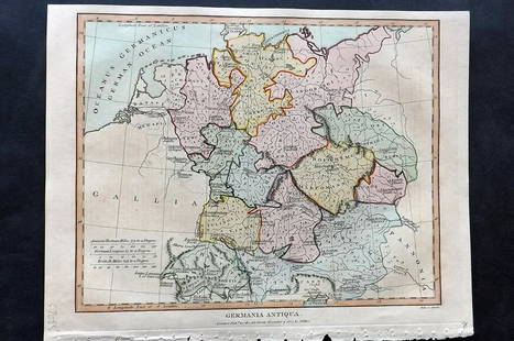
Sold2021Wilkes, John 1807 Hand Col Map. Ancient Germany"Germania Antiqua" Finely Hand Colored Copper Engraved Map Published 1796-1828 London for "Encyclopaedia Londinensis, or universal dictionary of arts, sciences and literature" by John Wilkes et al. PaSee Sold Price
Sold2021Wilkes, John 1801 Map. British County Map, CheshireCopper Engraved Map Published 1796-1828 London for "Encyclopaedia Londinensis, or universal dictionary of arts, sciences and literature" by John Wilkes et al. Paper Size: 10.5 x 8.5 inch (27 x 22cm) SSee Sold Price
Sold2016John Cary: Brazil & Buenos Aires 1815Map: Brazil & Buenos Aires Publishing: John Cary Date: 1815 Size: 11 x 14 inches Original copper engraving John Cary (1754-1835) was an English cartographer who is known for his maps, globes, and hisSee Sold Price
Sold2021Wilkes, John 1797 Map. United StatesCopper Engraved Map Published 1796-1828 London for "Encyclopaedia Londinensis, or universal dictionary of arts, sciences and literature" by John Wilkes et al. Paper Size: 10.5 x 8.5 inch (27 x 22cm) GSee Sold Price
Sold2021Wilkes, John 1796 Map. North AmericaCopper Engraved Map Published 1796-1828 London for "Encyclopaedia Londinensis, or universal dictionary of arts, sciences and literature" by John Wilkes et al. Paper Size: 10.5 x 8.5 inch (27 x 22cm) ISee Sold Price
Sold2021Wilkes, John 1797 Map. British Colonies in N. AmericaCopper Engraved Map Published 1796-1828 London for "Encyclopaedia Londinensis, or universal dictionary of arts, sciences and literature" by John Wilkes et al. Paper Size: 10.5 x 8.5 inch (27 x 22cm) VSee Sold Price
Sold2021Wilkes, John 1800 Map. ChinaCopper Engraved Map Published 1796-1828 London for "Encyclopaedia Londinensis, or universal dictionary of arts, sciences and literature" by John Wilkes et al. Paper Size: 10.5 x 8.5 inch (27 x 22cm) GSee Sold Price
Sold2021Wilkes, John 1798 Map. Ancient AfricaCopper Engraved Map Published 1796-1828 London for "Encyclopaedia Londinensis, or universal dictionary of arts, sciences and literature" by John Wilkes et al. Paper Size: 10.5 x 8.5 inch (27 x 22cm) GSee Sold Price
BonhamsLONDON SMITH (JOHN THOMAS) Antiquities of Westminster, FIRST EDITION, T. Bensley, 1807; and two ...£300
2 days LeftJasper521881 Vuillemin World Map with French Colonies Shown -- Planisphere: Indiquant les Colonies FrancisesUS$30
3 days LeftHolabird Western Americana CollectionsJohn Fremont Library of Books (6) c1845-1970 [179374]US$500
3 days LeftJasper52Africa. French Equatorial Africa. Rhodesia. Belgian Congo. TIMES 1956 old mapUS$25
5 days LeftEarly American History Auctionsc 1730 Hand-Colored Colonial Era Map of the Americas, California shown as an Island, Matted + FramedUS$500(1 bid)
BonhamsSPEED (JOHN) AND WILLEM BLAEU Pictorial title-pages to Speed's 'Theatre of the Empire of Great B...£10
BonhamsSPEED (JOHN) The Kingdome of China Newly Augmented by I.S. 1626, Thomas Bassett and Richard Chis...£900
4 days LeftFreeman's | HindmanMURCHISON, Roderick Impey, Sir. The Silurian System. 1839. COMPLETE WITH VERY RARE HAND-COLOREDUS$1,500


![[Lockhart, John Gibson], (1 of 7)](https://p1.liveauctioneers.com/1782/331487/178781730_1_x.jpg?height=282&quality=70&version=1716992745)


![John Fremont Library of Books (6) c1845-1970 [179374] (1 of 7)](https://p1.liveauctioneers.com/2699/331494/178785501_1_x.jpg?height=282&quality=70&version=1717094654)


