Sold2023Baedeker, Karl 1907 Lot of 65 Antique Maps. Eastern Alps. Germany Austria ItalyLithograph Maps Published 1907, Leipzig for "The Eastern Alps including The Bavarian Highlands, Tyrol, Salzburg, Upper and Lower Austria, Styria, Carinthia, and Carniola" by Karl Baedeker. Folds as isSee Sold Price
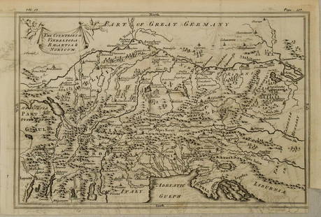
Sold20201750 c. Map of Eastern Alps Region in Ancient Times --Title: 1750 c. Map of Eastern Alps Region in Ancient Times -- The Countries of Vindelicia, Rhaethia & Noricum Cartographer: G Sale et al Year/Place: 1750 c., London Size: 7.8 X 11.8 in. Additional InfSee Sold Price
Sold2017Antique Map of the Eastern Hemisphere, 1800Map: The Eastern Hemisphere, from The Latest Discoveries. Publication Date: 1800 Authors: ANONYMOUS Size: Quarto – 10.10 W Inches Australia called New Holland. Lightly browned. One margin supplied,See Sold Price
Sold2023Baedeker, Karl 1895 Lot of 3 Panoramic Views of the Alps, AustriaGaisberg, Schmittenhohe, and Hohen Salve. Lithograph Maps Published 1895, Leipzig for "The Eastern Alps including The Bavarian Highlands, Tyrol, Salzburg, Upper and Lower Austria, Styria, Carinthia anSee Sold Price
Sold2023Baedeker, Karl 1895 Lot of 43 Maps of Austria & Germany (East Alps)Lithograph Maps Published 1895, Leipzig for "The Eastern Alps including The Bavarian Highlands, Tyrol, Salzburg, Upper and Lower Austria, Styria, Carinthia and Carniola" by Karl Baedeker. Folds as issSee Sold Price
Sold2022[MAPS & ATLASES]. COLTON, J.H. (1800-1893). Colton's New Topographical Map of The States Of[MAPS & ATLASES]. COLTON, J.H. (1800-1893). Colton's New Topographical Map of The States Of Virginia, Maryland and Delaware, Showing Also Eastern Tennessee & Parts Of Other Adjoining States. New York:See Sold Price
Sold2017William Faden 1796 Map Eastern US, North AmericaFaden, William (BRITISH, 1749-1836); Map of the Eastern United States, North American with British Territories and Those of Spain according to the Treaty of 1784 (from a larger atlas), 1796; handcolorSee Sold Price
Sold2019Eastern seaboard of USA. Rare early view.Reserve Reduced! Title/Content of Map: Eastern seaboard of USA. Rare early view. Date: 1598/99. Cartographer: Ruscelli Size: 11x9” Provenance: Venice. Reserve: $800.00 Jasper52 negotiates the lowestSee Sold Price
Sold2020Rasmusio and Gastaldi Map of Eastern Seaboard 160Giovanni Battista Rasmusio (1485-1557) and Giacomo Gastaldi (1500-1566), "La Nuova Francia," Venice, 1606. Woodcut map depicting the eastern seaboard of the United States and Canada from New York BaySee Sold Price
Sold2021Large map of Eastern Europe (60.5in x 35.5in)Large map of Eastern Europe The frame:(60.5in x 35.5in), the map:32.5" x 57.5".See Sold Price
Sold20231755 Tirion Map of Eastern North America -- Nieuwe Kaart van de Grootbrittannische Volkplantingen inTitle: 1755 Tirion Map of Eastern North America -- Nieuwe Kaart van de Grootbrittannische Volkplantingen in Noord America Cartographer: I Tirion Year / Place: 1755, Amsterdam Map Dimension (in.): 14.3See Sold Price
Sold2023TWO ANTIQUE MAPS OF CHINA.Two antique maps of China, including Chinae by Abraham Ortelius, 1595, image 14.25” x 18.25”, with map of Eastern Asia, Le table de la region orientale, image 10” x 13.5”.See Sold Price
Sold2022(COLONIAL NORTH AMERICA.) Jean-Baptiste Bourguignon d'Anville. Canada Louisiane et Terres Angloises.(COLONIAL NORTH AMERICA.) Jean-Baptiste Bourguignon d'Anville. Canada Louisiane et Terres Angloises. Large hand-colored engraved wall map of eastern North America. 4 sheets trimmed and joined, 37x45&#See Sold Price
Sold2021Southern Federal Inlaid Cherry China Pressprobably Eastern Tennessee, 1800-1820, upper case with inlaid swan's neck pediment with carved finial plinth above two glazed doors, lower case with four graduated dovetailed drawers, on turned feet,See Sold Price
Sold2022(TEXAS.) Texas Engraved Expressly for the World in Miniature.(TEXAS.) Texas Engraved Expressly for the World in Miniature. Detailed small-format lithographed pocket map of eastern Texas. 14x11¾ inches overall, folding into original 12mo cloth case with "TeSee Sold Price
Sold2021Federal Cherrywood Bowfront Chest of DrawersProbably Rhode Island or Eastern Connecticut, 1800-1820. Appears to retain its original acorn decorated brasses. 35-3/4"h x 41-1/4"w x 22"d Provenance: Property of a New England GentlemanSee Sold Price
Sold2021(CIVIL WAR.) U.S. Coast Survey; Nicholson, Walter L.(CIVIL WAR.) U.S. Coast Survey; Nicholson, Walter L. (compiler.) Map of Eastern Virginia. Chromolithographed map of Virginia from the Chesapeake Bay to Lexington. 26x21 inches sheet size, wide marginsSee Sold Price
Sold2023Matthaus Seutter Map of North AmericaColored engraving map of eastern North America by Matthaus Seutter (1678-1757). Framed; framing partially obscures borders. Map covers Eastern and Central United States and Canada, Northern Mexico, anSee Sold Price
SoldEASTERN EUROPEAN MAPS. Four framed maps.EASTERN EUROPEAN MAPS. Four framed maps. Comprising: Magni Ducatus Lithuaniae (18 1/4 x 22 1/2 in.); Emanuel Bowen's A New and Accurate Map of the Whole Russian Empire (15 x 20 in.); Polonia et SilesiSee Sold Price
Sold2022Islamic, Middle Eastern Geographical Map Of Mecca With Arabic Calligraphy.Islamic, Middle Eastern Geographical Map Of Mecca With Arabic Calligraphy. Size of page 16 x 11 1/4 inches. Fine Map of Mecca with hand written Arabic calligraphy on paper. Ex Private Los Angeles, CASee Sold Price
Sold2022North Carolina Federal Inlaid Walnut Chest of DrawersNorth Carolina Federal Inlaid Walnut Chest of Drawersattributed to the Sharrock family, eastern region, circa 1800, yellow pine secondary, dovetailed case, two board rectangular top with applied moldeSee Sold Price
Sold2022[MAPS]. MELISH, John (1771-1821). United States of America Compiled form the latest & bet[MAPS]. MELISH, John (1771-1821). United States of America Compiled form the latest & bet Authorities. Philadelphia: Murray Draper Fairman & Co., 1818. Engraved map of the eastern United States,See Sold Price
Sold2022Southern Federal Mahogany Inlaid Card TableSouthern Federal Mahogany Inlaid Card Tableattributed to Eastern Virginia, circa 1800, mahogany veneer, white pine or spruce secondary, solid mahogany demilune hinged top with gate-leg support, edge wSee Sold Price
Sold2015Period Sheraton ca 1800-1810 Eastern MA fabulous formPeriod Sheraton ca 1800-1810 Eastern MA fabulous form mahog & multi inlaid shaped top reeded leg card table - 34 1/2" wideSee Sold Price
Jun 08Early American History Auctions1853 Map of Portion of British North America and Gulf of St. Lawrence, by Henry PerleyUS$260
5 days LeftJasper521852 Norwood Geological Map of Wisconsin and Minnesota -- Geological Map of Parts of Minnesota andUS$55
5 days LeftHeritage Auctions70203: An Eastern Woodlands Pipe Tomahawk c. 1800 wooUS$1,000
Jun 12Dan Morphy AuctionsGEOLOGY OF THE BLACK AND GRAND RAPIDS OF TEXAS INCLUDING THE EASTERN AND WESTERN CROSS TIMBERS,US$100
1 day LeftGalerie Moenius AGFINELY PAINTED RUSSIAN ICON SHOWING ST. MARY OF EGYPT WITH SCENES OF HER LIFE€1,400
Jun 14DuMouchellesRigobert Bonne (French, 1727-1794) Hand Colored Engraving Ca. 18th Century, Les Etats Unis DeUS$50(1 bid)
1 day LeftGalerie Moenius AGRUSSIAN EASTER ICON SHOWING THE DESCENT OF CHRIST INTO HASES (ANASTASIS)€400
1 day LeftGalerie Moenius AGFINELY PAINTED RUSSIAN ICON SHOWING THE MOTHER OF GOD VLADIMIRSKAYA€1,200
1 day LeftGalerie Moenius AGRUSSIAN FINELY PAINTED ICON SHOWING ST. BARBARA WITH SCENES OF HER LIFE€1,600


![[MAP] CHAUCHARD. EASTERN ALPS ITALY/SLOVENIA. 1800 First Image](https://p1.liveauctioneers.com/8124/310027/165853623_1_x.jpg?height=300&quality=1&version=1700184289&width=300)
![[MAP] CHAUCHARD. EASTERN ALPS ITALY/SLOVENIA. 1800 First Image](https://p1.liveauctioneers.com/8124/310027/165853623_1_x.jpg?height=300&quality=95&version=1700184289&width=300)


![[MAPS & ATLASES]. COLTON, J.H. (1800-1893). Colton's New Topographical Map of The States Of: [MAPS & ATLASES]. COLTON, J.H. (1800-1893). Colton's New Topographical Map of The States Of Virginia, Maryland and Delaware, Showing Also Eastern Tennessee & Parts Of Other Adjoining States. New York:](https://p1.liveauctioneers.com/197/265299/138516337_1_x.jpg?height=310&quality=70&version=1666051328)


![[MAPS]. MELISH, John (1771-1821). United States of America Compiled form the latest & bet: [MAPS]. MELISH, John (1771-1821). United States of America Compiled form the latest & bet Authorities. Philadelphia: Murray Draper Fairman & Co., 1818. Engraved map of the eastern United States,](https://p1.liveauctioneers.com/197/265300/138516600_1_x.jpg?height=310&quality=70&version=1666052782)


