Sold2017Bradford: Antique Map of Lower Canada, 1838Title/Content of Map: Lower Canada and New Brunswick Date Printed: 1838/1841 Cartographer: Thomas G. Bradford Material/Medium: Paper Size: 16 1/2" x 13 1/2" Hand colored. A General Atlas of the WorldSee Sold Price
Sold2017Bradford: Antique Map of Upper Canada, 1838Map: Upper Canada Date Printed: 1838/1841 Cartographer: Thomas G. Bradford Material/Medium: Paper Size: 16 1/2" x 13 1/2" Hand colored. A General Atlas of the World, with a seperate map of each of theSee Sold Price
Sold2018Colton: Antique Map of Lower Canada, 1859Title/Content of Map: Lower Canada by Colton Date Printed: 1859 Cartographer: H.J. Colton Material/Medium: Paper Size: 17 1/2" x 15" Hand colored, engraved Map. Published in New York in Colton's 'GeneSee Sold Price
Sold2017Cary: Antique Map of Upper & Lower Canada, 1807Map: A New Map of Upper & Lower Canada Cartographer: John Cary Place & Date: London / 1807 Size: 20 1/4" x 18" Condition: original color; light overall age toning; a repaired nick in the edge of the uSee Sold Price
Sold2017Bradford: Antique Map of Louisiana, 1838Title/Content of Map: Louisiana by Bradford Date Printed: 1838/1841 Cartographer: Thomas G. Bradford Material/Medium: Paper Size: 16 1/2" x 13" Hand colored. A General Atlas of the World with a SeparaSee Sold Price
Sold2017Bradford: Antique Map of Ohio, 1838Title/Content of Map: Ohio by Bradford Date Printed: 1838/1841 Cartographer: Thomas G. Bradford Material/Medium: Paper Size: 13" x 16 1/2" Hand colored. A General Atlas of the World with a Separate MaSee Sold Price
Sold2017Bradford: Antique Map of Philadelphia, 1838Title/Content of Map: Philadelphia b Bradford Date Printed: 1838/41 Cartographer: Thomas G. Bradford Material/Medium: Paper Size: 13" x 16 3/4" Condition: Excellent Hand colored. A General Atlas of thSee Sold Price
Sold2017Bradford: Antique Map of Maine, 1838Title/Content of Map: Maine by Bradford Date Printed: 1838/1841 Cartographer: Thomas G. Bradford Material/Medium: Paper Size: 13" x 16 1/2" Hand colored. A General Atlas of the World with a Separate MSee Sold Price
Sold2017Bradford: Antique Map of Tennessee, 1838Title/Content of Map: Tennessee by Bradford Date Printed: 1838/1841 Cartographer: Thomas G. Bradford Material/Medium: Paper Size: 13" x 16 1/2" Hand colored. A General Atlas of the World with a SeparaSee Sold Price
Sold2017Bradford: Antique Map of Philadelphia, 1838Title/Content of Map: Philadelphia by Bradford Date Printed: 1838/1841 Cartographer: Thomas G. Bradford Material/Medium: Paper Size: 16 3/4" x 13" Hand colored. A General Atlas of the World with a sepSee Sold Price
Sold2017Bradford: Antique Map of Kentucky, 1838Title/Content of Map: Kentucky by Bradford Date Printed: 1838/1841 Cartographer: Thomas G. Bradford Material/Medium: Paper Size: 16 1/2" x 13" Hand colored. A General Atlas of the World with a SeparatSee Sold Price
Sold2017Bradford: Antique Map of Arkansas, 1838Title/Content of Map: Arkansas by Bradford Date Printed: 1838/1841 Cartographer: Thomas G. Bradford Material/Medium: Paper Size: 13" x 16 1/2" Hand colored. A General Atlas of the World with a SeparatSee Sold Price
Sold2017Bradford: Antique Map of Illinois, 1838Title/Content of Map: Illinois by Bradford Date Printed: 1838/1841 Cartographer: Thomas G. Bradford Material/Medium: Paper Size: 13" x 16 1/2" Hand colored. A General Atlas of the World with a SeparatSee Sold Price
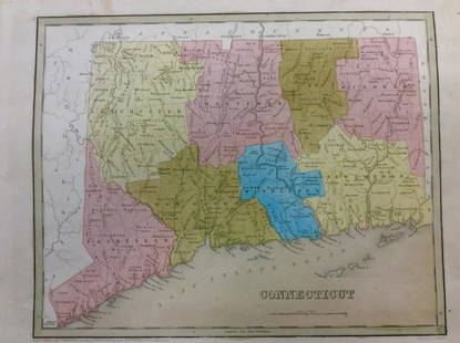
Sold2018Bradford: Antique Map of Connecticut, 1838Title/Content of Map: Connecticut by Bradford Date Printed: 1838 Cartographer: Thomas G. Bradford Size: 14" x17" Material/Medium: Paper Provenance: New York A General Atlas of the World with a separatSee Sold Price
Sold2017Bradford: Antique Map of Alabama, 1838Title/Content of Map: Alabama by Bradford Date Printed: 1838/1841 Cartographer: Thomas G. Bradford Material/Medium: Paper Size: 13" x 16 1/2" Hand colored. A General Atlas of the World with a SeparateSee Sold Price
Sold2017Bradford: Antique Map of Pennsylvania, 1838Title/Content of Map: Pennsylvania by Bradford Date Printed: 1838/1841 Cartographer: Thomas G. Bradford Material/Medium: Paper Size: 16 1/2" x 13" Hand colored. A General Atlas of the World with a SepSee Sold Price
Sold2017Bradford: Antique Map of Indiana, 1838Title/Content of Map: Indiana by Bradford Date Printed: 1838/1841 Cartographer: Thomas G. Bradford Material/Medium: Paper Size: 13" x 16 1/2" Hand colored. A General Atlas of the World with a SeparateSee Sold Price
Sold2017Bradford: Antique Map of Massachusets, 1838Title/Content of Map: Massachusets by Bradford Date Printed: 1838/1841 Cartographer: Thomas G. Bradford Material/Medium: Paper Size: 13" x 16 1/2" Hand colored. A General Atlas of the World with a SepSee Sold Price
2017Bradford: Antique Map of Conneticut, 1838Title/Content of Map: Conneticut by Bradford Date Printed: 1838/1841 Cartographer: Thomas G. Bradford Material/Medium: Paper Size: 13" x 16 1/2" Hand colored. A General Atlas of the World with a SeparSee Sold Price
Sold2017Bradford: Antique Map of Vermont, 1838Title/Content of Map: Vermont by Bradford Date Printed: 1838/1841 Cartographer: Thomas G. Bradford Material/Medium: Paper Size: 13" x 15" A General Atlas of the World with a seperate Map of each of thSee Sold Price
Sold2017Bradford: Antique Map of British Canada, 1835Map: British Canada 1835 Date Printed: 1835 Cartographer: Thomas G. Bradford Material/Medium: Paper Size: 13' x 10" Hand colored outlines. From a Comprehensive Atlas Geographical, Historical & CommercSee Sold Price
Sold2017Colton: Antique Map of East / Lower Canada, 1861Title/Content of Map: Canada east or lower Canada Date Printed: 1861 Cartographer: J. H. Colton Material/Medium: Paper Size: 17 1/2" x 13" Condition: Excellent Hand colored, steel engraved. From 'ColtSee Sold Price
Sold2017Bradford: Antique Map of Iowa & Wisconsin, 1838Title/Content of Map: Rare and Important early Iowa and Wisconsin Date Printed: 1838/1841 Cartographer: Thomas G. Bradford Material/Medium: Paper Size: 13" x 16 1/2" Hand colored. A General Atlas of tSee Sold Price
Sold2017T.G Bradford: Antique Map of United States, 1838Title: Map of United States by T.G Bradford Date: 1838 Medium: Wax Engraving Dimensions (in): 25 x 16 Condition: Excellent Condition Thomas G. Bradford was the author of the Illustrated Atlas of the USee Sold Price
Jun 30Broward Auction GalleryJohn Arthur Fraser (NY,Canada,1838-1898) watercolor painting antiqueUS$10(1 bid)
Jun 15Trillium Antique Prints & Rare BooksDavid Roberts - The Acropolis, Lower End of the ValleyUS$200
6 days LeftSwann Auction Galleries(CANADA.) Alexander Mackenzie. A Map of America, Between Latitudes 40 and 70 North and Longitudes 45US$300
6 days LeftJasper52Terrae Novae / Terra Nova by Bertius / Langenes. Newfoundland, Canada 1603 mapUS$500
Jun 15Trillium Antique Prints & Rare BooksKohler & Weigel - Pair of Maps of the Americas: Map of North America (Part of Canada, Greenland,US$75
Jun 15Trillium Antique Prints & Rare BooksChatelain - Pair of Engravings related to Canada & Niagara FallsUS$75
4 days LeftJasper521729 antique MAP OF GREAT BRITAIN Magna Britannia complectens Angliae ScotiaeUS$110
6 days LeftJasper52Patrimonio di S.Pietro, olim Tuscia Suburbicaria. Tuscany/Lazio. ROSSI 1696 mapUS$280
6 days LeftJasper52IRELAND on 2 sheets conjoined 62x50 cm. Round towers Cloigthithe. SDUK 1844 mapUS$320
6 days LeftJasper52IRELAND on 2 sheets conjoined 62x50 cm. Round towers Cloigthithe. SDUK 1844 mapUS$320
6 days LeftJasper52VENICE VENEZIA VENEDIG. Antique town city map plan. Environs. LARGE. SDUK 1844US$440
6 days LeftJasper52VENICE VENEZIA VENEDIG. Antique town city map plan. Environs. LARGE. SDUK 1844US$440
6 days LeftJasper52United States of North America. Early territorial boundaries. LOWRY 1860 mapUS$360
6 days LeftJasper52United States of North America. Early territorial boundaries. LOWRY 1859 mapUS$360
6 days LeftJasper52A New and accurate Map of Connecticut and Rhode Island… Universal Magazine 1780US$500
6 days LeftJasper52Suffolke described. Suffolk county map by John Speed. George Humble edition 1611US$500
6 days LeftJasper52A New & accurate Map of the Colony of Massachusets Bay… Universal Magazine 1780US$550
6 days LeftJasper52A New Map of the Province of Maryland in North America… Universal Magazine 1780US$550
6 days LeftJasper52Port of London. Royal Docks Tilbury Canary Wharf Surrey Quays. STANFORD 1904 mapUS$260
6 days LeftJasper52MOSCOW MOSKAU Москва Antique city town map plan & panorama SDUKUS$480
6 days LeftJasper52A New and accurate Map of New Jersey… Universal Magazine 1780 old antiqueUS$650