Sold2018Two Maps of Trade RoutesChronological Map of the origin and development of Colonial and early American Art in Industry. A supplement in The Upholsterer & Interior Decorator, July 15, 1925 together with A Graphic History of tSee Sold Price
Sold2020SOUTHERN STATES TRADE ROUTE MAPLarge Framed Trade Route Map showing waterways and towns from the Mississippi River to Charles Town. Geographic Area Covered: Southern States, South Carolina,Santee River Valley, Savannah River ValleySee Sold Price
Sold20211928 Santa Fe AT&SF Time Tables, Grand Canyon LineThis wonderful Santa Fe brochure time table is from March 4, 1928. It has two great maps for Santa Fe routes and beautiful graphics Measures 4" x 9"See Sold Price
Sold20202 Rare European Route Maps ~ Farmanhere two great airline route maps, also includes postcards, a very rare lot!See Sold Price
Sold2023Union Pacific RR February 1892 Public TimetableThis is an amazing Union Pacific Railroad public timetable from February of 1892. It has 42 pages (48 total panels) on two long sheets. Includes a route map, maps of Chicago and St. Louis, color coverSee Sold Price
Sold2019LeRoy Neiman America's Cup Maritime LithographUnited States,1921-2012 LeRoy Neiman, America's Cup. Image of two ships transposed over a map detailing a route from Martha's Vineyard to Block Island. Lithograph,Image 23" x 28",Frame 32 1/2" x 37 1/See Sold Price
Sold2024Chicago Danville and Vincennes RR Gold Bond Prospectus Book-1872This is a Chicago Danville and Vincennes gold bond prospectus book dated 1872. This book has a complete route map with connecting lines on two pages inside the front cover. Has 16 total pages, with teSee Sold Price
Sold2023Chicago and Northwestern RR November 1, 1884 Advertising FlyerThis is a Chicago and Northwestern Railroad November 1, 1884 advertising flyer. It is two sided, with a complete route map and information on one side, and has details about their individual lines onSee Sold Price
Sold2018Two Maps of New EnglandReproductions. Colonial Prototyopes of House Beautiful Houses together with New England Map of Chief Auto Routes. 12" x 18-1/2"; 22" x 17"See Sold Price
Sold2018India.- Joseph (Charles) Map of the Grand Trunk RoadIndia.- Joseph (Charles) Map of the Grand Trunk Road from the Karamnassa to the Sutledge, Part Second, from Agra to Ferozepoor, large folding road map of one of the oldest and longest trade routes linSee Sold Price
Sold2021Two Maps of Southwestern American InterestTwo Maps of Southwestern American Interest comprising the Map Of The Route Pursued In 1849 By The U.S. Troops, Under the Command of Bvt. Lieut. Col. Jno. M. Washington, Governor [of] New Mexico, in anSee Sold Price
Sold2015Two maps of the Sandwich Islandsincluding Charte von den Sandwich Inseln by James Cook (1728- 1779), published in Des Capitan Jacob Cook's dritte Entdeckungsreise, 1788, depicting Cook's route through the Sandwich Islands/Hawaii, wiSee Sold Price
Sold2020North Atlantic trade routes. Portolano styleTitle: North Atlantic trade routes. Portolano style Date/Period: 1744-1748 Materials: Copperplate engraved Dimensions: 19x16 1/4”. Map by Emanuel Bowen, published by John Harris in 'Navigantium AtquSee Sold Price
Sold2020World trade routesTitle: World trade routes Date/Period: 1744-1748 Materials: Copperplate engraved Dimensions: 19 x 16 1/4” Map by Emanuel Bowen, published by John Harris in ‘Navigantium Atque Itinerantium BiblSee Sold Price
Sold2020East Indies. Showing trade routes from India to theTitle: East Indies. Showing trade routes from India to the spice islands Date/Period: 1744-1748 Materials: Copperplate engraved. Dimensions: 19 x 16 1/4” Map by Emanuel Bowen, published by John HarrSee Sold Price
Sold2022Hand-colored engraving Map of Egypt and surrounding Kingdoms, engraved by Tardieu, based on drawingHand-colored engraving Map of Egypt and surrounding Kingdoms, engraved by Tardieu, based on drawing by Lapie. Lots of toponymy. trade routes. Scales in leagues and in caravan journeys with heavy or liSee Sold Price
Sold2015Railroad Maps and Trade CertificateRailroad Maps including; framed PRR map of Chesapeake Region, 1956, 20" x 28 1/2", 1893 railroad lines of the Pennsylvania System (folded), PRR Summer Excursion route (folded) and 1975 Conrail ServiceSee Sold Price
Sold2018Cram: Antique Map of the West Indies, 1892West Indies. Cram's large, highly detailed map of the West Indies from his Superior Atlas of the World features shipping routes and undersea cables. On the verso are two separate maps: "Jamaica, HaitiSee Sold Price
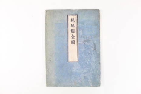
Sold2021Japanese Fold Out Handmade Ink Drawn Map,Islands,RoutesJapanese Fold Out Handmade Ink Drawn Map,Islands,Routes. This is a beautiful, handmade map of what appear to be islands and possibly routes. It is written in Japanese. The two hard covers are attachedSee Sold Price
Sold2024Cleveland and Mahoning RR 2nd Annual Report-December 20, 1854This is a Cleveland and Mahoning Railroad 2nd annual report, dated December 20, 1854. Has 24 total pages, and a complete route map dated 1853. The map is in two sections. Pages are also loose from theSee Sold Price
Sold20221757 Universal Dictionary of Trade Asia MapsLarge folio two volume set "The Universal Dictionary of Trade and Commerce, Translated from the French of the Celebrated Monsieur Savary…..", by Malachy Postlethwayt, printed at London by John KSee Sold Price
Sold2021Two 1830s Souheastern Maps by H. S. TannerTwo 1830s Souheastern Maps by H. S. Tannerto include: The Traveller's Pocket Map of Virginia with its Canals, Roads & Distances from place to place, along the Stage & Steam Boat Routes (Philadelphia:See Sold Price
Sold2023After Heinrich Scherer, Likely Reproductions of Two Circa 1700 MapsAfter Heinrich Scherer, Likely Reproductions of Two Circa 1700 Mapscopperplate engravings with color as follows: Navigationes Praecipuae Europaeorum ad Exteras Nationes, showing global sea routes withSee Sold Price
Sold2016Nashville Battlefields and TN MapTwo Tennessee related maps. 1st item: A NEW MAP OF TENNESSEE WITH ITS ROADS AND DISTANCES FROM PLACE TO PLACE ALONG THE STAGE AND STEAM BOAT ROUTES by H.P. Tanner, dated 1841, showing counties, canalsSee Sold Price
BonhamsRobert George Talbot Kelly, R.I., R.B.A. (British, 1861-1934) Shrine on the platform of Shwe Dag...£750
1 hr LeftThe Bidder AuctionsThe Land of Israel Wanderers Association Library - an assortment of 6 books about the geographicalUS$30
Jun 08Simpson Galleries, LLC.TWO AMERICAN MAPS, "Texas," AND "Mexico," J.H. COLTON, NEW YORK, CIRCA 1854-1856US$150
253 Lots AwayForum Auctionsd'Anville (Jean Baptiste Bourguignon) [Untitled Composite Atlas with 102 map sheets], [probably£2,000
5 days LeftJasper521908 Rand McNally Map of the Panama Canal [verso] Alaska -- Map of the Canal Zone… [verso]US$35
BonhamsBROCKEDON (WILLIAM) Illustrations of the Passes of the Alps, 2 vol., FIRST EDITION, for the Aut...£10
4 hrs LeftNY Elizabeth FIRST US EDITION OF 1869 MALAY ARCHIPELAGO BY A.WALLACE, ANTIQUE ILLUSTRATED WITH MAPSUS$150(2 bids)
5 days LeftJasper521852 Owen Geological Maps of the Pigeon River Minnesota -- (1) Geological Map Coast View and SectionUS$45


![Two Maps of Southwestern American Interest: Two Maps of Southwestern American Interest comprising the Map Of The Route Pursued In 1849 By The U.S. Troops, Under the Command of Bvt. Lieut. Col. Jno. M. Washington, Governor [of] New Mexico, in an](https://p1.liveauctioneers.com/197/208667/106254762_1_x.jpg?height=310&quality=70&version=1624480701)


![d'Anville (Jean Baptiste Bourguignon) [Untitled Composite Atlas with 102 map sheets], [probably (1 of 3)](https://p1.liveauctioneers.com/5458/329231/177514974_1_x.jpg?height=282&quality=70&version=1715269091)


![1908 Rand McNally Map of the Panama Canal [verso] Alaska -- Map of the Canal Zone… [verso] (1 of 2)](https://p1.liveauctioneers.com/5584/331064/178466470_1_x.jpg?height=282&quality=70&version=1716924723)


