Sold20181757 Venegas Map of Baja California -- NaauwkeurigeTitle/Content of Map: 1757 Venegas Map of Baja California -- Naauwkeurige Kaart van California, Uytgegeven door de Maatschappy der Jesuiten, en Opgedragen aan den Koning van Spanjen -- California (penSee Sold Price
Sold2022Important map of Baja California and today’s Arizona c1765. By TirionTitle: Important map of Baja California and today’s Arizona c1765. By Tirion Date/Period: c1765 Materials: Copper plate engraved Size: 14 x 13” AMONG THE BEST AND OLDEST DETAILED MAPS OBTASee Sold Price
Sold2021Map California during the ConquestHeading: Author: U.S. War Department Title: [Untitled map of California from Bodega Bay to San Diego, with inset of lower tip of Baja California and the Gulf of California] Place Published: [WashingtSee Sold Price
Sold202318TH C. M. SEUTTER NOVUS ORBIS SIVE AMERICA MAPCartographer Matthaus Seutter, German (1678-1757). Engraved map with hand-coloring. One of the last maps to feature California as an island. Dimensions: (Frame) H 22.5" x W 25.5" Condition: Not examinSee Sold Price
Sold20171703 Scherer - World Map [California as an Island]Title: World Map [without title] "Map maker: Heinrich Scherer, Atlas Marianus" "Place and Year: Munich, 1703" "Dimensions: 23.6 x 35.5 cm (9.3 x 14 in)" "Technique: Copperplate engraving" "Coloring: USee Sold Price
Sold2022Scarce 1757 map of America in Seven Years' WarMap published in the middle of the French and Indian War. Shows the theater of conflict between eastern Lake Ontario and New England. The war was fought between 1754 and 1763 and was part of a broaderSee Sold Price
Sold2020ELIOT PORTER Sunset Baja California 1966ELIOT PORTER Sunset Behind Las Tres Virgenes Volcano, Near Mezquilal, Baja California, August 12, 1966, Color Dye Transfer Print 1981 12.5x16" ASG# EP/1342 signed on mount below print right, mounted oSee Sold Price
Sold2023Jose Cisneros, "Vaquero de la Baja California", 1950Jose Cisneros (Texas, 1910-2009), "Vaquero de la Baja California", 1950, pen and ink drawing, includes (2) books by Jose Cisneros: "Faces of the Borderlands" and "Riders of the BorSee Sold Price
Sold20171749 MAP CALIFORNIA AS AN ISLAND, JACQUES CHIQUETFramed map, c. 1749, "L’AMERIQUE SEPTENTRIONALE qui fait partie des Indes Occidentales. Dressée selon les dernieres Relations des Voiageurs et Suivant les nouvelles Observations de Mur. de lSee Sold Price
Sold2023Carte de la Louisiane et pays voisins'. Mississippi basin. BELLIN 1757 mapCAPTION PRINTED BELOW PICTURE: Carte de la Louisiane et Pays Voisins [Map of Louisiana and neighbouring country] DATE PRINTED: 1757 IMAGE SIZE: Approx 23.0 x 31.5cm, 9 x 12.5 inches (Large); Please noSee Sold Price
Sold2023That part of America which was… New England NY St Lawrence. GENTS MAG 1757 mapTitle: That part of America which was… New England NY St Lawrence. GENTS MAG 1757 map Description: A map of that part of America which was the principal seat of war in 1756' by Unattributed (175See Sold Price
Sold2022(CALIFORNIA.) Valentín Gómez Farías. Order to secularize the missions of Alta and(CALIFORNIA.) Valentín Gómez Farías. Order to secularize the missions of Alta and Baja California. 2 printed pages, 12 x 8 inches, plus integral blank, signed in type as Vice President,See Sold Price
Sold2021M. SZULC-KRYZANOWSKI, BAJA, CA, 24 FEB. 1980MICHEL SZULC-KRYZANOWSKI (1949-), BAJA, CALIFORNIA, 24 FEB. 1980, triptych, gelatin silver prints; three panels, each 11 x 7 1/2 in.; signed, titled, numbered (10/25) recto in pencil. Condition: ExcelSee Sold Price
Sold2023BRETT WESTON, CACTUS AND MOUNTAINS, BAJA, CA, 1965BRETT WESTON (1911-1993) C ACTUS AND MOUNTAINS, BAJA, CALIFORNIA, 1965 vintage gelatin silver print, printed 1964-1967; 7 9/16 x 9 1/2 in. (image), 20 x 16 in. (matted); signed dated recto on mount inSee Sold Price
Sold2021Bancroft's Map of California, Nevada, 1873Heading: Author: Bancroft, Albert Little Title: Bancroft's Map of California, Nevada, Utah and Arizona, Published by A. L. Bancroft & Compy. Booksellers & Stationers San Francisco Cal. 1873 Place PubSee Sold Price
Sold20151867 Map of California and NevadaLeander Ransom & Amos Doolittle: A New Map of the States of California and Nevada, Exhibiting the Rivers, Lakes, Bays and Islands, with the principal Towns, Roads, Railroads and Transit Routes to theSee Sold Price
Sold2023Bancroft's Map of California and Nevada, Dated 1868Framed Bancroft's Map of California and Nevada, Dated 1868. 'BANCROFT'S MAP OF CALIFORNIA AND NEVADA Published by H.H. Bancroft & Co. Booksellers & Stationers SAN FRANCISCO, CAL. 1868', lower left corSee Sold Price
Sold2022Wells' world map with California an Island 1700Heading: Author: Wells, Edward Title: A New Map of the Terraqueous Globe according to the Ancient Discoveries and most general Divisions of it into Continents and Oceans Place Published: London PubliSee Sold Price
Sold2018Map of CaliforniaMagnum Mare del Zur cum Infula California, 20" x 23" (sight) R & I Ottens, AmsterdamSee Sold Price
Sold2015With the Kino map of California, German versionHeading: (Kino, Eusebio Francisco) Author: Stôcklein, Joseph Title: Allerhand So Lehr=als Geist=reiche Brief / Schrifften und Ries=Beschreibungen / Welche von denen Missionariis der Gesellschafft JesSee Sold Price
Sold2023AFTER NICOLAS SANSON (FRENCH, 1600-1667) MAP OF CALIFORNIA AS AN ISLANDAFTER NICOLAS SANSON (FRENCH, 1600-1667) MAP OF CALIFORNIA AS AN ISLAND, hand-colored engraving on laid paper, titled "AUDIENCE DE / GUADALAJARA / NOUVEAU MEXIQUE / CALIFORNIE, &c. / Par N. SSee Sold Price
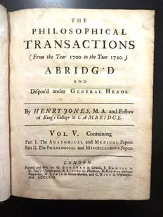
Sold20221721 Philosophical Transactions Map of CaliforniaTitle: 1721 Philosophical Transactions Map of California Description: "The Philosophical Transactions (From the Year 1700 to the Year 1720) Abridg'd and Dispos'd under General Heads", by Henry Jones,See Sold Price
Jun 23Schilb Antiquarian Rare Books1848 Emory Military Reconnaissance 1ed California MAP Indians Texas New MexicoUS$2(2 bids)
2024Thomaston Place Auction GalleriesCOLLECTION OF TRAVEL EPHEMERA, BROCHURES, BOOKLETS, MAPS 1900-1950See Sold Price
Jun 06Akiba GalleriesAntique Mast, Crowell, & Kirkpatrick Map Of Texas, California, & NevadaUS$25(1 bid)
Jun 07Freeman's | HindmanBELLIN, Jacques-Nicolas. Carte Reduite de L'Ocean Oriental ou Mer Des Indies. Paris, 1757. SecondUS$150
Jun 12Dan Morphy AuctionsBRUE'S MONUMENTAL WALL MAP OF TEXAS, UPPER CALIFORNIA & MEXICO, C. 1845US$500
Jun 08Early American History Auctionsc 1730 Hand-Colored Colonial Era Map of the Americas, California shown as an Island, Matted + FramedUS$500
May 30Forum AuctionsAmerica.- California gold mining.- Palmer (N.S.) Autograph Letter signed to his brother on mining£400
Jun 23Schilb Antiquarian Rare Books1877 Geology Geography Surveys 1ed Nevada Wyoming Utah George Wheeler US West 2vUS$1
Jun 23Schilb Antiquarian Rare Books1855 San Francisco 1st ed California Gold Rush Illustrated MAPS Soule IndiansUS$1(1 bid)
Jun 07Freeman's | Hindman[MAPS]. HOMANN, Johann Baptist, HOMANN HEIRS, and Georg Matthäus SEUTTER. [Composite Atlas].US$15,000
3 days LeftTrillium Antique Prints & Rare BooksWilkes - 4 View Engravings of Sydney, Australia / Mount Shasta, California / Fiji / Rewa, IndiaUS$100
4 days LeftLegacy Auctions & Estate SalesTwo 43" Carved Witco California Tiki Head PaddlesUS$50(1 bid)
May 31Freeman's | Hindman[CALIFORNIA - EARLY PHOTOGRAPHY]. Whole plate daguerreotype of San Francisco, California. CircaUS$15,000
7 days LeftCedarburg Auction & Appraisals LLCSet of Four Maps Showing All of Spain and PortugalUS$375(2 bids)
2 days LeftEldred'sAMERICAN SCHOOL (Circa 1932,), Carmel, California seascape., Oil on board, 12" x 15.5". Unframed.US$150
BonhamsHelen Rousseau (American, 1895-1992) Cultivation: Southern California 24 x 30 1/4in (61 x 76.5cm)US$420(14 bids)
2 days LeftEldred'sCALIFORNIA SCHOOL (20th Century,), California landscape., Oil on canvas, 12” x 16”.US$150
7 days LeftCedarburg Auction & Appraisals LLCRare 1877 Double sided map of Milwaukee and WisconsinUS$40(4 bids)


![Map California during the Conquest: Heading: Author: U.S. War Department Title: [Untitled map of California from Bodega Bay to San Diego, with inset of lower tip of Baja California and the Gulf of California] Place Published: [Washingt](https://p1.liveauctioneers.com/642/218849/112379356_1_x.jpg?height=310&quality=70&version=1631988625)

![1703 Scherer - World Map [California as an Island]: Title: World Map [without title] "Map maker: Heinrich Scherer, Atlas Marianus" "Place and Year: Munich, 1703" "Dimensions: 23.6 x 35.5 cm (9.3 x 14 in)" "Technique: Copperplate engraving" "Coloring: U](https://p1.liveauctioneers.com/5584/112867/57947644_1_x.jpg?height=310&quality=70&version=1511920104)


![Carte de la Louisiane et pays voisins'. Mississippi basin. BELLIN 1757 map: CAPTION PRINTED BELOW PICTURE: Carte de la Louisiane et Pays Voisins [Map of Louisiana and neighbouring country] DATE PRINTED: 1757 IMAGE SIZE: Approx 23.0 x 31.5cm, 9 x 12.5 inches (Large); Please no](https://p1.liveauctioneers.com/5584/309982/165835442_1_x.jpg?height=310&quality=70&version=1700599538)


![[MAPS]. HOMANN, Johann Baptist, HOMANN HEIRS, and Georg Matthäus SEUTTER. [Composite Atlas]. (1 of 5)](https://p1.liveauctioneers.com/197/329395/177650530_1_x.jpg?height=282&quality=70&version=1715364962)


![[CALIFORNIA - EARLY PHOTOGRAPHY]. Whole plate daguerreotype of San Francisco, California. Circa (1 of 7)](https://p1.liveauctioneers.com/197/329785/177758569_1_x.jpg?height=282&quality=70&version=1715625218)


