Sold20221766 Magazine Opium Ireland MapThe March 1766 issue of "The London Magazine". Printed for R. Baldwin, 56 pages and a folding map of Munster in Ireland. Additional contnet on Ireland. Article on overuse of Opium including eating ofSee Sold Price
Sold20211766 Magazine American Trade Connaught MapThe May 1766 issue of “The London Magazine”, printed for R. Baldwin. 56 pages and a map of the Irish province of Connaught. Interesting content including American trade, also on Quakers, and alliaSee Sold Price
Sold20211766 Magazine American Trade Connaught MapThe May 1766 issue of “The London Magazine”, printed for R. Baldwin. 56 pages and a map of the Irish province of Connaught. Interesting content including American trade, also on Quakers, and alliaSee Sold Price
Sold20211766 London Magazine Colonial taxation CherokeesThe February 1766 issue of "The London Magazine", printed for R. Baldwin. 54 pages and one engraving being a map of Perth. Lacks one plate. Content including on American taxation with the article in fSee Sold Price
Sold20211766 London Magazine Indians Pontiac Stamp ActThe January 1766 issue of "The London Magazine", 56 pages. Engraved folding map by Thomas Kitchin of Ulster. Great content including regarding American Indians including Major Roger engagements with CSee Sold Price
Sold202218TH-CENTURY MAP OF IRELANDPar Mr. Brion. Paris 1766. Image size: 29 x 32 cm.; framed: 46 x 49 cm.See Sold Price
Sold2018The Universal Magazine of Knowledge V38 1766The Universal Magazine of Knowledge and Pleasure. John Hinton, London. 1766, January - June. 381 pp. + frontispiece and index. 15 plates, some of which are foldout maps. Missing front endsheet. FoxingSee Sold Price
Sold2024Gentleman's Magazine 1778 Canal Map. Belfast to Loughneagh Northern Ireland"A Plan of the River Lagon, and of the intended Navigable Canal from Belfast to Loughneagh?" Copper Engraved Map Published 1778, London for the "Gentleman's Magazine" Folds as issued. Paper Size: 13 xSee Sold Price
Sold2019Karte Von Grossbritannien Und Ireland.Title/Content of Map: Karte Von Grossbritannien Und Ireland. Date: 1795 Cartographer: REILLY, FRANZ JOHANN JOSEPH VON (1766-1820) Publisher: REILLY'SCHEN LANDKARTEN UND KUNSTWERKE VERSCHIESS KOMPTOIRSee Sold Price
Sold20171773 Gentlemans Magazine Map Voyage South Seas Cpt CookFirst printing in original blue advertising wrapper of the Supplement issue of Gentleman's Magazine for the year 1773. Bound with the General Title and Preface and 26 pages, engraved folding plate shoSee Sold Price
Sold20181778 Revolutionary War Magazine & Map of Hudson's RiverThe January 1778 issue of Gentleman’s Magazine featuring a folding map of “Hudson’s River with the Adjacent Country”, showing area from Lake Ontario to Long Island and Philadelphia. ImportantSee Sold Price
Sold2017British Isles: C England Wales Scotland Ireland MapBritish Isles: Counties. England Wales Scotland Ireland. Tallis/rapkin 1851 Map. Vignettes: London; Edinburgh; Dublin. Approx 36.5 x 26.5cm, 14.5 x 10.25 inches (Large). Antique engraved map by J RapkSee Sold Price
Sold20231766 Magazine Repeal of the Stamp ActThe September 1766 issue of "The London Magazine…" 56 pages, no plate. Masthead of London from the Thames. Important content debates in Parliament regarding the repeal of the Stamp Act. MagazineSee Sold Price
Sold20211766 Magazine Repeal of the Stamp ActThe June 1766 issue of "The London Magazine" printed for R. Baldwin. 56 pages. One plate present as called for but lacks plate of Mrs. Cibber. Important content on the Repeal of the Stamp Act in the HSee Sold Price
Sold2017County Cork Antique Ireland Map, Creighton & Dower 1846County Cork Antique Map For Lewis By Creighton & Dower. Ireland 1846 Approx 21.0 x 26.5cm, 8.25 x 10.25 inches Cork' The top image on the right hand side shows the entire map. To view a close up of thSee Sold Price
2023Gentleman's Magazine Map, A Chart of Delaware Bay and RiverTitle: A Chart of Delaware Bay and River, from the original by Mr. Fisher of Philadelphia 1776. Engraved map by cartographer Joshua Fisher. Featured in the July 1779 edition of Gentleman s Magazine. FSee Sold Price
Sold20211843 Weekly Globe RARE American Magazine MAP Washington1843 Weekly Globe RARE American Magazine MAP Washington DC Politics LAW Texas ‘The Weekly Globe’ was a 19th-century American periodical out of Washington D.C. This regularly published magazine preSee Sold Price
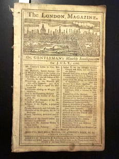
Sold20221766 Magazine Repeal of Stamp ActTitle: 1766 Magazine Repeal of Stamp Act Description: The July 1766 issue of "The London Magazine..", printed for R. Baldwin. 56 pages, lacks engraving. First article is letter from British SecretarySee Sold Price
Sold2016(2) ANTIQUE IRELAND MAPSCarte D' Irlande map published in 1867 by Alvin J. Johnson New York. Measures 10 3/4" x 15 3/4" (Framed 19 1/2" x 23 1/2") and a Jacques Nicolas Bellin A Chart of Ireland 1803 hand colored map. MeasurSee Sold Price
Sold2017Gentleman’s Magazine Map of the New Continent, 1758Map: A Map of the New Continent according to its greatest diametrical Length from the River la Plata to beyond the Lake of the Assiniboits Maker: Gentleman's Magazine Place & Date: London / 1758 Size:See Sold Price
Sold2023Gentleman's Magazine Map, A Chart of Delaware Bay and RiverTitle: A Chart of Delaware Bay and River, from the original by Mr. Fisher of Philadelphia 1776. Engraved map by cartographer Joshua Fisher. Featured in the July 1779 edition of Gentleman's MagazinSee Sold Price
Sold2018Gentlemen’s Magazine: Map of Chagres, Panama, 1740An Exact Draught of the Castle of San Lorenzo and the Village & River of Chagre A fascinating chart of the Village and River of Chagre and the castle of San Lorenzo under siege by Admiral Vernon in MaSee Sold Price
Sold2021IRELAND MAP 1878Size: 18 X 13 inches approx. Unframed. Printed 1878. Centerfold as issued.See Sold Price
Sold20241762 Gentlemans Magazine Map West IndiesThe April 1762 issue of "Gentleman's Magazine...", printed at London by Sylvanus Urban. 48 pages and an engraving of the island of Jamaica. Much on the taking of Martinico including the Articles of CaSee Sold Price
Jun 18DOYLE Auctioneers & AppraisersA block puzzle with maps of Europe, England, Ireland, Scotland, America and the WorldUS$100
Jun 02Mynt AuctionsPaul Hornung Signed 1956 Sport Magazine Autographed Notre Dame PSA/DNA AL85509US$10
Jun 01Trillium Antique Prints & Rare BooksSanson - Map of the British Isles (Ireland, Scotland, England)US$75
Jun 07Freeman's | Hindman[SLANT MAGAZINE]. BERGERON, Richard, (ed.). Warhoon 28. 1978. INSCRIBED BY SLANT EDITORS TO FORRESTUS$200
4 days LeftJasper52Antique Felix Delamarche Vaugondy Mappemonde Double hemisphere world map 1838US$45
4 days LeftJasper521794 de la Rochette Map of the English Channel and Bay of Biscay -- A Chart of the British ChannelUS$240
Jun 08AUTOMOBILIA LADENBURG AUCTIONmixed lot with 2 pieces, among it race programme Grand Prix Belgium June 18, 1961, with list of€50
5 days LeftAdam's AuctioneersWilliam Crozier (1930-2011) Untitled Oil on board, 91 x 71.5cm (35¾ x 28'') Signed William€5,000


![[SLANT MAGAZINE]. BERGERON, Richard, (ed.). Warhoon 28. 1978. INSCRIBED BY SLANT EDITORS TO FORREST (1 of 3)](https://p1.liveauctioneers.com/197/329395/177650270_1_x.jpg?height=282&quality=70&version=1715364962)


