Sold20231795 Map, Maryland & Delaware [18th c. Cartography]Engraved map of Maryland and Delaware printed in 1799, based on a 1795 edition produced by Samuel Lewis. Drawn by A. Anderson, engraved by J. Scoles. Includes an inset map of the Continuation of the PSee Sold Price
Sold2016*ZATTA, ANTONIO(18th C. Italian) Handcolored engraved map illustrating Maryland, Jersey, Delaware, Virginia and Carolina settlements, approximate plate size 13 1/4" x 17 1/2", frame 16" x 22 1/2".See Sold Price
Sold2018ANTONIO ZATTA (ITALIAN, 18TH CENTURY) MAP OF VIRGINIAANTONIO ZATTA (ITALIAN, 18TH CENTURY) MAP OF VIRGINIA AND MARYLAND, hand-colored, on laid paper, title and plate number to top margin "FOGL. VIII. IL MARYLAND, IL JERSEY MERIDIONALE, LA DELAWARE, E LASee Sold Price
Sold2024ANTONIO ZATTA (ITALIAN, 18TH CENTURY) MAP OF VIRGINIAPlate No. FOGL. VIII. "IL MARYLAND, IL JERSEY MERIDIONALE, LA DELAWARE, E LA PARTE ORIENTALE DELLA VIRGINIA, E CAROLINA SETTENTRIONALE"See Sold Price
Sold2018German Historic War Maps, Towns, and Sieges17th and 18th Century German Cartography School, Various Maps showing Battles, Settlements, Wars at German, Swedish, and Dutch Cities, copperplate engravings, approximately 12 x 14.5 inches, approximaSee Sold Price
Sold20231795 J. Denison & A. Doolittle Maryland/Delaware Map1795 J. Denison & A. Doolittle Maryland/Delaware Map of the States Maryland And Delaware by J. Denison. 7 1/2 x 10 in acid free matt.See Sold Price
Sold2024Exceptional 18th Century Map of The Carolinas, Maryland and VirginiaBy Johann Baptist Homann, Germany, late 17th/early 18th century. Hand colored map of the region which is excellent and quite rare. The map giving excellent details of the region and having exquisite eSee Sold Price
2023MAP OF MARYLAND AND DELAWARE BY JOHN REID.Engraved map on laid paper, published by John Reid, New York. "The States of Maryland and Delaware, from the Latest Surveys, 1795" with Chesapeake Bay in the middle. Stains, minor creases, glued down.See Sold Price
Sold2018Two 18th C American coin silver tablespoonsA coffin ended tablespoon by Ebenezer Moulton Boston Circa 1795. Together with a picture back table spoon by Jesse Zane. Wilmington, Delaware. Circa 1795. The Zane spoon is a particularly fine exampleSee Sold Price
Sold2022Scarce 1846 map of Maryland and Delaware by MitchellStrikingly lovely map of Maryland and Delaware by perhaps the premier map producer of the mid-19th century. The map is centered on Washington, D. C., and extends eastward from Maryland to New Jersey aSee Sold Price
Sold20231894 Cowles Civil War Map of Northern Virginia, Maryland, Delaware and Parts of West Virginia andTitle: 1894 Cowles Civil War Map of Northern Virginia, Maryland, Delaware and Parts of West Virginia and Pennsylvania -- General Topographical Map, Sheet I [Plate CXXXVI] Cartographer: C Cowles (compiSee Sold Price
Sold202218th c. Folio King James Bible, IllustratedTHE CHRISTIAN'S NEW AND COMPLETE BRITISH FAMILY BIBLE. London: for Hogg, n.d. (circa 1795.) 15" x 9". With 80 engraved plates (of?), including a few maps/plans. 4 page list of subscribers at end. BounSee Sold Price
Sold2020[AUSTRIA]. Manuscript Map. 18th Century[Unknown Artist] "Geographischemappa des untern Kreis in Hertzzogthum Carnthen". Manuscript. Ink and watercolour on paper, dissected and mounted to cloth. Mid 18th century. 100cm x 67cm.See Sold Price
Sold2020Antique Map (18th Century)DOMINIUM VENETUM, 1729, hand-colored double page atlas engraving, engraved by G. Mattheus Seutter Jr., image 19 ½ x 22 ¾”, sheet 21 x 23 ¾”.See Sold Price
Sold2020Antique Map (18th Century)IMPERII MAGNI MOGOLIS SIVE INDICI PADSCHACH, hand-colored double-page atlas engraving, engraved by Albrecht Carl Seutter, sheet 19 ½ x 22 ½”.See Sold Price
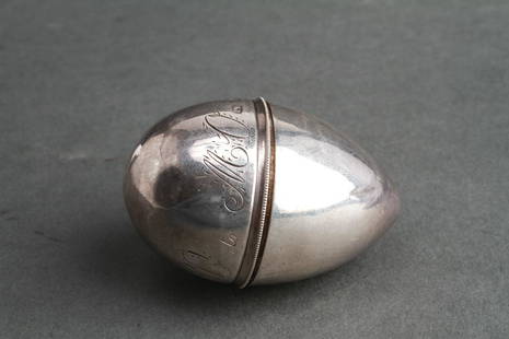
Sold2019John Turner Silver Acorn-Form Nutmeg Grater 18th CJohn Turner (reg. 1773) sterling silver nutmeg grater box, acorn-form with screw thread opening and metal rasp, monogrammed. hallmarked: "IT / Birmingham / England / 1795," 18th century. 2.125" H x 6.See Sold Price
Sold2024A CHINESE INK CAKE, DRAGONS IN THE CLOUDS, QING DYNASTY (1644-1912), QIANLONG REIGN (1736-1795),A CHINESE INK CAKE, DRAGONS IN THE CLOUDS, QING DYNASTY (1644-1912), QIANLONG REIGN (1736-1795), 18TH CENTURY, compressed carbon, one side of dense, swirling relief clouds, and two dragons in a yin-yaSee Sold Price
Sold2023A Sketch of the Operations before Charlestown, South CarolinaEngraved map, 18th century. Condition as pictured with competent older repairs evident verso. 8 1/8" x 13 1/8".See Sold Price
Sold2021Map of City and Harbour of MacauA Plan of the City and Harbour of Macao" engraved by B. Baker, Islington 27" x 20 1/2" (sight) hand-colored engraved map 18th century framed- 32 1/2" x 40See Sold Price
Sold2017Phaenomena Motuum Irregularium, celestial mapPhaenomena Motuum Irregularium, celestial map, 18th c., Doppelmayr/Homann, each sheet: 19"h x 22.5"w (sight), 43.5"h x 26.75"w (framed ensuite) Provenance: Property from a New York Corporate CollectioSee Sold Price
Sold2022Cherry Inlaid Slant Lid Desk, probably Delaware Valley, 18th century, the desk extensively inlaidCherry Inlaid Slant Lid Desk, probably Delaware Valley, 18th century, the desk extensively inlaid with checkered banding, demilunes, and a central diamond, with motifs repeated on the drawer fronts, wSee Sold Price
Sold2023Diminutive Yellow Pine Corner Cupboard, possibly southern New Jersey or Delaware, late 18th century.Diminutive Yellow Pine Corner Cupboard, possibly southern New Jersey or Delaware, late 18th century. A shaped shelf on an extension of the back with the cove molded flat cornice above a tombstone raisSee Sold Price
Sold2022Side chair, Delaware Valley, 18th C., ladder back with five arched, graduated slats, turned finials,Side chair, Delaware Valley, 18th C., ladder back with five arched, graduated slats, turned finials, rush seat with top painted yellow, turned base with bulbous and ring turned front stretcher, turnipSee Sold Price
Sold2016Map of Maryland, Delaware and Washington, DC, 1796Original engraving from Morse’s Universal Geography published by Thomas & Andrews, Boston, 1796. Dimensions: 12 3/4” x 15” No Reserve This item ships from Ocean View, DE.See Sold Price
19 hrs LeftFleischer's Auctions1755 Map Partie de l'Amerique Septentrionale, qui comprend Le Cours de L'Ohio...US$200(3 bids)
2 days LeftJasper52Turchia d'Europa… Turkey in Europe. Balkans Greece Bulgaria &c. ZATTA 1783 mapUS$55
2 days LeftJasper52l'Arménie, la Géorgie et la Daghistan Caucasus. SANTINI/RIZZI-ZANNONI 1784 mapUS$120
2 days LeftJasper52Les Royaumes de Suede et Norwege…. Scandinavia. SANTINI / JANVIER 1784 mapUS$100
1818 AuctioneersMaps. Lake District interest. Cumberland and Westmorland Antiquarian and Archaeological Society£16
Featured2 days LeftJasper52Chart of the Sea Coasts of England, Flanders & Holland. MOUNT & PAGE 1758 mapUS$420
2 days LeftJasper52Les Royaumes de Suede, de Danemark et de Norwege. Scandinavia. BONNE 1787 mapUS$25
2 days LeftJasper52Turquie Européenne. Turkey in Europe. Balkans Greece Aegean. VAUGONDY 1755 mapUS$100
2 days LeftJasper52Imperium Caroli Magni… Western Europe. Carolingian Empire. VAUGONDY 1752 mapUS$100
2 days LeftJasper52Gli Stati del Piemonte e Savoja. Savoie. French & Italian Alps. ZATTA 1784 mapUS$130
2 days LeftJasper52A Chart of the Sea Coast from England to the Streights. MOUNT & PAGE 1758 mapUS$500
May 23Plakas AuctionsA CHINESE PALE WHITE GREEN AND BROWN-STREAKED JADE VASE, HU, 18TH CENTURY, QIANLONG PERIOD (1736-179£600


![1795 Map, Maryland & Delaware [18th c. Cartography]: Engraved map of Maryland and Delaware printed in 1799, based on a 1795 edition produced by Samuel Lewis. Drawn by A. Anderson, engraved by J. Scoles. Includes an inset map of the Continuation of the P](https://p1.liveauctioneers.com/7226/275519/144720286_1_x.jpg?height=310&quality=70&version=1673742614)
![1795 Map, Maryland & Delaware [18th c. Cartography] First Image](https://p1.liveauctioneers.com/7226/275519/144720286_1_x.jpg?height=300&quality=1&version=1673742614&width=300)
![1795 Map, Maryland & Delaware [18th c. Cartography] First Image](https://p1.liveauctioneers.com/7226/275519/144720286_1_x.jpg?height=300&quality=95&version=1673742614&width=300)


![1894 Cowles Civil War Map of Northern Virginia, Maryland, Delaware and Parts of West Virginia and: Title: 1894 Cowles Civil War Map of Northern Virginia, Maryland, Delaware and Parts of West Virginia and Pennsylvania -- General Topographical Map, Sheet I [Plate CXXXVI] Cartographer: C Cowles (compi](https://p1.liveauctioneers.com/5584/300803/160207035_1_x.jpg?height=310&quality=70&version=1693946338)

![[AUSTRIA]. Manuscript Map. 18th Century: [Unknown Artist] "Geographischemappa des untern Kreis in Hertzzogthum Carnthen". Manuscript. Ink and watercolour on paper, dissected and mounted to cloth. Mid 18th century. 100cm x 67cm.](https://p1.liveauctioneers.com/1124/187577/94368842_1_x.jpg?height=310&quality=70&version=1607095126)