Sold20151937 Paper Map of Wilton ConnecticutPaper map dated 1937 showing residents locations for Wilton Connecticut.See Sold Price
Sold20241859 Clark & Tackaburys' Wall Map of ConnecticutAntique 1859 Clark & Tackabury Topographical Wall Map of Connecticut, Coated Paper with Original Rollers. Measures 55 inches x 71 inches. Please note condition issues noted in photography including teSee Sold Price
Sold2023Great Western Railway Tin MapGreat Western Railway Tin Map GWR system enamel map, in original oak frame Property from: The Estate of Thomas ('Tom') Jones, Wilton, Connecticut Height: 23 1/2 inches, Width: 29 1/2 inches Frame SizeSee Sold Price
Sold2024Leon V. Carroll(Connecticut, 1887 - 1937) Gouache on paper titled Night Blooming Cirrus. Signed lower right. Framed in period frame. H25" W17 3/8" (without frame)See Sold Price
Sold20231886 J.B. Beers & Co. Map of ConnecticutUnited States,1885 Antique folding map of Connecticut created by J. B. Beers & Co. copyrighted 1885. Print on paper laid on textile,Approx. 52" x 46". From the collection of a Seekonk, Massachusetts eSee Sold Price
Sold2021MAP OF DARIEN CONNECTICUTDimensions: (Frame) H 26" x W 22" (Sight) H 18.5" x W 15" Condition: Wear consistent with age and display including light age toning to paper.See Sold Price
Sold20241859 Clark & Hopkins Wall Map Litchfield County CTAntique 1859 Clark & Hopkins Topographical Wall Map of Litchfield County Connecticut, Coated Fabric Backed Paper with Original Rollers. Measures 55 inches x 51 inches. Please note condition issues notSee Sold Price
Sold2017VINTAGE 1937 ROYAL CROWN COLA ADVERTISEMENT, "THANKS AVINTAGE 1937 ROYAL CROWN COLA ADVERTISEMENT, "THANKS A MILLION", MOUNTED ON PAPER, GOOD CONDITION, 12" X 11", SKU407.01See Sold Price
Sold2022The Dole Map of the Hawaiian IslandsThe Dole Map of the Hawaiian Islands Lithograph, copyright 1937. measures 19 x 37 inches, no framed, stored in cardboard tube, paper weights not included, surface wear to piece. Artwork, fine art, walSee Sold Price
Sold2023Connecticut River RR June 1874 Public TimetableThis is a Connecticut River Railroad June 1874 public timetable. Printed on one sheet of paper, with eight total panels and four to a side, one side shows a complete route map, with the other side shoSee Sold Price
Sold2020Milton Glaser (1929-2020), Potrait of Chuck Jackson (b.Milton Glaser (1929-2020)Potrait of Chuck Jackson (b. 1937) Signed, "Milton Glaser", l.r., ink and watercolor on paper, matted.24 in. x 18 in.PROVENANCE:The Collection of a Connecticut Gentleman.See Sold Price
Sold2017Charles Henry Fromuth,Am.,Boats on Water at SunsetCharles Henry Fromuth, American, 1861-1937, Boats on Water at Sunset, oil pastel on paper, signed and dated lower right (DMAS7153){MM} Property Title: From a Newtown Connecticut Collector MeasurementSee Sold Price
Sold2022Irvin Shope History Montana 1937 MapFor your bidding pleasure in this lot is a 1937 pioneer/frontier/historic map of Montana. One side of the map shows the state of Montana with landmarks, sites, and historical events, including YellowsSee Sold Price
Sold2023MAP, Connecticut, ReidConnecticut. John Reid, Connecticut from the Best Authorities, from Winterbotham's History of America, 1796 (circa). Black & White. This early and uncommon map of Connecticut was engraved by BenjaminSee Sold Price
Sold2020Scarce 1937 Map of Nantucket IslandScarce 1937 Map of Nantucket Island, from aerial survey made by, "The New England Cartographers, Inc.", with inset photo at Allen's Lobster Grill" 11 ¾ in. x 26 ½ in. Overall 15 ½ in. x 30 ½ in.See Sold Price
Sold2016Pastel on Paper, Connecticut LandscapeSigned l.r. illegible, possibly Kirill Doron (Russian born American 20thC.) 24"h x 39"w Provenance: Woman's League Arts Festival, Westport, CTSee Sold Price
Sold2021Original Framed Red Ink On Paper MapThis is a framed pen sketch of what appears to be a city map. There is a ton of little details on this sketch. There appears to be no artist signature on the piece. It's either not on it, or is hiddenSee Sold Price
Sold2022Vintage Magnifying Glass Turtle Paper Weight Paper Map ReaderVintage Magnifying Glass Turtle Paper Weight/Paper Map Reader. Maker and date of creation is unknown. Is made of resin, and is made to look bronze. Is approx 5" x 6" x 2" and is in good, vintage condiSee Sold Price
Sold20221990 - Florida Under 5 Flags Paper Mapmeasures about 21 1/2 inches by 17 inches; has pin holes in cornersSee Sold Price
Sold20231940's Coca-Cola Paper Map Of North America1940's Coca-Cola Paper Map Of North America, 29" x 36", Poster Board Backing. Woody Auction Cannot Ship This Item - It Must Be Picked Up In Person In Douglass, KS, Or Shipped Via A Professional ShippeSee Sold Price
Sold2017Bradford: Antique Map Connecticut & Rhode Island, 1835Title/Content of Map: Connecticut & Rhode Island Date Printed: 1835 Cartographer: T. G. Bradford Material/Medium: Paper Size: 9 1/2" x13" A Comprehensive Atlas Geographical, Historical & Commercial. PSee Sold Price
Sold2021Rand McNally maps rack w/ nine paper mapsEsso & Standard oil Maps from different countries in different languages, 14" tall X 19" wideSee Sold Price
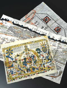
Sold2019China Missions, late 19th century, a small box ofChina Missions, late 19th century, a small box of various China Missionary items and ephemera, including a tissue paper map, passport to Rev. A W Nightingale expiring 1880, signed 'Bullock', printed sSee Sold Price
3 days LeftBlackstone Valley Auctions & Estates LLCCoronation Procession Scroll of King George VI & Elizabeth.US$100
3 days LeftRoyal Treasures Warehouse LLC1876 New York City, New York Vintage Old Panoramic NY City MapUS$100(1 bid)
May 24Kinghams AuctioneersTolkien, J.R.R. 'The Hobbit, or There and Back Again', 1st ed, 1st impression, pub Allen & Unwin,£3,400