Sold2023AFTER NICOLAS SANSON (FRENCH, 1600-1667) MAP OF GREAT BRITAINAFTER NICOLAS SANSON (FRENCH, 1600-1667) MAP OF GREAT BRITAIN, hand-colored engraving on laid paper, engraving by Robert De Vaugondy. Unframed. Circa 1750. 21 3/4" x 31". Provenance: BSee Sold Price
Sold2018AFTER NICOLAS SANSON (FRENCH, 1600-1667) MAP OF NORTHAFTER NICOLAS SANSON (FRENCH, 1600-1667) MAP OF NORTH AMERICA, hand-colored, on laid paper, title in cartouche to upper left corner lettered "NORTH AMERICA / Divided into it's Principall Parts / whereSee Sold Price
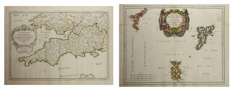
Sold2023AFTER NICOLAS SANSON (FRENCH, 1600-1667) MAP OF CALIFORNIA AS AN ISLANDAFTER NICOLAS SANSON (FRENCH, 1600-1667) MAP OF CALIFORNIA AS AN ISLAND, hand-colored engraving on laid paper, titled "AUDIENCE DE / GUADALAJARA / NOUVEAU MEXIQUE / CALIFORNIE, &c. / Par N. SSee Sold Price
Sold2023AFTER NICOLAS SANSON (FRENCH, 1600-1667) MAP OF FLORIDAAFTER NICOLAS SANSON (FRENCH, 1600-1667) MAP OF FLORIDA, hand-colored engraving on laid paper, titled "FLORIDA / zoo als het van de / SPAANSCHEN en FRANSCHEN / wordt bezeten. / door N. Sanson. /See Sold Price
Sold2022Alexis Hubert Jaillot and Nicolas Sanson - Map of the Grand Duchy of Moscow, Etching, 1708.Alexis Hubert Jaillot (French, 1632-1712) and Nicolas Sanson (French, 1600-1667) - Map of the White Russia or the Grand Duchy of Moscow, Etching, 1708. Title: Les Estats du Czaar de Russie Blanche ouSee Sold Price
Sold2023AFTER NICOLAS SANSON (FRENCH, 1600-1667) MAP OF CANADAAFTER NICOLAS SANSON (FRENCH, 1600-1667) MAP OF CANADA, hand-colored engraving on laid paper, titled "CANADA / of / NIEW VRANKRYK / Getrokken uit verfscheide Franfche, / Engelfche, en HollanSee Sold Price
Sold2017Nicolas Sanson, 17th c. map of Imperial RomeNicolas Sanson, 17th c. map of Imperial Rome, Nicolas Sanson (French, 1600-1667), "Imperii Romani geographica descriptio ad Herodiani historiam", c. 1650, Roman territory throughout Europe and Asia asSee Sold Price
Sold2018AN 1659 FRENCH MAP OF DENMARK BY NICOLAS SANSONA hand-colored map of Northern Denmark by Nicolas Sanson (1600-1667), signed Sanson and dated with a cartouche on the lower left. Sheet measures 16.25 x 21 inches. Frame measures 20.5 x 26.5 inches. WSee Sold Price
Sold2022French Le Maine hand colored map engraving, central France, by Nicolas Sanson (1600-1667) 15"H xFrench Le Maine hand colored map engraving, central France, by Nicolas Sanson (1600-1667) 15"H x 19"W (image), 23"H x 30 3/4"W (frame)See Sold Price
Sold2019Three Maps by Nicolas Sanson (1600-1667, Paris), Two-Three Maps by Nicolas Sanson (1600-1667, Paris), Two- "Carte Generalle d'Espagne .. Royaumes," 1641; together with "Gouvernement General d'Orteans Maine, le Perche, la Beauce..Gastinois," 1650, hand cSee Sold Price
Sold2019Two Maps by Nicolas Sanson (1600-1667, Paris), "Isle deTwo Maps by Nicolas Sanson (1600-1667, Paris), "Isle de France, Champagne, Lorraine," 1679; together with "Le Royaume de France, Toutes ses Provinces, et ses Acquisitions, L'Espagne le Luxembourg," 16See Sold Price
Sold2019Three Maps by Nicolas Sanson (1600-1667, Paris),Three Maps by Nicolas Sanson (1600-1667, Paris), "Lespagne en Plusieurs Peuples suiant Peolomee," 1641; together with two- "Galliae Antiquae Descriptio Geographica," 1629 Geographica- H. - 17 in., W.See Sold Price
Sold2019Two Maps by Nicolas Sanson (1600-1667, Paris), " LaTwo Maps by Nicolas Sanson (1600-1667, Paris), " La France L'Ancienne Gaule Primatiats… ar Evesches et Evesches," 1679; together with "Le Royaume de France et es Acqusitions Pays Bas L'AllemagneSee Sold Price
Sold2019Group of Three Maps by Nicolas Sanson (1600-1667,Group of Three Maps by Nicolas Sanson (1600-1667, Paris), "La Gaule en dixsept provinces Romain," 1641; together with "Gouvernment General du Lyonnois, Forez, Beavoilais," 1679; and "Gouvernment De FrSee Sold Price
Sold2019Two Maps by Nicolas Sanson (1600-1667, Paris),Two Maps by Nicolas Sanson (1600-1667, Paris), "Provinces d'West Royame d'Westsex," 1679; together with"Les Isles Orcadney, ou Orkney Farre," 1665, Orcadney- H. - 16 in., W. - 23 in., d'Westsex- H. -See Sold Price
Sold2019Two Maps by Nicolas Sanson (1600-1667, Paris), "LeCoursTwo Maps by Nicolas Sanson (1600-1667, Paris), "LeCours de la Riviere du Rhein. Tous LeDauphin les Estats et Souverainetes," 1692; together with "Gallia Vetus ex C.lulii C aefaris comentarii descripaeSee Sold Price
Sold2019Two Maps by Nicolas Sanson (1600-1667, Paris)," AncientTwo Maps by Nicolas Sanson (1600-1667, Paris)," Ancient Royaume de Northumbland and Provinces de Nort," 1679; together with " L'Escosse de la Tay… Provinces… Stralloch," 1665, Stralloch- HSee Sold Price
Sold2019Two Maps by Nicolas Sanson (1600-1667, Paris),Two Maps by Nicolas Sanson (1600-1667, Paris), "L'Estats de'Englise et de Toscane," 1648, together with "Nicens Ory de Mercie," 1654 H. - 17 in., W. - 23 in. (2 Pcs.)See Sold Price
Sold2019Two Maps by Nicolas Sanson (1600-1667, Paris),Two Maps by Nicolas Sanson (1600-1667, Paris), "Principaute de Galles, Nort Walles," 1679; together with "Hispaniae Antiqua Tabulae," 1641, hand colored, Tabulae- H. - 16 in., W. - 23 in., Galles- H.See Sold Price
Sold2019Two Maps by Nicolas Sanson (1600-1667, Paris), "LaTwo Maps by Nicolas Sanson (1600-1667, Paris), "La Judee ou Palestine Herodes," together with "Gouvernement General de L'lsle de France et Pays Circomvoisins," 1679, France- H. - 15 in., W. - 20 in.,See Sold Price
Sold2019Two Maps by Nicolas Sanson (1600-1667, Paris), "CarteTwo Maps by Nicolas Sanson (1600-1667, Paris), "Carte General du Royaume de France Auceq tousles Pays Circomuoisins," 1658; together with "Anciens Royaumes de Kent, D'Essexet de Sussex de Picardie etSee Sold Price
Sold2019Two Maps by Nicolas Sanson (1600-1667, Paris),Two Maps by Nicolas Sanson (1600-1667, Paris), "Picardie et les Pays Bas Catholiques," 1667; together with "Carte des Rivieres de la France," 1641, hand colored, France- H. - 17 in., W. - 23 in., CatoSee Sold Price
Sold2019Two Maps by Nicolas Sanson (1600-1667, Paris),Two Maps by Nicolas Sanson (1600-1667, Paris), "L'Estats de'Englise et de Toscane," 1648, H. - 17 in., W. - 23 in. (2 Pcs.)See Sold Price
Sold2019Two Maps by Nicolas Sanson (1600-1667, Paris), "LeTwo Maps by Nicolas Sanson (1600-1667, Paris), "Le Marquisat et Electorat de Brandeburg," 1692; together with "Partie du Cercle d'Austiche Divise en Haute et Basse," 1696, d'Austiche- H. - 21 in., W.See Sold Price
21 hrs LeftJasper52South-west & Central Europe. Switzerland includes Haute-Savoie. THOMSON 1817 mapUS$100
21 hrs LeftJasper52South-west & Central Europe. Switzerland includes Haute-Savoie. THOMSON 1830 mapUS$100
21 hrs LeftJasper52South-west Europe. Swiss Savoy. British Hanover. THOMSON 1817 old antique mapUS$100
1 day LeftPotter & Potter AuctionsTAVENER. A Literary Map of Britain / Fly There by BOAC. 196...US$125
Jun 02Schilb Antiquarian Rare Books1871 Alfred the Great King of England MAP Battle of Ashdown Vikings Thom HughesUS$110(3 bids)
6 days LeftDoyle New YorkRoyal Interest: Set of Twelve French Empire Silver-Gilt Chargers with the Royal Arms of HanoverUS$4,000
6 days LeftDoyle New YorkRoyal Interest: Pair of French Empire Silver-Gilt Verrieres with the Royal Arms of Hanover Biennais,US$3,500
Jun 02Schilb Antiquarian Rare Books1897 History of British Empire England Scotland Canada James II MAPS India 6vUS$2(2 bids)
3 days LeftTrillium Antique Prints & Rare BooksGould - Blood-rumped Groove-bill Aracari or ToucanUS$100(1 bid)
11 hrs LeftUniversity ArchivesAmelia Earhart & George Putnam Plan Route for Notorious Flight, Fantastic Wire PhotoUS$100(1 bid)
1 day LeftPotter & Potter AuctionsYork In Daffodil Time / British Railways. 1950. Great Brita...US$50(1 bid)