Sold2018Air France. Large World Map Airways Route Poster.Masse, Jean. Air France. Large World Map Airways Route Poster. Paris: R. Graindorge/Perceval, ca. 1961. Color map of the world detailing the airline's routes. Linen backed. 45 ½ x 81". Small browSee Sold Price
Sold20191943 Rand McNally Air-Age Map of the World Fold Out1943 Rand McNally Air-Age Map of the World Fold Out27 1/2 x 20 when opened Shipping in continental US $4.00 Please ask any questions before bidding Good Luck!See Sold Price
Sold2018Two Large Maps of the WorldTwo Large Maps of the World, American Air Lines & Menier Chocolate. American Airlines Air World Map, showing the distances to various cities and locations from the geographical center of the United StSee Sold Price
Sold2022Large World Map Fountain PenLarge World Map Fountain Pen approx. 9 3/4 inches depicting world map in multi-colored enamel with high polished silvertone accents, iridium nibSee Sold Price
Sold2023Large World Map Rand McNally Cosmopolitan SeriesLarge World Map Rand McNally Cosmopolitan Series . Measures about 31"x48"See Sold Price
Sold2019Gross, Alexander 1920 Lot of 4 Large World MapsIncl Time Zones, Wind, Production and Religions/Races. Large Lithograph Maps Published 1920, London for "The Daily Telegraph Victory Atlas of the World" by Alexander Gross. Centre fold as published. PSee Sold Price
Sold2019Bartholomew, John 1922 Lot of 4 Large World MapsPopulation, Commerce, Vegetation/Ocean Currents, and Bathy-Orographical. Large Lithograph Maps Published 1922 by The Times, London for "The Times Survey Atlas of the World" Maps by John George BartholSee Sold Price
Sold20191945 Turner Dated Events War Map -- Dated Events WarTitle/Content of Map: 1945 Turner Dated Events War Map -- Dated Events War Map Cartographer: S TurnerDate: 1945, New York Size: 17 x 38.8 in. This is a large world map, detailing the key events towardSee Sold Price
Sold20181942 Turner Dated Events War Map -- Dated Events WarTitle/Content of Map: 1942 Turner Dated Events War Map -- Dated Events War Map Date Printed: 1942, New York Cartographer: S Turner Size: 17 x 38.8 in. This is a large world map, detailing the key evenSee Sold Price
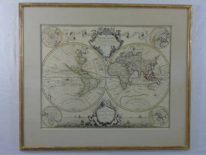
Sold2016Large Framed World Map w/ Latin InscriptionsLarge Framed World Map w/ Latin Inscriptions. Hand colored. Professionally framed and matted. Titled Mappe Monde. Measures 28 by 33 inches.See Sold Price
Sold2016Lucien Boucher Air France World Map of Air Routes,Lucien Boucher Air France World Map of Air Routes, original poster printed by Perceval c.1939 - 63 x 99 cmSee Sold Price
Sold2016Lucien Boucher Air France World Map of Air Routes,Lucien Boucher Air France World Map of Air Routes, original poster printed by Perceval c.1939 - 64 x 101 cm Crinkled paperSee Sold Price
Sold2023Collection of Large Vintage World MapsLarge format MAPS and city views. Approximately 50 pieces. As is, as shown. Provenance: Phyllis Lucas Gallery, NYC.See Sold Price
Sold2017Johnson: Map of the World On Mercator's ProjectionMap Title: Map of the World On Mercator's Projection Publisher: Johnson And Ward, Alvin Jewett Johnson Publishing Date: 1861 Size: Double Folio - 15.25 x 24.00 inches Large, Handsome world map showingSee Sold Price
Sold2017Brue: Antique Map of the World; East & West HemispheresMap: Large antique world map of the east and west hemispheres Publication Date: 1822 Creator: Brue, Adrien Hubert Size: 26 x 15 Coloring: Outline hand-coloring Conditoin: Very good. Wide margins. A feSee Sold Price
Sold2022Large Copper Top World Map Cocktail TableLarge Copper Top World Map Cocktail / Coffee Table - 21 in tall x 55 x 31See Sold Price
Sold2024Blackie (Pub) 1882 Large Map. World on Mercators ProjectionLithograph Maps Published 1882 by Blackie & Son, London for "The Comprehensive Atlas & Geography of the World" by W. G. Blackie. Paper Size: 22.5 x 15.5 inch (57 x 39cm) Good conditionSee Sold Price
Sold2021Large Carved Wooden World Map - 65'' x 41'' , Heavy -Large Carved Wooden World Map - 65'' x 41'' , Heavy - Pick up or Arrange Own Shipping -See Sold Price
Sold2023Large Brass 1628 World Map Wall Art by MasketeersThis impressive piece of wall art is a reproduction of a 1628 world map, created by Masketeers, Inc. in 1963. Measuring a substantial 43 1/2" by 30 1/2", it is a striking addition to any space. CrafteSee Sold Price
Sold2024Blackie (Pub) 1882 Large Map. World HemispheresLithograph Maps Published 1882 by Blackie & Son, London for "The Comprehensive Atlas & Geography of the World" by W. G. Blackie. Paper Size: 22.5 x 15.5 inch (57 x 39cm) Good conditionSee Sold Price
Sold2019Gross, Alexander 1920 Large Map. World HemispheresLarge Lithograph Map Published 1920, London for "The Daily Telegraph Victory Atlas of the World" by Alexander Gross. Centre fold as published. Paper Size: 25 x 19.5 inch (64 x 49cm) Good ConditionSee Sold Price
Sold2023Nat. Encyclo. 1890's Large Map. World on Mercator's ProjectionSteel Engraved Map Published 1891-1901 by William Mackenzie, London for "The National Encyclopedia: A dictionary of Universal Knowledge" Folds as issued. Paper Size: 20.5 x 13.5 inch (52 x 33cm) A couSee Sold Price
Sold2023Gross, Alexander 1920 Lot of 5 Large Maps. World & OceansIncl World Hemispheres, North Atlantic, South Atlantic, World Rainfall, Temperature and Winds, and World Population and Occupations. Large Lithograph Maps Published 1920, London for "The Daily TelegraSee Sold Price
3 days LeftJasper521699 Moll World Map with Cowley's Voyages -- Nouvelle Carte du Monde Suivant l'idee de Mercator ouUS$240
May 16Potter & Potter AuctionsBOUCHER, Lucien (1889 – 1971). Provence Breguet 763 / Air F...US$300
4 days LeftJasper52New Guinea-Solomon Islands 1942/3. Pacific Campaign. World War 2 1961 old mapUS$10
11 hrs LeftKCM GalleriesLarge Detailed Original Oil Painting United States Map Julius Lira Salazar 48 x 36 inchesUS$1,800
May 05KCM GalleriesLarge Detailed Original Oil Painting United States Map Julius Lira Salazar 48 x 36 inchesUS$1,800