Sold2023Antique Framed Map of CubaAntique Framed Map of Cuba. Framed measures 15 inches x 20 inchesSee Sold Price
Sold2019.18th Century French Map of Cuba, Florida and Louisiana21 1/4 x 16 3/4 in. (framed).18th Century French Map of Cuba, Florida and LouisianaGulf of Mexico antique map Golfe du Mexique Zannoni 1762Title: Carte Geo-Hydrographique du Golfe du Mexique et de sesSee Sold Price
Sold2021Antique Framed Map. Virginia Marylandia et Carolina. JoAntique Framed Map. Virginia Marylandia et Carolina. Johannes Baptisa Homann-- Dimensions: Image Size: H: 21 inches: W: 24.5 inches -- FRAME SIZE: Frame Height 25 inches - Frame Width 28.5 inches ---See Sold Price
Sold2016Antique Framed Map of Israel, C. 1748.Ivdaea Sev Palaestina, ... Terra Sancta. By Johann Baptist Homann. Framed, 18.5" x 21.5" sight size. Visible foxing. From a Larchmont NY estate. Dimensions: 23" w x 20" h framed. Condition: Foxing, noSee Sold Price
Sold2021Antique Framed Map Livingston,Germantown,Claremont NYAntique Framed Map of Livingston, Germantown and Claremont, Columbia County, NY. Dated 1850. Engraved by R.H.Pease, Albany, NY. Lovely early map is nicely framed in dark brown wood, and wired on the bSee Sold Price
Sold2017Antique framed map of Indian Ocean, Asia, AustraliaTitle/Content of Map: Antique framed map of Indian Ocean, Asia, Australia Date Printed: 1713 Cartographer: Aa, Pieter van der Size (in): 11 x 8 Very attractive framed copper-engraved antique map by PiSee Sold Price
Sold2018Mercator / Hondius: Antique Map Cuba / Hispaniola, 1607Title/Content of Map: Cuba Insul/Hispaniola Cartographer: Mercator / Hondius Place & Date: Amsterdam / 1607/1620s Size: 7 1/8" x 5 5/8" Condition: full color; overall age-toning and some staining; resSee Sold Price
Sold2021Antique Framed Map of Columbia County, NY 1829Antique Framed Map of Columbia County, NY, dated 1829. Engraved by Rawdon Clark & Co, Albany, NY. Also marked Rawdon Wright, New York. Map includes locations of mills, churches and stage roads. NicelySee Sold Price
Sold2019Antique Framed Map Showing Estonia Coast & RussiaAntique Framed Map Showing Estonia Coast & Russia. Professionally framed and matted. Showing the current coast and islands of Estonia as well as a portion of Russia. Measures 26 x 31 inches.See Sold Price
Sold2023Antique Framed Map of Greece by Nicolaum VisscherAntique Framed Map of Greece by Nicolaum Visscher. 21 inches x 25 inches.See Sold Price
Sold2021Antique Framed Map of Europe, Europa Guilielmo BlaeuwAntique Color Map of Europe, Dutch Cartography. "Europa Recens Descripta" by Guilielmo Blaeuw, a cartographer for the Dutch East India Company. Lots of colorful detail of different nationalitiSee Sold Price
Sold2021Antique Framed Map of Germany by A Christophoro HurteroAntique Framed Map of Germany by A Christophoro Hurtero. Full title: Alemannia Sive Svevia Superior. Date of printing is somewhere in 1640's, and possibly engraved. Golden painted inner frame. DimSee Sold Price
Sold2021(2) ANTIQUE FRAMED MAPSAntique world map approximately 16" x 9.75" w/ frame and Asia minor 11.75" x 9.25" w/ frame.See Sold Price
Sold20242 ANTIQUE FRAMED MAPSMAP OF FRANCE, DATED 1850, BY THOMAS COWPERTHWAIT AND ONE OF ENGLAND. FRAMED 21"X 24"See Sold Price
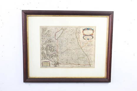
Sold2021Antique Framed Map of East HamptonAntique map of East Hampton, Long Island, NY, framed under glass. [Sight: 10" H x 14 1/2" W; Frame: 17 1/2" H x 21" W]. Minor creases.See Sold Price
Sold2021Antique Framed Map of Livingston Manor, NY, dated 1714Antique Framed Map of Livingston Manor, NY, dated 1714. Engraved by J.E. Gavit, Albany, NY. Lovely early map is nicely framed in dark brown wood, matted in white, and wired on the back and ready to haSee Sold Price
Sold2021Antique Framed Map of Russian Empire "Improved to 1321"Antique Framed Map of Russian Empire "Improved to 1321." Geographical and statistical map, with full color and cultural information. This includes natural history, national character, manners,See Sold Price
Sold2021Antique Framed Map of England / Germanic SeaAntique Framed Map of England / Germanic Sea. Circa late 17th Century & early 18th Century. Featuring "De Noort Zee" & "T Canaal". Map measures 23 inches high x 19.25 inches wide, framed measures 28.5See Sold Price
Sold2018Antique Framed Map of The Caspian Sea Area of Asia26.5x23.5 inches, Nova & Accvrata Wolgae Flvminis olim RHA dicti Delineatio Auctore Adamo Oleario.See Sold Price
Sold2023Antique Framed Map of "Pars Scotiae Australi's"Description: This lot includes what appear to be an antique map titled "Pars Scotiae Australi's". The map is not dated however it appears to have age to it. See photos for details. Condition: ExpectedSee Sold Price
Sold2019Tobias Lotter Antique Framed MapTobias Lotter antique map. Measures 7.75" x 10" plate size and approximately 8.5" x 11" sheet size. Good condition, taped to mat verso. We ship most items in this auction in house and gladly combine sSee Sold Price
Sold2016Antique Map - Cuba & The Bahama Islands - 1889Antique Map - Cuba & The Bahama Islands - 1889 from Cram's Atlas 1889. Size : 14.5" x 11"See Sold Price
Sold2022Collection 6 Antique Framed MapsAntique Maps. Africa 1767 Dimensions: xx inches wide x xx inches deep x inches high Please refer to photos for more details. Click on photo and expand so see more detail condition CONDITION Please insSee Sold Price
May 26Ararity AuctionsThomson's 1817 Hand Colored Map Comparative Heights of the World's Great MountainsUS$50
May 26GOLDEN SUN AUCTIONS, Inc. (formerly Appraisal & Estate Sale Specialists, Inc.)William Guthries British Colonies of North America Map Circa 1800US$40
May 25Auction WallstreetCuban Painting Domingo Ravenet Esquerdo "Figuras en sepia" ("Figures in sepia"),1968US$1,000(1 bid)
4 days LeftLangston Auction Gallery2 Antique Framed Embroideries & Antique Framed SilhouetteUS$50(4 bids)
May 26Ararity AuctionsLarge Eberhardt & Ober Brewing Company Antique Framed Beer Advertising LithographUS$100(1 bid)


![Antique Framed Map of East Hampton: Antique map of East Hampton, Long Island, NY, framed under glass. [Sight: 10" H x 14 1/2" W; Frame: 17 1/2" H x 21" W]. Minor creases.](https://p1.liveauctioneers.com/1221/225810/117094074_1_x.jpg?height=310&quality=70&version=1637685024)


