Sold2019Antique Hand Colored Map Titled MappeAntique Hand Colored Map Mappe-Monde Indiquant les Possessions Coloniales des diverses Puissances By Drioux, Claude Joseph (1820 - 1898) [M. Drioux et Ch. Leroy] | Published Paris, Belin, 1859 | 19thSee Sold Price
Sold2024Antique North America West Indies Caribbean MapAn antique hand-colored copperplate engraving on rag paper map titled "Part of North America (West Indies)" by Malachy Postlethwayt (English, 1707-1767). This large map depicts Florida, the Bahamas, PSee Sold Price
Sold2022ANTIQUE FRENCH NORMANDY MAPS ENGRAVINGS 17TH CEN.A pair of antique French hand-colored engravings maps. The first is titled, Le Pais De Cavx Normandy Part of Picardy. The Pais or Pays de Caux is a natural region of Normandy belonging to the Paris BaSee Sold Price
Sold2018Antique French Copper Engraved Colored Map, Amsterdam18th century antique French copper engraved and hand colored maps of Amsterdam, Netherlands titled "Lemouicum, Auctore Jo. Faiano M.L. - Lymosin [on sheet with] Topographia Limaniae, Auctore GabrieleSee Sold Price
Sold2024Henricus Hondius 1630 "Nova Virginiae Tabula" Hand Colored Map of Virginia and Chesapeake #1Antique, original hand-colored map of Virginia and the Chesapeake Bay originally by Henricus Hondius in 1630 titled "Nova Virginiae Tabula". With French text on reverse final catchword "n'en" and signSee Sold Price
Sold2023ANTIQUE 18TH C HAND COLORED MAP OF OTTOMAN EMPIREAn antique early 18th-century hand-colored engraved map representing the Ottoman Empire. Published in Nuremberg, Germany, 1720. Titled Imperium Turcicum, technical information in Latin in the lower leSee Sold Price
Sold20222 E. Bowen Maps of Italy & GreeceEmanuel Bowen, Welsh, 1694-1767. Two 18th century hand-colored engraved maps. Includes one titled "Middle or Proper Italy" and another titled "A Map of Great Greece and the Islands of Sardinia and CorSee Sold Price
Sold20222 Antique Maps of Saltzberg & Swiss AlpsTwo 18th century hand-colored engraved maps. Includes one titled "Saltzberg" by Gabriel Bodenehr and another titled "La Descente du Cote du Midi des Alpes" (The Descent on the South Side of the Alps)See Sold Price
Sold2022A. Mallet & G. Ruscelli MapsThree 16th and 17th century hand-colored engraved maps. Includes one titled "Cercle de Bourgogne" (Circle of Burgundy) and another titled "France par Governmens Generaux" (France by General GovernmentSee Sold Price
Sold2024ANTIQUE MAP - REPRESENTATION OF THE TURKISH EMPIRE IN THE 16TH C.16TH C. FRAMED HAND COLORED ANTIQUE MAP - ABRAHAM ORTELIUS (BELGIAN, 1527-1598) REPRESENTATION OF THE TURKISH EMPIRE IN THE 16TH C. - TITLED "TURCICI IMPERII DESCRIPTO" - FRAME MEASURES APPROX. 23 1/2See Sold Price
Sold202317TH C. HAND COLORED MAP OF BERMUDA - CIRCA 167017TH C. HAND COLORED MAP OF BERMUDA - CIRCA 1670 - TITLED "MAPPA AESTIVARUM INSULARUM ALIAS BARMUDAS" - FRAMED AND IN VERY GOOD CONDITION - FRAME 21 3/4" X 19 1/8", SIGHT 14 3/4" X 11 3/4"See Sold Price
Sold2023Carey & Lea - Map of AlabamaThis hand-colored map was part of the atlas titled A Complete Historical, Chronological, and Geographical American Atlas, being A Guide to the History of North and South America, and the West Indies:See Sold Price
Sold2023Carey & Lea - Map of MissouriThis hand-colored map was part of the atlas titled A Complete Historical, Chronological, and Geographical American Atlas, being A Guide to the History of North and South America, and the West Indies:See Sold Price
Sold2023Carey & Lea - Map of IndianaThis hand-colored map was part of the atlas titled A Complete Historical, Chronological, and Geographical American Atlas, being A Guide to the History of North and South America, and the West Indies:See Sold Price
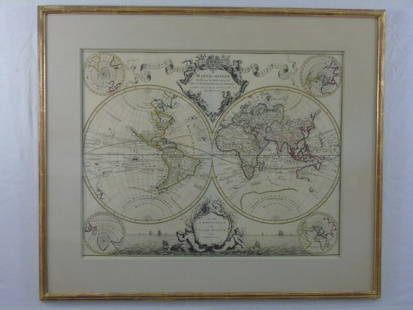
Sold2016Large Framed World Map w/ Latin InscriptionsLarge Framed World Map w/ Latin Inscriptions. Hand colored. Professionally framed and matted. Titled Mappe Monde. Measures 28 by 33 inches.See Sold Price
Sold2015A. M. Perrot. Map of the World. 1837.Print of hand colored steel engraving titled Mappe - Monde“.Author A. M. Perrot.Engraved by unknown.From Dictionnaire universel Geographie moderne, description physique, politique et historique de tSee Sold Price
Sold2020Jan Jansson Hand Colored Old Map of South AmericaJan Jansson (Johannes Janssonius; Dutch, 1588-1664). Framed antique etching print of South America. Titled AMERICAE PARS MERIDIONALIS. Hand colored. Unknown printing date in two sheets joined in the mSee Sold Price
Sold2017Antique Map of France Antique map of France titled "LeAntique map of France titled "Le Pais Messin ses Dependances et Terre Adiacentes" and dated 1705. Attributed to H. van Loon fec. Hand colored. Housed in a black wood frame. 11 inches height, 15 inchesSee Sold Price
Sold2020AN ANTIQUE MAP, "America," MILAN, CIRCA 1832,AN ANTIQUE MAP, "America," MILAN, CIRCA 1832, hand-colored lithograph on paper, titled "America," above "Dono," and the encyclopedic title, attributed as one of seven folding maps found in the thirtSee Sold Price
Sold2020Jan Jansson Colored Map of Central & South AmericaJan Jansson (Johannes Janssonius; Dutch, 1588-1664). Framed antique etching print of South and Central America. Titled TERRA FIRMA ET NOVUM REGNUM GRANATENSE ET POPAYAN. Hand colored. Unknown printingSee Sold Price
Sold2023Antique 18th C Map of the Gulf of Mexico, M. Rizzi ZannoniM. RizziZannoniMapofthe Gulfof Mexico, Caribbean, and parts of Central America, hand-colored engraving on paper, titled "Carte Geo-Hydrographique du Golfe de Mexico Et Des Ses Isles". Published in ParSee Sold Price
Sold2024Matthaus Merian 1627 Antique Hand Colored Map "Virginia" from Theodore de Bry's "Grand Voyages" #2Antique 1627 hand-colored map of Virginia by Matthaus Merian after John Smith's 1612 map, from Theodore de Bry's "Grand Voyages". Good condition overall, with age-appropriate wear, repairs (see photosSee Sold Price
Sold2024John Speed 1676 Antique Hand Colored "Map of Virginia and Maryland" #2Antique 1676 hand-colored map of Virginia and Maryland engraved by Francis Lamb and republished by Thomas Basset & Richard Chriswell after John Speed's 1611 atlas. Good overall, apparent repairs, minoSee Sold Price
Sold2023Antique Hand Colored Map of the Western Part of CanadaAntique Hand Colored Map of the Western Part of CanadaNice hand colored engraved on paper an antique, 1755 map of the western part of New France or Canada by M. Bellin, Engineer of the king. FeaturingSee Sold Price
May 26Ararity AuctionsThomson's 1817 Hand Colored Map Comparative Heights of the World's Great MountainsUS$50
May 26Ararity AuctionsTwo Large Antique Hand Colored Engravings After S. J. Carter "Young Freebooters" & "The First Taste"US$50
6 days LeftAlbion AuctionsPrichard & Walker 1844 Hand Colored Map. Ethnological Map of AsiaUS$15(2 bids)
May 19Neely AuctionAntique Boris O'Klein Canine hand colored etching on Rives paper, (1) titled a la queue! in pencilUS$200
6 days LeftAlbion AuctionsClarke & Russell 1814 Hand Col Map. Canada - British Dominions in North AmericaUS$25(3 bids)


![Antique Hand Colored Map Titled Mappe: Antique Hand Colored Map Mappe-Monde Indiquant les Possessions Coloniales des diverses Puissances By Drioux, Claude Joseph (1820 - 1898) [M. Drioux et Ch. Leroy] | Published Paris, Belin, 1859 | 19th](https://p1.liveauctioneers.com/6084/152756/77258508_1_x.jpg?height=310&quality=70&version=1573249011)


![Antique French Copper Engraved Colored Map, Amsterdam: 18th century antique French copper engraved and hand colored maps of Amsterdam, Netherlands titled "Lemouicum, Auctore Jo. Faiano M.L. - Lymosin [on sheet with] Topographia Limaniae, Auctore Gabriele](https://p1.liveauctioneers.com/6377/128239/65869733_1_x.jpg?height=310&quality=70&version=1540604375)