Sold2018[ATLASES AND MAPS]. A group of 5 atlases and maps,[ATLASES AND MAPS]. A group of 5 atlases and maps, comprising: [MARSHALL, John]. Atlas to Marshall's Life of Washington. Philadelphia: J. Crissy, n.d. 8vo. Numerous hand-colored engraved maps. OriginaSee Sold Price
Sold2020[Maps & Atlases] [London] Stow, John, Group of 5 maps[Maps & Atlases] [London] Stow, John Group of 5 maps of London London, 1754-55. Approximately 18 1/2 x 15 7/8 inches. Five matted maps from Stow's "A Survey of Cities of London and Westminster and theSee Sold Price
Sold2024Polynesia. Fiji, Hawaiian & Samoan islands. Vanua/Viti-Levu. THE TIMES 1900 mapTITLE/CONTENT OF MAP: 'Polynesian groups' DATE PRINTED: 1900 IMAGE SIZE: Approx 19.5 x 25.0cm, 7.75 x 9.75 inches (Medium) TYPE: Antique colour atlas map CONDITION: Good; suitable for framing. PleaseSee Sold Price
Sold20242 VOLUMES, FOLIO, THE COMPLETE ATLAS OF MODERN CLASSICAL, AND CELESTIAL MAPS, 1873The Complete Atlas of Modern Classical and Celestial Maps, in two Volumes. London: Edward Stanford. 1873. Folio. For display and reference in your library. Condition as shown. Group: 17.75" x 14.5" xSee Sold Price
Sold2019Bryce, James 1881 Group of 3 Maps. Roman EmpireLithographs Map Published 1881, London for ""The International Atlas and Geography..." by James Bryce. Maps by Edward Weller & John Bartholomew. Uncommon. Paper Size: 13.5 x 10 inch (34 x 25cm) and 18See Sold Price
Sold2018Levasseur, Victor 1869 Group of 3 Maps of France"Loir et Cher" "Bas Rhin" and "Loire" Steel Engraved Maps Published 1869, Paris for "Atlas National Illustre" by Victor Levasseur. Paper Size: 20.5 x 14.5 inch (52 x 37cm) Good ConditionSee Sold Price
Sold2019Cortambert, Eugene 1874 Group of 3 HC French MapsHand Coloured Lithograph Maps Published 1874, Paris for "Atlas de la Geographie de L'Europe" by Eugene Cortambert. Paper Size: 13.5 x 10 inch (34 x 26cm) Good ConditionSee Sold Price
Sold2018United States North America... the South Eastern StatesTitle/Content of Map: United States North America... the South Eastern States Comprising... Date Printed: 1854 Cartographer: SWANSTON, G.H. Size: 15.3X19.5 Best atlas map of period for placenames.PastSee Sold Price
Sold2023Colton's Central America. Decorative antique map. Honduras Guatemala 1869Title: Colton's Central America. Decorative antique map. Honduras Guatemala 1869 Description: Colton's Central America' by Joseph Hutchins Colton (1869). Antique engraved hand coloured atlas map, 33.5See Sold Price
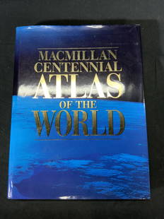
Sold2022Macmillan Centennial Atlas of the World BookMacmillan Centennial Atlas of the World. Published by Macmillan, 1997. Wear to cover and jacket consistent with exposure. Measures approx. 12 x 15.5 inches. Atlas, map, topography, photo book, referenSee Sold Price
Sold2023South America #1. Peru Ecuador Colombia Venezuela Amazonia. BARTHOLOMEW 1888 mapTitle: South America #1. Peru Ecuador Colombia Venezuela Amazonia. BARTHOLOMEW 1888 map Description: South America (Section 1)' by John Bartholomew & Co. (1888). Antique colour atlas map, 20.5 x 16.5cSee Sold Price
Sold2023South America #1. Peru Ecuador Colombia Venezuela Amazonia. BARTHOLOMEW 1893 mapTitle: South America #1. Peru Ecuador Colombia Venezuela Amazonia. BARTHOLOMEW 1893 map Description: South America (Section 1)' by John Bartholomew & Co. (1893). Antique colour atlas map, 20.5 x 16.5cSee Sold Price
Sold2022Very clean 1849 map of southern states by Jesse OlneyUnusually presentable school atlas map of No. 5 Georgia, Florida, Alabama, Mississippi & Tennessee. Clean and sound with good original hand coloring. Nice image of sailboat in corner of map. Shows raiSee Sold Price
Sold2023SAMUEL DUNN NEW ATLAS MAP ENGRAVINGS LOT OF 5The North Part of Italy Comprehending the Dominions of the King of Sardinia, the Estates of Parma & Modena of Genoa, Venice and Lucca & Spain and Portugal with Their General Divisions & The Northern SSee Sold Price
Sold2022Lot of Vintage Maps, Atlases, License PlatesGroup of Vintage Maps/ Atlases, Travel Booklets; Souvenir Trays, 1937 & 38 illinois License Plates and Leather Harley Davison Wallet in form of Saddlebag.See Sold Price
Sold2020[Maps & Atlases] [Africa] Ortelius, Abraham, Group of 2[Maps & Atlases] [Africa] Ortelius, AbrahamGroup of 2 MapsBarbariae et Biledulgerid, nova descriptio(Antwerp, ca. 1570-1612). Hand-colored engraving. Coastal map of North Africa and the Mediterranean,See Sold Price
Sold2022Mountains and RiversTitle: Mountains and Rivers Date Printed: 1860 Cartographer: Johnson & Browning Material/Medium: atlas map, hand colored lithograph Size: 16.5 x 23.5 Condition: Condition is very good with some centerSee Sold Price
Sold2018Upper CanadaReserve Reduced! Item: Upper Canada Date: 1840 Cartographer: GREENLEAF, JEREMIAH Publisher: GREENLEAF, JEREMIAH Size (inches): 10.5X12.5 Map from Greenleaf's Universal Atlas. Map showing districts namSee Sold Price
Sold2018Sidney Hall: Antique Map of the West Indies, 1856Title/Content of Map: 'West Indies [inset: Panama Railway, Jamaica]' Date Printed: 1856 Image Size: Approx 29.0 x 42.0cm, 11.25 x 16.5 inches (Large) Type: Antique atlas map with original hand colouriSee Sold Price
Sold2021Large Group of Vintage Maps,Road Atlas - Atlas of theLarge Group of Vintage Maps,Road Atlas - Atlas of the World War, Atlas Portfolio w/ Asst Loose Maps, Maps from Around The WorldSee Sold Price
Sold2024Group of 4 1897 The Century Atlas MapsIncludes Iowa, Central Europe Travel Map, Balkan Peninusla and Austria Hungary, Balkan Peninusla Map measures 19 1/4 x 14 1/2 inchesSee Sold Price
Sold2024The Caucasus. Georgia Armenia Azerbaijan Russia Turkey Iran. THE TIMES 1895 mapTITLE/CONTENT OF MAP: 'The Caucasus' DATE PRINTED: 1895 IMAGE SIZE: Approx 25.5 x 39.5cm, 10 x 15.5 inches (Large) TYPE: Antique colour atlas map CONDITION: Good; suitable for framing. Please check thSee Sold Price
Sold2024CAUCASUS. Russia Circassia Astrakhan Georgia Azerbaijan Armenia. LETTS 1884 mapTITLE/CONTENT OF MAP: 'Russia No.9' DATE PRINTED: 1884 IMAGE SIZE: Approx 36.0 x 42.0cm, 14.25 x 16.5 inches (Large) TYPE: Antique colour atlas map CONDITION: Good; suitable for framing. However, pleaSee Sold Price
Sold2023The Caucasus. Georgia Armenia Azerbaijan Russia Turkey Iran. THE TIMES 1900 mapTITLE/CONTENT OF MAP: 'The Caucasus' DATE PRINTED: 1900 IMAGE SIZE: Approx 25.5 x 39.5cm, 10 x 15.5 inches (Large) TYPE: Antique colour atlas map CONDITION: Good; suitable for framing. Please check thSee Sold Price
1818 AuctioneersMaps/Atlases. Joan Blaeu - Atlas Major selection. Taschen editions circa 2006-2010. Five volumes£18(1 bid)
6 days LeftPotter & Potter Auctions[NEW YORK CITY – PICTORIAL MAPS]. Group of 3 pictorial maps...US$200(1 bid)
May 18THOS. CORNELL GALLERIES, LTD.GROUP OF ANTIQUE AND VINTAGE MAPS, INC.. NORTH AND SOUTH AMERICA, WORLD MAPS, LOSSES THROUGHOUT,US$100(1 bid)


![[ATLASES AND MAPS]. A group of 5 atlases and maps,: [ATLASES AND MAPS]. A group of 5 atlases and maps, comprising: [MARSHALL, John]. Atlas to Marshall's Life of Washington. Philadelphia: J. Crissy, n.d. 8vo. Numerous hand-colored engraved maps. Origina](https://p1.liveauctioneers.com/197/119933/61100823_1_x.jpg?height=310&quality=70&version=1522758048)
![[ATLASES AND MAPS]. A group of 5 atlases and maps, First Image](https://p1.liveauctioneers.com/197/119933/61100823_1_x.jpg?height=300&quality=1&version=1522758048&width=300)
![[ATLASES AND MAPS]. A group of 5 atlases and maps, First Image](https://p1.liveauctioneers.com/197/119933/61100823_1_x.jpg?height=300&quality=95&version=1522758048&width=300)
![[Maps & Atlases] [London] Stow, John, Group of 5 maps: [Maps & Atlases] [London] Stow, John Group of 5 maps of London London, 1754-55. Approximately 18 1/2 x 15 7/8 inches. Five matted maps from Stow's "A Survey of Cities of London and Westminster and the](https://p1.liveauctioneers.com/65/168030/84729856_1_x.jpg?height=310&quality=70&version=1588715715)


![[Maps & Atlases] [Africa] Ortelius, Abraham, Group of 2: [Maps & Atlases] [Africa] Ortelius, AbrahamGroup of 2 MapsBarbariae et Biledulgerid, nova descriptio(Antwerp, ca. 1570-1612). Hand-colored engraving. Coastal map of North Africa and the Mediterranean,](https://p1.liveauctioneers.com/65/180189/90674454_1_x.jpg?height=310&quality=70&version=1601308774)


![Sidney Hall: Antique Map of the West Indies, 1856: Title/Content of Map: 'West Indies [inset: Panama Railway, Jamaica]' Date Printed: 1856 Image Size: Approx 29.0 x 42.0cm, 11.25 x 16.5 inches (Large) Type: Antique atlas map with original hand colouri](https://p1.liveauctioneers.com/5584/115413/59308590_1_x.jpg?height=310&quality=70&version=1516757305)


![[NEW YORK CITY – PICTORIAL MAPS]. Group of 3 pictorial maps... (1 of 3)](https://p1.liveauctioneers.com/928/325952/175495562_1_x.jpg?height=282&quality=70&version=1712935174)


